
Last year, the City of Vancouver launched the Villages Plan, which is an attempt to implement the land use rules for the areas identified as villages in the Vancouver Plan. In brief summary, the Villages Plan identifies 17 areas and proposes that a nucleus of mixed-use buildings surrounded by a small area of low-rise apartments be allowed in them.
Review the Villages Plan here.
Send your feedback on the Villages Plan by December 12th here.
There is one remaining in-person open house on Sunday, December 7, from 12-3 pm in Room 208, Dunbar Community Centre (4747 Dunbar Street)
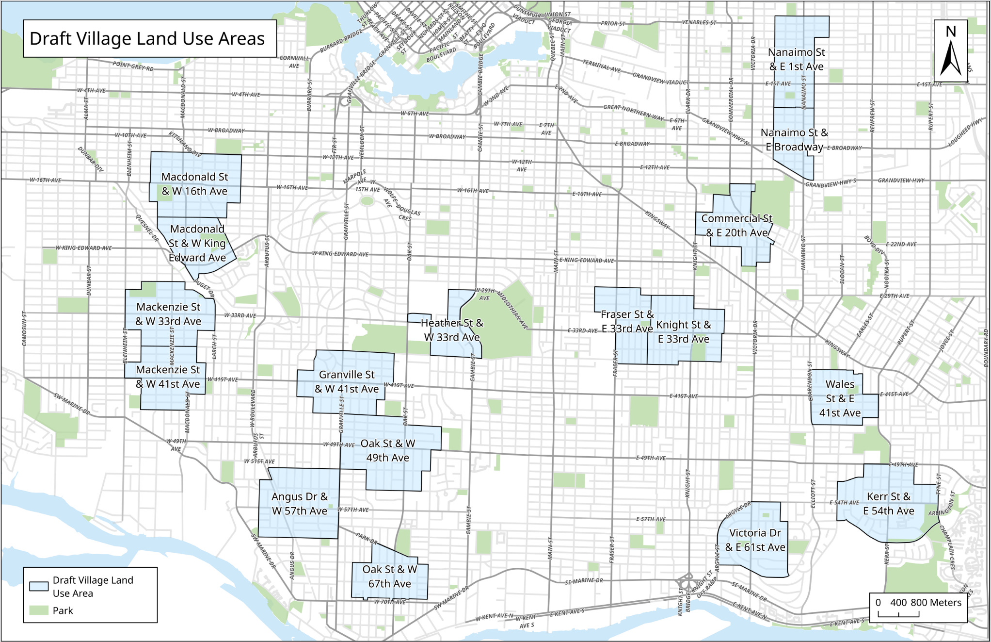
The Villages Plan consists of seventeen uniquely planned neighbourhoods. If you live in one of the Villages Plan areas, you can read how the city summarized your neighbourhood. As well, you can review the proposed land use changes.
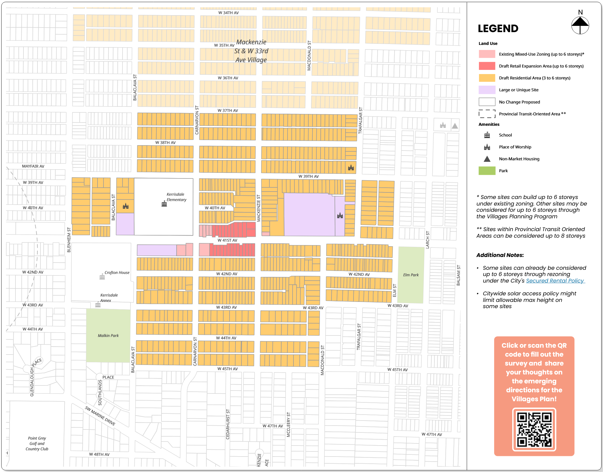
Let’s examine the Villages plan by using this village in Kerrisdale as an example. This is the proposed land use map, expanding this area from seven commercial buildings surrounded by low-density housing to a block of mixed-use surrounded by low-rise apartments.
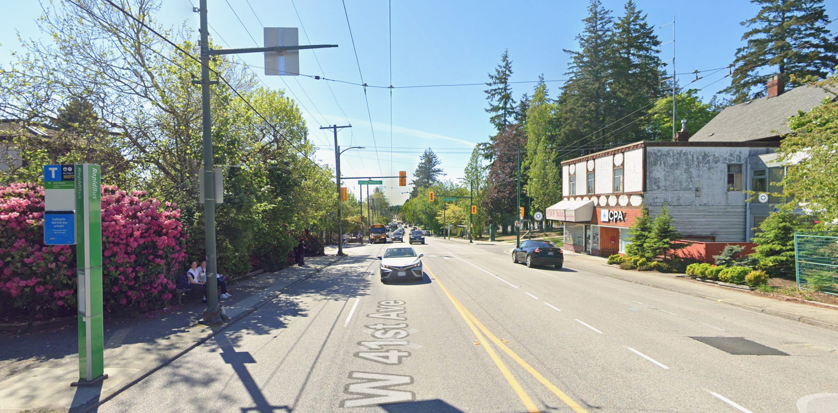
This is what the area looks like currently, per Google Maps.
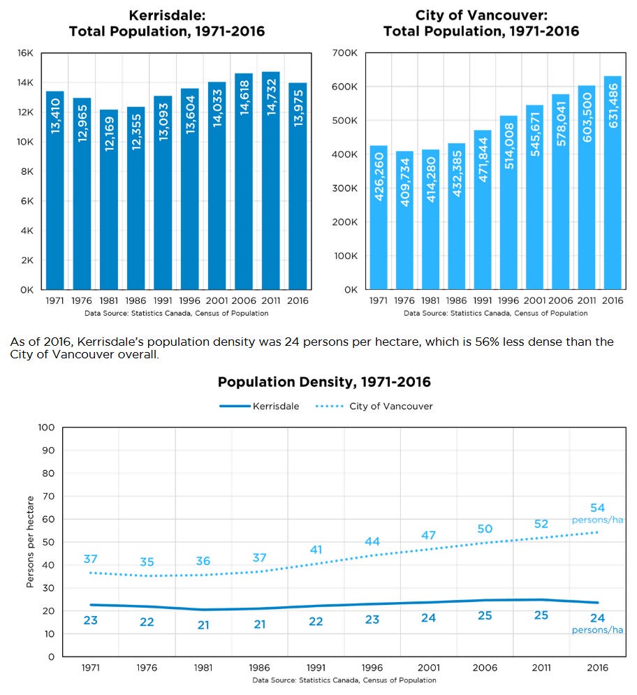
Kerrisdale has been shrinking for years and is today one of the least dense neighbourhoods in Vancouver. With such low population densities, it is difficult for the neighbourhood to sustain enough amenities.
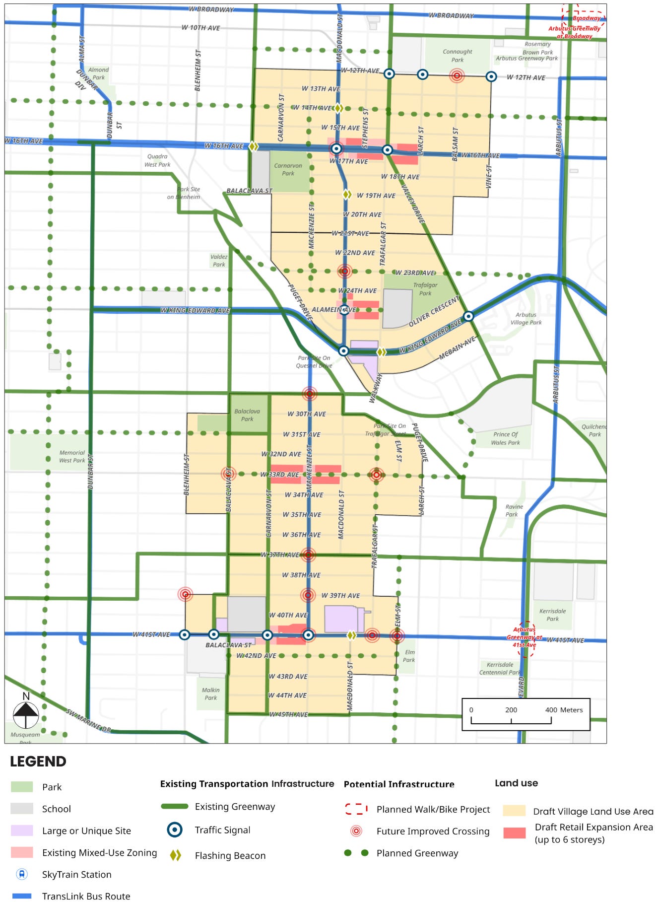
The Villages Plan is also an infrastructure plan. Each of the villages will gain a number of infrastructure upgrades to support the increased population. This is a map of the proposed upgrade for the example village in Kerrisdale. This village will receive improved crossings and greenways to support the local community.
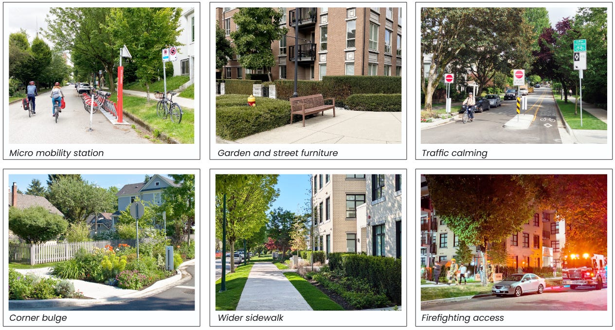
As well, the plan proposes a number of livability improvements to each of the villages.
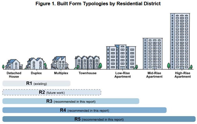
There’s no doubt that most of the proposed village areas are expensive and inaccessible, and fail to serve their residents with abundant local amenities (with some notable exceptions). It is very likely that the proposed apartment zoning will be one of the new R3 zones used in the Broadway Corridor Rezoning, which we wrote about earlier:
City-initiated rezoning along Broadway and the Cambie Corridor
·
September 5, 2025
Although the Broadway and Cambie Plans envisioned substantial changes to land use along the Broadway Corridor and along Cambie Street, they did not actually change any land use rules. In Vancouver today, any land use change must be performed through a “rezoning”, a process which (over the course of 12-18 months) formally changes the land use rules of a …
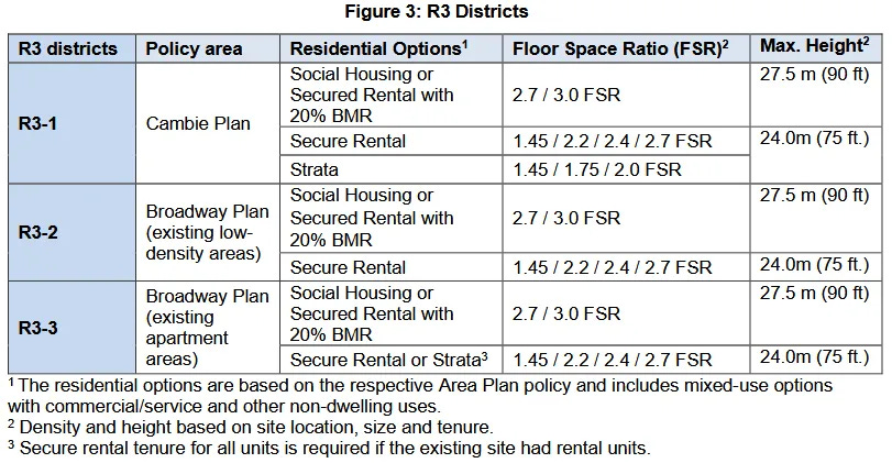
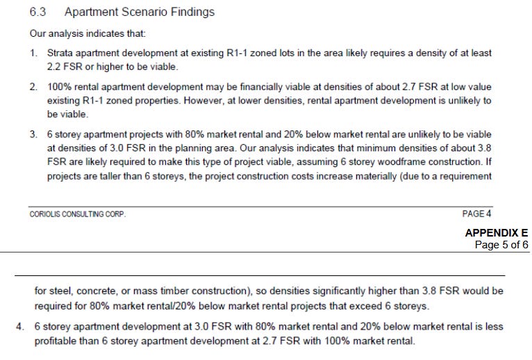
This is similar to the zoning that will be used in the Rupert-Renfrew Plan area, which the Coriolis Report in Appendix E of the referral report was pessimistic about. Given the restrictions on height, density, and especially minimum frontage, it’s possible that many of these villages will be unlikely to see apartments develop instead of multiplexes.
Review the Villages Plan here.
Send your feedback on the Villages Plan by December 12th here.
There is one remaining in-person open house on Sunday, December 7, from 12-3 pm in Room 208, Dunbar Community Centre (4747 Dunbar Street)
No posts
Comments
Nothing yet. Say the first thing.
Sign in to join the conversation.