
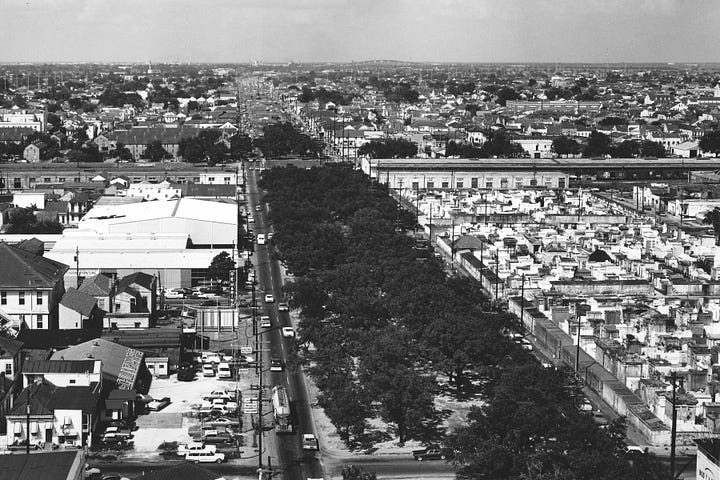
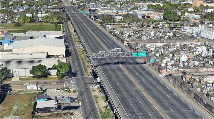
Cutting right through Treme and Seventh Ward, the construction of I-10 during the 1960s over Claiborne Avenue was destructive to the surrounding communities. Urban3’s work has provided data analysis and modeling for the Claiborne Avenue Alliance in their pursuit of justice for the Tremé and Seventh Ward neighborhoods.
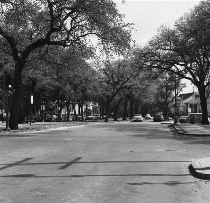
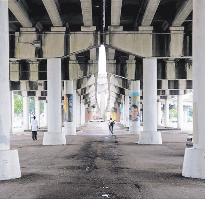
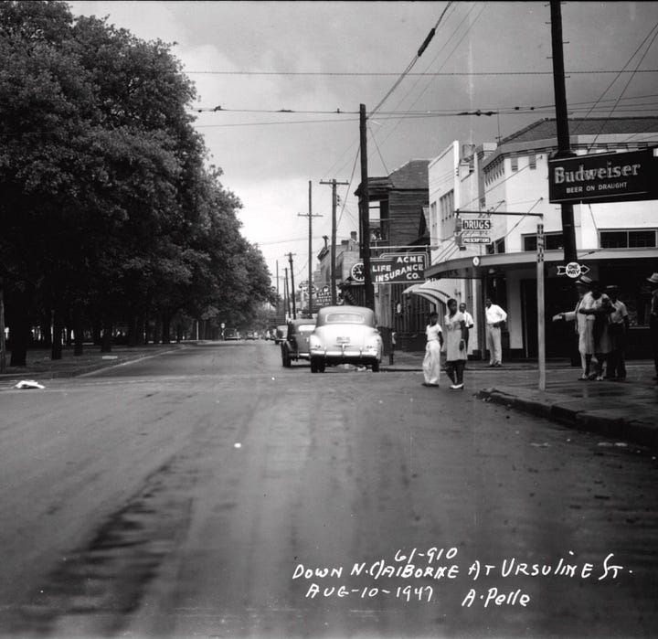
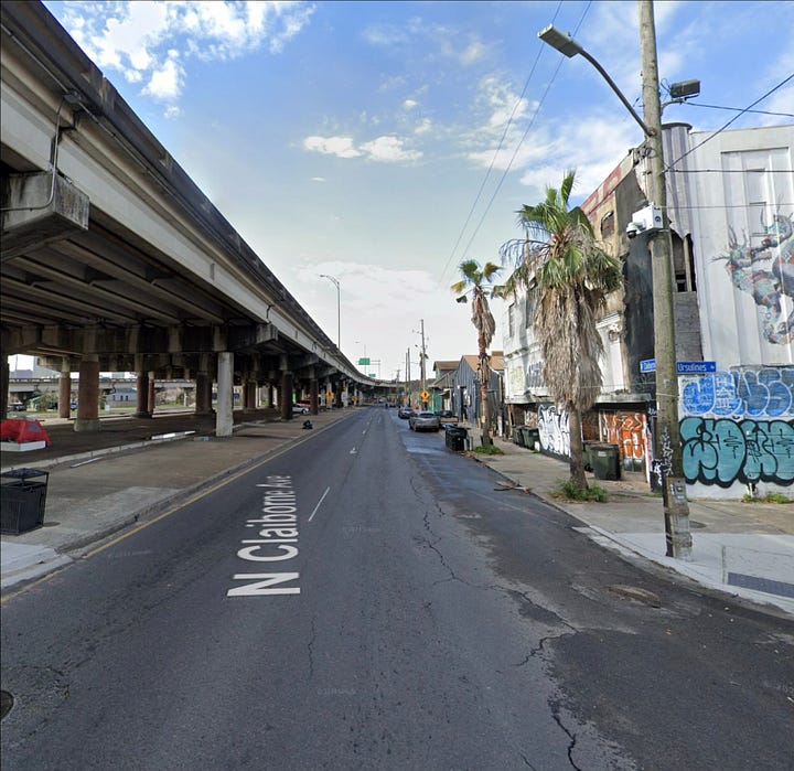
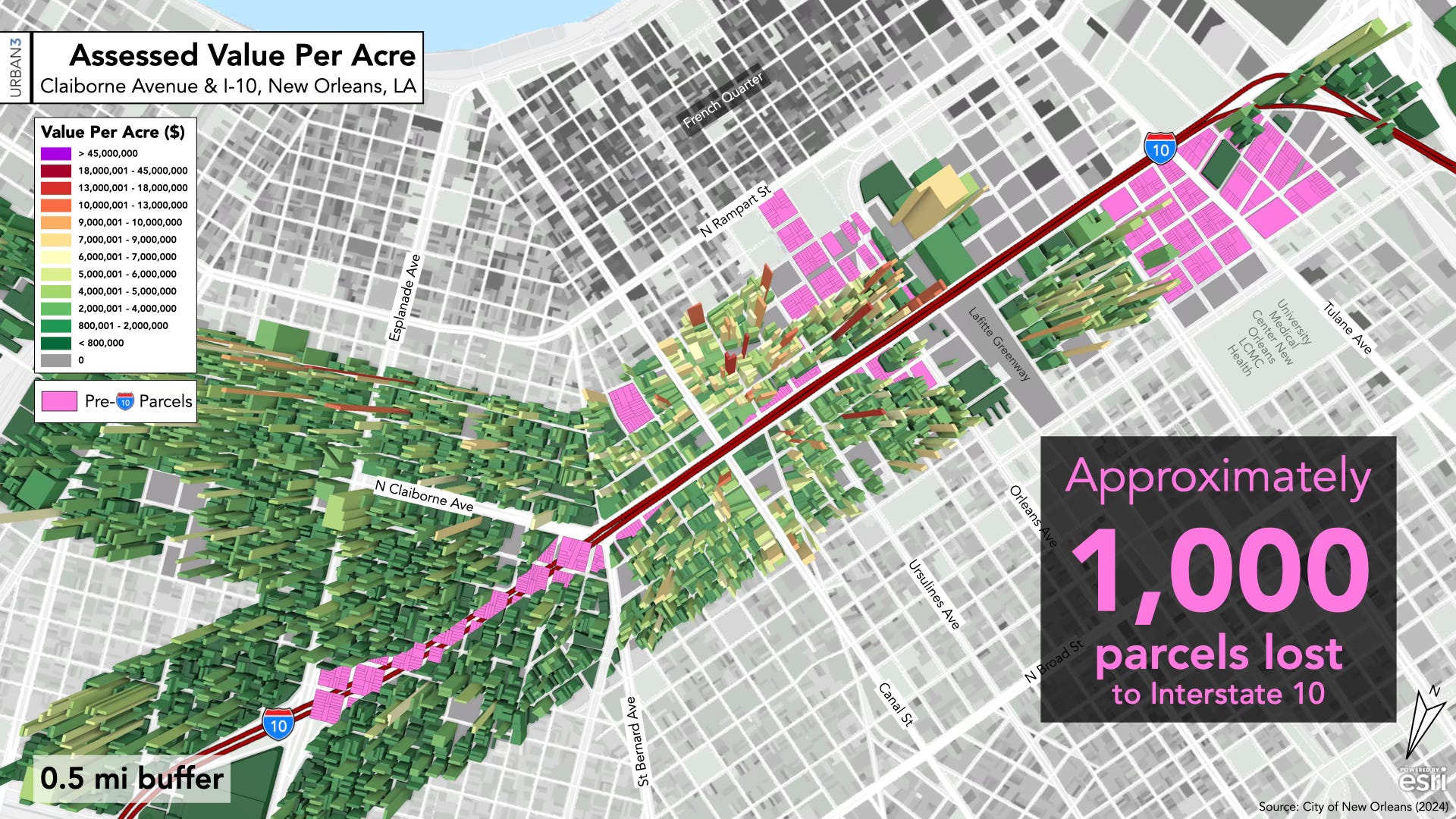
To understand restoration, Urban3 modeled different scenarios to take some measure of how the highway has led to loss of housing, businesses, and diminished property values. Historical redlining maps were used to analyze the long-term economic impact on property values and neighborhood fiscal health in the Orleans Parish. Additionally, using historical Sanborn maps Urban3 quantified and visualized the lost value from the demolition of real estate along Claiborne Avenue for the construction of the elevated highway. The analysis re-imagined Claiborne Avenue’s streetscapes and the value growth of properties along the corridor if the highway was not built, and informs future redevelopment that can encourage restoration and wealth building.
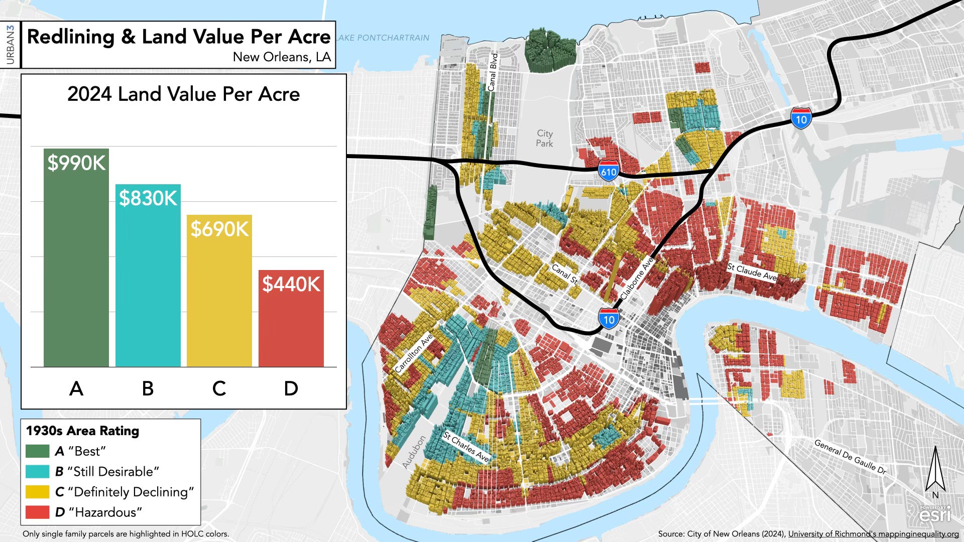
The Claiborne Expressway cuts through the Treme and Seventh Ward neighborhoods which have been historically redlined. A 0.5 mile buffer around the expressway contains 78% of redlined properties indicating the systemic harm that the community has suffered.
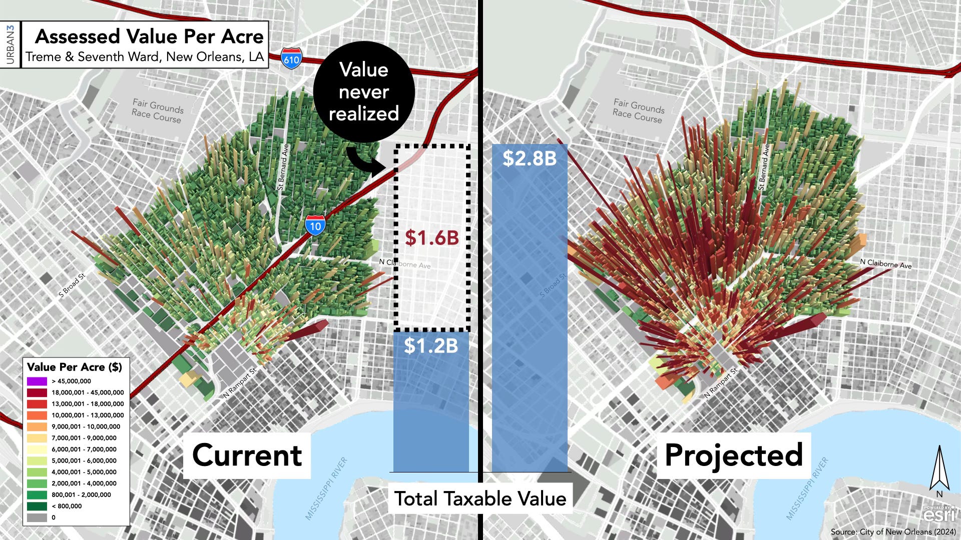
The analysis revealed that Treme and Seventh Ward have experienced loss of real property and property value. Approximately, a thousand parcels were lost to the highway, and the remaining properties have much lower values per acre as compared to similar neighborhoods like French Quarter, Marigny, and Bywater.
Projecting the lost value revealed that if the highway was never built, the total taxable value of Treme and Seventh Ward would have been 2.3 times its current taxable value. The highway has induced a $30M annual loss in property tax revenue from the two neighborhoods.
Comments
Nothing yet. Say the first thing.
Sign in to join the conversation.