
StandUp Ventures is proud to announce that we have led GroundedAI’s $2M pre-seed round alongside BoxOne Ventures, SOSV, The51, Accelia Capital and LOI Ventures.
GroundedAI is building a system of record for underground construction. Its technology captures, georeferences, and maps subsurface conditions as they are encountered, giving tunnelling teams real-time visibility into the ground through which they are building.
Today, much of this critical information is recorded through paper sketches, phone photos, spreadsheets, and disconnected software. Grounded replaces these fragmented processes with a structured record that helps contractors identify material differences between expected and actual ground conditions, document their impact, and respond while there is still time to act.
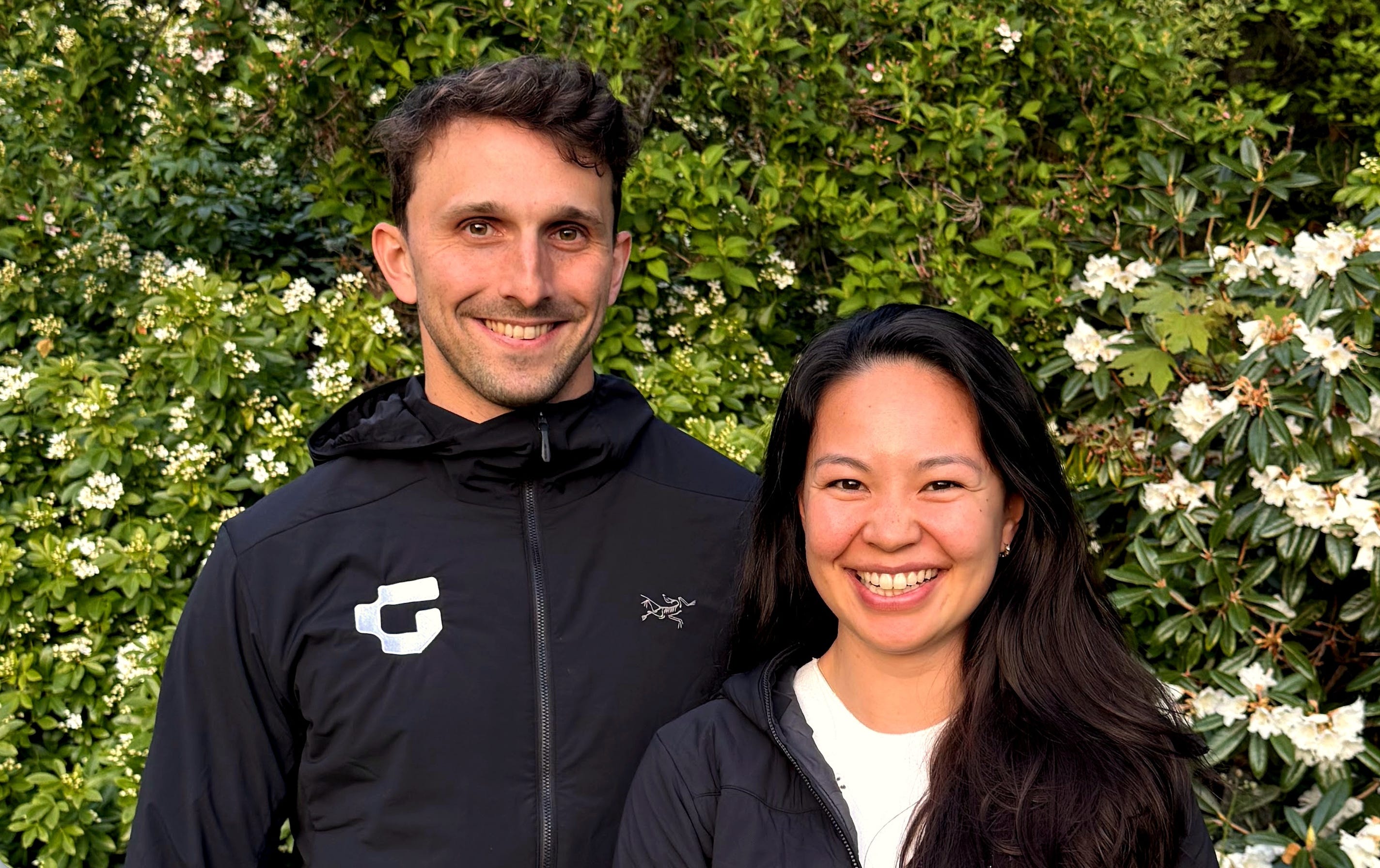
The company was founded by Shelby Yee, a geological engineer, and software engineer Stuart Bourne, based on the expertise and insights they developed while building RockMass, their previous underground mapping company serving the mining industry.
Canada, like many western countries, has internalized the need to build again.
Our cities need more housing, transit, energy infrastructure, water systems, and public works. Our industries need access to critical minerals, reliable power, and modern transportation networks. At the same time, our collective ability to deliver large infrastructure projects on time and on budget has deteriorated.
As Ezra Klein and Derek Thompson describe in their 2025 book Abundance, countries that know what they need to build are increasingly constrained by their ability to deliver it. Well-intentioned but complicated processes, aging infrastructure, fragmented responsibility, and limited adoption of modern technology have made major projects slower and more expensive.
A significant portion of this work happens underground.
Subways, road tunnels, water systems, hydro projects, power transmission, gas pipelines, and critical-mineral developments all require teams to excavate through ground that has never previously been seen. The world bores approximately 5,200 kilometres of new tunnel each year, as part of a global tunnelling project pipeline valued at more than $1 trillion.
These projects are also particularly susceptible to delays and cost overruns. Unexpected ground conditions are estimated to create tens of billions of dollars in additional costs each year across Europe and North America, while cost overruns on major tunnelling projects regularly exceed 30%.
Canadians are familiar with the consequences. The Eglinton Crosstown LRT took approximately 15 years to complete, six years beyond its original target, while costs grew to more than $13 billion. The Niagara Tunnel began as a $620 million contract and ultimately cost more than $1 billion. In Montreal, the Blue Line extension is expected to cost approximately $6.4 billion for five new stations and less than six kilometres of tunnel.
Many factors contribute to the complexity of these projects. One of the most persistent is the difference between the ground contractors expect to encounter and the ground that is actually there.
Before a tunnel is excavated, the project owner drills boreholes along its proposed route. These boreholes provide physical samples that geologists use to estimate the composition and behaviour of the ground.
The findings are incorporated into a Geotechnical Baseline Report, or GBR. This report becomes the contractual baseline for the project. Contractors use it to determine the equipment, labour, safety procedures, timelines, and costs required to complete the work.
The challenge is that boreholes capture only a very small sample of the total project site. A kilometre of tunnel may be scoped using approximately a dozen boreholes, leaving substantial space between the points that have actually been examined.
Once excavation begins, the contractor inevitably learns more.
The team may encounter water where dry rock was expected, unstable rock instead of competent ground, or large boulders where the baseline suggested clay. Each difference can require new equipment, changes in ground support, additional labour, modified safety procedures, or delays to the construction schedule.
The contract anticipates some of this uncertainty. When the ground differs materially from what was established in the GBR, the contractor can submit a Differing Site Condition, or DSC, claim. The claim explains what was encountered, how it differs from the contractual baseline, what changes are required, and how those changes affect the cost and schedule of the project.
For contractors, these claims can represent millions of dollars and materially erode project margins. For owners, they can materially change the cost of the infrastructure being delivered. The ability to document actual site conditions quickly, accurately, and defensibly is therefore critically important.
Unfortunately, the processes used to create this evidence remain highly manual.
A geologist may document the tunnel face through a paper sketch and several phone photos. Information is then manually transferred into spreadsheets, reports, or project-management systems, often by different people and at different points in time. Photos may be stored in unlabelled folders. Observations may lack precise location data. Important context can remain in notebooks or in the memory of the individual who was underground.
At the same time, DSC claims often have strict notice requirements. A contractor may have only 24 to 48 hours to inform the owner that conditions have materially diverged from the baseline. Missing the deadline, or failing to provide sufficient evidence, can significantly reduce or eliminate the value of the claim.
Contractors frequently recover only a fraction of the value associated with legitimate claims, not necessarily because the underlying condition did not exist, but because the records were incomplete or could not sufficiently demonstrate what happened.
This creates costs for everyone involved. Contractors absorb expenses they did not anticipate. Owners face disputes and litigation that can continue for years. Insurers struggle to accurately price ground risk. Projects are delayed while teams attempt to reconstruct events after the fact.
The problem is not simply that underground construction lacks data. It is that the data is not being captured in a sufficiently structured, timely, and usable form.
GroundedAI is designed to create that record.
After each excavation cycle, a geologist examines and maps the newly exposed tunnel face. This is the moment when the actual ground becomes visible. It is also a temporary moment. Within hours, the face may be bolted, covered with shotcrete, and advanced past as construction continues.
Anything that is not recorded during this window can be difficult, and often impossible, to recover later.
Using Grounded, the geologist captures and annotates the face directly on an iPad. Rock types, geological structures, water conditions, and ground-support elements can be documented in structured form on a two-dimensional image or on a full three-dimensional mesh generated using the device’s LiDAR.
The platform also calculates the classification systems used by geotechnical teams to assess rock quality and stability, including Q, RMR, and GSI. These calculations can be completed at the face rather than several hours later from a desk above ground.
Each observation is georeferenced, timestamped, and connected to the location where it was captured.
From there, the information becomes immediately useful to the broader project team. Engineers on surface can review three-dimensional meshes, verify conditions, and add annotations without travelling underground. Incoming shifts can access a chronological history of the project rather than relying on informal handovers or disconnected folders of images.
Over time, these captures create a searchable record of the entire tunnel alignment, showing what was encountered, where it was encountered, when it occurred, and how it compared with the original baseline.
When conditions differ from the GBR, the documentation required for a DSC claim can be assembled directly from that record. Rather than spending days or weeks reconstructing information from notebooks, SharePoint folders, and spreadsheets, the commercial team can access evidence that has already been captured, organized, and tied to a specific location and point in time.
The product therefore solves an immediate and measurable problem. It helps tunnelling contractors protect the value of legitimate claims, reduce administrative work, communicate more effectively with owners, and prevent disagreements from becoming prolonged disputes.
At StandUp, we have long been interested in companies that collect and structure data in industries where doing so has historically been difficult.
In 2023, we invested in Vivid Machines, which is building a plant-level dataset for specialty crops. Our thesis was that improvements in passive data collection would make it possible to apply machine learning to agricultural optimization problems that were previously constrained by the quality and availability of information.
GroundedAI reflects a similar thesis in the underground environment.
The recent acceleration in artificial intelligence has increased the number of applications that can be built from high-quality data. However, many of the most widely used forms of data, including language, images, and code, had already been digitized at enormous scale before the current generation of AI models was developed.
We believe significant value will increasingly accrue to companies that can create new, proprietary datasets in parts of the physical economy that have never been adequately recorded.
Underground construction is a particularly compelling example.
Every tunnel is excavated once, through ground that has never previously been exposed. The tunnel face that reveals its actual condition may exist for only a few hours before it is permanently covered. Historical information cannot be purchased from a data provider or reconstructed after the project has advanced.
The ground is also dynamic. Excavation itself changes the physical environment. Stress redistributes around the opening, water moves through new pathways, and the conditions observed at one stage of construction may be partially influenced by the work that preceded it.
As a result, accurately understanding underground conditions requires more than static geological information. It requires a detailed record of what was encountered, how the environment changed, what action was taken, and what followed.
Grounded is building that record at the point where the information is created.
Every deployment adds new observations of actual underground conditions, connected to location, engineering decisions, project costs, and outcomes. Because the underlying tunnel faces no longer exist, this dataset cannot be recreated by a competitor after the fact.
We believe this has the potential to become an important compounding advantage.
The initial product helps contractors document claims and improve project coordination. As the dataset grows, it can support better condition detection, more accurate cost estimates, stronger bids, and more effective risk management. In the longer term, it may also provide owners, contractors, and insurers with a much stronger basis for understanding and pricing ground risk.
The opportunity is therefore not limited to digitizing a manual workflow. Grounded is creating the information infrastructure required for underground construction to become more measurable, predictable, and efficient.
Shelby and Stuart have spent approximately eight years building technology for underground environments.
Through RockMass, they worked directly with geologists, engineers, mine operators, and construction teams. They learned how underground work is performed, what information users need, why many products struggle to achieve adoption at the job site, and how software must operate in environments with limited connectivity and demanding safety requirements.
They also learned that capturing information is not, on its own, enough.
For data to create value, it must be structured, connected to the decisions being made, and delivered in a format that project teams can actually use. Grounded was built from that insight.
Shelby and Stuart understand both the technical complexity of the underground environment and the operational realities of selling into it. They have worked at the tunnel face, inside the relevant workflows, and across the table from the customers Grounded now serves.
We have been particularly impressed by the specificity of their product vision, the depth of their customer understanding, and their ability to translate years of industry experience into a solution that addresses an immediate commercial problem while supporting a much larger long-term opportunity.
Canada and other western countries have committed to an ambitious period of infrastructure development. Much of what we need to build will pass through ground that has never been seen, and our ability to deliver these projects efficiently will depend in part on our ability to understand what is happening beneath the surface.
We are incredibly proud to support Shelby, Stuart, and the GroundedAI team as they build the system of record for the underground.
Warm welcome to the portfolio!
If you build, own, or insure underground infrastructure, you should see what Grounded is building. You can book a meeting with the team here.
Thanks for reading,
Katie & Lucas
No posts
Comments
Nothing yet. Say the first thing.
Sign in to join the conversation.