
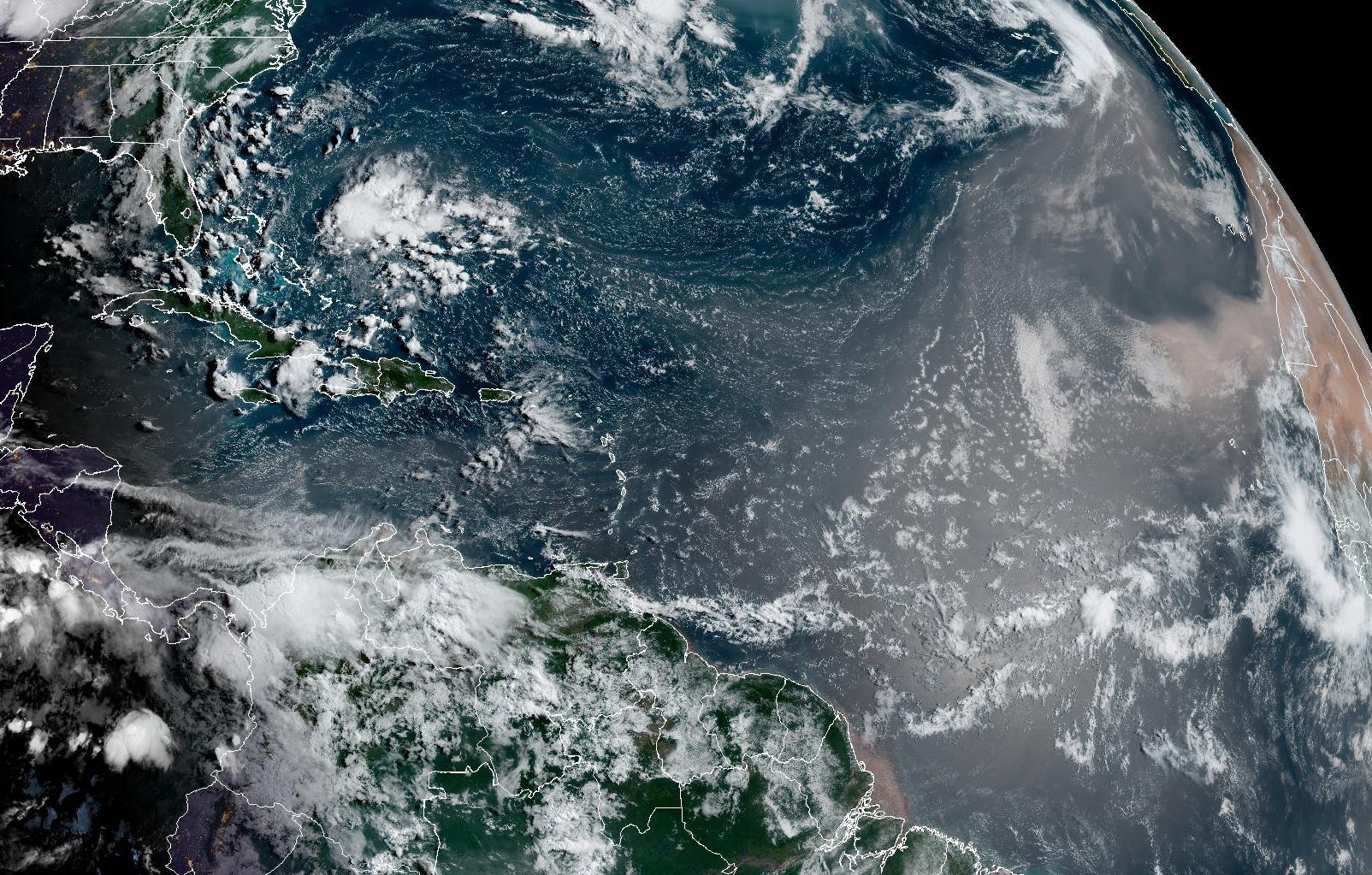
The Atlantic basin looks to stay in hibernation until at least mid August, something we previewed in this newsletter over a week ago.
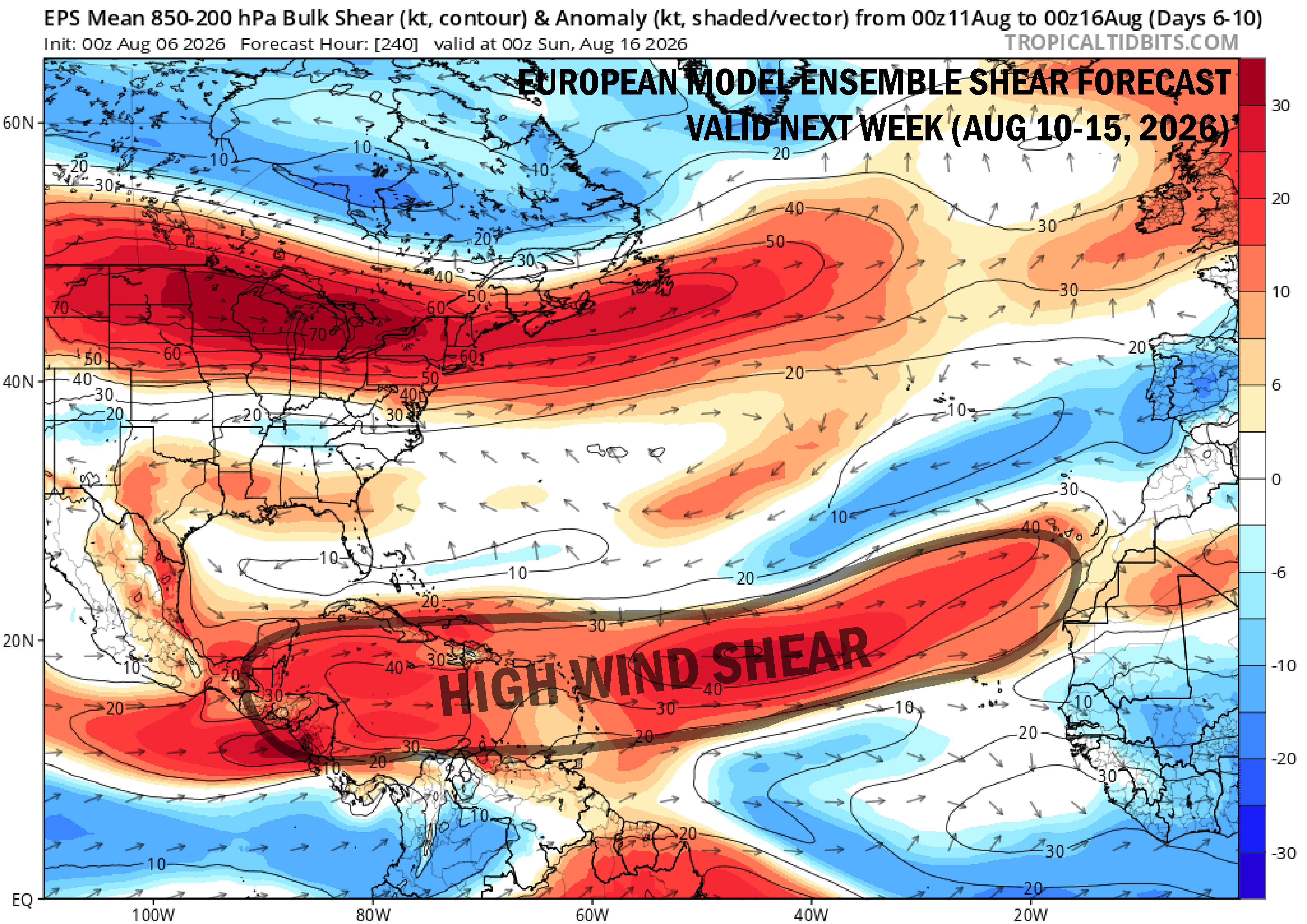
A curtain of wind shear is draped across the tropical Atlantic courtesy of the fast-developing Super El Niño and has assembled a road block with little detour for wannabe storms.
Meanwhile, gobs of dry, Saharan air are heaving off Africa and wafting through the preferred formation areas for early August.
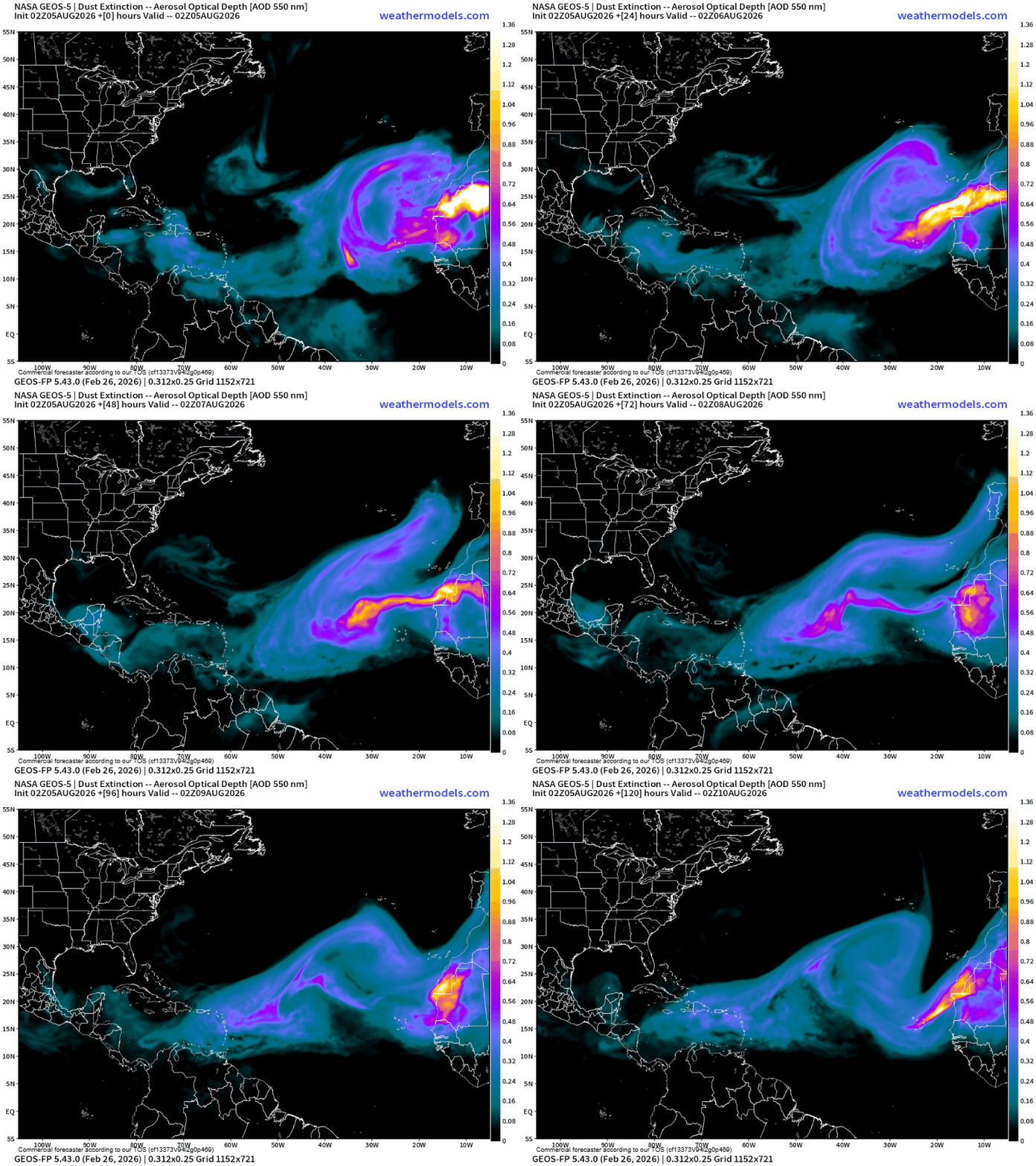
The combination of these conditions is making the Atlantic an exceptionally hostile place for would-be hurricanes.
While we don’t see any major changes in the big-picture across the Atlantic, longer range models do continue to hint at the possibility of a weak tropical candidate by late next week and next weekend (weekend of August 15th) over the open Atlantic between Africa and the Caribbean.
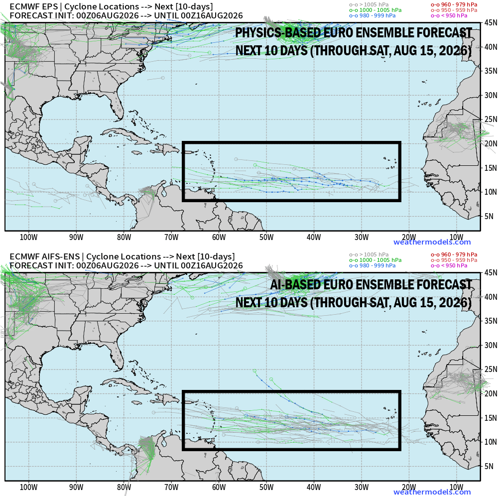
Models have waffled on odds, but chances remain low (around 10%) for now. The AI camp has been a little more enthusiastic overall than our traditional physics-based models but both suggest a window for development as we approach the middle part of the month.
The long-term prospects of anything starting out in the eastern Atlantic doesn’t favor transatlantic journeys this season, but we’ll follow the trends for next week. Obviously this isn’t any concern for now and the Atlantic will stay closed for business until further notice.
Comments
Nothing yet. Say the first thing.
Sign in to join the conversation.