
A few months ago I told you about my mate Doug Duncan’s adventure inside a young thunderstorm. For those of the congregation who were dozing in their pews, here’s a brief summary.

CAUGHT IN THE NIMMIES
Doug was flying a Cherokee Six across the Free State – slap in the middle of South Africa. He was below a solid overcast and was going round a patch of heavy rain when he got sucked into the bottom of a Cb. He didn’t even know it was there.
He throttled fully back, put on full flap and shoved the nose down, but it still pulled him in. It then tossed him around like a terrier with a rag. The aircraft was inverted as much as it was the right way up.
Eventually it spat him out at 20,000 ft. At first he didn’t realize he was out of it because all the windows were iced over.
Doug was not instrument rated; in any case all the gyros had toppled, and the engine had stopped, probably because of negative G taking the fuel away from the tank outlets.
He opened the storm window and was able to see enough to regain control.
His radio calls were relayed to Bloemfontein by a Boeing which reported that it was a “Papa Charlie caught in the nimmies.”
He got the engine running and was escorted down through the overcast by two Air Force Impala jets.
Amazingly, the aircraft was undamaged and Doug continued his trip a couple of hours later, a very lucky and much wiser man.
I’ve told you this story to remind you that even baby Nimmies can cause massive grief. A big one can go up to 60,000 ft – three times the height of Doug’s feeble one – and some even tower up to 70,000 ft.
WEATHER FACTORIES
Now, although I have been in aviation for nearly 70 years, I have never had reason to find out exactly what goes on inside one of these weather factories. It’s the same as I don’t know much about what happens inside a mountain. All I know is that flying into either will do me a power of no good.
My lack of knowledge turned out to be a good thing because it has just caused me to demand answers from a couple of AI platforms. You will be amazed at what I found. Here it is – there are only two points of identification that apply to all Cbs.
They all have strong updraughts and they all have strong downdraughts with precipitation.
I’ll tell you about other features like mammatus, roll clouds and anvils in a moment, but from the perspective of us flyers of little aeroplanes, Doug’s story is very significant. He saw a patch of heavy rain – which signified the downdraught section – so he flew round it, slap into what? You’ve got it – the updraught.
Even with a small thunderstorm these updraughts and downdraughts will easily outperform our aircraft. We become like leaves being tossed around in the wind.
Little Charlies will harbor vertical wind speeds of 5,000 ft/min, up and down, while their grandfathers have ones of 20,000 ft/min.
So even the toddlers outperform all but jet fighters, and the biggies support chunks of ice the size of microwave ovens. They will rip any aircraft apart.
HAIL DAMAGE
On 22 April 1999 a South African Airways Boeing 727-300 (registration ZS-IJE) was damaged by hail while descending into Johannesburg. As they passed through 20,000 ft they hit serious hail for about 30 seconds, after which the aircraft landed safely.
The damage to the radome, engines, and wings was so severe that the aircraft was deemed ‘beyond economical repair.’ It never flew again.
Now, here’s a report of a thunderstorm accident that happened a couple of weeks ago. It’s significant in that this guy did exactly the opposite to Doug – he went in high and the downdraught did the damage. I’m quoting verbatim.
CESSNA 421C – LAST MONTH
FLIGHT SAFETY FOUNDATION
This information is added by users of AS. Neither AS nor the Flight Safety Foundation are responsible for the completeness or correctness of this information.
A Cessna 421C Golden Eagle II (RAM conversion), N291AN, was destroyed when it crashed under unknown circumstances near Wimberley, Texas. The pilot and four passengers sustained fatal injuries.
ADS-B data shows that the airplane was cruising at 17,400 ft when it entered an area of weather activity. At 2247, the airplane initiated a descent from cruise altitude. At 2259, the airplane was descending through 14,000 ft when it entered a rapid right-hand descent with an average rate of 5,000 feet per minute (fpm). At 2300, the airplane appeared to be in a 7,000 fpm climb before it entered another rapid descending right-hand turn which it did not recover from. The airplane had an average rate of -11,000 fpm towards the final seconds of flight.
Weather conditions at two nearby airports showed low scattered/broken and overcast ceilings, in addition to distant lightning and rain. The NWS area forecast discussion for the San Antonio area indicated isolated to scattered thunderstorms for the night into early Friday evening, with locally heavy rain.
The pilot reported icing and loss of instruments due to the pitot heat being unserviceable.
Confidence Rating: 0, Info. only available from news, social media or unofficial sources
WARREN BROWN’S COMMENTARY
Brown’s presentation showed very interesting ADS-B data from long before the aircraft entered the cell. This seemed to indicate, from the continual small variations in the track, that the pilot was hand-flying the aircraft, possibly due to an unserviceable autopilot.
There were also indications that the pilot had comparatively low hours and very little time on type.
Brown was critical, and I believe justly, of such a pilot heading off on a night IMC flight with known thunderstorm and icing activity. This being aggravated by an unserviceable autopilot and pitot heat.
It seems, from the final radio transcript, that pitot icing may have been the last straw when it rendered the ASI, VSI and altimeter unserviceable.
My own speculation is that serviceable weather radar and Stormscope / Strike Finder could have alerted the pilot to make a diversion round this cell in clear air.
SIGNS OF TROUBLE
In VMC there are a number of signs that you are entering airspace which the Gods have reserved for thunderstorms and brave men.
Such airspace is not suitable for members of the Famous Live Cowards’ Club (LCC).
10 CLUES THE MONSTER MAY BE HIDING NEARBY
1. An Environmental Lapse Rate (ELR) greater than 5.5°F per 1,000 feet (3°C per 1,000 feet). Don’t panic – this is easy. You have a look at your outside air temp gauge as you climb. If the temp decreases by more than 5.5°F for every 1,000 feet you climb, this means there is potential for cumulus cloud.
2. If you keep drifting to the right this means that you are heading towards a low-pressure area which may harbor thunderstorms – Northern Hemisphere.
3. If you see the classic anvil shape topping a cumulus cloud – that’s a sure sign it contains really bad stuff.
4. The taller any cumulus cloud, the more violent will be the updraught.
5. Lightning.
6. Those strange mammatus clouds (see photo) often hang around thunderstorms. The name comes from mammary glands – think of cows’ udders.
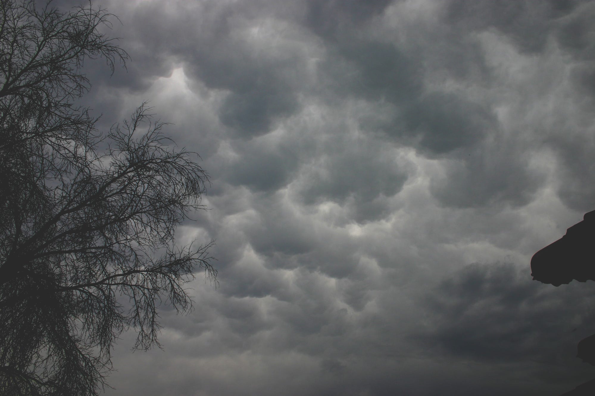
7. Lenticular clouds (see photo) – those smooth lens-shaped clouds are an indication of strong winds and are sometimes associated with thunderstorms.

8. A roll cloud is a very definite sign that a serious Cb lurks in the immediate vicinity. It’s a nasty, vicious creature that lives low down at the leading edge of a thunderstorm.

9. Whirlwinds, whirligigs, twisters, tornadoes, vortices, cyclones, and dust devils are all names for those things that vary in size from the little goody that sucks up dust and stones into your prop, to the monsters that cause mass destruction.
10. Roll clouds and whirlwinds both give themselves away by picking up dust from dry countryside and ploughed fields.
WHERE ARE THE WORST CBs?
Okay, to settle Ian’s discussion about where the biggest nimmies live, I spoke to Mr NASA the other day and he said, “I don’t know how big thunderstorms become in various countries, but I can tell you how many lightning strikes per square inch different places have.” Actually that’s a lie – he said per square kilometer, which is a bit over a thousand yards each way.
Imagine a one-square-kilometer airfield in each of the following places, then these figures tell you how many times a year your place is likely to be nailed.
233 – Lake Maracaibo, Venezuela
205 – Kabare, Republic of the Congo
177 – Kampene, Republic of the Congo
173 – Caceres, Colombia
143 – Sake, Republic of the Congo
143 – Dagar, Pakistan
139 – El Tarra, Colombia
130 – Nguti, Cameroon
130 – Butembo, Republic of the Congo
128 – Boende, Republic of the Congo
Africa is the top continent for lightning hotspots with 283 sites, followed by Asia with 87 places. South America has 67, North America has 53 and Oceania has only 10.
The top five most lightning-prone states in the USA, in order of magnitude, are:
Florida
Louisiana
Mississippi
Alabama
South Carolina and Oklahoma
Finally, we had a pilots’ barbeque at the airfield yesterday so I asked four of the airline guys where the biggest thunderstorms in the world lurk. They all agreed – West Africa and the Congo.
I take it my bourbon is in the post, Ian.
Over the next few months I have some wonderful stories about the aircraft and astonishing people I flew with in Africa during the heydays of aviation.


Comments
Nothing yet. Say the first thing.
Sign in to join the conversation.