
I know that there are lots of good Leadville recaps out there already; last week, I started thinking what I might want to publish, if anything, then saw someone spun up this website with way more metrics that I could ever hope to capture: http://therealleadville2026course.com/
That being said, I still wanted to highlight the course modifications due to the Willow Fire. Per the official Leadville page, these three areas were impacted, and therefore removed, from this year’s race due to the Willow Fire:
Hagerman Pass Road
Sugarloaf Mountain
Powerline
These detours actually make a significant difference for the first and last twenty-ish miles of the race. Admittedly, I don’t know the Leadville course very well, so I turned to GPX data to attempt to understand it better.
I’m playing around with some new charts, which would have been a lot easier / better had I just had Strava Pro and did a flyby, but I’ll make due with what I was able to finagle here (using terrain/elevation mesh files by MapTiler).
The Leadville course leaves the city of Leadville, after approximately one mile in, the 2026 course (blue) diverges north towards Carter Summit while the 2025 course (yellow) continue west. 2026 heads east along the north short of Turquoise Lake while 2025 went west. Then, 2026 rejoins towards Outward Bound, while 2025 would take in Sugarloaf.
(Apologies for anyone who happens to be colorblind)
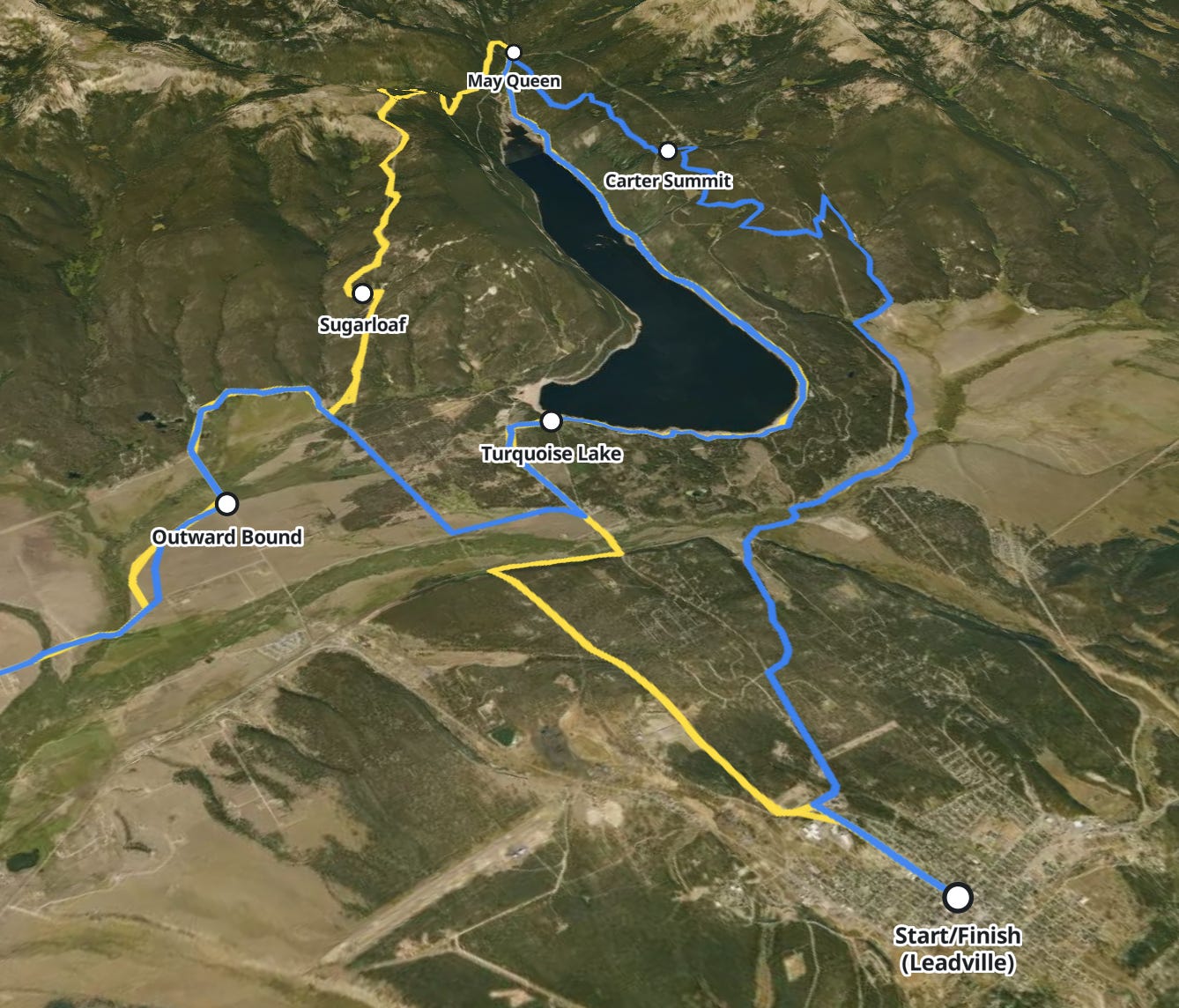
(I did tilt the orientation of this chart, to better highlight the vert)
To meet the approximate mileage, the way back to Leadville is slightly different in 2026. Again, the race is unable to head to the west past Sugarloaf to May Queen and along the north short of Lake Turquoise (yellow). Instead, in 2026, the course goes to the right of Lake Turquoise, heads towards but doesn’t pass Carter Summit (blue route) then makes its way back to Leadville.
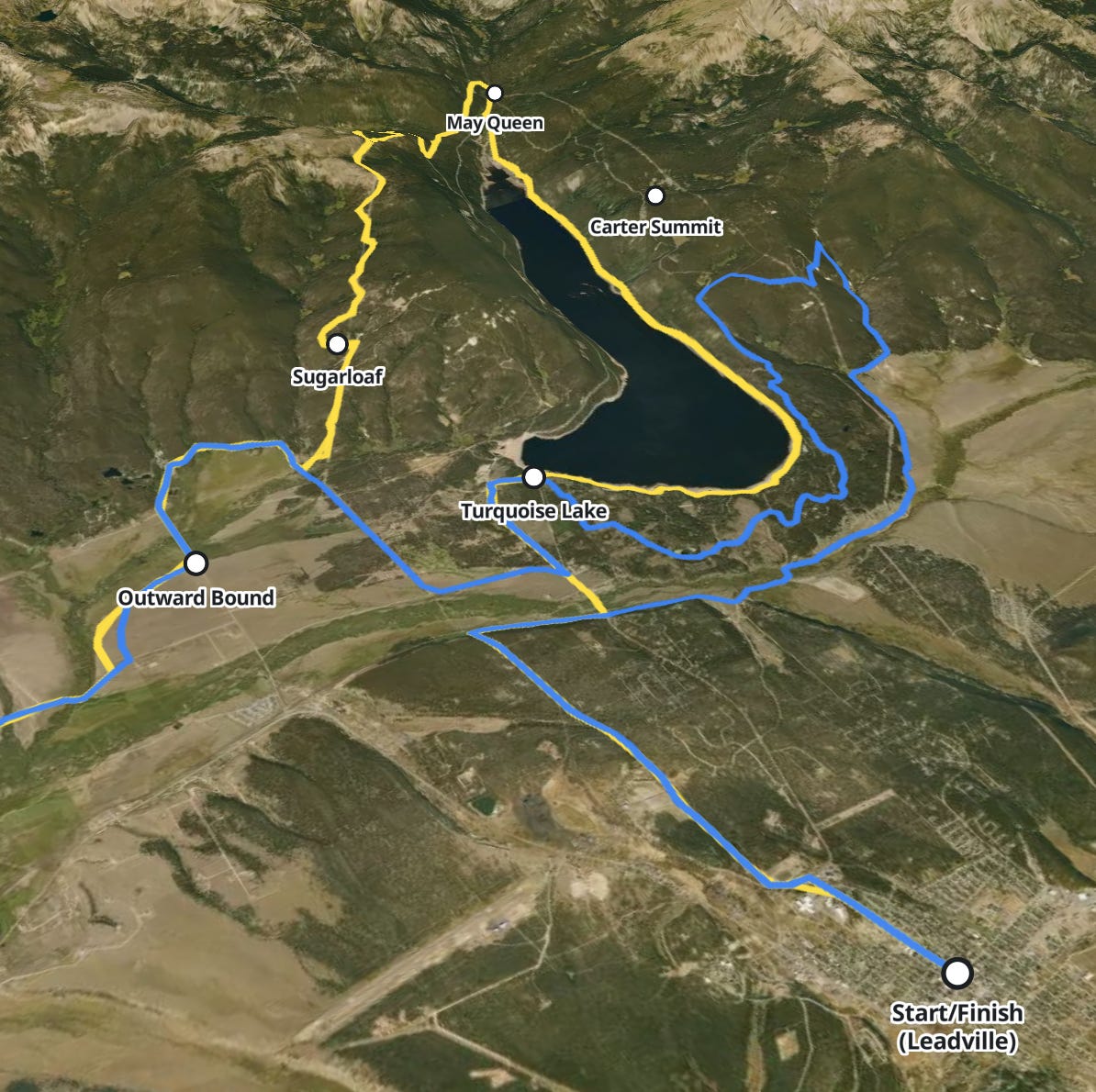
Here is a full rendering of the course (tilted slightly) to take in the full majesty of the Leadville 100:
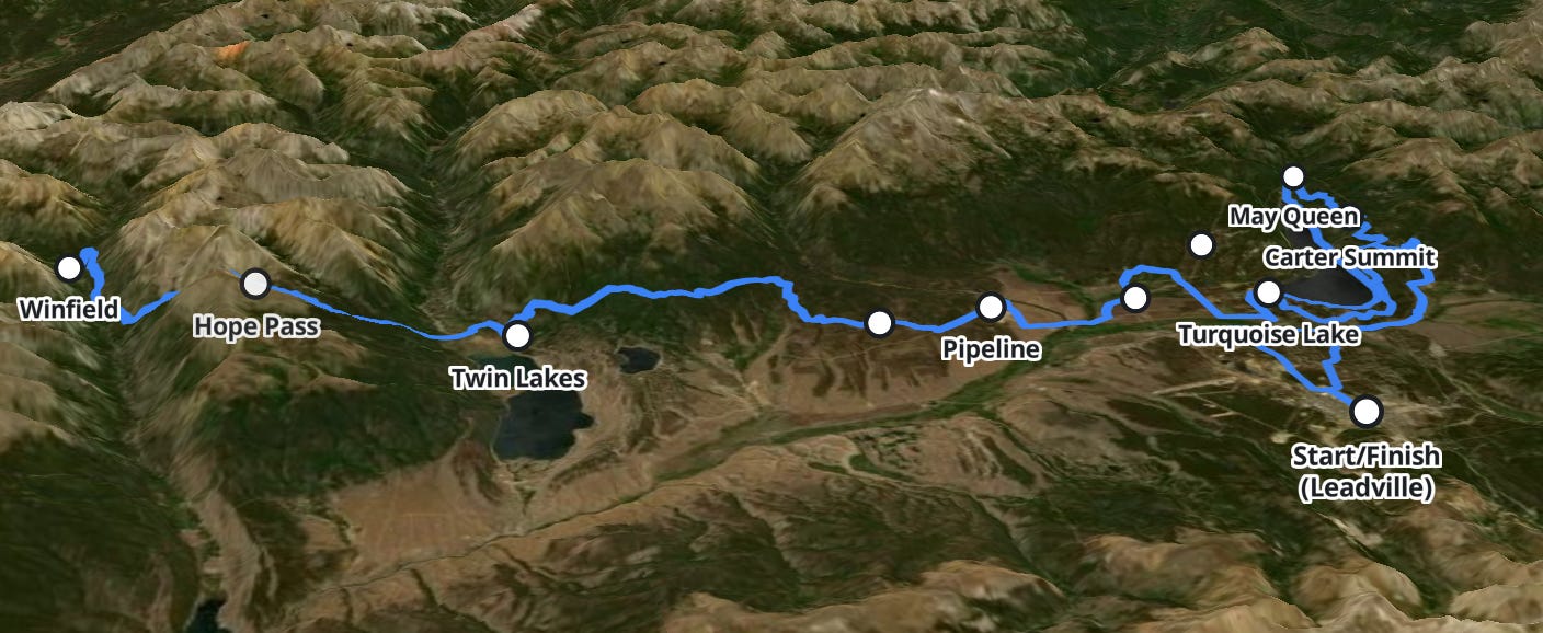
To be honest, I’ve never really had Leadville on my bucket list, but after spending time with these topo charts, I think it’s earned a spot.
So then what does the weather, etc, look like for this weekend? 2026 is shaping up to be very warm, perhaps the warmest race in the last 10 years:
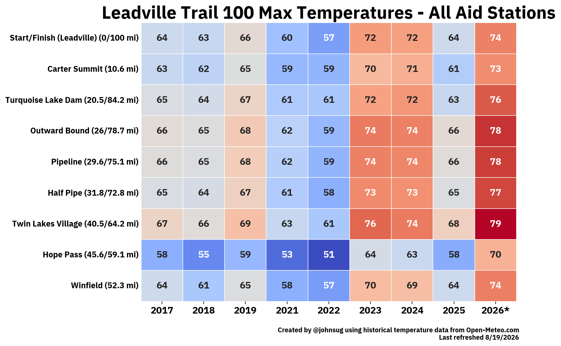
Note, Carter Summit is a new aid station for 2026, added on account of the fire re-route.
Temperatures max out at Twin Lakes Village, the lowest point of the race (which is still at elevation, roughly ~9,200 feet).
What this all is expected to look, aerially:
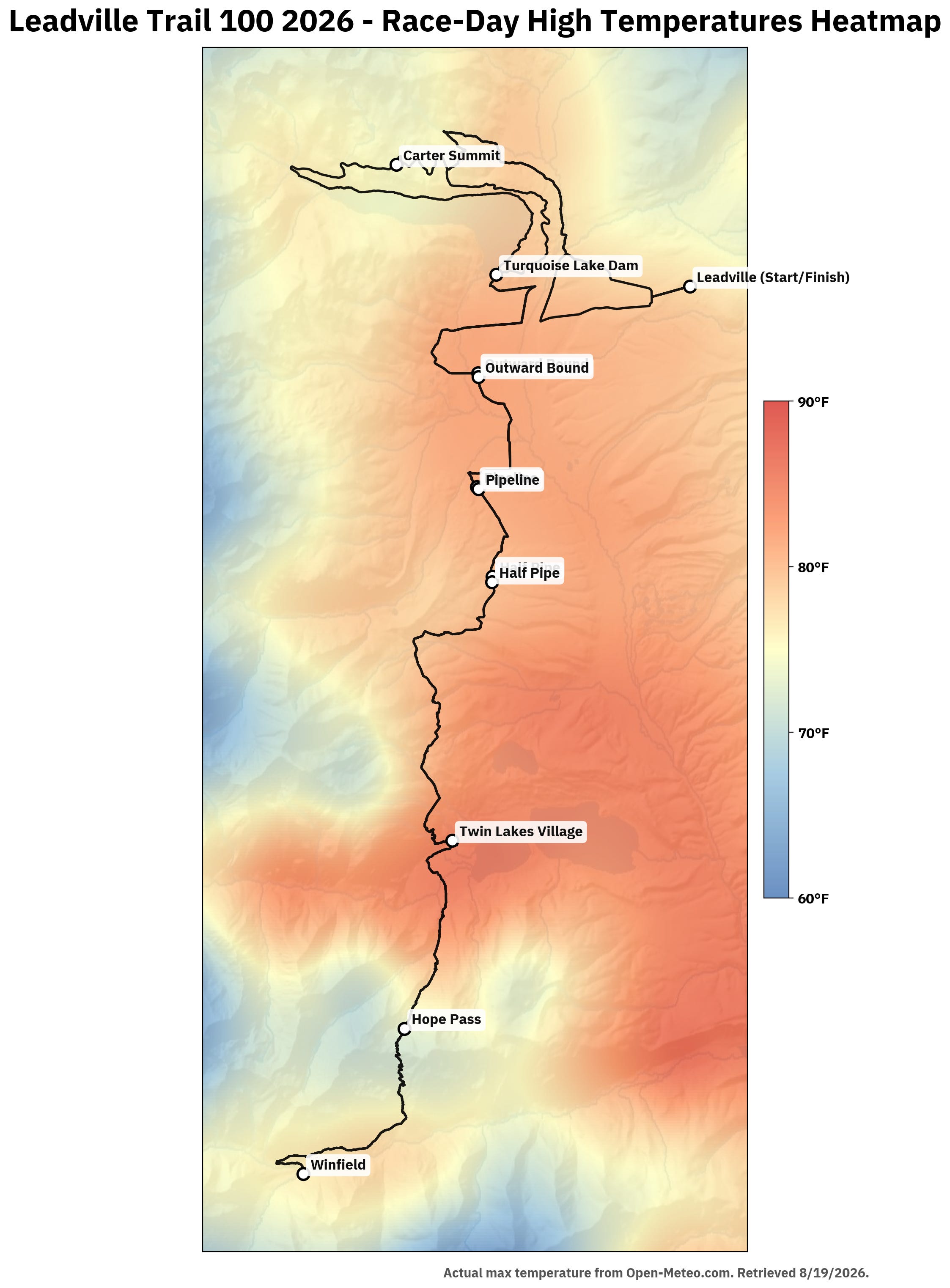
Or, in just two dimensions:
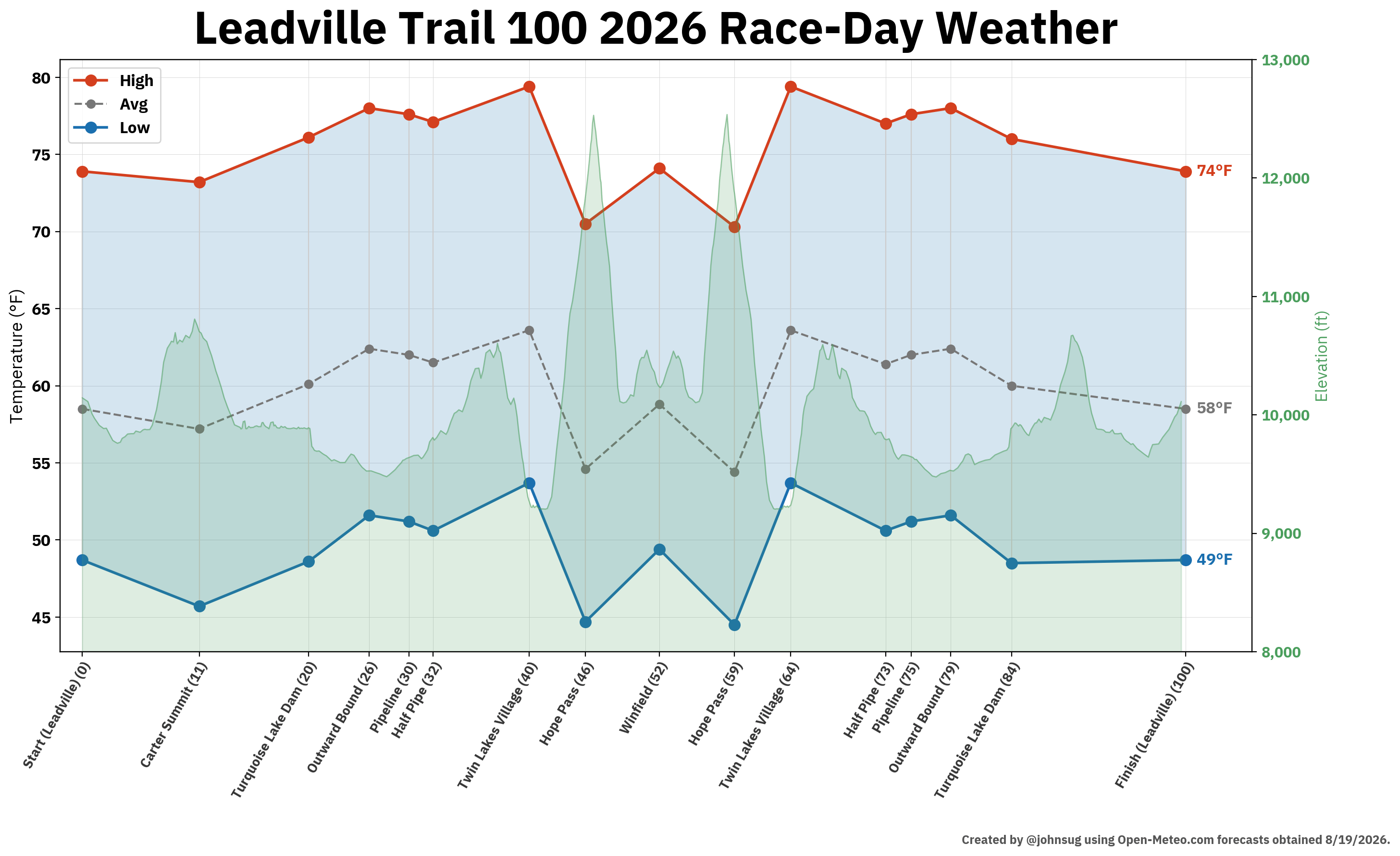
That last 16 miles, between Turquoise Lake Dam and the finish, without aid looks rough; good luck, runners!
Edited on Friday, August 21st, using MapLibre basemaps instead of the USGS Elevation Point Query Service 3DEP Dataset
No posts
Comments
Nothing yet. Say the first thing.
Sign in to join the conversation.