
Walk through the churchyard at Snaith Priory today and it is easy to assume that the church is all that remains of the medieval monastery. The great church of St Laurence dominates the town, its stone walls bearing witness to centuries of worship, but where are the buildings that once supported the monks who lived and worked here?
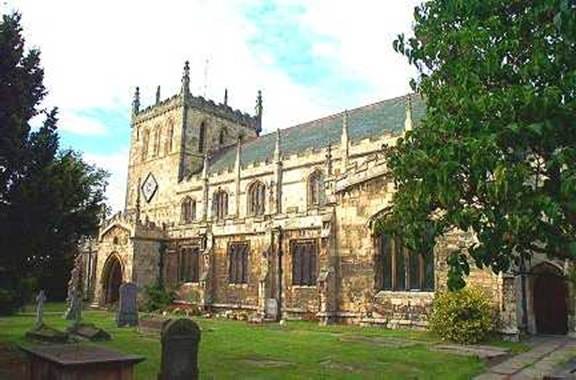
St Laurence Priory Church in Snaith. The south side.
It is a question that has intrigued members of the Howdenshire Archaeological Society for some time. Snaith was no ordinary parish church. Before the Dissolution of the Monasteries, it formed a small Benedictine priory dependent upon Selby Abbey. Even more intriguingly, it stood at the centre of the Peculiar of Snaith, an unusual ecclesiastical jurisdiction that survived outside the normal structures of church government. Behind these medieval arrangements may lie an even older story, for Snaith was also the centre of a substantial royal soke before the Norman Conquest.
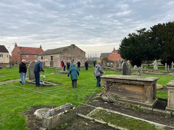
Note the ‘Old School House behind the extensive volunteer team.
Could traces of this long and complex history still survive beneath the churchyard? Could the ‘Old School House’ actually date right back to the medieval period, much altered through time?
A Community Investigation
In 2025 and 2026 we set out to find out.
Working with St Laurence’s Church and local volunteers, we organised a programme of geophysical survey designed to investigate the former Priory Garth surrounding the church. Before a single survey line was laid out, however, we began with people rather than archaeology.
A geophysics workshop attracted local residents keen to learn more about both the history of Snaith and the techniques archaeologists use to investigate buried remains. Some arrived with an existing interest in local history. Others simply wanted to know what was happening in the churchyard and how they might become involved.
Within a few weeks volunteers were helping to operate Earth Resistance survey equipment across the graveyard. Despite the technical-sounding name, the process is surprisingly straightforward. By passing a small electrical current through the ground it is possible to identify differences in soil conditions that may indicate buried walls, ditches or other archaeological features.
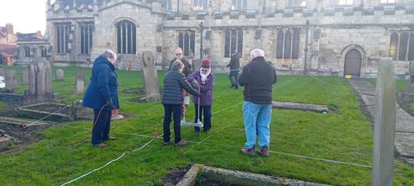
Operating the Earth Resistance rig.
What quickly became apparent was that archaeology is a team activity. Surveying an active churchyard requires patience, accuracy and a willingness to work around gravestones, monuments and visitors. It also requires plenty of conversation.
One of the pleasures of community archaeology is watching people who arrived as strangers gradually become a team.
Looking for Lost Buildings
The original aim was simple enough. If Snaith had once been a priory, surely there should have been more than a church.
Monastic communities required accommodation, storage areas, workshops and service buildings. Although many of these structures disappeared after the Dissolution, there remained the possibility that traces of their foundations might survive beneath the present churchyard.
The Earth Resistance survey covered extensive areas to both the north and south of the church. When the results were processed, several potentially interesting anomalies began to emerge. In places, linear features appeared within areas of higher resistance, raising hopes that buried structural remains might have been detected.
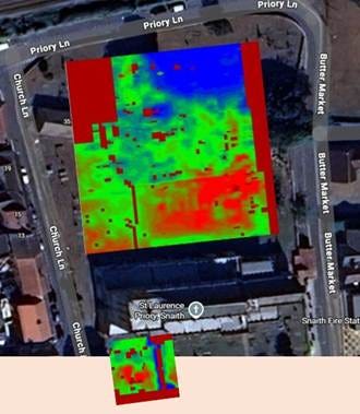
The Earth Resistance Results. At first exciting, then needs some support.
As always in archaeology, however, the first interpretation is not always the correct one.
The churchyard has been used for burial over many centuries. Graves, memorials and changes in soil conditions can all influence survey results. Some of the anomalies appeared suspiciously aligned with burial patterns rather than with the sort of structures we hoped to find.
To investigate further, we brought in Ground Penetrating Radar.
What Did We Find?
Ground Penetrating Radar allows archaeologists to look beneath the surface by transmitting radar signals into the ground and recording the reflections that return. It can be particularly useful in churchyards, where complex layers of burial activity are often present.
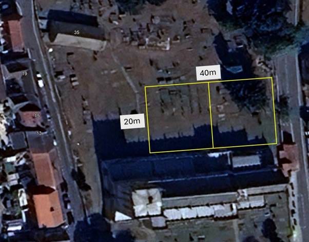
We surveyed the 40m by 20m block north of the church.
The results revealed a fascinating picture of graves, possible small crypts and drainage features beneath the churchyard. What they did not reveal was clear evidence for substantial surviving priory buildings.
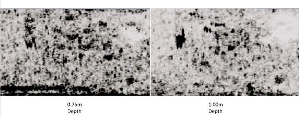
The RADAR Results at two different depths.
Looks very much like graves and crypts.
At first glance that might sound disappointing.
In reality it is simply archaeology.
Negative results are still results. We now know far more about the buried complexity of the churchyard than we did before the project began. We can also be more cautious about where surviving priory buildings might be expected and where future investigations should focus.
The survey has not solved the mystery of Snaith Priory.
But it has refined the questions.
The Most Important Discovery
Perhaps the most significant outcome was not archaeological at all.
Over the course of the project, 83 people became involved in one way or another. Some attended the introductory workshop. Others joined the field surveys. Members of the Snaith and District Men’s Association took part in discussions about the results, while many visitors stopped to ask questions and learn about the work taking place around them.
Twelve volunteers attended every workshop and survey session.
In a world where heritage can sometimes feel distant or inaccessible, projects like this remind us that archaeology is not simply about discovering the past. It is about bringing people together to explore the places in which they live.
Watching volunteers learn new skills, share stories and develop a deeper connection with Snaith’s history was every bit as rewarding as examining the survey results.
What Happens Next?
The search for Snaith Priory is not over.
Can RADAR survey inside the church give us clues as the earlier layout of the church?
Can we learn more from the ‘Old School’?
The geophysical survey has provided an important baseline for future research, but many questions remain unanswered. How extensive was the medieval priory? Does the Peculiar of Snaith preserve traces of an earlier Anglo-Saxon landscape? Could documentary research help us understand the relationship between the priory, the royal soke and Selby Abbey?
The answers may lie in old maps, forgotten documents or future archaeological investigations.
For now, the priory remains elusive.
But sometimes the value of archaeology lies not in finding all the answers, but in discovering which questions are worth asking next.
For the Howdenshire Archaeological Society, this was never simply a search for buried walls. The project offered an opportunity to bring local people together to investigate one of the most important historic buildings in the area. Over the course of the project, more than eighty people became involved through workshops, survey work, talks and discussions.
No posts
Comments
Nothing yet. Say the first thing.
Sign in to join the conversation.