
(This post was originally issued to paid subscribers in March 2026)
I have long been interested in Cricket Inn Road; a route that starts close to the city centre with good views of the East end and beyond, and which used to end at a large colliery and was also dominated for decades by the Corporation abattoir. Those industries, along with the views, have changed - but there was an earlier history of Cricket Inn Road, possibly a very long one indeed. Many of the looks I have made at individual Sheffield streets follow a similar pattern; lost industry and houses, but also a long history - and the city is full of those stories, and they do tend to naturally repeat themselves. The road appears named on Fairbank plans of the late eighteenth century, although interestingly a nice clear 1793 plan calls it the ‘Road to Cricket Inn’, so what we do know is that Cricket Inn Road has been known as such for over two centuries.
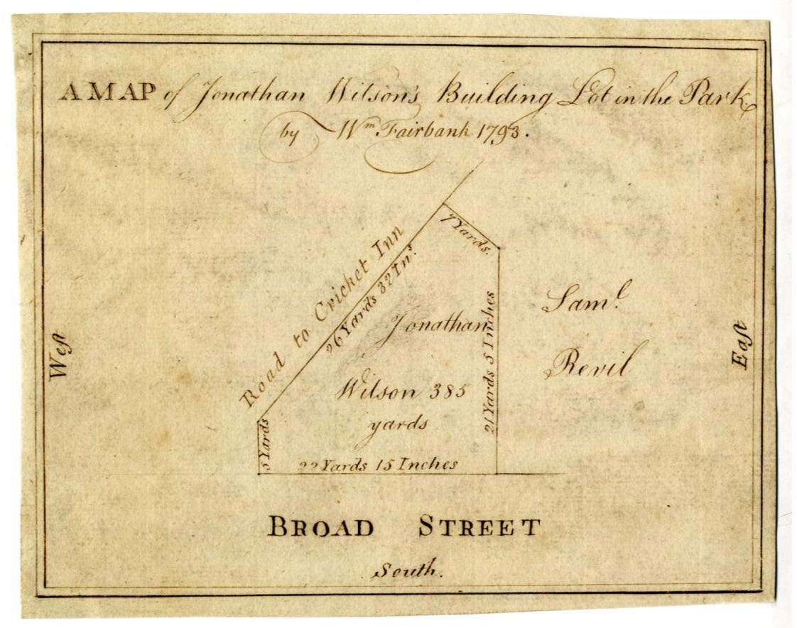
The ‘Road to Cricket Inn’ recorded by William Fairbank in 1793
The road is near the former Hyde Park Cricket Ground, however we have seen that was a co-incidence, as the ground was recorded in use from 1830. The name also pre-dates organised cricket in the old town - only rough forms of the game existed, but we may assume that the owner who named the Cricket Inn was a fan. Or can we? There is a school of thought that the rural area of the eighteenth century may have sounded to the sound of chirping crickets, rather than of bat and ball. The road may be very old indeed; it runs close to the edge of the old Deer Park that extended across Manor and beyond, and may be the route of one of the access paths to the park, being connected with the bottom of Manor Lane - and which then went on to the Manor Lodge itself.
The Cricket Inn Road that we can be sure about begins at the top of Broad Street, at the junction with Old Street. Immediately there is the sorry state of an abandoned old Sheffield pub - the Durham Ox. The pub was open from 1862 until 1993, and like the Old Harrow down the road has stood gradually deteriorating ever since. There have been several pubs on the road, a couple of them open until relatively recently. The detached and isolated property makes for a particularly sad sight, clearly visible as it is at the top of the hill. The pub’s name remembers a celebrated animal which had been bred in the early nineteenth century, and gave its name to many pubs around the country (indeed there was even another one nearby, on Exchange Street).
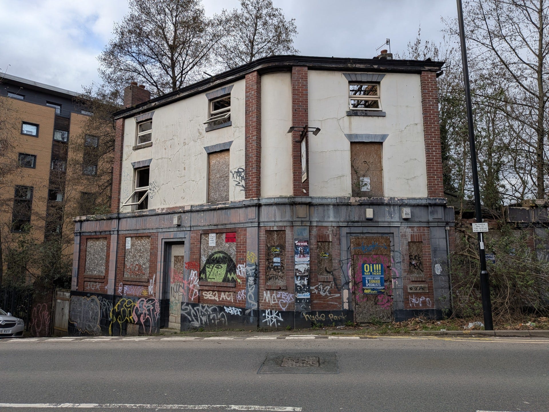
The sorry state of the former ‘Durham Ox’ pub today
Passing the old pub building the road continues up the hill towards the Bernard Road junction. Here views open up towards the industry, and over the railway to both sides. However there were a lot more railway views in the past; Sheffield Victoria Station in particular, but also the Nunnery Colliery branch line which headed down close to the canal basin. Running down the side of the old Durham Ox there used to be a road with the great name ‘Navigation Hill’, which connected the road with Blast Lane and the canal - the gates that it led to can still be seen in the railings alongside the canal path. In the opposite direction the Don Valley open up to the east - here was a view that used to be very different, and it was photographed in the 1860s to give us a remarkable look into the Sheffield of the time.
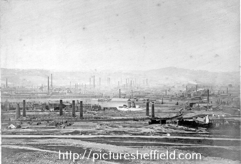
View from Cricket Inn Road in the 1860s
Although in the twentieth century the above view gradually improved as industry and our attitude to clean air changed, for half a century the Sheffield Corporation Abattoir was located along Cricket Inn Road. This does also reflect changing attitudes as the old town shambles were located near to the markets and the Don, and the animal slaughter was carried out in less than clean surroundings. The new state of the art abattoir was opened here in the early twentieth century and remained until the 1980s - these days there is another change in our sensitivities, as wherever meat is processed now, it doesn’t tend to be in a large building with a sign proudly announcing its purpose! Today the Supertram line to Meadowhall cuts through part of the site.
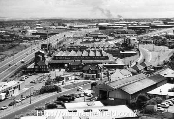
The former Sheffield Corporation Abattoir (Cricket Inn Road on right)
The Durham Ox wasn’t the only pub on Cricket Inn Road by a long way - they have all gone now though. In the photo above the former ‘Wybourn Tavern’ can be seen from the rear, the pub dating from the 1840s and now with just an empty space in its place. Cricket Inn Road also has a number of roads turning off along its length, and some have changed beyond recognition - most notably of all Aston Street, once a lengthy road full of houses and shops, but now barely exists being just a short stub cut-off by the Supertram tracks. Everything in the photo below has gone; the houses, corner shop, school - everything. That stretch of the road, just before the Parkway Retail Park, hasn’t been replaced by much at all.
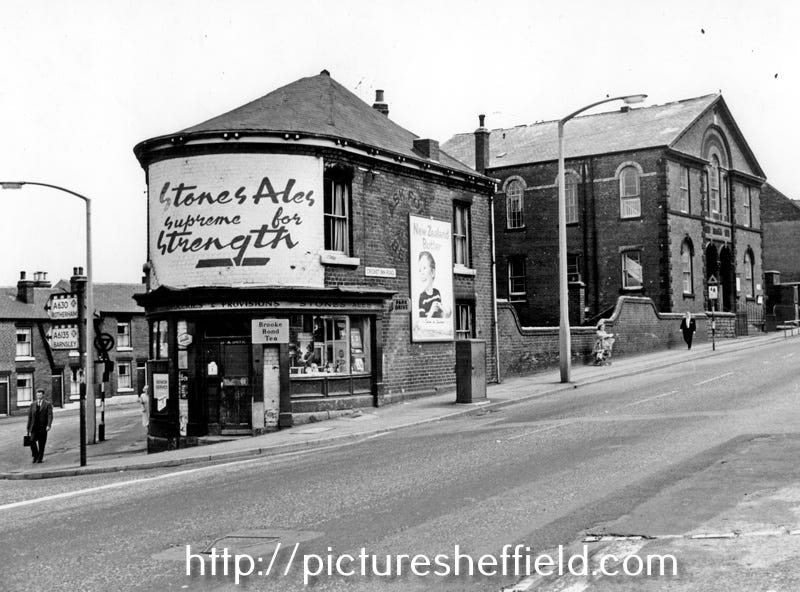
The junction of Aston Street and Cricket Inn Road in 1965
On the opposite side of the road from the retail park though there are new houses, and although much has been lost it does look quite pleasant now. Historically the people living here would have had a different view; that of Nunnery Colliery and its smoking spoil heaps. The colliery was opened in 1868, effectively replacing several smaller pits in the Manor area, before finally being closed in the 1950s. The area that the mineworks occupied is now greener of course, but there might be a (relatively) small remnant still to be found at the far end of Cricket Inn Road, where there is a marked heap beyond the junction with Manor Way - although some fly-tipping has added to its height I believe that this feature originally consisted of spoil from the colliery.
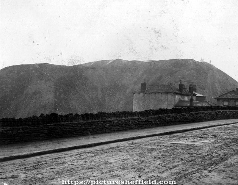
The view of the old Nunnery Colliery spoil tip from Cricket Inn Road in 1898
The far end of Cricket Inn Road is where my interest in the area began, as it is here that the tramroad crossed from the Manor pits down towards the canal basin from 1830 to 1870 (a subject covered elsewhere on this page). Now it is a changed road layout, and a bit of a curiosity as a result - Manor Way is a relatively recent connection with our road, but the original course of Manor Lane took it round the remaining spoil heap where it joined Cricket Inn Road. These days that junction is only used for parking and access to the businesses nearby, and part of a historic Sheffield road has been partly abandoned - a contrast to the retail park and newly built houses on the other side of the roundabout.
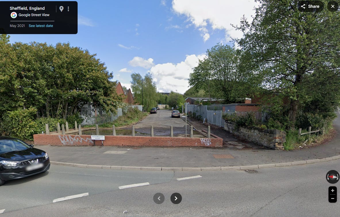
The cut-off section of Cricket Inn Road, with grassed over spoil heap to the right.
From abandoned pub to an abandoned piece of road, passing the site of lost streets, houses, shops and pubs along the way - this is the story of both an interesting and typical Sheffield street. A good enough view of the old town’s industry and chimneys for a photographer to take up position in the 1860s, but for many decades providing a no doubt unpleasant view and smell for the people who lived and worked here. Today it has a mixed story; some regeneration has taken place, with new residents creating their own chapter in a long story. That story is of a road that is certainly old, but may even be ancient - and with a name that has a mystery behind it too. All in all a street that deserves a second look, and is worth its place in the city’s story.
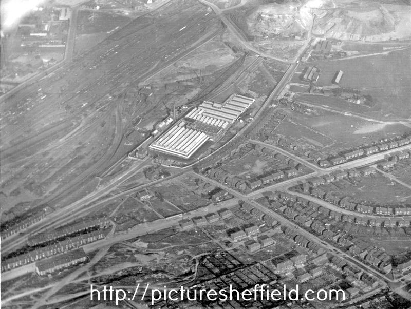
Cricket Inn Road running through centre of shot in 1935 - with abattoir and colliery
No posts
Comments
Nothing yet. Say the first thing.
Sign in to join the conversation.