
One of my hobbies used to be reading the archaeological studies submitted with municipal planning applications. (Now it’s more work than hobby.)
There’s a new housing development being proposed for 319 Huntmar Drive next to Tanger Outlets in Kanata. Back in 2015, the site was being considered for “Phase 2” of Tanger Outlets, including a hotel and restaurants. The archaeological assessment submitted by Nicholas R. Adams for Adams Heritage (June 30, 2009) and the accompanying photos of artifacts recovered during a survey, made for a really interesting story.
Here’s a story about that assessment that I wrote for StittsvilleCentral.ca in 2015.
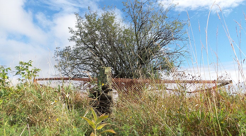
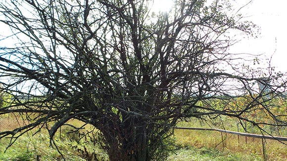
(Above: This old crab apple tree just south of Tanger Outlets led archaeologists to the site of a the 19th century Burroughs Farm. Photo by Glen Gower / September 2015.)
It’s hard to imagine Kanata/Stittsville without an NHL arena, without big box stores, without the Queensway. But every once in a while, we get a little reminder of what this area used to be like when it was known as one of the finest farming communities in Eastern Ontario.
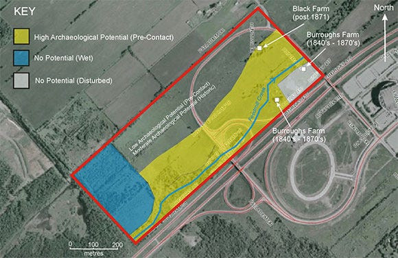
Within the next couple of years, pending development approvals, the second phase of Tanger Outlets will be built, including a hotel and restaurants. Phase Two will be built between the Queensway and Feedmill Creek, the waterway that flows from west to east across the property.
According to the development plan, archaeological features next to the creek will be preserved and incorporated into the landscaping of a park on the site.
Fotenn, the consulting company that’s developing plans for the site, couldn’t tell me exactly what that park would look like, or what those foundations are, but they appear to be remains from one of two farmsteads that operated on the site.
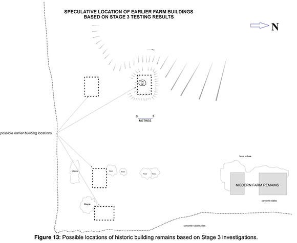
In 2009, as part of an archaeological assessment of the site, a team of researchers led by archaeologist Nicholas Adams uncovered the remains of the George Burroughs farmstead, a farming operation from the early 1840s until the 1870s.
They also found the remains of structures from a later farm that operated on the land until at least the early 1990s.
What’s interesting is how they came across the old farm: It was all thanks to a crab apple tree.
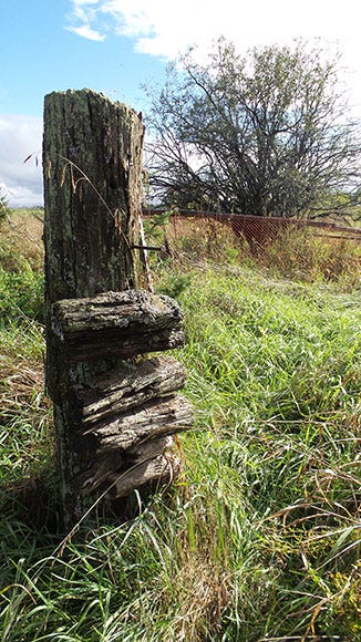
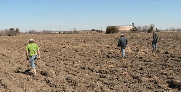
The archaeological team first noticed the tree while surveying the site in early spring 2009, and recognized right away that there was something different about it.
“A large sunken feature surrounding an old crab apple tree was the first indication that an historic archaeological site was present between Feedmill Creek and Highway 417 in the southeastern quadrant of the property.”
“Although this feature lay in close proximity to the remains of the more modern farm, it was evidently of some antiquity since the tree growing from its centre was clearly old.”
Further excavation of the area uncovered artifacts and evidence of a farm that operated in the mid-19th century.
Based on old maps, census data and other historical references, we can get a pretty good idea of who owned the land over the years, and what was on it.
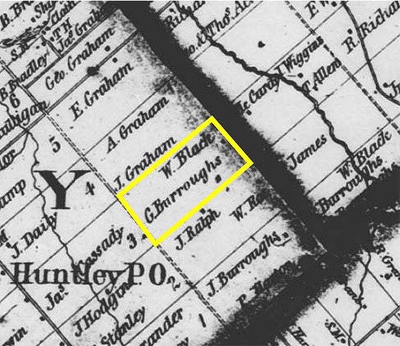
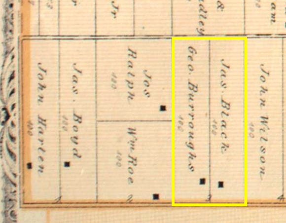
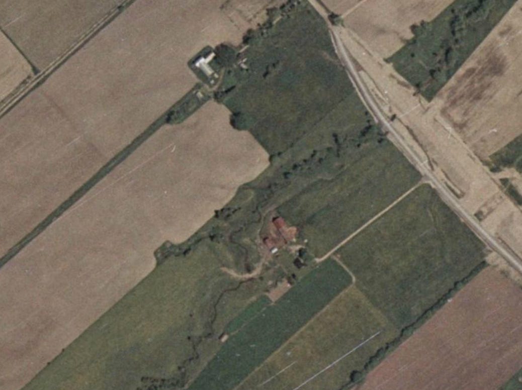
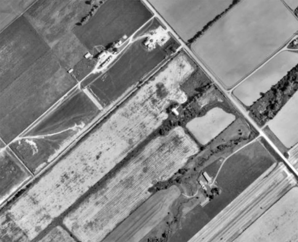
Adams outlines the likely ownership of the property and farm in the report:
The 1851 Personal Census shows George, his wife Anne and their several children, all of whom were born in Upper Canada beginning about 1831. The family lived near John Burroughs. A John Burroughs, who emigrated from Mothell, Kilkenny … appears on the 1822 Census for Huntley, so the presence of other Burroughs families may represent chain immigration of a large family group.
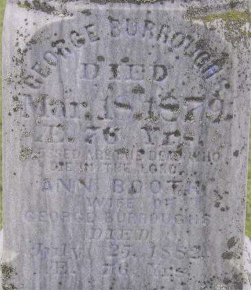
In 1851, George Burroughs had fifty acres cleared, of which twenty were in crop, and thirty in pasture. He was present in the township through to his death in 1879. The 1871 Census records him as having one house, 1 storehouse, four barns and stables, and a large number of agricultural implements.
It also records that 80 acres of his total of 250 acres were cleared. We know that the Burroughs family owned other farms in the area, but it is not clear how much of the farm on Lot 3 was cleared at the time.
His wife, Ann Booth Burroughs, appears on the 1881 Census, living next to her son, Benjamin. Ann died in 1882, and in 1885/6, Benjamin Burroughs is listed in a local directory as the owner of part of Concession 1, Lot 3. The Burroughs family also owned Lot 1, Concession 1, and Lot 2, Concession 2, at this time.
Walling’s Map of 1863 shows a structure on the property, close to the southern boundary of the lot, with a significant setback from the township line. A map of 1878 suggests that in the intervening years the house location had changed. On this map, in Belden’s Historical Atlas, the house is shown closer to the township line, and near the northerly property boundary, in close proximity to the Black Farm.
It’s possible the original house on the 1863 map burned in the great fire of 1870. Most homes and buildings in the area were obliterated by the fire.
(The Burroughs would eventually sell Lot 1, Concession 1 to James and Jane Boyd, who I’ve written about previously.)

***
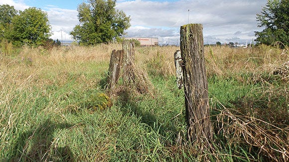
A number of artifacts were found that are believed to date from between 1840-1879, including hand-painted dishes, window glass, a cast iron kettle and a green glass bottle. They also found what they believed to be an old fence line, marked by a lilac bush and a line of maple trees.
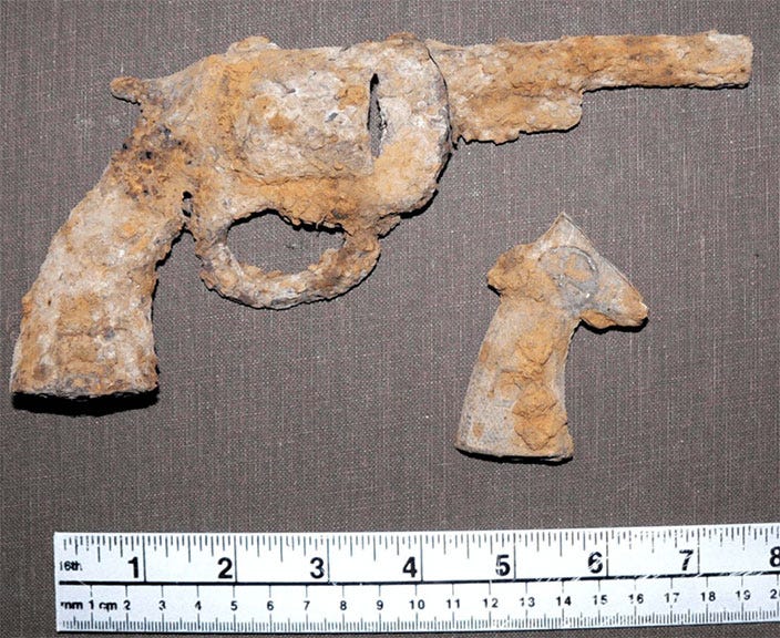
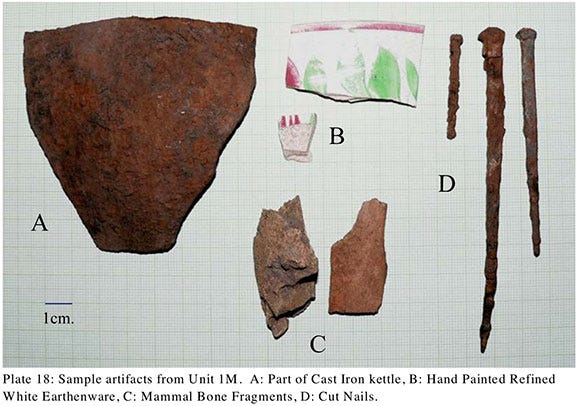
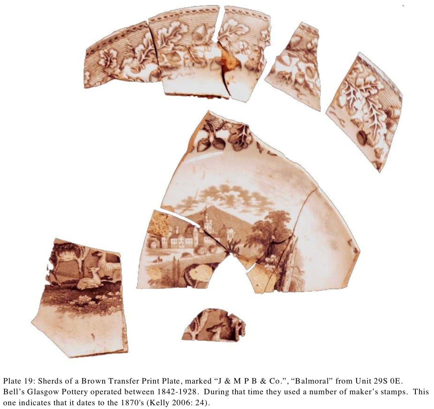
The items found are useful for establishing a date of the farm that was there, but don’t have any special significance themselves.
“Toy guns (are) not so common, but typical of the kind of twentieth century trash one can anticipate from a farmyard that has been in active use well into the twentieth century,” says Adams.
“Same with the pottery. Usually we find smaller bits, but people create garbage and since a broken plate is no longer useful, it gets thrown out to wherever garbage is thrown. The same materials could be found around old farmsteads on every single 100 acre piece of property in Carleton County (or the whole of eastern Ontario, for that matter). So no, not rare, not unusual and not particularly interesting,” he says.
The site has been registered as “BhFx-40”, and notes that it should be preserved and protected from any development activities.
It’s not entirely clear what will happen to the tree or the archaeological remains when Tanger’s Phase Two is built.
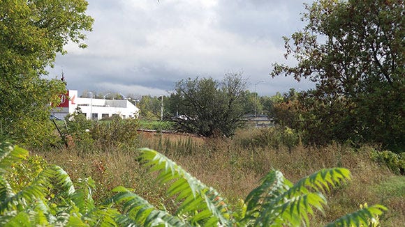
The tree itself is visible from the road south of the current Tanger mall, near the children’s playground. It’s surrounded by protective fencing, as are two other large trees nearby. The area is grown over with weeds, and there are a few newly-planted trees, but the crab apple tree still stands out.
Earlier this year I asked Fotenn, the company that developed the plan for the site, about what will happen to the trees and the remains of the farm.
“At this point, RioCan and Tanger are considering the options for the site. The site plan that was submitted to the City is still very much in flux and is subject to change based on lease deals, revisions responding to city comments, etc. We continue to work with the City and the Province regarding the archaeology present on the site,” replied planner Paul Black.
***
I wonder if George and Ann Burroughs could ever have imagined what Concession 1, Lot 3 of Huntley would eventually become, with outlet stores across the creek and a highway next door? What would they think, what would they say if they could see their farm today?
Post script: The proposed hotel and restaurants were never built. Plans for the new housing proposal, published in May 2026, would avoid development on the most archaeologically significant part of the Burroughs Farm. And it looks like they’re planning to name the development “The Burroughs”, as a nod to the land’s history.
Comments
Nothing yet. Say the first thing.
Sign in to join the conversation.