
The last couple of weeks have been hot and humid! Seems like “High Summer” has come earlier than the “Dog Days” of August this year. But, even with the hot weather I’ve managed to get out and do some exploring along the Big Sioux River in South Dakota and Iowa. I’ve also had a tour of some sites in Minnesota where buffalo remains have been found in streams. Good stuff for future essays. But for now, let’s continue our look at archaeology in another part of the country.
We’re about halfway through our summer “stroll” around the Southwestern United States looking at perspectives for the Big Sioux Watershed…. differences and similarities. This post focuses on Chaco Canyon. It was the epicenter for the Ancestral Puebloan Culture that built the cliff dwellings at Mesa Verde and the structures at Aztec Ruins before eventually becoming the Descendant Nations that live in contemporary Pueblo communities. The main objective for our trip was to visit Chaco Canyon even though we were lucky enough to “discover” some of the other sites.
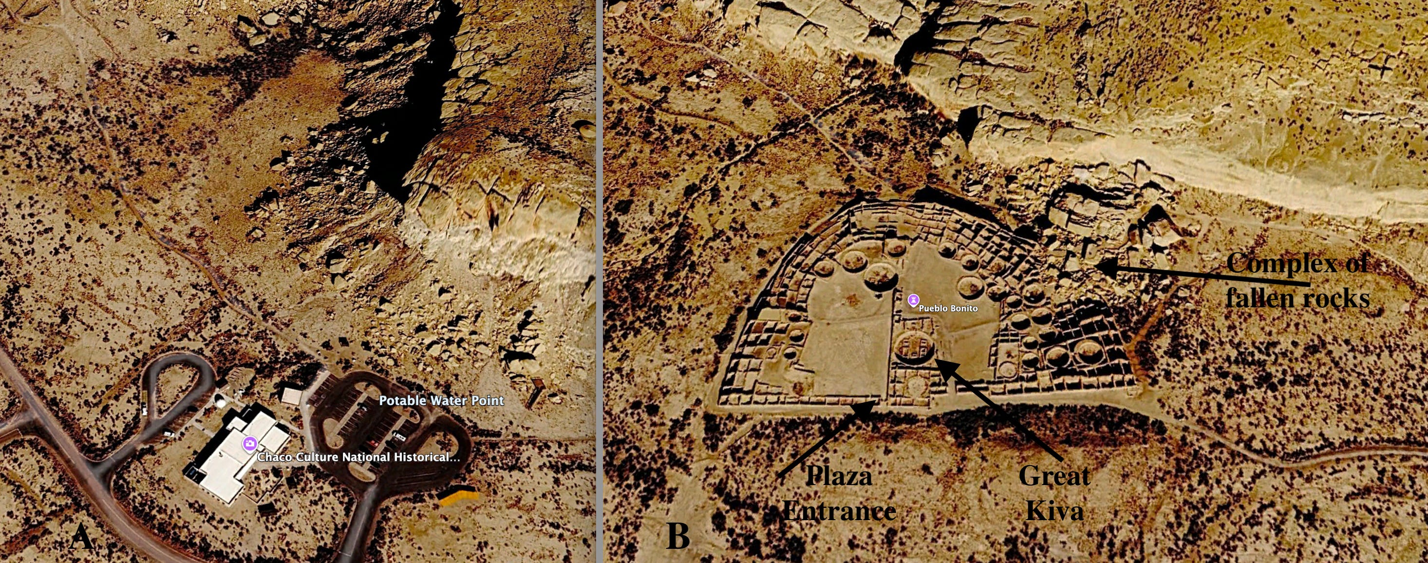
Figure 1---- A) Visitor’s Center at Chaco Culture National Historical Park. B) Pueblo Bonito. These images are from Google Earth.
The brown satellite images in Figure 1 capture the general feeling of the desert experience. However, the thing that really stuck out for me were the fractures in the vast exposures of bedrock! We’re looking down from space in these images, but the fractured bedrock was even more conspicuous on the ground looking at the cliffs. (I can’t help it; I’m a geologist!) Actually, this sandstone is closely related (age and environment of deposition) to the rocks that I described in my dissertation back in the Age of Dinosaurs (that’s when the deposits formed NOT when I wrote it!).
The Visitor’s Center has potable water labeled on the image (Figure 1-A). and that’s important in a desert environment. The jagged cliffs in the upper right-hand corner of the image are the result of the fractures that are also visible in the top of the mesa. Similar rectangular patterns are seen in the bedrock above Pueblo Bonito (Figure 1-B). The fractured bedrock posed a threat when a complex of large blocks (marked by the black arrow) fell onto the northeast corner of the structure in the 1940s. We’ll come back for a closer look at Pueblo Bonito later in this essay.
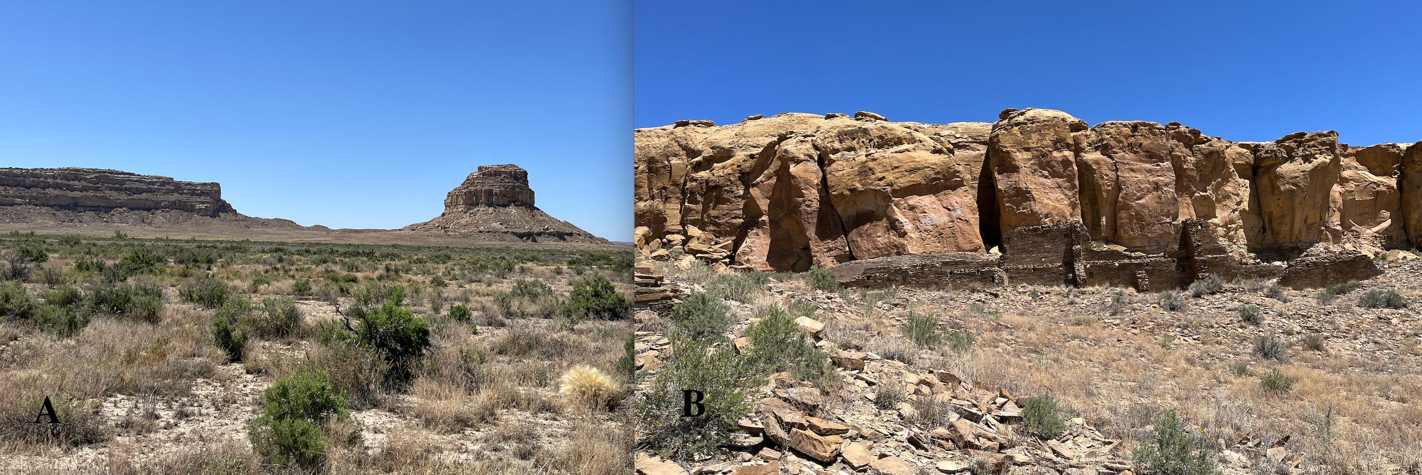
Figure 2----The margins of Chaco Canyon. A) Mesas and buttes along the south margin. B) Rims of exposed bedrock along the north margin.
On the drive in toward Chaco Canyon, I was impressed at how familiar the landscape seemed to be. It reminded me a lot of the badlands scenery in the western Dakotas. But then when we got into the actual canyon proper, the iconic mesa country of the high desert asserted itself (Figure 2-A). It looks like something out of a classic old western movie. There are no green fields of corn and soybeans here, in contrast with the Big Sioux Watershed.
When you stand looking at a building with the cliffs of fractured bedrock in the background, there’s a really striking pattern. The walls in the structure seem to be related to the arrangement of the fractures (Figure 2-B). Astronomical alignments of building components have been a really big deal in the studies of Chaco Canyon. But replication of the fracture patterns in the bedrock has not been discussed much at all.
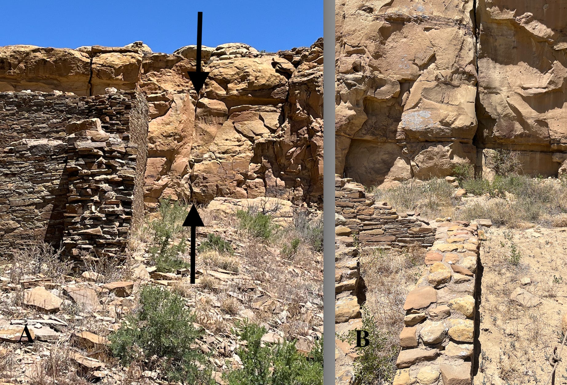
Figure 3----Buildings and bedrock fractures appear to be aligned. A) Structure standing away from the bare bedrock cliff. B) Structure standing close to the cliff.
So, here are a couple examples of the alignment of constructed buildings with the natural fractures in the bedrock. In the first photo the building is located away from the cliff face, but the building wall trends into the cliff, parallel with the fracture marked with the black arrow (Figure 3-A). Although the overall trend is generally to the north here, there are other orientations in the canyon that are east-west as well as to the northeast and southeast.
In the second example (Figure 3-B) a different building stands closer to the cliff face. That makes it even easier to see that the wall is in perfect alignment with a bedrock fracture. I measured the orientations of both the building wall and the fracture (like any good geology geek) and the compass orientations are identical. The people who built the structure seemed to have matched the bedrock patterns.
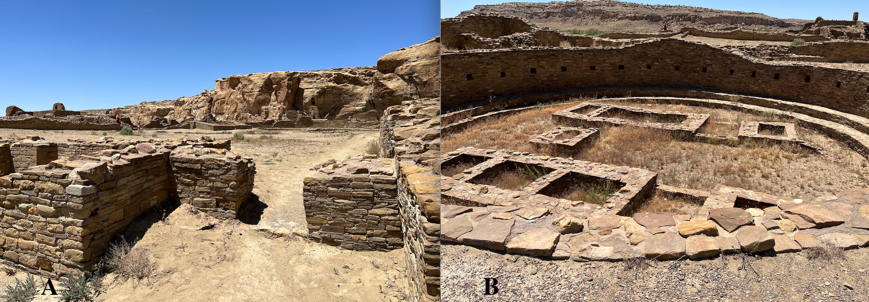
Figure 4----Pueblo Bonito components. A) Main plaza entrance. B) Interior view of the Great Kiva.
Pueblo Bonito is probably one of the most important structures in Chaco Canyon. It’s part of collection of buildings known as “Downtown Chaco” because the cultural activities seemed to be centered in this area. And many of those buildings are oriented to replicate patterns in the land and sky. Pueblo Bonito is a complex of small square rooms and larger circular ceremonial kivas (see Figure 1-B). It was built in stages from about 900 to 1100 AD and was a focal point for the “empire” that spread out into the surrounding region.
The entrance to the main plaza (Figure 4-A) is located in the central part of the south wall (Figure 1-B). That straight wall is oriented exactly east-west, so it aligns with the sunrise and sunset positions on the spring and fall equinoxes. Some sets of bedrock fractures also trend east-west. The Great Kiva is a major ceremonial space located within Pueblo Bonito (Figure 4-B). A few of the more obvious internal structural elements of the kiva that are visible on the ground can also be seen in the satellite image (Figure 1-B). However, there are some aspects of Downtown Chaco that are much more subtle than the aligned walls and important ceremonial spaces.
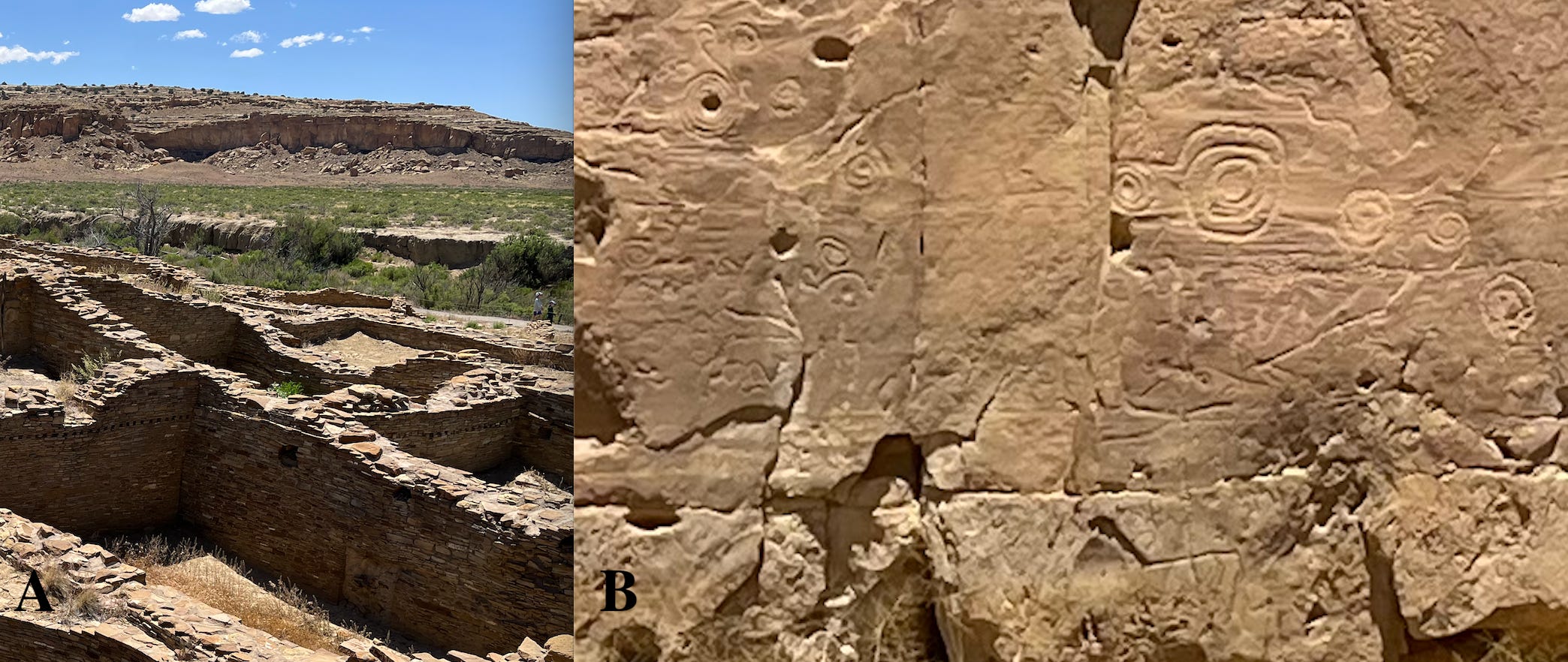
Figure 5----Subtle cultural features. A) Possible amphitheater in the south canyon wall. B) Rock art on the north canyon wall.
There’s a new area of research in Chaco Canyon that aims to describe the “soundscape” or “acoustic landscape” of the area. One aspect of that work identifies an arc-shaped place in the cliff line that acts as an “amphitheater” to amplify ceremonial sounds. I’m not certain that this is the exact place (Figure 5-A), but it at least resembles the feature. In addition to trying to understand and recreate the ancient soundscape, there’s also the contemporary issue of how the sounds of drilling and mining operations might impact the ceremonial canyon.
Rock art in the desert southwest and in other parts of the country is often controversial in archaeology. That’s because it’s usually hard to put a date on it and often does not involve Native American perspectives in the interpretations. There is rock art in Chaco Canyon (Figure 5-B) and the circles and spirals are a common motif. But these are subtle features that tend to be overshadowed by the dramatic architecture. In addition, the issues of interpretation and dating make the rock art less impressive than the stories associated with the buildings.
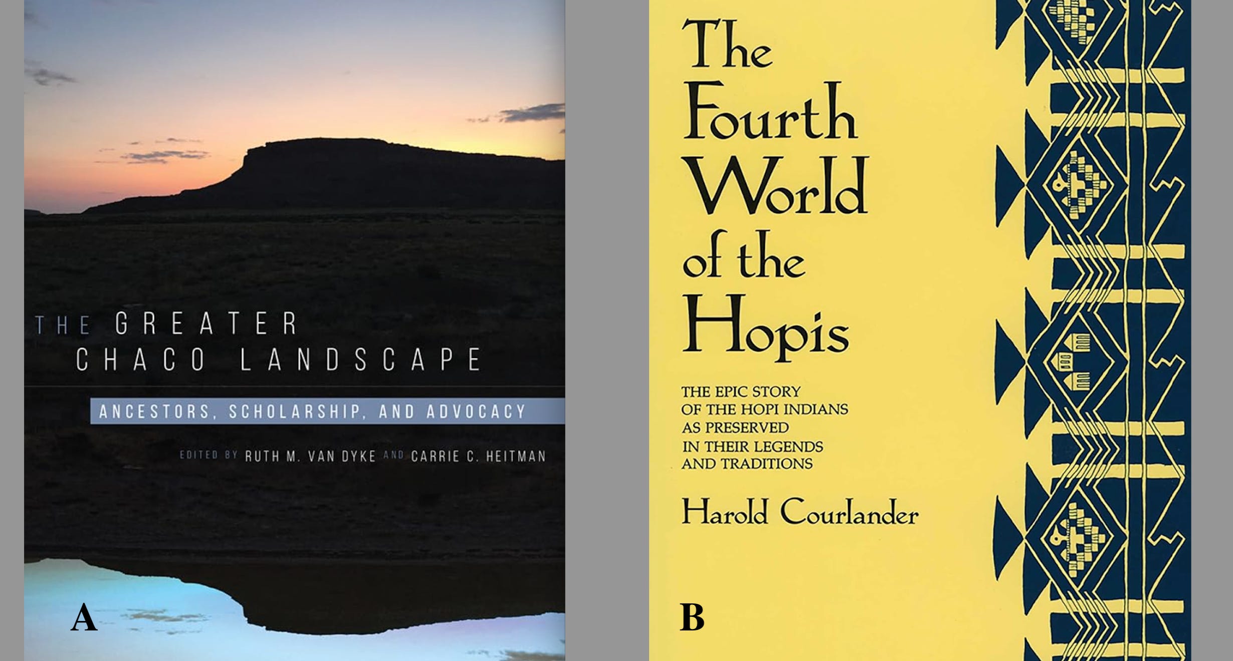
Figure 6----Suggested books that deal with Chaco Canyon and the Ancestral Puebloan Cultural tradition.
One of the people who read the last post thanked me for the book suggestions. So, here are a couple more related to Chaco Canyon. The Greater Chaco Landscape (Figure 6-A) is a relatively recent research summary that’s unique because there are links to online videos for all 17 chapters. I haven’t read all of the chapters or watched all of the videos, but the things that I have read and/or watched are cool. The unique format tends to acknowledge the importance of oral traditions for Native Americans.
I bought The Fourth World of the Hopis (Figure 6-A) because of the pleasant memories I have of The Book of the Hopi by Frank Waters. I read the book by Waters back while I was in grad school, but Wikipedia tells me it was part of the “Mayanism” movement that gave us the excitement about the world ending in 2012. So, it’s sorta contaminated as a New Age fad and money maker.
Like Frank Waters, Harold Courlander was not Native American. However, Courlander was a more careful folklorist who acknowledges most of his sources by name. I’ve not finished reading the book yet, but there are some obvious commonalities with Native American traditions in the Big Sioux Watershed. For example, clan migrations are central to the stories, the number 4 is prominent in them, and the importance of serpents or snakes associated with natural springs is emphasized. Those are all things that are highlighted by Dakota and Omaha/Ponca traditions in the Big Sioux Watershed.
However, there are also some commonalities between Chaco and the Big Sioux that are not so innocuous.
“And now for something completely different”
Did you ever watch “Montie Python’s Flying Circus” back in the day? I think that it might still be available on YouTube? It was a crazy British comedy TV show that used this catch phrase to pause the chaos periodically and do a parody of a newscast.
Unfortunately, this “News” is not funny!
For several weeks we’ve been hearing news about the current Administration reducing the size of the protected areas around two National Monuments in southern Utah called Bears Ears and Grand Staircase-Escalante. The fickle Feds are now opening up that country to expansion for oil and gas drilling and for coal and uranium mining. Aside from the general concerns about the value of an extractive economy, there’s also a very immediate direct threat to the ceremonial landscape in Chaco Canyon. We are now hearing that environmental protections will also be removed from the ten-mile buffer zone that has surrounded the canyon.
It’s hard to believe, but this mess is all related back to the confusion in Washington, DC, about the Lincoln Memorial Reflecting Pool! Revisions to Section 106 of the National Historic Preservation Act (NHPA) have made it possible to tear up landmarks in DC as well as now remove protections for national monuments all over the country. Here’s link to a Substack essay that lays out how the troubles at the Reflecting Pool are tied to the threats at Chaco Canyon:
“Everything is related” and what’s happening in the southwestern US and in Washington, DC, will directly impact our historic and cultural sites in the Big Sioux Watershed. We’ve got plenty of properties in the National Register of Historic Places. Now those are all at risk with this tinkering and revision of Section 106 of the NHPA.
No posts
Comments
Nothing yet. Say the first thing.
Sign in to join the conversation.