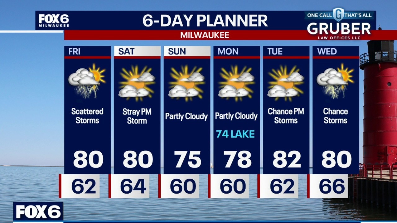
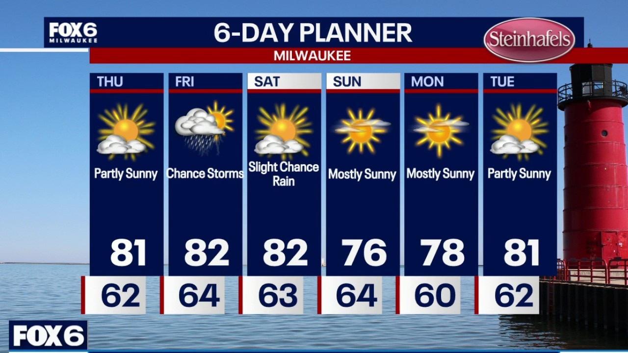
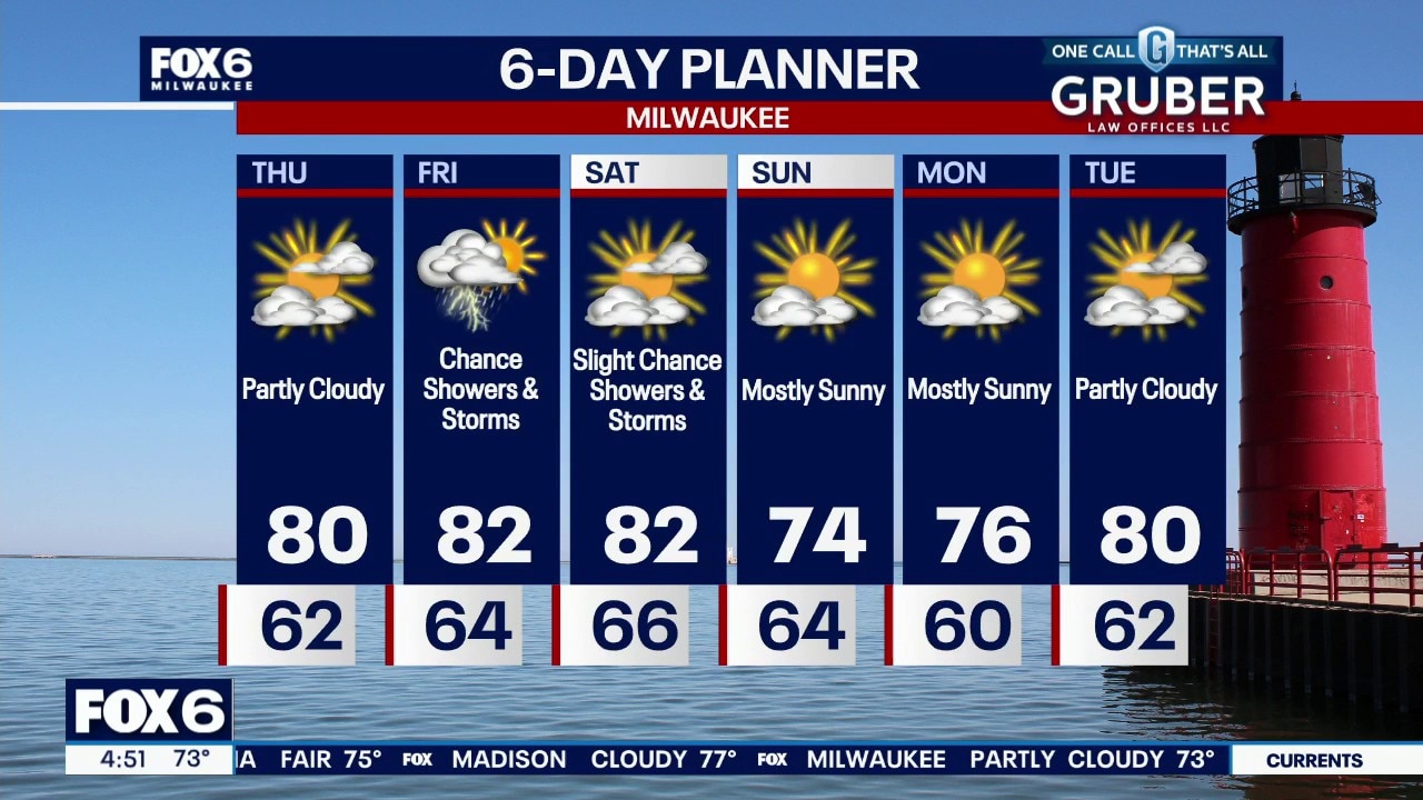
Dry tonight, then scattered thunderstorms are expected throughout Friday. Some storms could be strong to severe as the cold front moves through in the evening. These could very well impact some high school football games. Only a slight chance of a shower or storm Saturday, otherwise dry this weekend. Dewpoints drop Sunday.
Dry tonight, then scattered thunderstorms are expected throughout Friday. Some storms could be strong to severe as the cold front moves through in the evening. These could very well impact some high school football games. Only a slight chance of a shower or storm Saturday, otherwise dry this weekend. Dewpoints drop Sunday.
Spotty light showers possible Friday morning, then scattered thunderstorms through Friday night. These may impact high school football games. A few storms could be severe with all modes of severe weather possible, including a weak tornado.
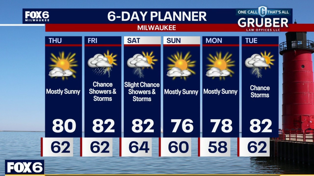
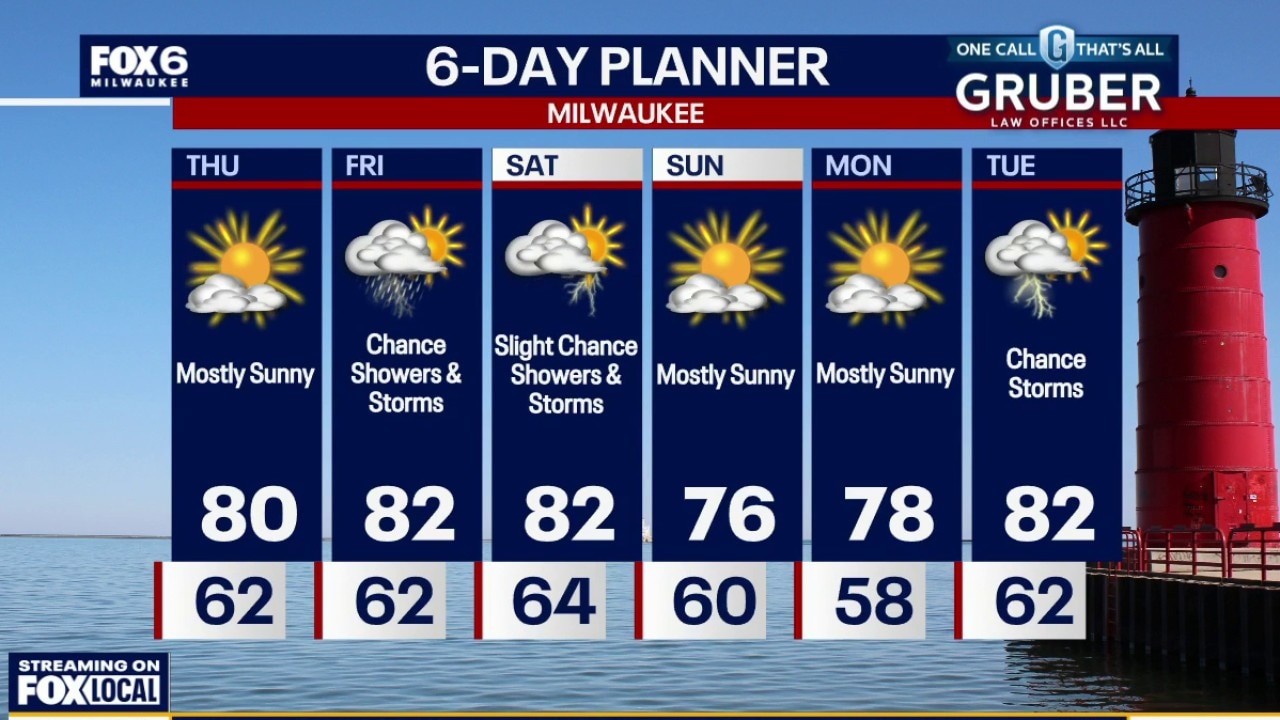
Thursday gives us one more quiet and pleasant day, although some patchy fog could develop early. Showers and a few thunderstorms return Friday as a weak low and cold front cross the region.
Thursday gives us one more quiet and pleasant day, although some patchy fog could develop early. Showers and a few thunderstorms return Friday as a weak low and cold front cross the region.
Patchy fog tonight and refreshing with temperatures in the 50s and low 60s. More sunshine Thursday, then a few scattered showers and storms on Friday. We are not looking at severe weather at this time. Slight chance of a pop-up Saturday, otherwise dry this weekend.
Violent wind and rain created a mess in parts of southeast Wisconsin on Tuesday, Aug. 18. The hardest hit areas include Waukesha and Milwaukee counties.