
Published August 22, 2026 9:00 AM EDT
Extreme heat declines as storms stretch through Central Florida
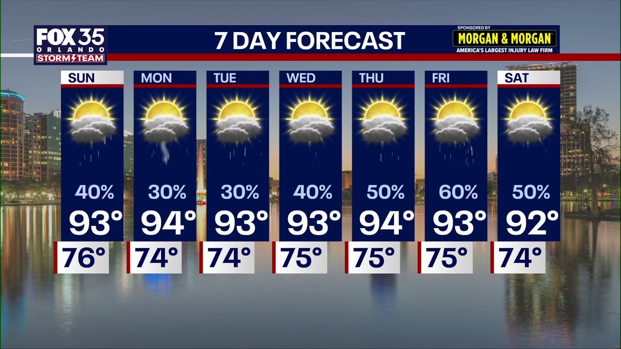
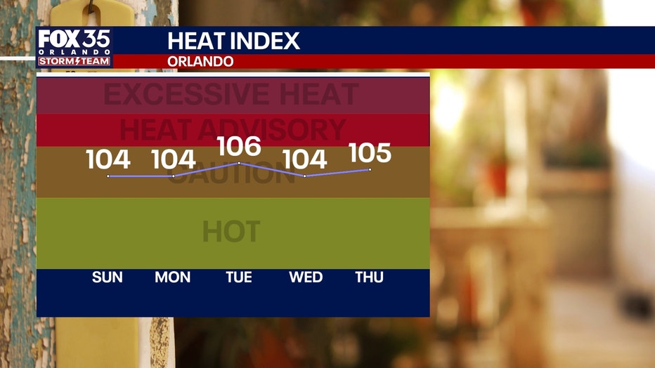
The steaminess is sticking around as we kick off our weekend, but thankfully, temps are slightly cooler than where they were earlier this week. Temperatures this past week felt like 112 and above. This weekend and through the next seven days, temperatures will linger in the low 90s with heat indices feeling at about 100 degrees.
ORLANDO, Fla. - The extreme heat has finally come to an end.
Going into next week, temperatures will remain hot and humid, but much more reasonable for this time of year with our typical afternoon and evening seabreeze-initiated storms.
Extreme hot stretch ends
What we know:
The steaminess is sticking around as we kick off our weekend, but thankfully, temps are slightly cooler than where they were earlier this week.
Temperatures this past week felt like 112 and above. This weekend and through the next seven days, temperatures will linger in the low 90s with heat indices feeling at about 100 degrees.
Showers bring a small dip in temperatures
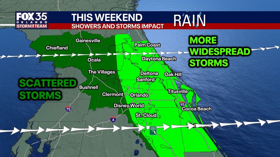
There will be downpours for the rest of the weekend with more of a chance of storms, especially along I-4 and Orlando on the East Coast.
It won't be a wash out, but keep the raincoat handy through the afternoon. FOX 35's Laurel Blanchard recommended.
We start to tap into more tropical moisture later next week as our wind turns back around from the south. That will make for higher rain chances as we progress through midweek onward. Our days won't be washouts, but we'll see numerous more storms around during the afternoon and evening. It'll be more typical of our classic "rainy season" weather pattern.
With the help of the sea breeze collision as well as a front stalled to our north, rain chances come back up to around 50% to 60%.
7-day weather forecast
Image 1 of 2
▼
Tracking the tropics
The National Hurricane Center has outlined three areas of interest for the potential of a tropical development.
There’s a 20% chance of development of a weak low pressure system near Bermuda.
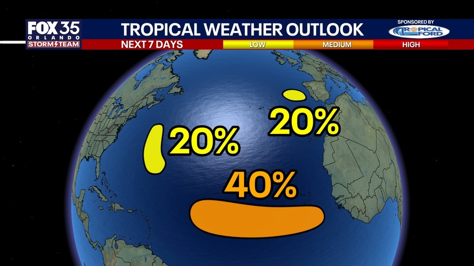
The system is set to stay fairly disorganized and we will continue to keep eyes on it.
Another system off the coast of Spain and Portugal also has a 20% chance of development over the next seven days. This will bring rain in gusty winds to those countries.
A new area of interest has now been out looked across the main development region with a 40% chance of development over the next week. This wave looks to come off the coast of West Africa on Monday. This disturbance looks to have a better chance of organizing, which is something we'll be watching.
The Source: Information in this story was gathered from FOX 35's Laurel Blanchard.
Comments
Nothing yet. Say the first thing.
Sign in to join the conversation.