
I had the chance to visit Williamsburg last winter, which was my first time. As the Fourth nears, I thought it might be worth a post about the visit because it struck me that this re-created historical theme park is still probably one of our best ways to think about the ideals of urban planning in the colonies.
There has been much written about Williamsburg lately but most of it has focused on the re-creations of life in the village. An article in The Atlantic, “What Is Colonial Williamsburg For?" is among the better of those articles. Almost all of this has focused on how to represent the complex stories of the people who lived in the colonial city. For instance, about half of the residents in the city at the time of the Revolution were slaves, but until recently that side of the story was seldom told.
I wanted to focus, however, on some of the land use aspects of the city that I think make it worth a visit for anyone who is interested in the history of cities without regard to whatever historical actors may be walking about.
The city remains one of our best examples of a baroque colonial city planning. Whatever you think of the historic recreation—too tidy, too theme park—you can walk down Duke of Gloucester Street and envision the ideal of what a 1699 vision of empire looked like in the Americas. An excellent report on the city’s planning details much of this baroque ideal, which focused on geometric proportions to give gravitas to buildings—and the institutions inside them—that anchored the ends of prominent streets. The report notes:
Hidden in the [first plan of Williamsburg] is a subtle set of proportions, revealing that the designer, Governor Francis Nicholson, was well grounded in the principles of Baroque architecture and town planning. . . .
The shape of the proposed town breaks down into two sections: a large square 160 poles on each side and a smaller rectangle 120 poles by 80 poles. The square is centered on Bruton Parish church, which is located approximately 80 poles from each side of the square. The proportions of the rectangle are 2:3 (dimensions particularly favored by Baroque architects); the proportions of the length of the rectangle to the length of the square are 3:4, and the proportions of the width of the rectangle to the width of the square are 1:2. The large square, 160 poles on each side, also happens to contain 160 acres. The small rectangle contains 60. There is not a measurement or relationship in this central part of the plan that does not work out to an even integer.
The purpose of all these mathematical ratios was not merely ornamental. They were an aggressive ethical and philosophical statement. In the contemporary world view, there was an underlying identity between nature, art, and the human mind — for all of these were based on the principles of a mathematically structured cosmos. Thus the regularly proportioned city was both the most natural and the most aesthetically pleasing, for it emphasized the harmony, symmetry, and proportion from which all nature and beauty sprung. As Batty Langley, an Enlightenment architect, put it, beauty was the result of "well-chosen Symmetry, connected together according to the harmonick Laws of Proportion, which of necessity naturally produce that Effect upon the Mind thro' the Eye, as the Cords 6 or Discords of Musick, please or displease the Soul thro' the Ear." What Williamsburg symbolizes is the very antithesis of the Romantic concept that the organic and natural, though it can be quantified and articulated through mathematics, is not in essence mechanical. To the town's Baroque designer, there was no dividing line between a tree and a machine. Both were examples of formal, rationalized aesthetic principles, differing in complexity but not in quality.
The map from the report below shows the land uses in Williamsburg at the time of the Revolution.
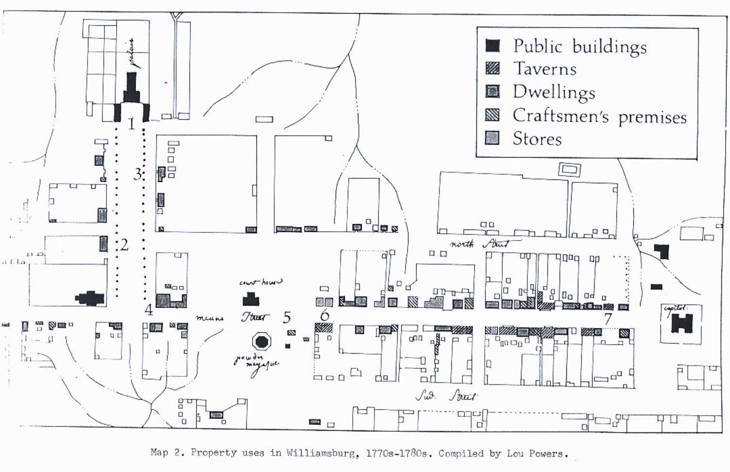
And for those who like land use, this map may be more interesting than the grand planning of the baroque era. Why? Well, what fills in the gaps between the grand buildings other than the stores, craft buildings, dwellings of residents, and let us not forget, the taverns. Look closely and what do you see but…a mixed use development of residences and craft stores beside the taverns and even a coffee shop or two. In between the grand structures, daily life goes on without uses districted but next to each other in intimate ways.
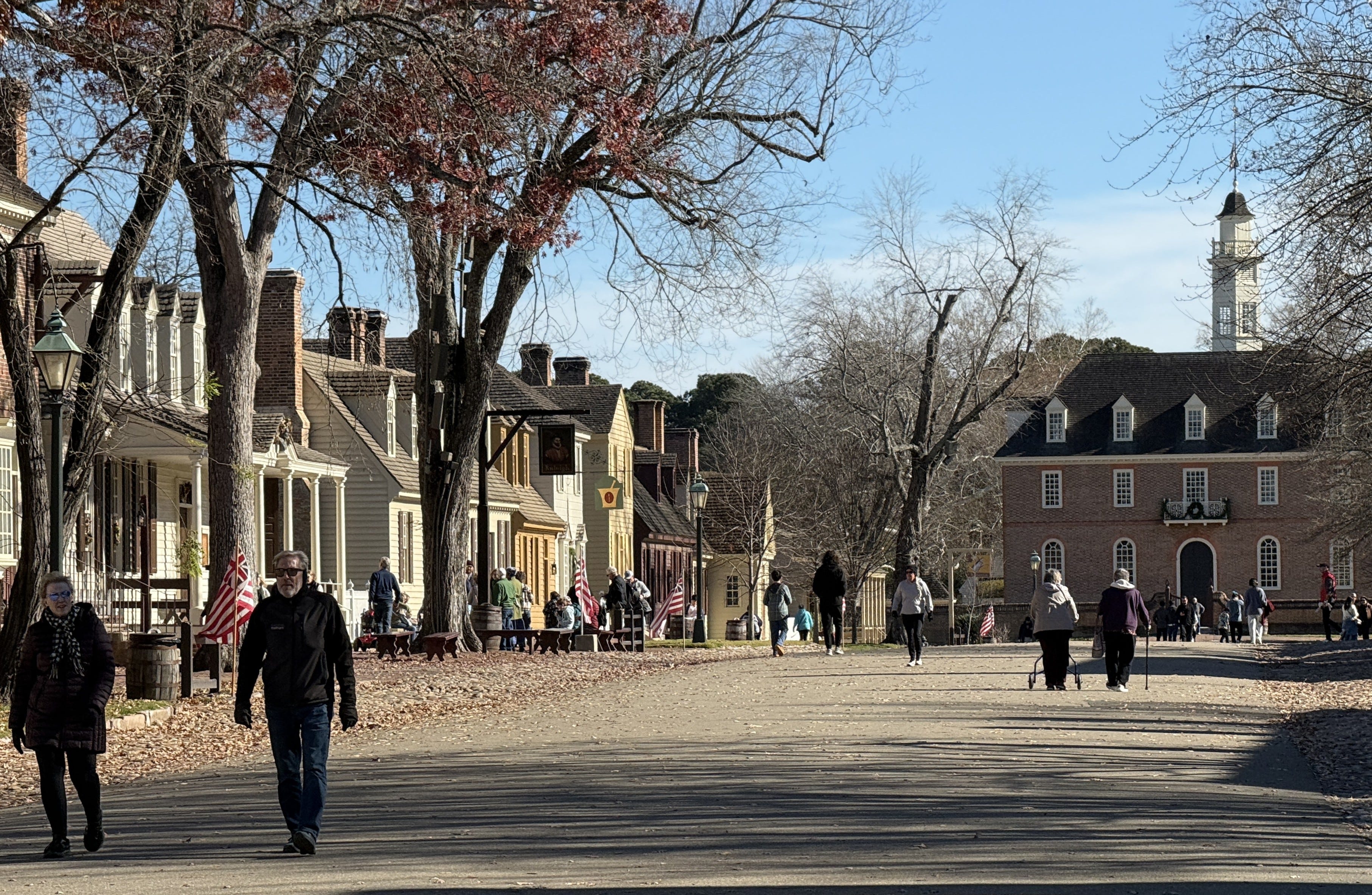
My visit to Williamsburg reminded me of the kind of grand boulevards ending in major buildings that we often today associate with Haussmann’s Parisian boulevards. But the effect, and the desire to aggrandize institutions with public space, has been there longer. You can see it in its colonial infancy in Williamsburg with one axis dominated by the Capitol building (below).
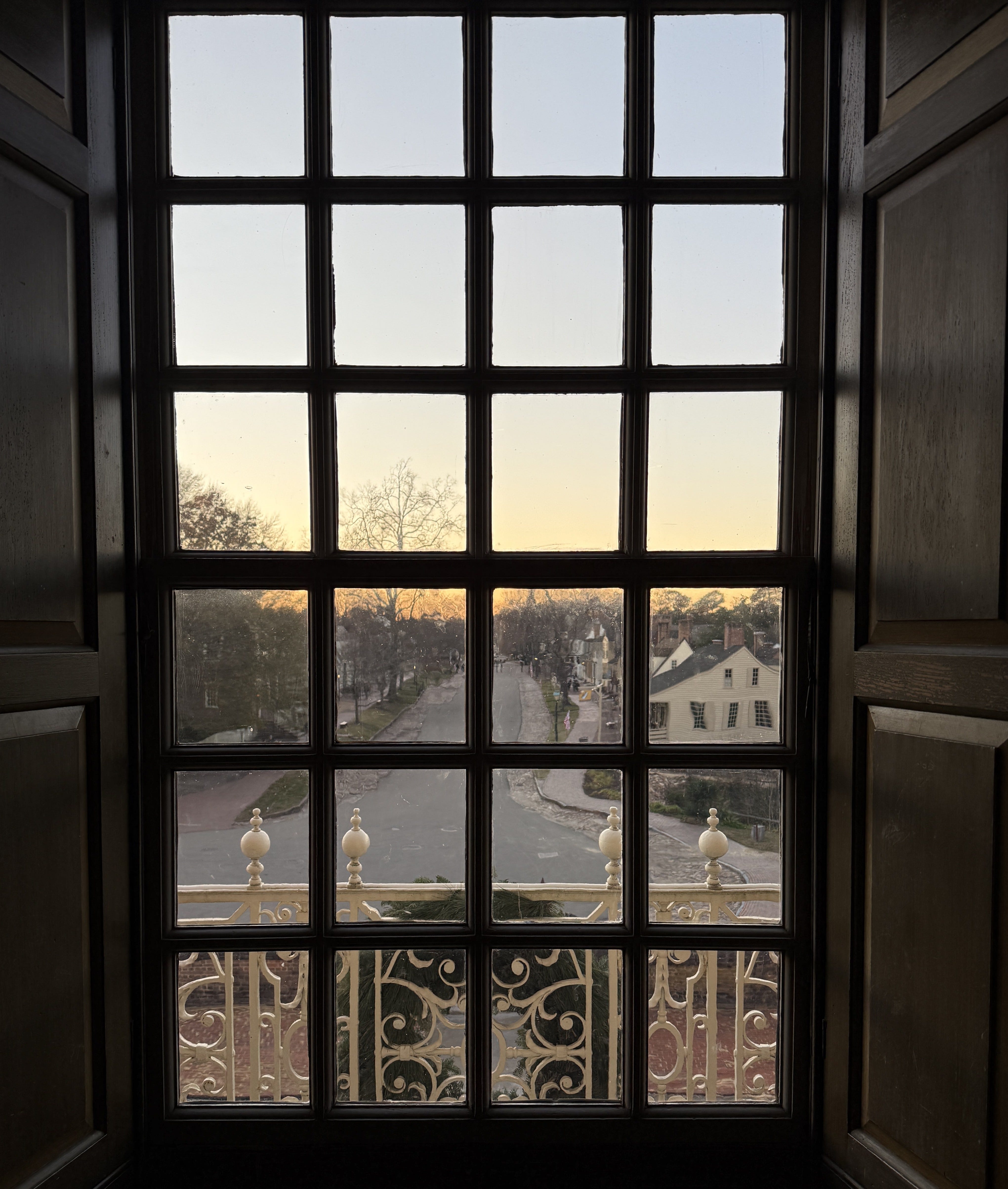
And the view back down the central axis of town from the Capitol looks like this.
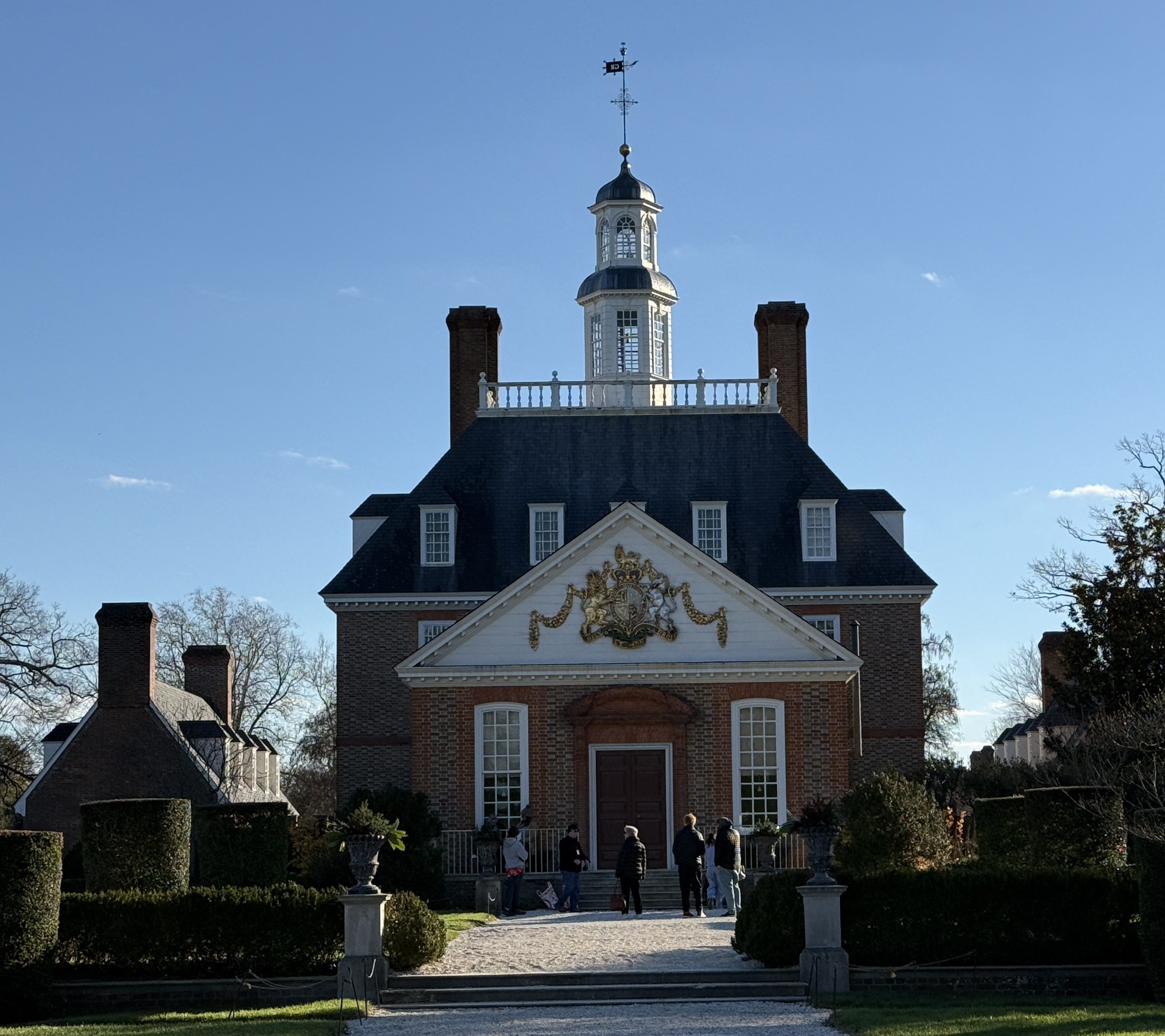
On the other axis, the Governor’s Palace dominates with its imposing facade outside and weaponry lining the walls as testament to colonial might of the time.
The inside of the Governor’s Palace.
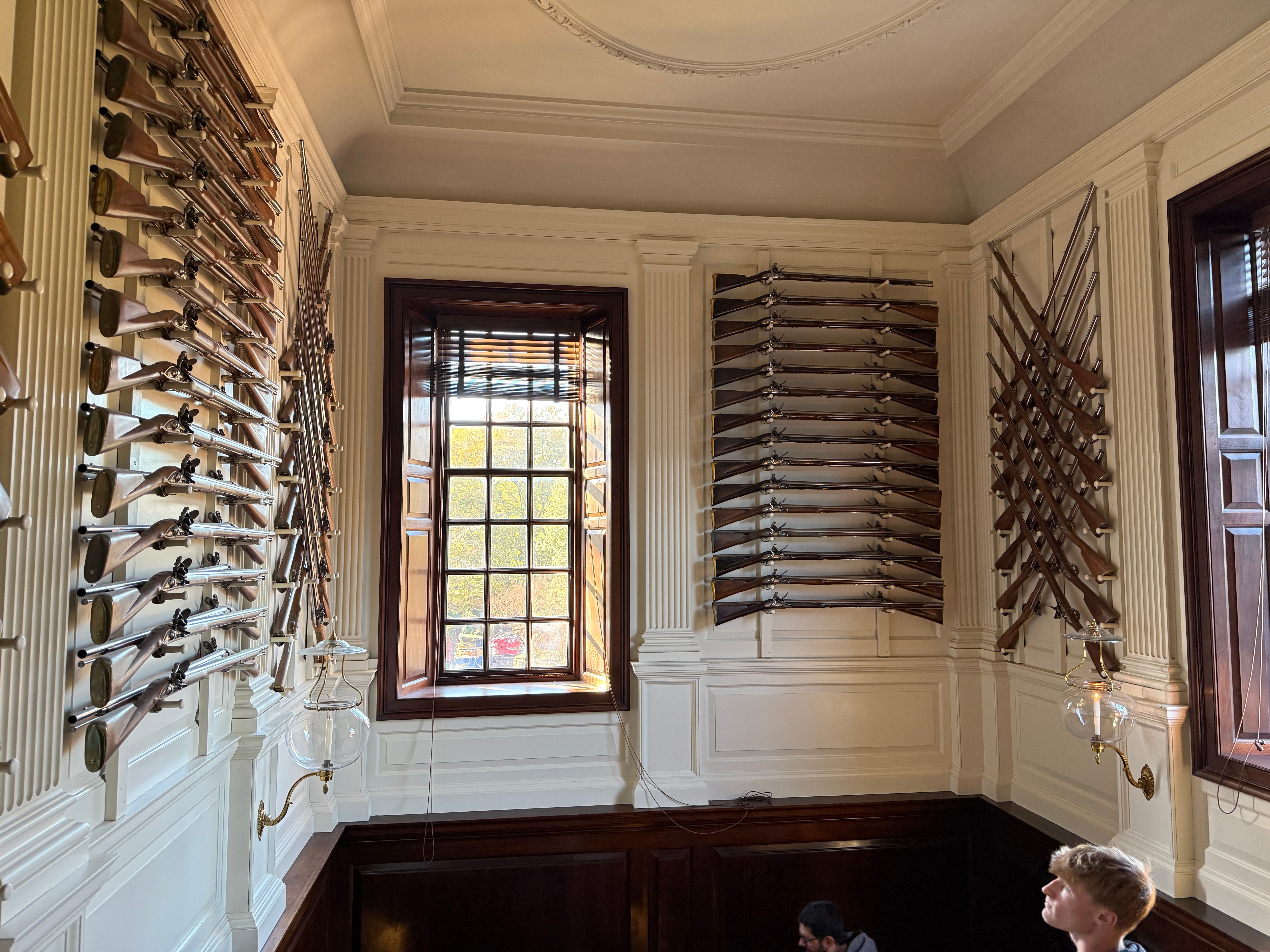
Two other land use elements should be mentioned. First, the two axes meet at the church and the courthouse. Again, the symbolism of place as the embodiment of power. Below, the courthouse.
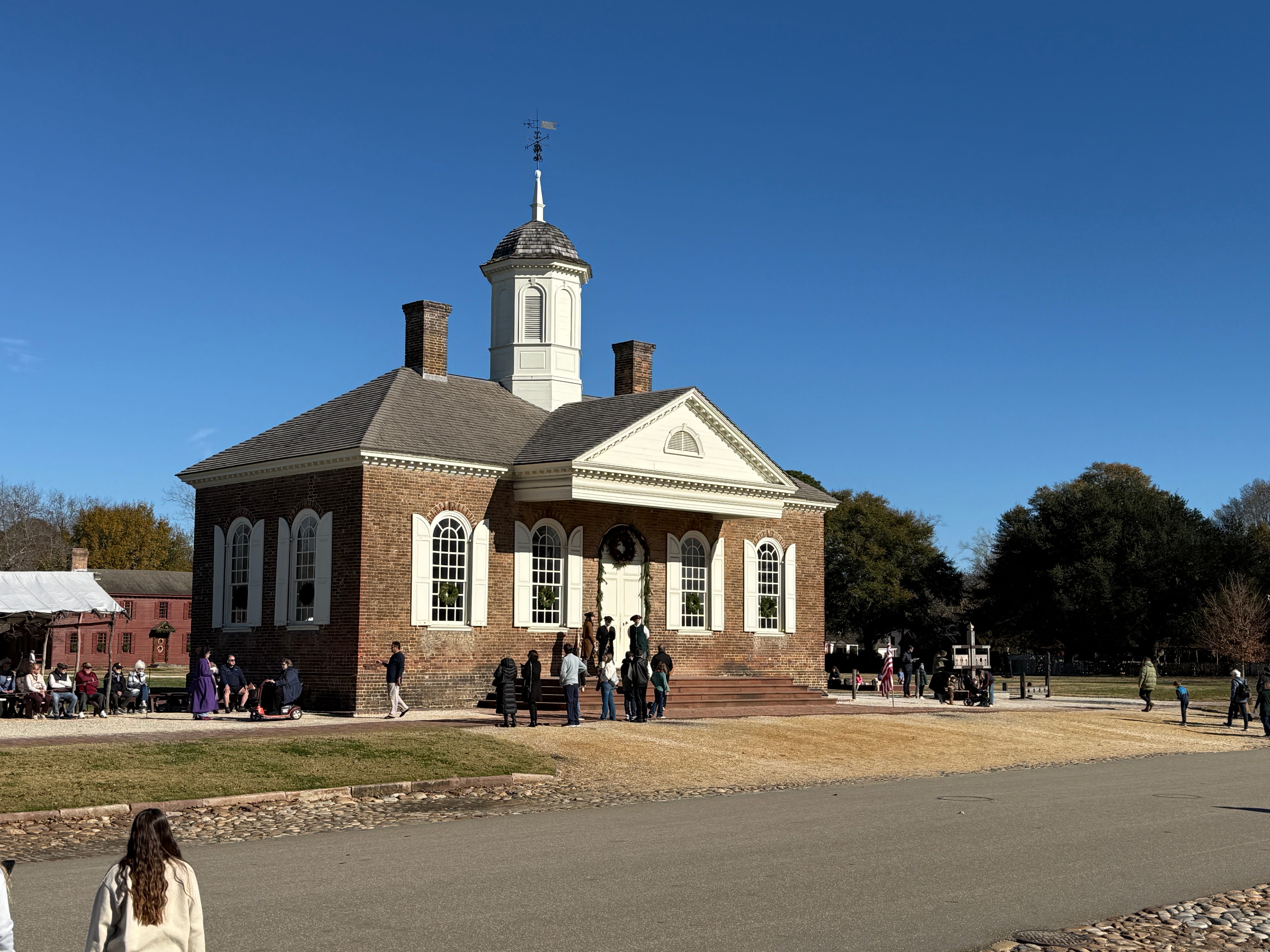
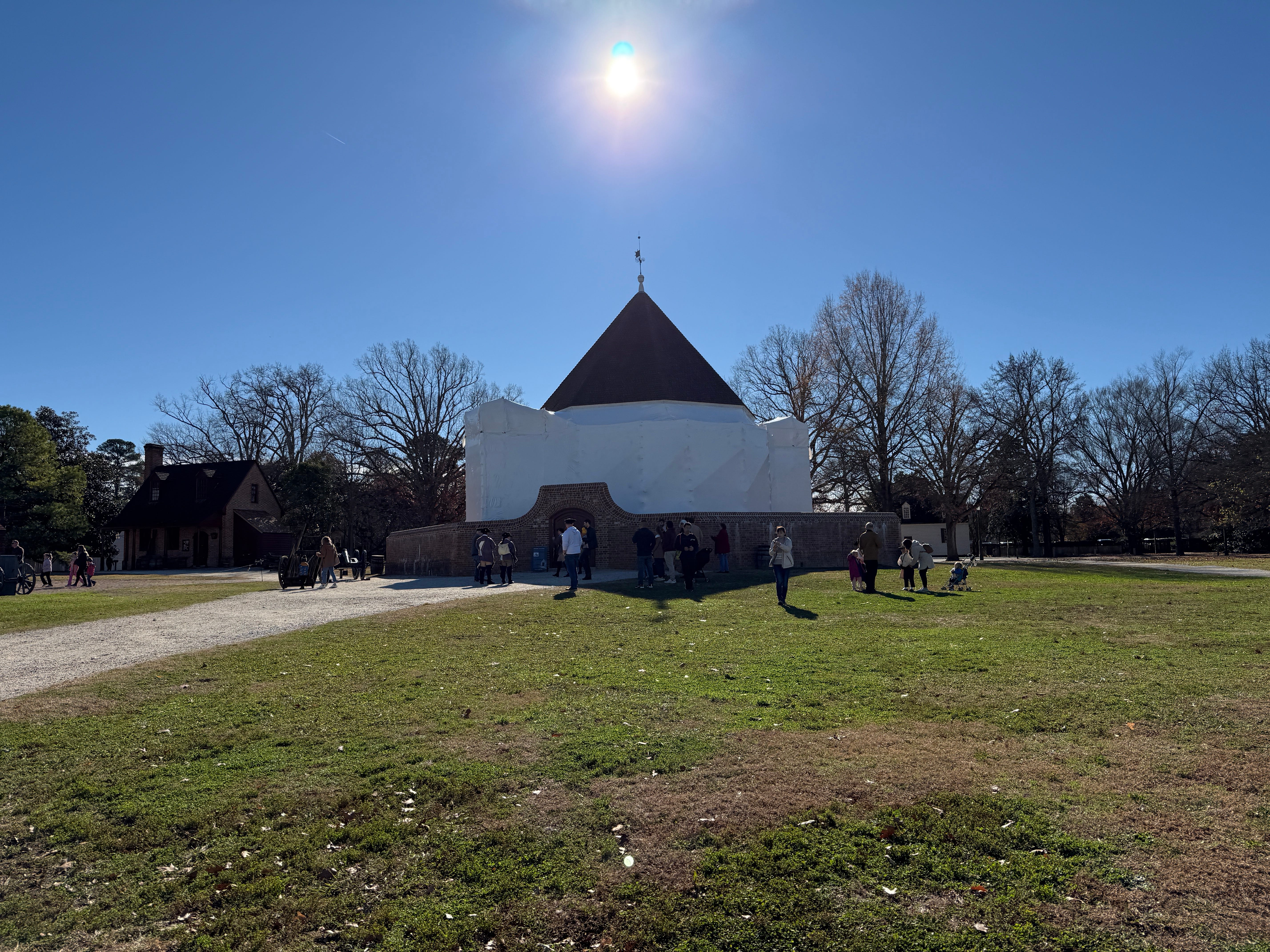
Also, close to the center of town: the gun powder repository. This is a remarkable part of the time because this is essentially a nuisance use—ripe for explosion—in the middle of the town. But in a colonial city, the placement of a literal powder keg in the middle of town tells us a lot about life in colonial times.
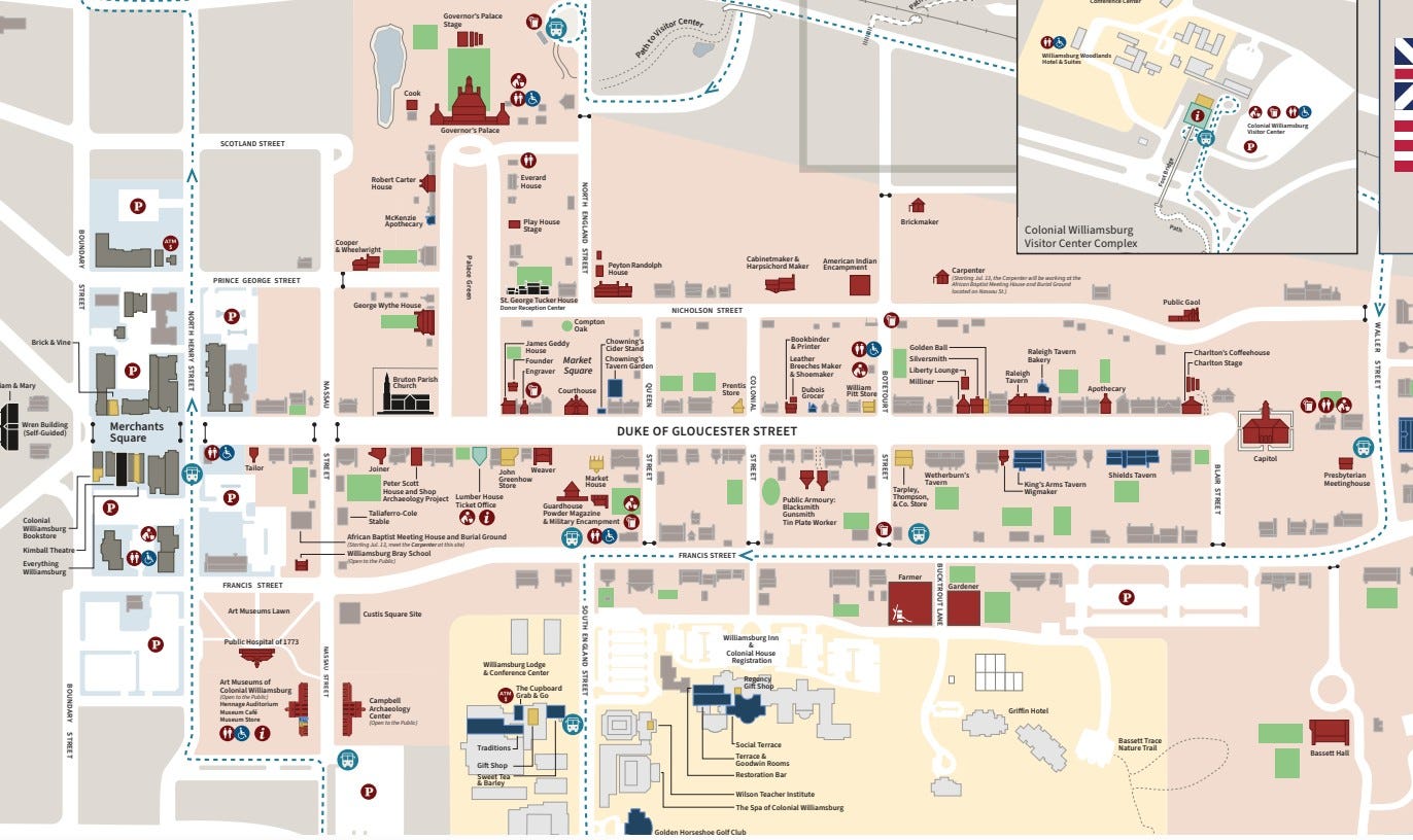
Here is a map of Williamsburg illustrating the baroque axis you can still see today:
The siting of Williamsburg, too, reminds us of the land use limitations of the time but also speak to us at this celebration of Revolution. There was no reason for Williamsburg to exist where it was except that it was close to two rivers, which were the highways of the time. Indeed, those same rivers caused Virginia to retreat from the site to Richmond during the Revolution because of the exposure to British war ships.
And finally, Williamsburg is an interesting place to think about at this time of the country’s 250th birthday. The historic park today was created, in large part, by a preacher and John D. Rockefeller who put the site together as a way to tell the nation’s history at the country’s 150th birthday. A hundred years on, the historical recreation still allows us to see a glimpse of an early colonial city in a way that we can see in few other places.
Incidentally, I also had reason to visit Santa Fe, New Mexico, this year. And as I will write in another post, I think Santa Fe is one of the other places where you can also see this same early colonial land use history. But in Santa Fe, the history is Spanish. And the powder keg wasn’t in the center of town. More on that soon…
No posts
Comments
Nothing yet. Say the first thing.
Sign in to join the conversation.