
Yr Wyddfa (Snowdon) is the highest mountain in Wales and one of the most walked summits in Britain. On a busy summer weekend, the Llanberis Path resembles a slow queue rather than a mountain walk. The summit café has a till.
None of this is a reason not to climb it. But Wales has dozens of mountains that match or exceed Snowdon for the quality of the experience, and most of them are almost empty by comparison.
The five walks below cover north Wales, mid Wales and the south. Each one is a full day out. Each one has something Snowdon cannot offer, either solitude, a more dramatic approach, or a view that encompasses Snowdon itself.
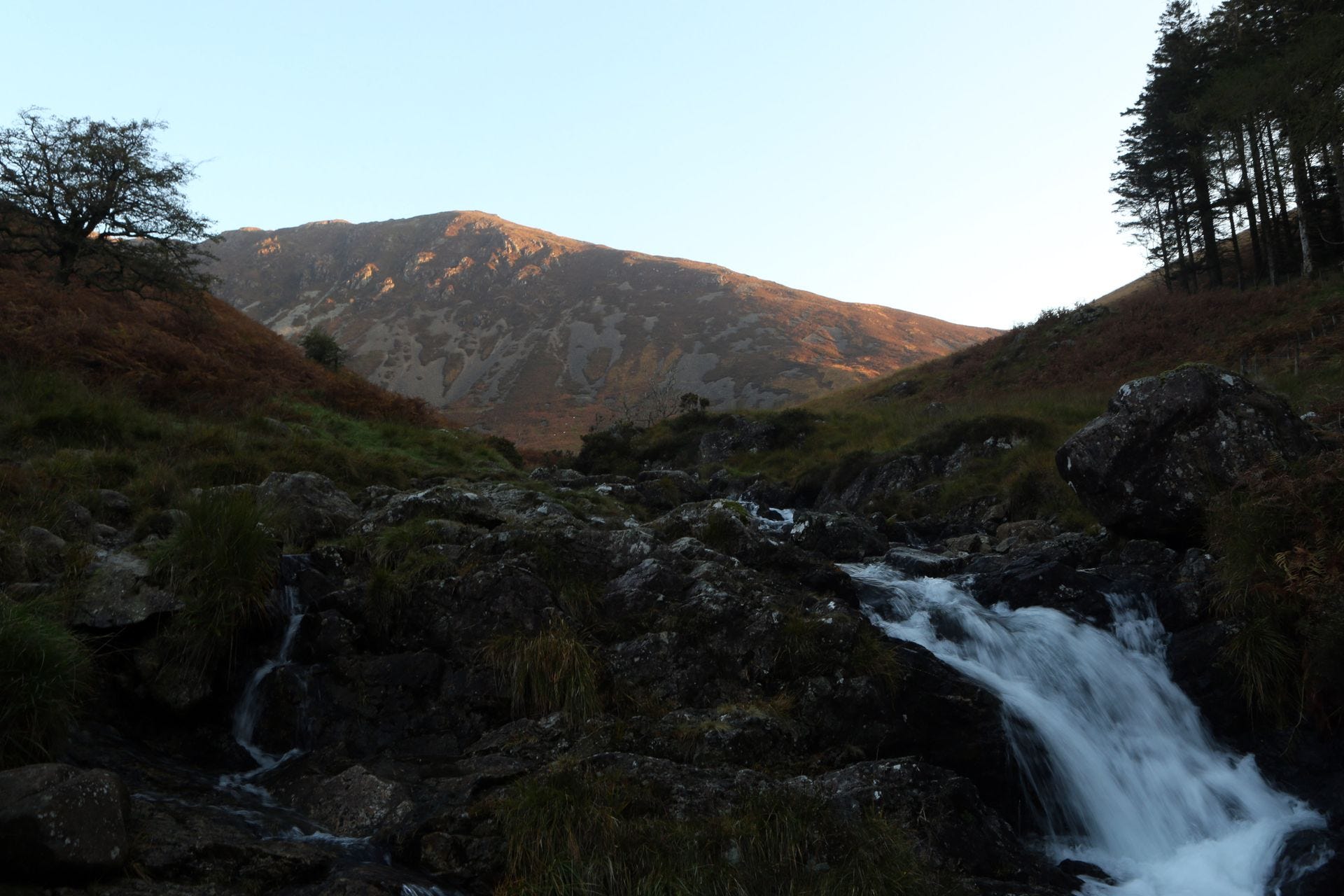
Circular route from Dôl Idris · 9.6km · 900m ascent · 5–6 hours
Eryri (Snowdonia) National Park, Gwynedd
Parking: Dôl Idris car park, LL36 9AJ
Cadair Idris is the mountain that belongs to Welsh mythology in a way Snowdon does not. The name means Chair of Idris - Idris being a giant whose chair is the summit ridge, and whose cauldron is the glacial lake of Llyn Cau cupped below the cliffs. The legend holds that anyone who sleeps on the summit overnight wakes either a poet or a madman.
The Minffordd Path is the finest route up. It begins in mixed woodland at the Dôl Idris car park, rises steeply through a gorge beside a stream, and emerges dramatically above the treeline onto the ridge above Llyn Cau. The lake sits in a natural amphitheatre on three sides, with steep cliffs above, the dark water below, the path contouring above it. It is one of the best moments on any mountain walk in Wales.
From the lake the path climbs to the summit at Penygadair (893 metres), then descends via the subsidiary peak of Mynydd Moel on the circular return. The full circular route is 9.6km with around 900 metres of ascent. Allow five to six hours. The path is well marked but the final section to the summit can be tricky to follow in low cloud, cairns guide the way.
The view from the summit, on a clear day, takes in the Llŷn Peninsula, Cardigan Bay, the Preseli Hills, the Cambrian Mountains and Snowdon itself to the north.
Practical: Dôl Idris car park LL36 9AJ, pay-and-display. Seasonal toilets and visitor centre at the car park. Dogs allowed on leads. The T2 bus between Aberystwyth and Bangor stops at Minfford, so a car-free day is possible.
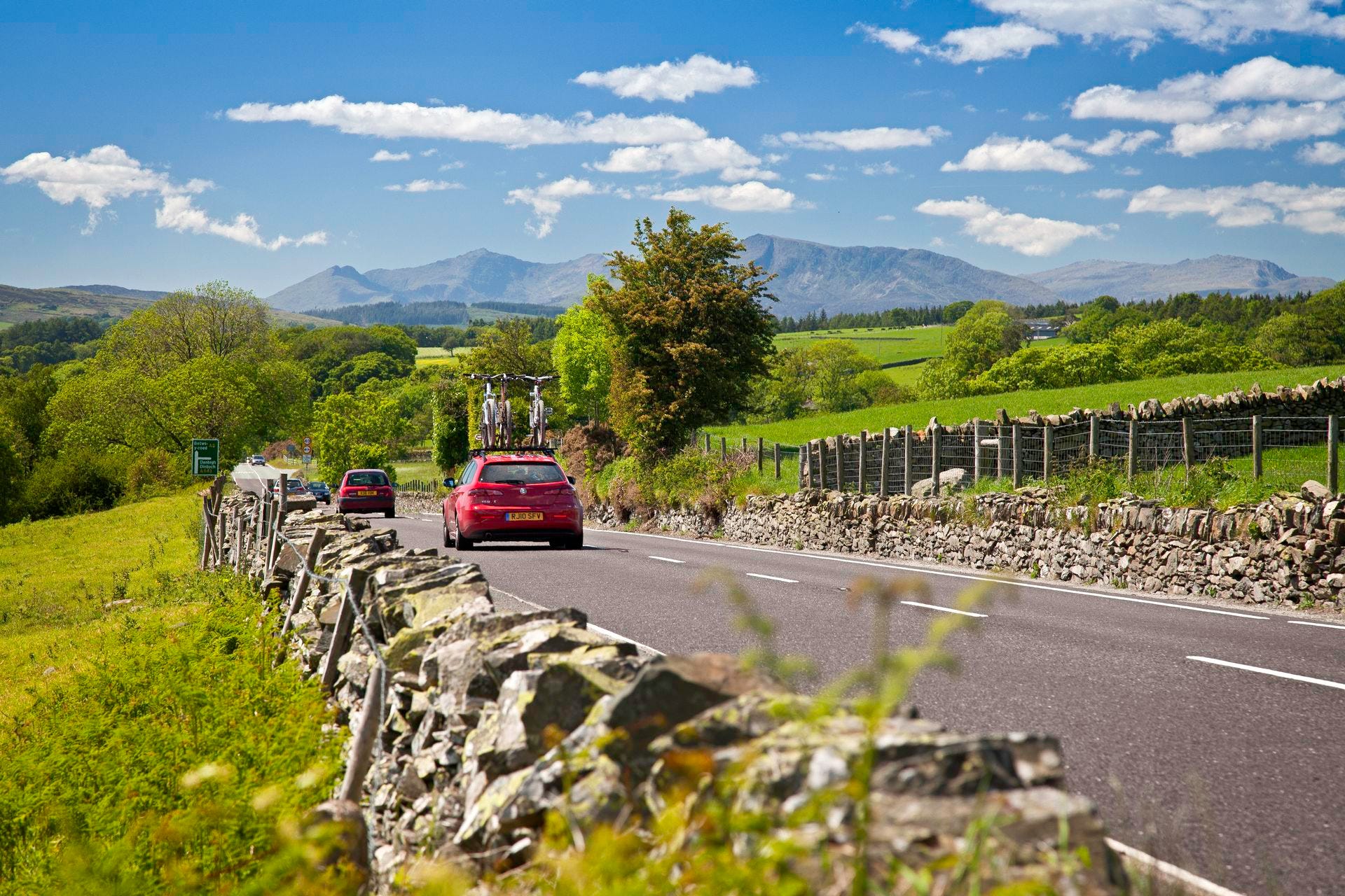
Circular from Pont Cyfyng · 11km · 700m ascent · 5–7 hours
Eryri (Snowdonia) National Park, Gwynedd
Parking: Layby on A5 at Pont Cyfyng, SH735571
Moel Siabod stands alone at the eastern edge of the Snowdonia massif, separated from the main range and offering something no other mountain in north Wales can quite match: a view that takes in thirteen of the fourteen highest peaks in Wales without turning your head.
The route from Pont Cyfyng, just outside Capel Curig, is the best approach. It begins with a track through an old slate quarry, passes the mountain lake of Llyn y Foel, and then climbs the Daear Ddu Ridge which is a Grade 1 scramble, meaning hands are needed on rock for a short section, but nothing technical enough to require climbing experience. The scramble is entirely optional; a path around it exists for those who prefer not to use their hands.
The summit stands at 872 metres. The descent via the north-east ridge is a long, satisfying walk back down to Capel Curig, with the valley and the A5 coming gradually into view below.
Moel Siabod’s relative isolation is the point. The path sees a fraction of the traffic of the main Snowdon routes. On weekdays in summer it is possible to reach the summit and find nobody else there.
Practical: Park in the layby on the A5 at Pont Cyfyng (grid ref SH735571). No facilities at the start — Capel Curig has a café and pub a short walk west. Dogs welcome. Allow six to seven hours for the full circular.

Circular from Neuadd · 15km · 800m ascent · 6–7 hours
Bannau Brycheiniog (Brecon Beacons) National Park, Powys
Parking: Neuadd car park, CF48 2UT
Pen y Fan is the highest mountain in southern Britain at 886 metres. Most people reach it via the Pont ar Daf car park on the A470 via a route locally known as the Motorway, for reasons that become self-evident in July.
The Horseshoe is what the mountain deserves. Starting from the Neuadd car park in the Taf Fechan forest, a long drive from the A470 through single-track lanes, which is exactly why it is quiet. The route climbs to Craig Fan Ddu ridge, traverses west along the escarpment edge to Corn Du and Pen y Fan, then crosses to Cribyn and Fan y Big before descending back to the valley.
The four summits in a horseshoe arc around the Taf Fechan glacial valley. The north-facing cliffs of Pen y Fan drop vertically below the summit trig point. The Lower Neuadd Reservoir sits in the valley floor below. On a clear day the Bristol Channel is visible to the south. The Brecon town and the hills of mid-Wales fill the north.
The Neuadd car park is free. The car park on the A470 is frequently full by 9am in summer. This alone is a good reason to take the longer approach.
Practical: Neuadd car park CF48 2UT — free. No facilities at the car park. Follow the single-track road past Pontsticill Reservoir. Allow six to seven hours for the full horseshoe. Take a map — the Ordnance Survey OL12 covers the central Beacons.
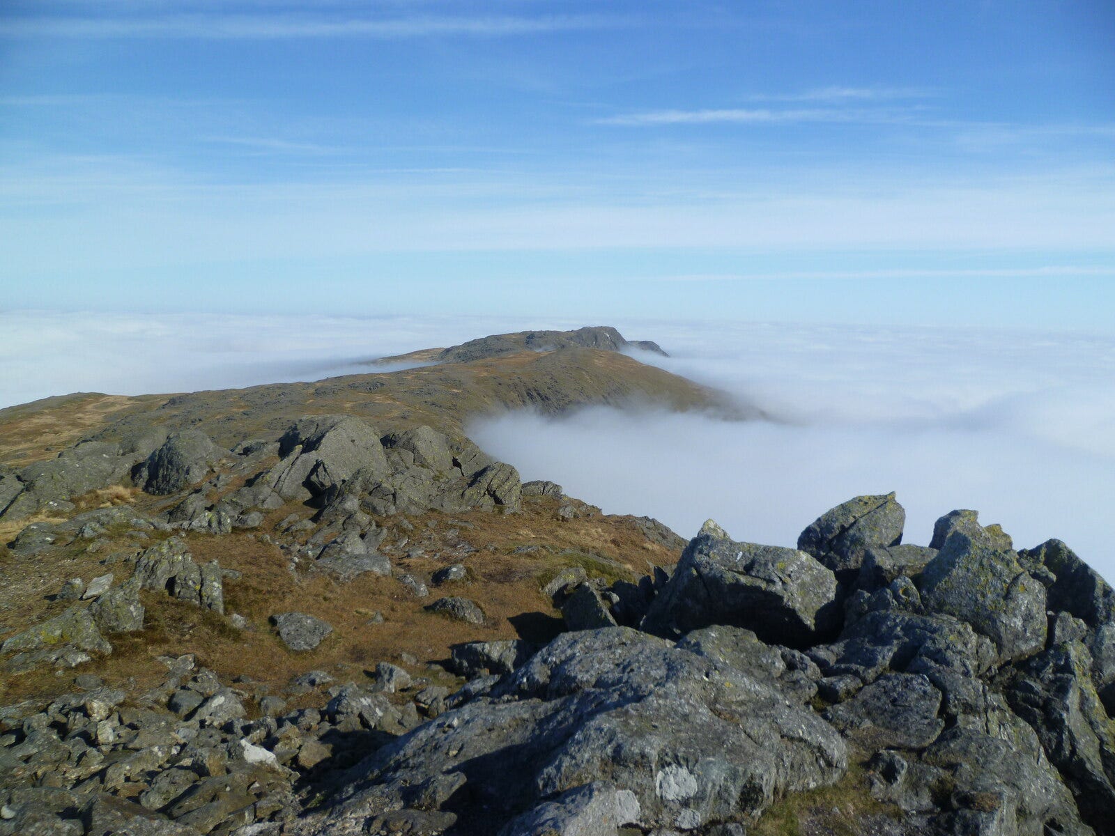
Out and back · 16km · 850m ascent · 6–7 hours
Eryri (Snowdonia) National Park, Gwynedd and Powys border
Parking: Llanuwchllyn village, LL23 7UB
Aran Fawddwy stands at 905 metres and is the highest mountain in Wales south of Snowdon, and one of the least visited peaks in Eryri. It sits on the Gwynedd-Powys border above the Dyfi Valley, at the southern end of a ridge that culminates at Aran Benllyn above Bala Lake to the north.
The walk from Llanuwchllyn, the small village at the southern end of Bala Lake climbs steadily through farmland before gaining the ridge and following it south to the summit. The approach is long and the path is less well-defined in places than on more popular mountains. This is not the walk for first-time mountain walkers. For experienced walkers, it is one of the quietest and most rewarding summit days in Wales.
The view from Aran Fawddwy is a revelation. The Dyfi Valley spreads below to the south. Cadair Idris stands to the south-west. Snowdon and the main Eryri peaks fill the northern horizon. Bala Lake is directly below to the east. The pass of Bwlch y Groes — the second highest road pass in Wales is visible in the valley between the ridges.
Practical: Park in Llanuwchllyn village, LL23 7UB. The Bala Lake Railway stops at Llanuwchllyn — a car-free approach is possible from Bala. Check access notices at the start of the path, which passes through private farmland on agreed permissive routes. A compass and OS map are strongly recommended — OS Explorer OL23 covers the area.
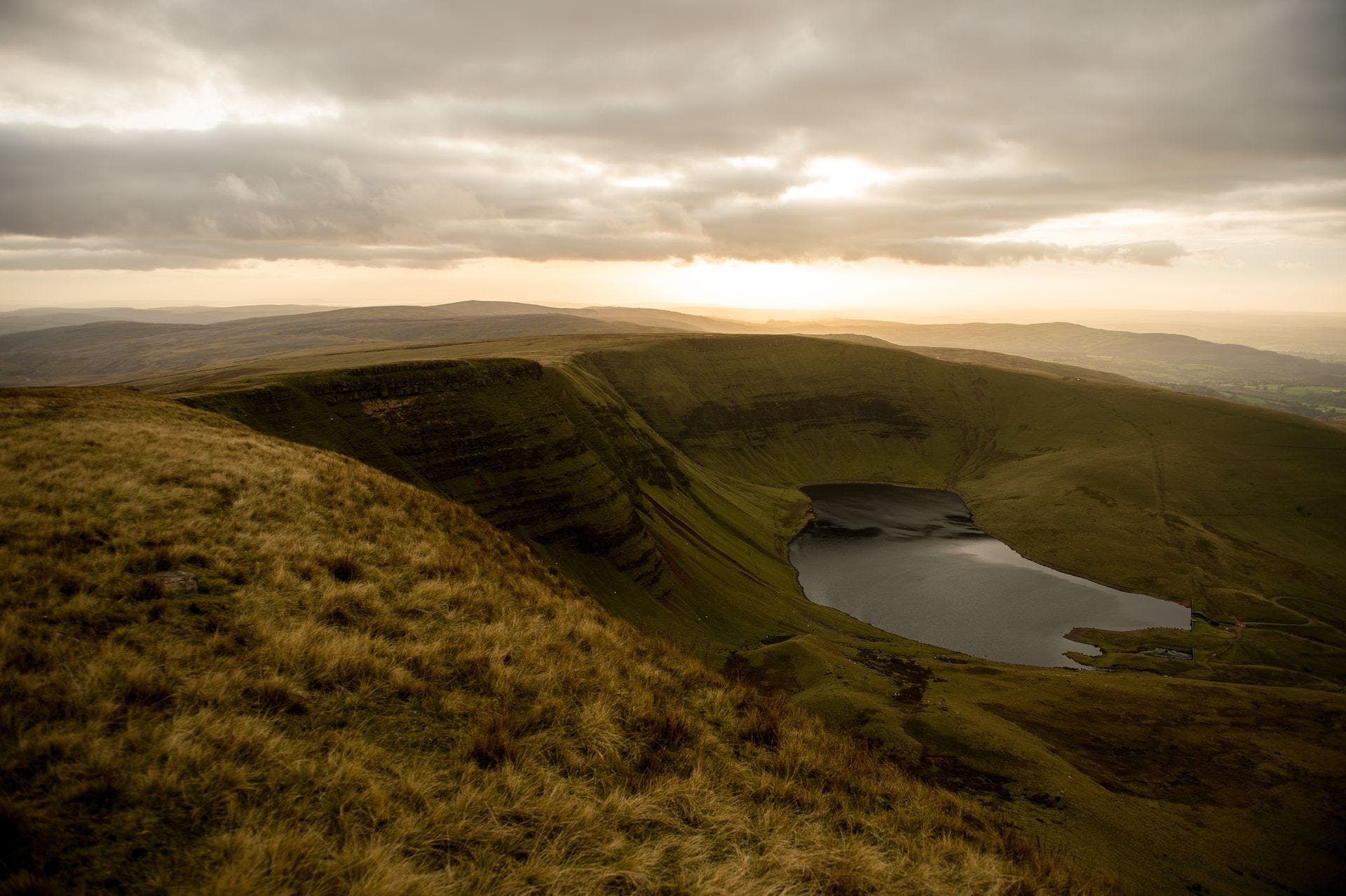
Out and back from Llyn y Fan Fach · 12km · 600m ascent · 4–5 hours
Bannau Brycheiniog (Brecon Beacons) National Park, Powys and Carmarthenshire
Parking: Llyn y Fan Fach car park, SA19 9UN
The Black Mountain is the western massif of the Brecon Beacons National Park, is a broad, flat-topped plateau edged by dramatic north-facing escarpment cliffs. It is entirely different in character from Pen y Fan, fifteen miles to the east. Where Pen y Fan is steep, pointed and crowded, the Black Mountain is wild, trackless and almost always quiet.
The approach from the Llyn y Fan Fach car park is the finest route. The path climbs gently to the lake, itself the setting for one of the great Welsh legends, the Lady of the Lake and then rises steeply up the escarpment to the plateau above. The summit of Fan Brycheiniog stands at 802 metres. The rim of the escarpment, running east and west from the summit, gives one of the longest and most open ridge walks in the south of Wales.
The plateau above the lake is peat bog and grassland, pathless in places, and navigation requires map and compass in mist. This is not a mountain for an inexperienced walker in poor visibility. In clear weather, with the escarpment edge to follow and the view south across Carmarthenshire laid out below, it is one of the finest half-days on any mountain in south Wales.
Practical: Llyn y Fan Fach car park SA19 9UN — small, fills quickly on weekends. Alternative parking at Llanddeusant village. Allow four to five hours. OS Explorer OL12 covers this area.
Cadair Idris (Minffordd): LL36 9AJ · 9.6km · 900m ascent · 5–6hrs · Pay-and-display
Moel Siabod (Pont Cyfyng): SH735571 · 11km · 700m ascent · 5–7hrs · Free layby
Pen y Fan (Horseshoe): CF48 2UT · 15km · 800m ascent · 6–7hrs · Free car park
Aran Fawddwy (Llanuwchllyn): LL23 7UB · 16km · 850m ascent · 6–7hrs · Village parking
Fan Brycheiniog (Llyn y Fan Fach): SA19 9UN · 12km · 600m ascent · 4–5hrs · Small car park
OS Maps: OL23 (Cadair Idris/Arans) · OL17 (Snowdonia) · OL12 (Brecon Beacons)
For more walking inspiration, including family walks, waterfall trails, accessible routes and the full Wales Coast Path, I’ve put together the Ultimate Guide to Walking in Wales on the website.
It covers everything from a ten-minute stroll to Swallow Falls to the 870-mile Wales Coast Path, with specific start points, distances, parking and accessibility notes throughout.
Read it at: wales.org/things-to-do-in-wales/adventures-and-activities/walking/
Hwyl am y tro.
Nick — Discover Wales · wales.org
P.S. If you are planning a trip to Wales this summer, Sykes Cottages are running a summer sale with up to 40% off holiday cottages and some of them are right here in Wales. Availability runs through to the end of August.
Browse the sale here: Sykes Summer Sale
Comments
Nothing yet. Say the first thing.
Sign in to join the conversation.