
In the grand, scheme of things sometimes the most happens in the quiet work and commit logs. This month, the Awesome GEE Community Catalog crossed two milestones and I thought who better to celebrate it with than the community that makes this possible. The catalog logged 5 million+ visits last month and crossed the threshold of 1,000 stars on GitHub. We also crossed over 4360 datasets and over 544.26 TB of dataset size.
Release 3.9.0 arrives against this backdrop of shared growth, and it brings with it a payload of datasets with varying range of granularity and I am going to jump a few of the highlights
Copernicus Exposure Mapping Component (EMC) Built-up product (EMC-BUILT R2025A)
Produced by the European Commission’s Joint Research Centre (JRC) as part of the Copernicus Emergency Management Service (CEMS), this dataset is the first operational production of global built-up information based entirely on Sentinel-2 imagery processed through a modified U-Net Convolutional Neural Network (CNN). The JRC team trained this model using a massive “ensemble of truths” a reference library compiled from OpenStreetMap (OSM), Microsoft Building Footprints, and Google Open Buildings.
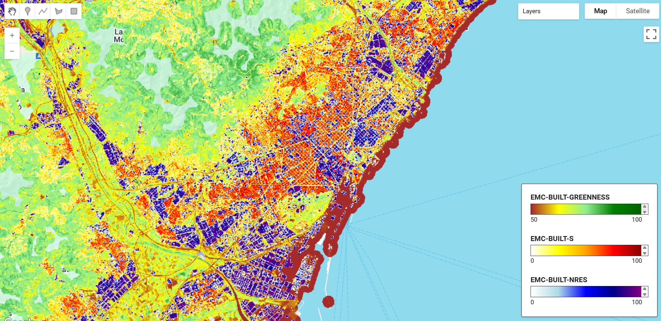
The result is a continuous variable: the built-up surface fraction at 10-meter resolution. The dataset provides three core products at multiple resolutions (10m, 100m, 1000m in World Mollweide projection, and 3/30 arc-seconds in WGS84): total built-up surface, non-residential built-up surface, and greenness fraction within the built-up domain. All products follow an open and free data access policy aligned with the Copernicus programme principles. Try it in a script here and the dataset on the community catalog page.
Open Building Map Global Building Footprints with Semantic Information
Open Building Map (OBM) is a comprehensive global dataset containing 2.7 billion building footprints with semantic attributes including occupancy type, height, number of stories, and floorspace. This dataset addresses critical gaps in global building data by conflating AI-derived building footprints from Google Open Buildings and Microsoft Global ML Building Footprints with crowd-sourced OpenStreetMap data, creating the most detailed and extensive building dataset available.
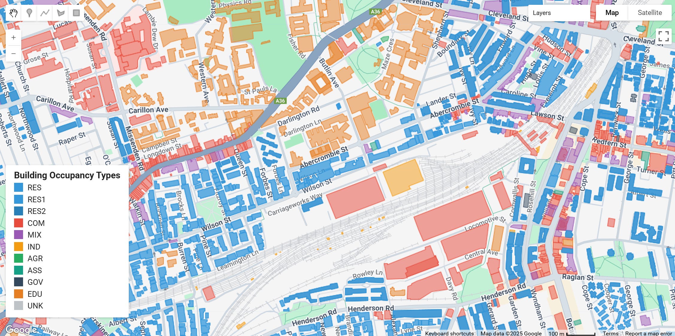
The dataset provides structured building information using the Global Earthquake Model (GEM) Building Taxonomy, making it particularly valuable for disaster risk assessment, urban planning, energy efficiency analysis, and multi-hazard risk modeling. By combining multiple data sources with quality-based precedence, Open Building Map balances the completeness bias in OpenStreetMap while maintaining high geometric accuracy. This further includes heigh attributes like estimated story count and building height.
LandScan Population Data Updates
The LandScan Program was initiated at Oak Ridge National Laboratory (ORNL) in 1997 to address the need for improved estimates of population for consequence assessment. For example, natural and manmade disasters across the globe place vast populations at risk, often with little or no advance warning. It was critical to develop highly resolved estimates so that they were useful to evaluate to events across multiple geographic scales.
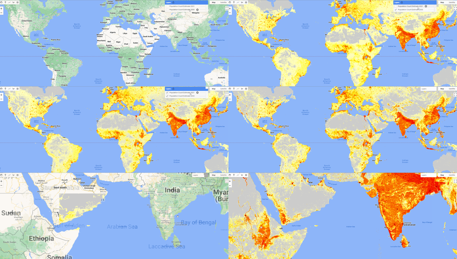
This has been an annual product since 1998 and 2024 was just added to the dataset. Building on the modeling approach developed for LandScan Global, and taking advantage of higher quality data available for the U.S., we improved on both the spatial and the temporal resolution with our first version of LandScan USA in 2004.
Global Pesticides and Fertilizer Application Rates
Global Pesticide Grids (PEST-CHEMGRIDS) v1.01 offers mapped estimates of the twenty most widely used pesticide active ingredients applied to six major crops and four aggregated crop classes at a 5-arc-minute resolution. It provides values for 2015 along with projections for 2020 and 2025, helping quantify where pesticides are being used and how their distribution aligns with human and ecological exposure patterns. This aligns with FAO figures showing that global pesticide use reached 4.1 million tonnes in 2015 an increase of 35% since 2000 and is expected to rise further as population and agricultural land use expand.
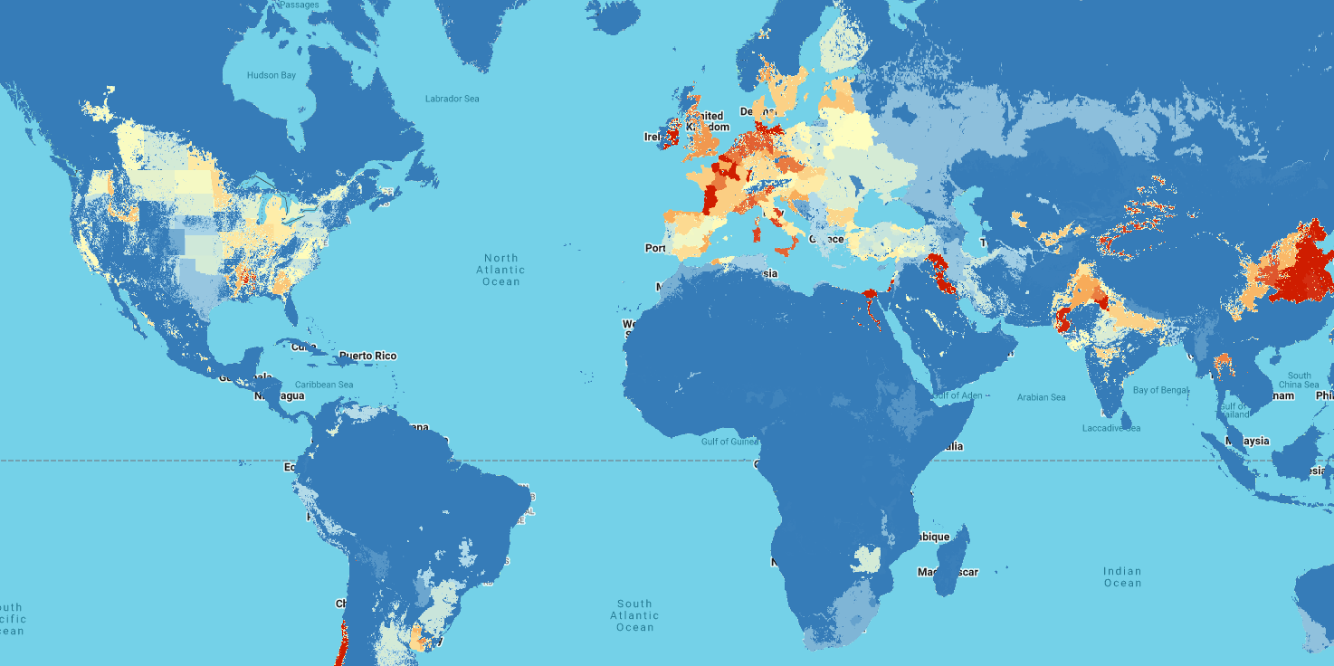
NPKGRIDS supplies global, high-resolution maps of nitrogen (N), phosphorus (P₂O₅), and potassium (K₂O) fertilizer application rates across 173 crops for 2020 at a spatial resolution of 0.05°. This dataset helps illuminate fertilizer-use patterns within the broader context of chemically intensive agriculture, which has expanded nearly tenfold over six decades. Its granularity supports evaluations of how fertilizer practices interact with climate, soils, hydrology, crop distributions, and farm management, all of which influence environmental outcomes such as nutrient runoff, eutrophication, and soil or water degradation.
Ground-Mounted Solar Energy in the US (GM-SEUS)
The Ground-Mounted Solar Energy in the United States (GM-SEUS) dataset offers a unified, high-resolution view of the nation’s ground-mounted solar infrastructure. It integrates leading public datasets with detailed interpretation of aerial imagery to map solar installations across the contiguous states at both system and sub-system scales.
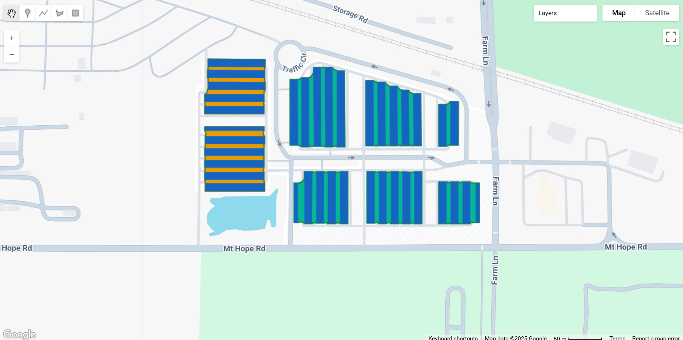
This resource catalogs more than 15,000 commercial and utility-scale photovoltaic and concentrating solar installations totaling 186 GWDC. It also features 2.92 million individual panel rows spanning 466 km², enabling analyses of design patterns, land-use performance, and ecological considerations. The compilation brings multiple sources into a consistent framework while generating key attributes such as installation year, mounting type, orientation parameters, ground-cover ratio, and estimated capacity.
In the long arc of geospatial innovation, progress often reveals itself quietly inside pull requests, commit histories, dataset updates, and the steady rhythm of community contributions. This month’s milestones are reminders that shared infrastructure grows strongest when many hands shape it. Every dataset added, every script tested, and every idea exchanged contributes to a wider ecosystem that benefits researchers, practitioners, and decision-makers across the world.
Release 3.9.0 reflects that collective momentum. The diversity and depth of the new datasets from global built-up mapping to population models, agricultural inputs, and renewable energy infrastructure signal how expansive and interdisciplinary our community’s needs have become. These additions aren’t merely data drops; they’re new foundations for questions that haven’t yet been asked and analyses that will ripple far beyond their source.
As the catalog continues evolving, its strength will come from the same place it always has: a community that cares about transparency, access, and the open exchange of knowledge.
Curious about what’s next? Explore the changelog to see the latest additions to the GEE Community Catalog, complete with links to new datasets and features. If the work resonates with you, consider sponsoring the project or starring the GitHub repository ⭐️ small gestures that help strengthen and extend the reach of this growing resource.
Community has always been the core of this effort. Connect with us on on Linkedin and Github to share ideas, offer feedback, or take part in the conversation that drives the catalog forward. Whether you’re improving a dataset, building a tool, or simply exploring what’s new, you’re part of this arc. Here’s to what we’ve built together and to everything still ahead.
No posts
Comments
Nothing yet. Say the first thing.
Sign in to join the conversation.