
“Cycling Across Oregon,” published in 2024, is an exploration of rural Oregon using the state’s official scenic bikeways network as a road map. I am posting chapters here each month as a bonus for paid “Why We Ride” subscribers. This chapter is available to all until October.
CHAPTER 2
‘The Formula Works’
Port Orford – April 22, 2021
The wind pushes against us as we pedal west. This was expected. The Cape Blanco headland, the westernmost point in Oregon, protrudes into the Pacific Ocean along a coastline known for its blustering year-round breezes. Why should we be spared?
A narrow road rises and falls as we pass cranberry bogs, a field with grazing sheep and gorse, an invasive shrub that glows with its clusters of bright yellow spring flowers. We proceed, lowering our heads against the gusts. Six miles in, the historic Hughes House appears on our right. Designated camping for touring hikers and bikers is to the left. Straight ahead, a towering white lighthouse glimmers in the noon sun.
After 47 miles of riding today, the Cape Blanco Lighthouse is our featured destination. But while the Wild Rivers Coast Scenic Bikeway takes us to the lighthouse and the ocean, I’m enamored with another segment, a squiggling, secluded, two-lane forest road that follows the Elk River inland to the Rogue River-Siskiyou National Forest.
Wild Rivers Coast Scenic Bikeway
Start and Finish: Port Orford
Distance: 61 miles
Elevation Gain: 3,028 feet
Rating: Moderate
Port Orford, an hour’s drive north of the Oregon-California border, is part of a coastal region promoted as the Wild Rivers Coast to highlight the towns, local beaches, and rivers that flow to the sea on both sides of the state line. While the popular Rogue, Smith and Chetco rivers get most of the acclaim, the smaller Elk River captures us today.
We’re here in late April when dry weather usually arrives first in Southern Oregon. We have a full cycling schedule ahead of us this year and Bob Cortright suggested we get started as early as possible. After more than four hours driving from the Willamette Valley and a night at the local Sea Crest Motel, we begin early from Port Orford’s Battle Rock Wayside Park.
Waves crash on the park’s wide beach only yards from Highway 101, a roadway that sweeps into town past local storefronts and leaves just as quickly as it arrives. The road is wide, very wide, despite allowing only one traffic lane in each direction. Near a bend sits The Crazy Norwegian’s Fish & Chips, a small dinner shack where the food is fast and tasty. It’s become a regular stop for us each time we come to town.
“The vibe is definitely irreverent if not crazy,” owner Dianne Hosford says with a laugh. “I don’t expect my employees to be super-serious about things. It’s not supposed to be a serious dining establishment.”
It’s not. Wooden tables and chairs are positioned next to wood-paneled walls across two small rooms. Customers are likely wearing knit caps and jackets in winter and ball caps and shorts in summer. The Crazy Norwegian is predictable, Dianne emphasizes. “The formula works.”
It’s been working for nearly 30 years. The fare has been steady since Dianne became the fourth owner in 2014. The No. 1 seller on the menu is fish and chips. No. 2 is fish tacos. “It’s old school coastal fish and chips here.”
The restaurant fits well within the community. Port Orford remains a throwback of sorts on the Oregon coast. It’s a small town by anyone’s definition; the 2020 U.S. census counted 824 residents. Dianne calls it “the outpost.”
“It’s a little hub in the middle of nowhere,” she says. “It’s an agrarian economy with a fishing industry. And, it’s old.”
All is quiet on this weekday morning, but I imagine a steady stream of recreational vehicles must roll through here on summer weekends. The local economic base hasn’t changed much over the decades.
“It’s still fishing for the folks who live here full time,” concurs Erin Kessler, the local bike shop owner. “And logging, ranching, cranberries, stuff like that.”
Erin and her family relocated here from Alaska in 2008, seeking just what Port Orford has to offer. “We wanted a smaller town with a smaller population where everybody might have varying political opinions or social opinions, but everyone still talks to each other. We wanted our kiddo to be in a smaller school.”
She opened Pineapple Express Adventures in 2017, a bike shop catering to mountain bike and beach-compatible fat tire bike rentals. It’s also a popular repair and resource center for cyclists riding the scenic bikeway or following the 370-mile Oregon Coast Bike Route from Washington state to California, though she admits there’s not much money generated from these passers-through. “I give a lot of free air and free advice, and I sell a couple tires here and there. I’ve got free maps for people who come in and I show them the best places to catch the [scenic bikeway] route if they don’t want to do the whole thing.”
Here’s her free advice. Drive north to Elk River Road and skip 3-plus miles of uphill pedaling on Highway 101.
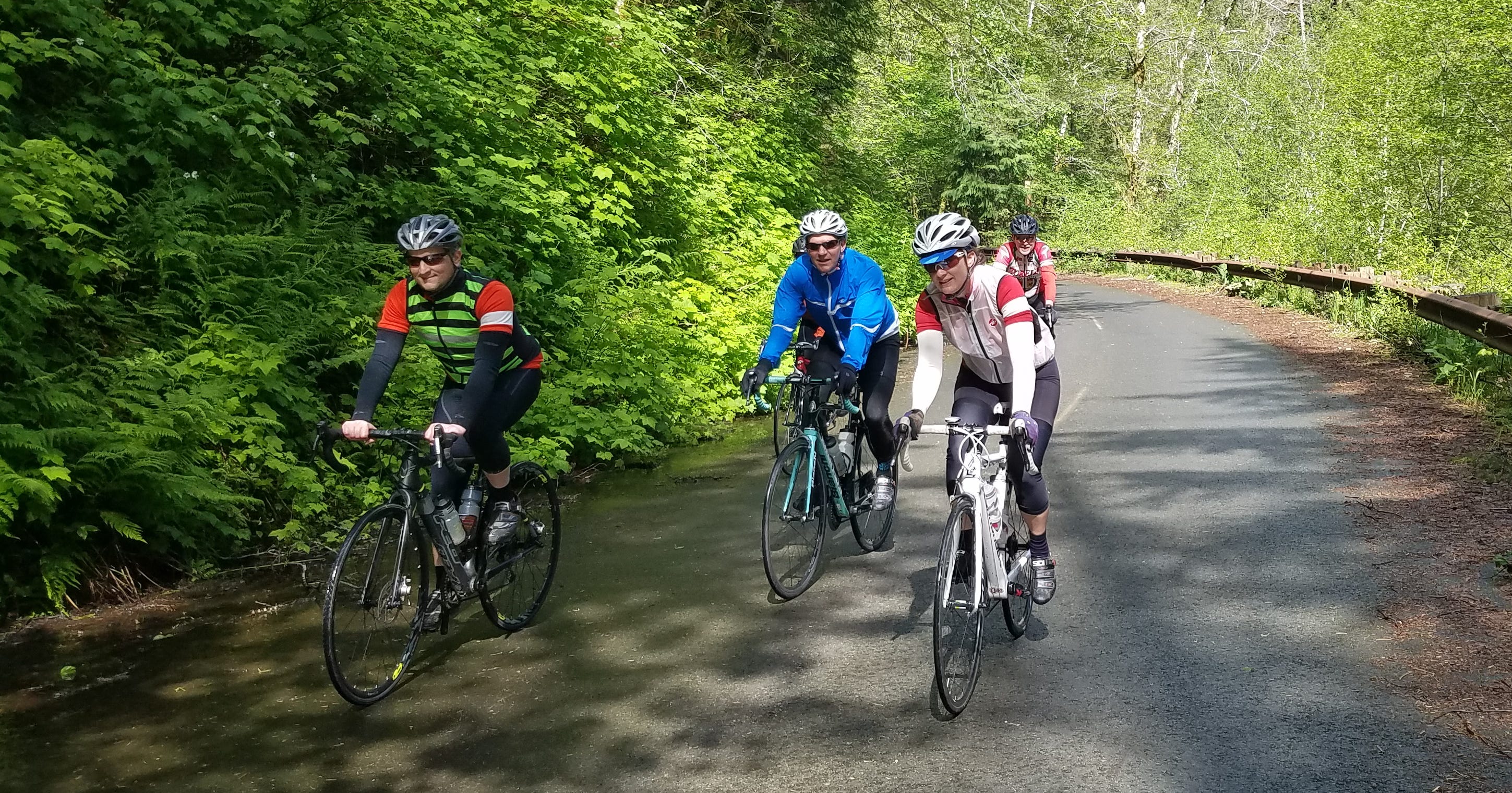
I get it. Some people rightfully are concerned about riding alongside the highway traffic, but we find the road shoulders sufficiently wide to provide a safe buffer. Patti Rogers, Bob, and I push away from Battle Rock at about 10 a.m., ready for a stern test. A stiff breeze blowing from the north adds a chilled, resistant headwind as we travel first along a quiet, residential street and then on the highway until we reach Erin’s recommended starting point. With a right turn into the trees, we escape the wind.
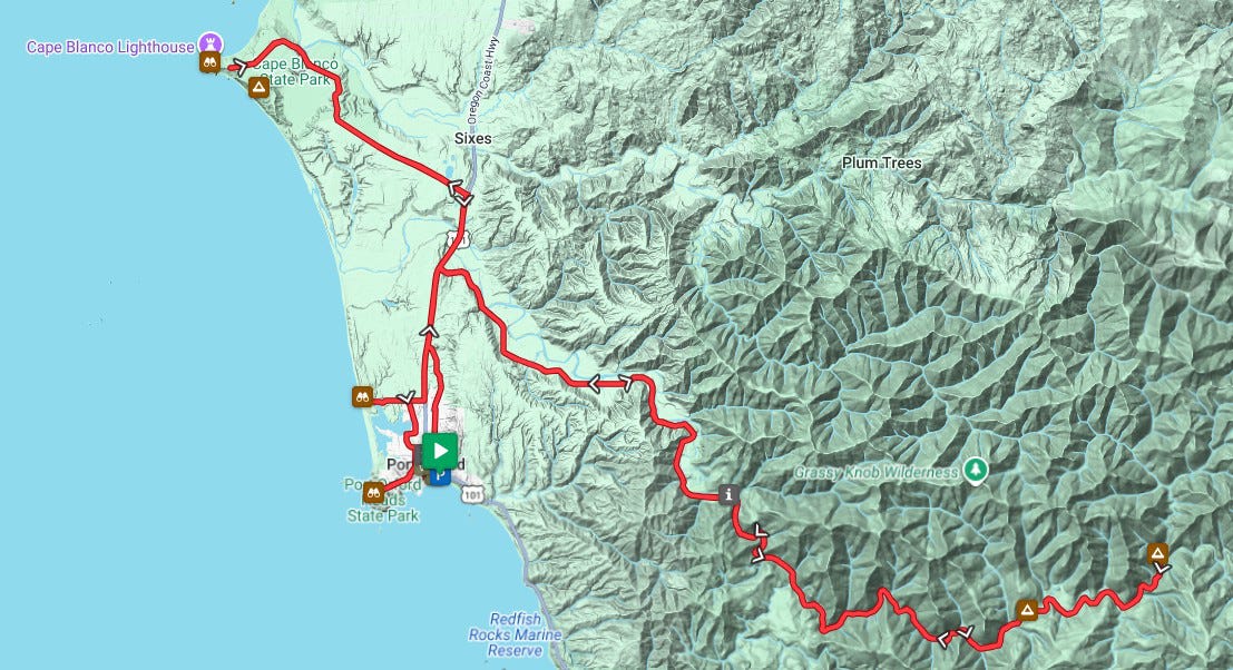
This is Elk River Road, Coos County Road 208, and the Rogue River-Siskiyou National Forest. We will pedal 19 miles southeast along the river to our turnaround point at Butler Bar Campground. Drainage from the nearby Copper Salmon Wilderness area flows into the river’s north and south forks and merge. Still, the river is neither wide nor rushing. With a few exceptions, this water lingers, flowing to the sea at a leisurely pace.
We pass a few homes as we begin on this secluded stretch of road, each house set back from the right-of-way. Traffic is minimal, only those who live here, are camping or fishing, or are on the job with the National Forest Service have a reason to be here. The road is in relatively good condition; several smooth patches cover potholes we encountered on the same ride four years ago. The repairs give us more time for river watching and less time worrying about tire damage.

When asked to name salmon habitats across the state, Oregonians likely would suggest the Rogue, the Umpqua, the Deschutes and even the Columbia River, but not the Elk River tucked away here on the South Coast. The river is not long; about 29 miles, national forest officials say. We efficiently click off the first seven miles and arrive at the Elk River Salmon Hatchery, an Oregon Fish and Wildlife operation along the river. An official state document states the hatchery is designed “to supplement natural production of fall Chinook in the Elk and Chetco Rivers and Winter Steelhead in the Chetco River, and to protect and restore wild populations of fall Chinook, Coho, and Winter Steelhead.”
Ryan Gertken, a local hatchery technician, says it in simpler language. “We want people to catch the fish we raise.”
The hatchery collects and incubates fish eggs to nurture and enhance populations. The fish are later released into rivers. There are two boat ramps at the hatchery for launching drift boats in the peak season, usually between November to April, Ryan says.
The hatchery, nearly eight miles from the highway, seems remote and perhaps a little distant for visitors but Ryan says that’s far from the truth. Plenty of people stop by, some to fish and some to follow a self-guided hatchery tour. Others drive to the parking lot, unload bikes, and follow the same path we ride today into the national forest. “This is a very popular spot for the bikers,” Ryan says. “They swing through here all the time. I see a lot of the same people, too. Some are seniors and some are families with little kids. They’ll either park at the hatchery or start out by Highway 101.”
Ryan lives and works at the hatchery, and regularly takes advantage of his location by heading out at 6 or 7 a.m. for a ride before his workday begins.
What’s the appeal?
“The scenery. It’s calm, it’s quiet. There are plenty of pull-offs to hang out by the river. I usually have a snack at the bridge and watch the fish. That’s kind of my thing.”

I enjoy how the environment changes once we cross into the national forest. The road narrows and deep, lush green becomes a primary color. Trees, thick underbrush, ferns. We instinctively slow down as if we’ve passed through a gate and entered an enchanted wilderness. We move under the canopy and recalibrate to listen for the babbling river, chirping birds, and a much gentler wind wiggling leaves above us. We stop, as Ryan does, to watch water spill over rocks and flow down through an increasingly narrow gorge. Once calm in pools, the water turns emerald to the eye. We take pictures and marvel. There are many miles ahead of us, yet we’re not in a hurry.
Eventually, we pass Butler Bar Campground and briefly stop at a small bridge spanning the narrow river, Ryan’s snack spot. It’s not unusual to see wildlife here both in the water and in the sky. Bald eagles glide above, the steelhead and salmon swim below. We listen and absorb, then return to the campground for our own food break before following the river back to the highway, the wind, and our ride to Cape Blanco.
Back at U.S. 101, we turn west toward Cape Blanco State Park and its 147-year-old lighthouse. It’s not an easy ride. Shifting winds buffet us for five miles. There are rare escapes from the gusts as Cape Blanco Road passes through a stand of trees and over a hill before finally opening to the windy headlands, the lighthouse, and the ocean.
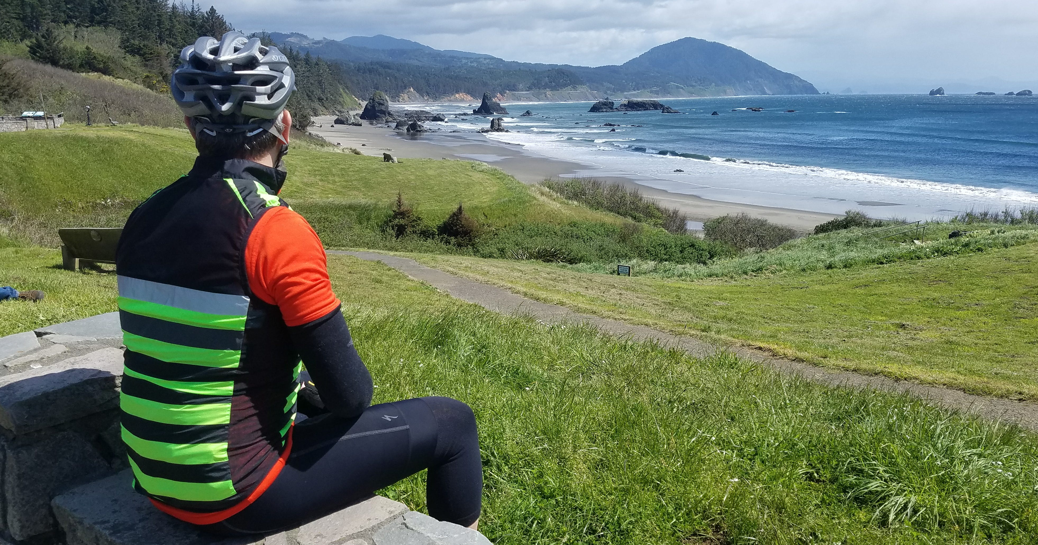
The lighthouse, constructed in 1870, remains the oldest existing beacon on the Oregon coast. The nearby Hughes House was built 28 years later for ranchers Patrick and Jane Hughes. Both the lighthouse and the Hughes home are normally open for tours, but these are not normal times. It’s late April 2021 and public places remain closed to guard against COVID exposure. It wasn’t always this way, of course. Bob, Eric Jacobson, Jennifer Donnelly, Elise Hendrickson, Robert Mansolillo, and I rode this bikeway in May 2017. We entered the lighthouse and shed our bike shoes with their metal pedal clips in order to safely climb a narrow, spiral steel staircase to the top of the 59-foot tower. Emerging into the glassed “lens room,” we gazed across a 180-degree view of the Pacific Ocean, beaches, and coastline.
The focal point of the room is the lens itself, an assembly of thick glass surfaces 4 feet, 8 inches in diameter and 6 feet, 8 inches high. A 1,000-watt light bulb beams its signal to all the ships at sea every 18.2 seconds. That wasn’t always the case. Lighthouse keepers James Langlois and James Hughes, the second son of Patrick and Jane Hughes, kept lamps fueled first by lard oil and then mineral oil burning inside the tower from sunset to sunrise for decades. Langlois, namesake of a small, unincorporated town 14 miles to the north, served as head lighthouse keeper for 42 years. Hughes, at first Langlois’s assistant before succeeding his boss, worked there for 37 years. Oil burning ended in 1936 when the lighthouse was electrified.
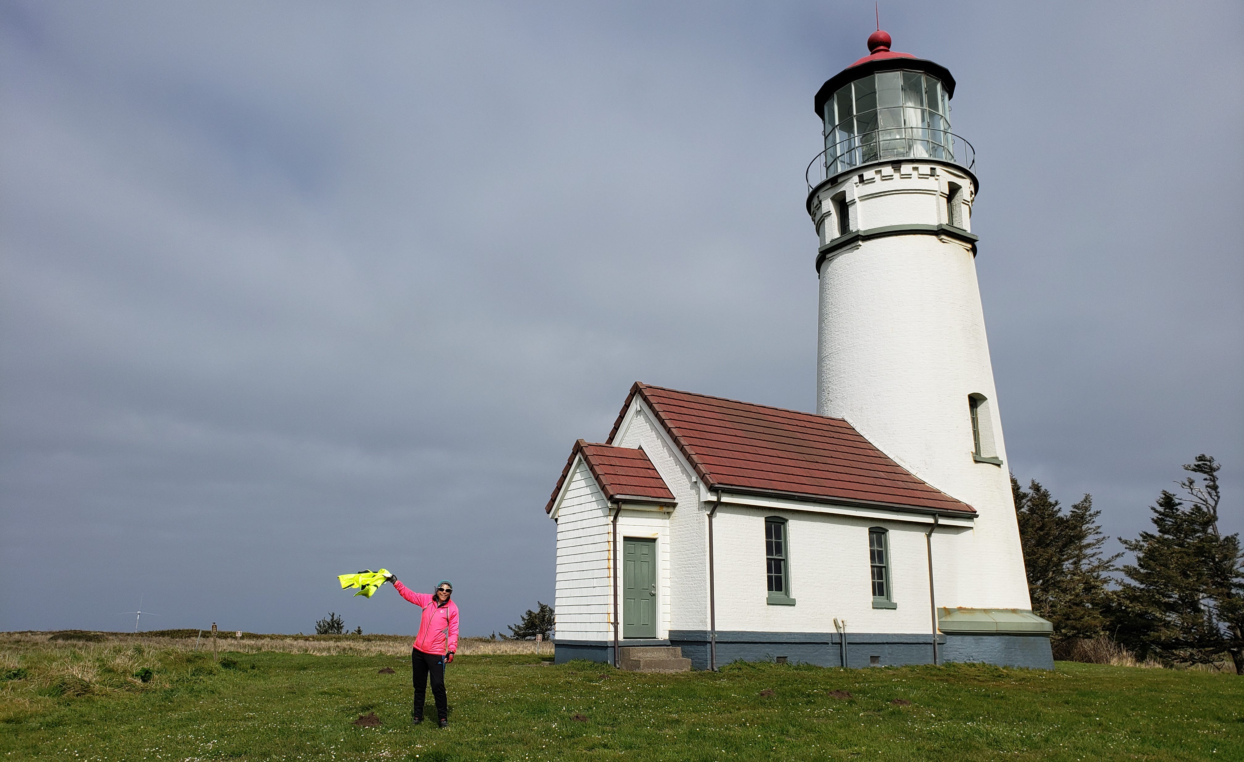
Winds sweep the headland today. “Will you hold your jacket above your head while I take a picture,” I ask Patti, hoping to capture the wind’s intensity in a single image.
“How’s this?” she yells so she can be heard over the rush of air. Her arm, at a 45-degree angle, isn’t high enough.
“Straight up,” I yell back.
She raises the jacket higher with her right arm and the current immediately pushes it horizontally pointing south. I hear the fabric snap as though it were a flag on a pole. A few seconds later, the wind eases and the jacket slumps then dangles limp. I got the picture.
The gusts make riding a bike on the steep, narrow path between the lighthouse and the road a challenge as it pushes to our right. We pass through a small gate and retrace our route back past the cranberry bogs and grouse, over hills and across small patches of gravel to Highway 101 and our return to Port Orford. The highway slopes downhill. After a three-mile, gravity- and wind-assisted descent, the directional scenic bikeway signs tell us to turn toward the ocean for a leisurely tour to Paradise Point State Recreation Site and then Port Orford Heads State Park. After one more ocean view, we return to Battle Rock and prepare for the four-hour drive home.

Jennifer couldn’t make this trip to the South Coast. I thought it was unusual when she missed our planning meeting in January because she enjoys working through ideas with us. Then, in February, she sent unimaginable news.
“I have been delaying this email, but I wanted to let you all know what is going on with me, so when it comes to bike planning and trips you understand why I am a maybe or a no or not-sure participant,” Jennifer wrote.
She explained that she had been diagnosed with ovarian cancer, and briefly outlined her chemotherapy schedule. “As you can imagine, this rocked my world to the core. I will try to join you to the best of my ability on shorter rides.”
We’re shocked and saddened yet buoyed by her optimism.
“Chemo is going better than I expected,” she updated us in an April 5 email. “I am not halfway through the process. My energy level is pretty good, but my strength is not great. I ride at least 20 minutes every day—my health ride.”
She remains upbeat and seems encouraged that she’ll be back with us, we tell each other. We would expect nothing less from Jennifer, and we try to stay as positive as we wait to hear more about her recovery.

Dan Shryock is a travel writer and career journalist who focuses on cycle tourism. Based in Oregon, his work has appeared in magazines and websites in California and the Pacific Northwest. His book, “Cycling Across Oregon: Stories, Surprises & Revelations Along the State’s Scenic Bikeways” is available on Amazon.
No posts
Comments
Nothing yet. Say the first thing.
Sign in to join the conversation.