
i’ve been pretty happy about my consistency with sharing cool maps once a month. some might call it a strong personal brand, but one of my favourite side effects is how often friends and mutuals (and my students!) will share a fun piece of cartographic inspiration with me, and often with multiple people sending the same things! this edition is filled with exactly that:
3 inspirations
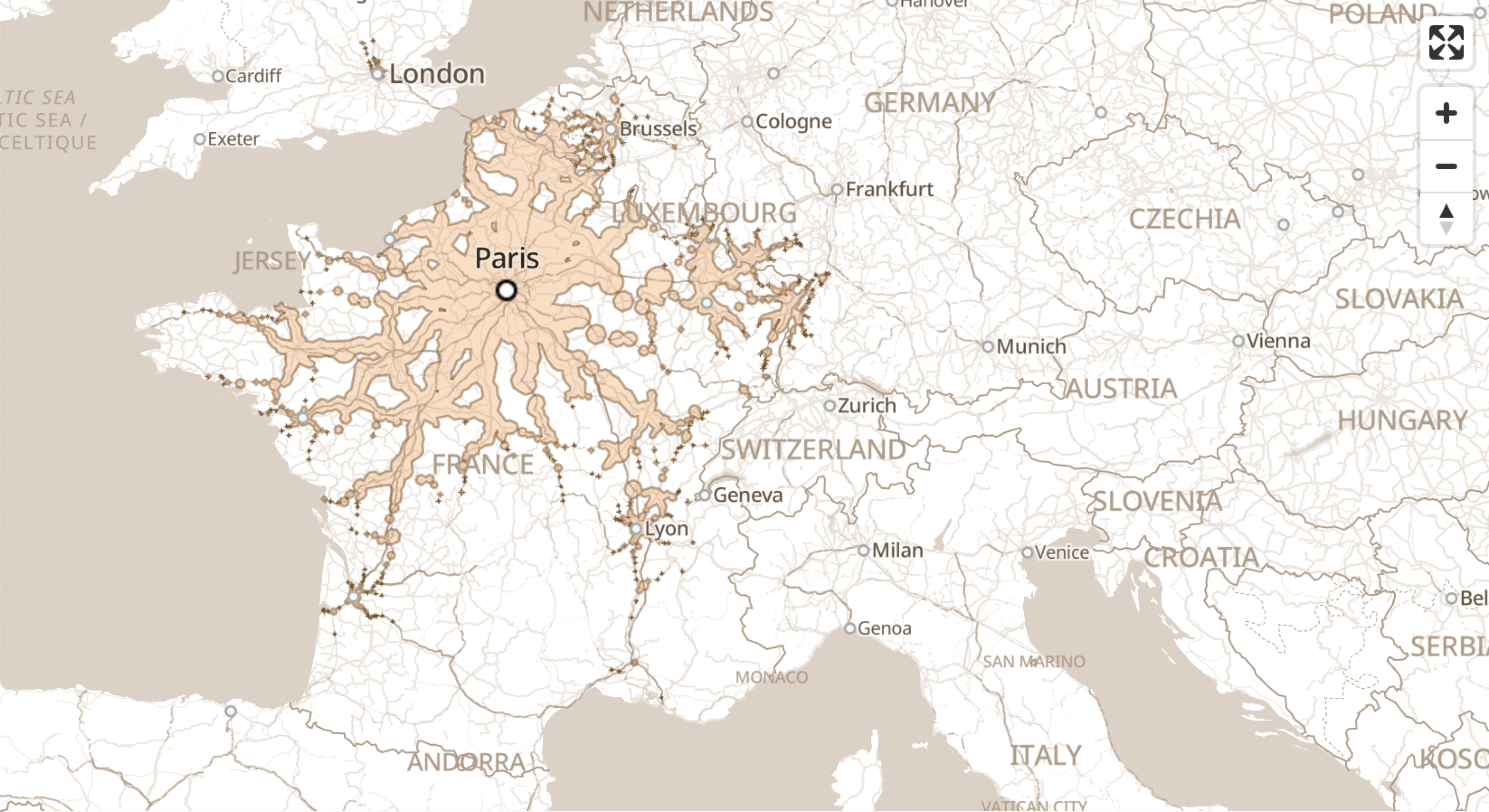
i love trains. i used to think that engineers only existed for the sake of trains. mechanical engineers? they make the train gears. civil engineers? they build the train bridges. software engineers? they make sure the train scheduling & signals are running and optimal.
Chronotrains is an interactive library of isochrones that let you explore how far you can get from one city within a set time by train. while it only works in Europe, you can play around with the expansive train network, and dream up a quick getaway. its search function also gives you the ability to turn that imagined escape into a real one.
this map was shared to me by my friend Levi. help us cross our fingers that we’ll make it to Berlin next January via grad school, and get to put this map to use.
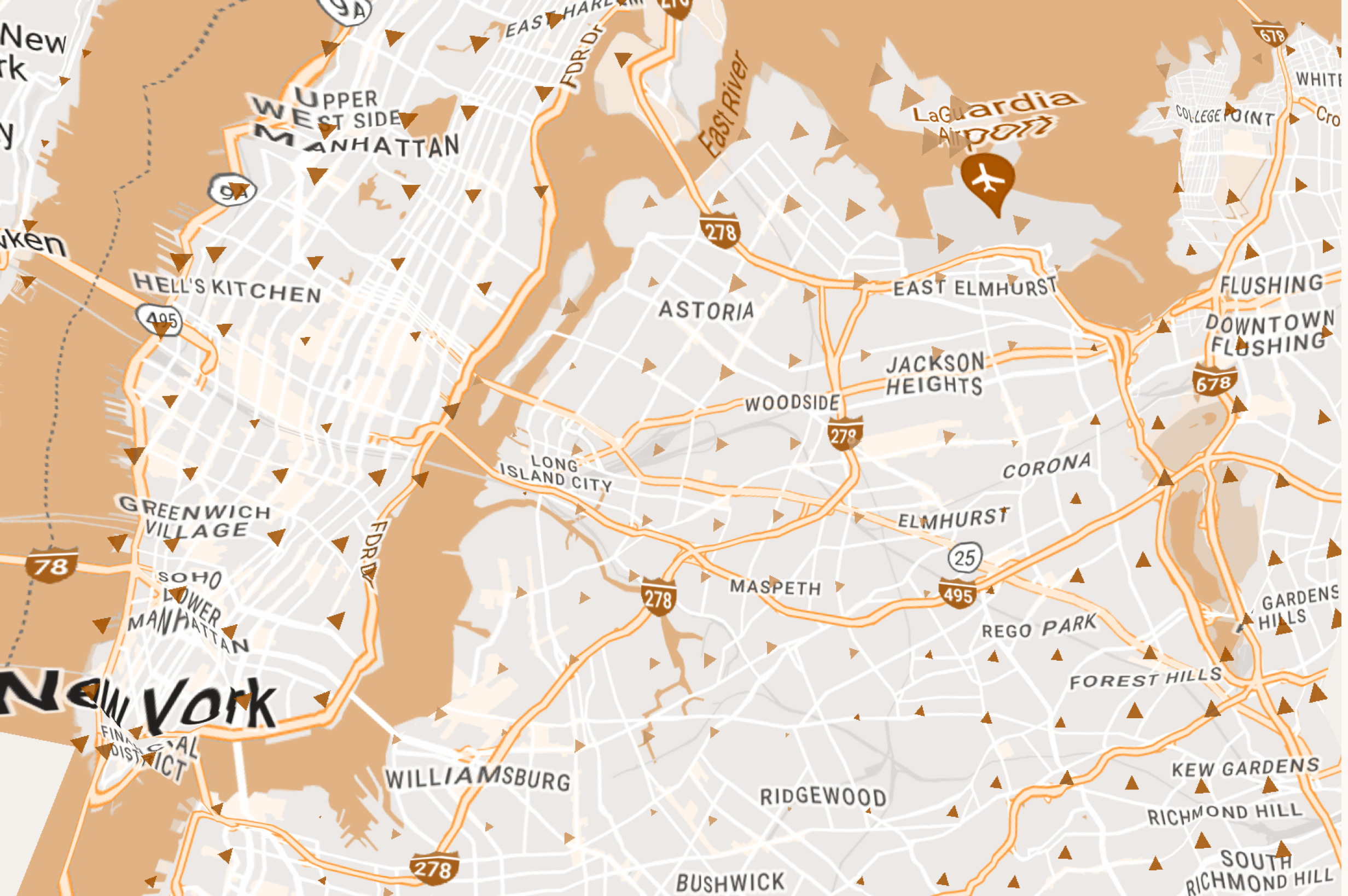
in a similar vein, instead of visualizing where you can go in a certain amount of time, this space-time map tries to shift the actual map itself. distances in this map indicate travel times compared to its actual distance. points that are close but take a long time to travel between are pushed away from each other, while easily transportable areas squeeze in - like wormholes.
Václav, the map’s creator, also made a great explainer video - showing methods of visualization that led to his exploration into distortion.
this distortion is much more common than you think! a lot of functional maps are often geographically “inacurrate” shifted and abstracted to best suit the purpose of the map when details are either distracting or simply impossible to show. the largest example being the Mercator projection - made with the purpose of straightening out cardinal directions to benefit sailors, but when used in other situations such as education, its many repercussions include stretching the sizes of polar continents until they’re unrecognizable.
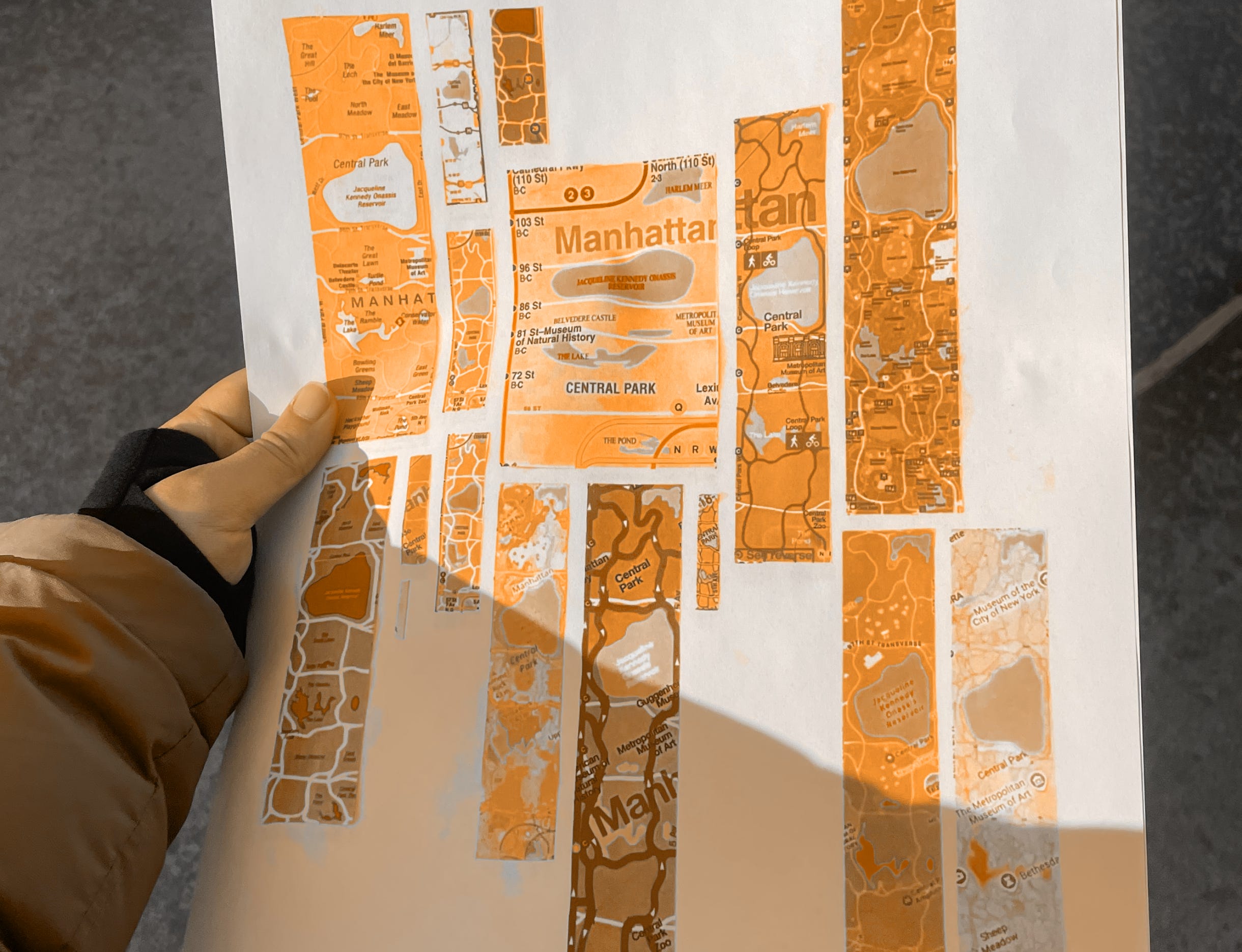
another example lives in the maps i harvested for this poster of central parks that i shared in last month’s edition. these collage of cutouts represent the same space, but you. might notice their ratios vary widely. particularly, the MTA subway map squishes the long stretch of green into a short stubby rectangle in order to fit, relatively, the subway stations that span the park’s avenues versus its streets.
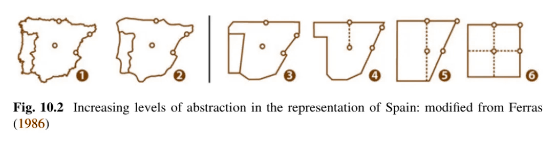
my friend Omar shared with me this snippet as we were talking about abstraction. I ended up printing out this chapter preview, and found fascinating their explanation of schematization, and when accurate geographic details become distractions.
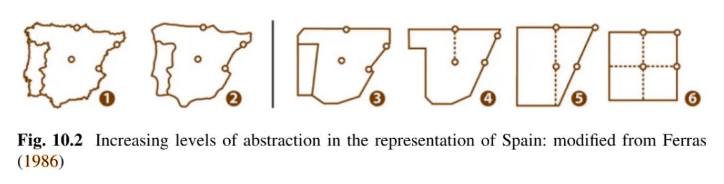
it’s fun to notice the effects of schematized maps on its surrounding base map - warping geography depending on the overall goals of the map. sometimes you have to very purposefully break through your existing knowledge about the space to actually create a map that’s easy to understand for a specific purpose. i’m excited to notice even more examples of this, and i hope this seed gets planted in your map viewing activities too.
i love thinking about levels of abstraction! it’s the basis of what design is.
1 work in progress
i’m not typically a resolutions person, but when my friend Lucy shared a friend’s past resolution, i immediately resonated: waste more paper. of course, not in the literal definition of wastefulness, but a bottom up version of the more common resolution to “create more”. i want to cash in on all the art supplies that i’ve been hoarding for that imaginary “perfect” piece, and put it towards just… making.
adjacent to this resolution, i’m starting an into to risograph printing course at the School of Visual Art starting mid-February into April. i’m excited to just make and make and make and make. and maybe finally put into production those collective atlases.
and of course, maps wise, i want to find more tangible paper inspiration too! but the sources are sometimes sparse and the antique print shop in my neighbourhood bans photos being taken.
that’s it! let me know if you see a cool map in the wild (or if you make one yourself)

No posts
Comments
Nothing yet. Say the first thing.
Sign in to join the conversation.