
If you’re not from upstate New York, or you weren’t living there in 2011, you probably don’t remember Irene. That’s not a knock on anyone. When billion-dollar disasters hit this country every two and a half weeks, they blur together, and the ones that didn’t happen to you are the first to go. For a young and relatively green meteorologist, though, it was the one storm I will always remember.
It was a late August weekend, and I figured that if my photographer and I could find higher ground, we could show people the wind coming off Irene even that far from the coast. We picked Thacher State Park, up on the Helderberg escarpment southwest of Albany. Until Hurricane Harvey in 2017, it is the wettest I have ever been outside of the times I was standing in the ocean on purpose.
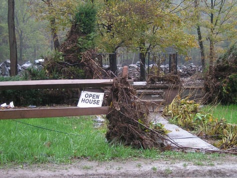
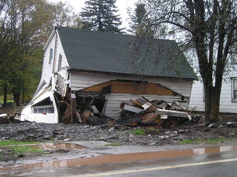
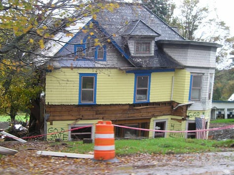
Rain came down the park roads in torrents, moving fast enough to cut deep channels into the dirt paths. Then our assignment desk called and sent us to the Village of Schoharie. In my handful of years upstate, I had never had a reason to go there.
I-88 was a straight shot from our morning live location. As we came up on the exit, there were school buses sitting on the highway, full of evacuees. Officials were evacuating the evacuation center, because the evacuation center was flooding.
We took Route 30 off the interstate and into town. It crosses the Fox Creek, which was barely clearing the bridge. The Schoharie Creek cuts through town and then runs close to Route 30 south of it, closer than you would want. We stopped for some b-roll and decided to keep going south. That did not last long. The creek came over its banks and put the road under water, and we turned around and raced back north, getting over the Fox Creek bridge by the skin of our teeth, right before it went under.
There were towns along the Schoharie Creek that were washed downstream. We were close to becoming causalities of Irene, but somehow made it out alive.
That was fifteen years ago. This week it happened again, in the same region, and this time the storm didn’t have a name.
It was a slow-moving upper-level low that parked itself over eastern New York on Tuesday and would not leave. Locations near Albany, New York recorded just over eleven inches of rain in twenty-four hours, shattering the previous mesonet twenty four hour record of 9.4 inches set in August 2024. Three-day totals reached 11.8 inches at Schodack and 11.48 inches at Kinderhook, with widespread totals of roughly five to nine inches concentrated along the Hudson Valley. At Albany, where precipitation records run back to 1826, it was the wettest July day ever measured. The old mark was 3.49 inches, set in 1996 by Tropical Storm Bertha.
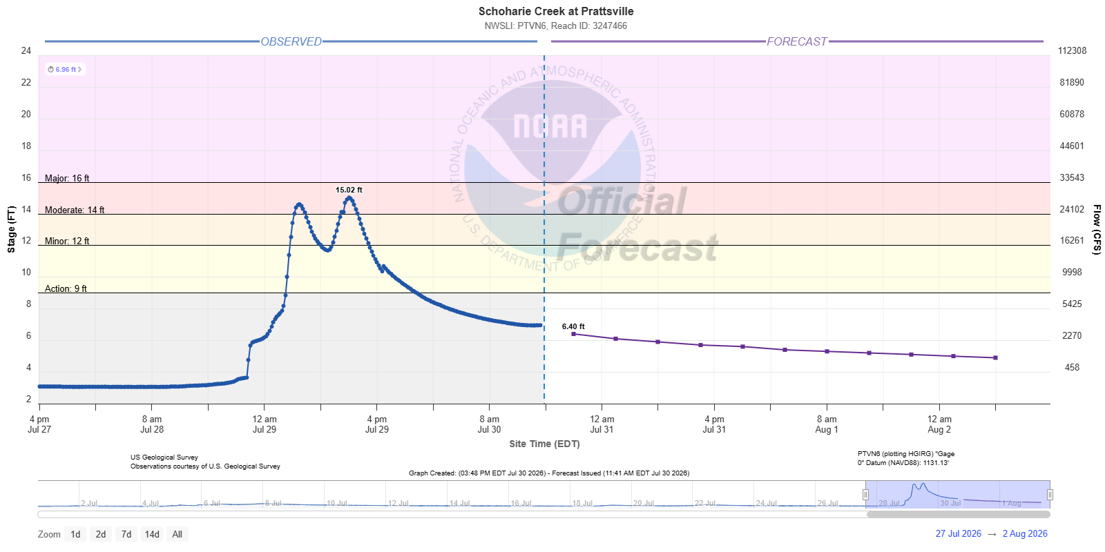
There is a trend. Most of the storms that produce flooding had a name. Bertha in 1996. Irene in 2011. Isaias in 2020. Meteorologists in Albany made the same point this week, that unlike those tropical systems, Wednesday’s rain came out of a strong upper-level low, which is not the kind of feature that produces this in midsummer. The rainfall that used to require the remnants of a hurricane arrived on an ordinary Tuesday in late July, and nobody had a reason to evacuate a valley in advance because there was nothing on the map to be afraid of.
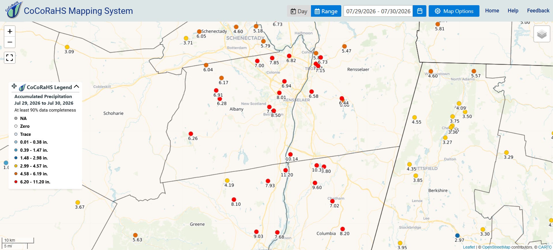
Can you say the upper-level low was caused by climate change? No. However, you can say it infused the system with more moisture. Warmer air holds more water vapor, roughly four percent more for every degree Fahrenheit of warming.
The Northeast is where this shows up most clearly in the American record. The Fifth National Climate Assessment found that the amount falling in the heaviest one percent of precipitation days in this region has increased about sixty percent since 1958, the largest increase of any region in the country.
And that is the part that actually drowns people. Every storm drain, culvert, bridge opening and detention basin in the Schoharie and Hudson valleys was sized against a rainfall statistic, and that statistic was calculated from a record that assumed the climate holds still. It doesn’t anymore. We built a drainage system for a century that ended, and we are still adding to it using the same numbers.
River levels were low heading into this event. The ground was not saturated. This was largely driven by rainfall rate alone, water arriving faster than any surface could move it, and it still took out a gristmill in Castleton-on-Hudson that had stood since the 1640s.
Proud to be part of this amazing group. If you can, please support the work:
No posts
Comments
Nothing yet. Say the first thing.
Sign in to join the conversation.