
In May, I attended the Congress for the New Urbanism in Northwest Arkansas. I expected to hear a lot about walkability, street design, mixed-use buildings, and the failures of sprawl. I heard that and more from the professionals from the “big leagues” of urban planning, as well as local politicians from across the country (including several mayors), and storied developers. There were also many young developers and practitioners like me, including a large representation from the Incremental Development Alliance seeking ideas and principles from people who have been working on urban projects for decades. The most useful idea I brought home from CNU 34 was not about street trees, retail, architecture, or density in isolation. It was about scale: the idea that a large parcel gives a developer enough room to build a complete place.
The conference was split between Bentonville and Fayetteville, two rapidly growing Arkansas towns with different histories.
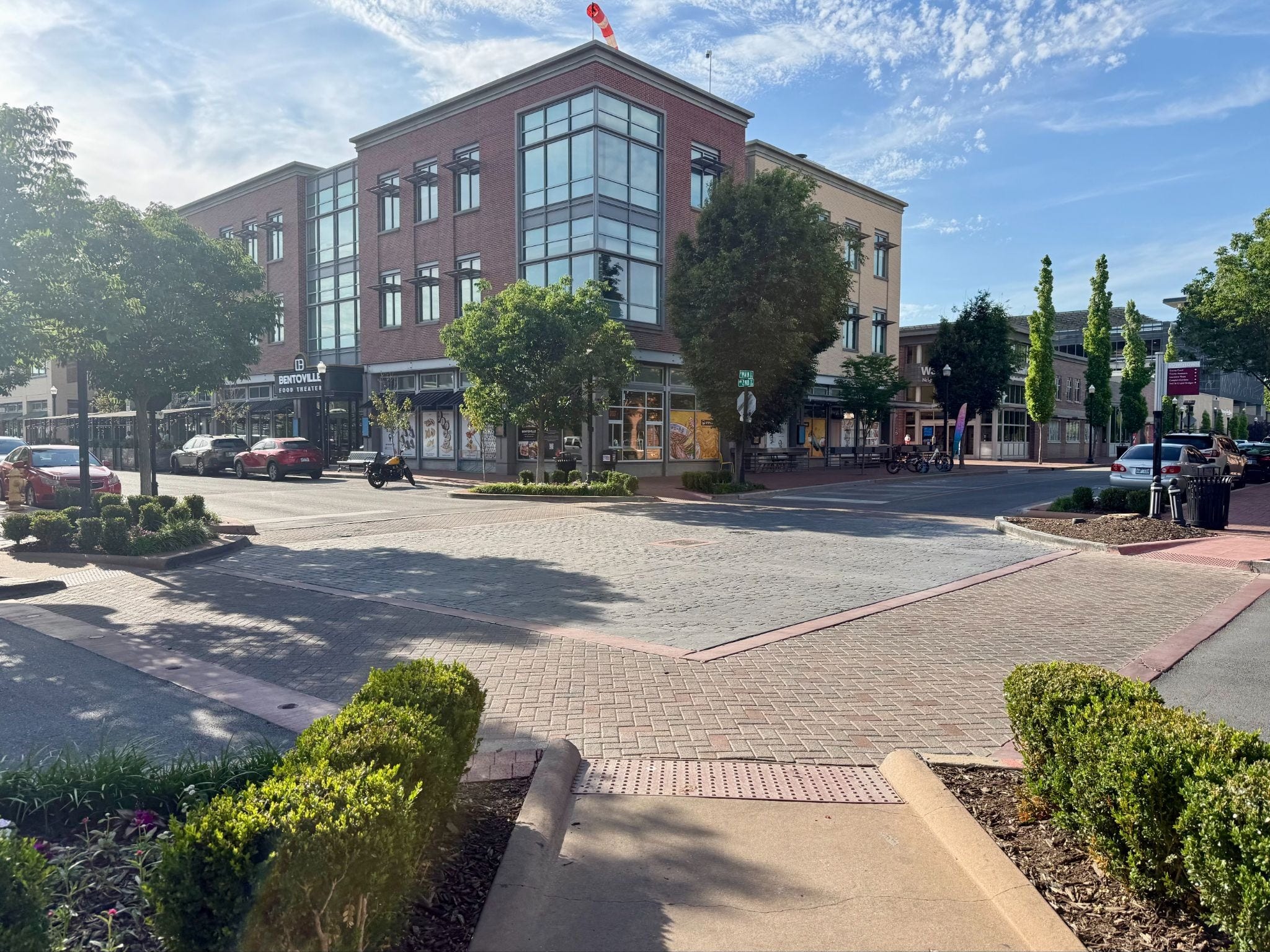
Bentonville is being reshaped by the capital, employment, and civic ambition surrounding Walmart and the Walton family. The result is unusual for a small American city: a historic town center with a walkable grid, strong frontage, good public spaces, elegant streets, and even an urban-format Walmart that fits naturally into the downtown fabric.
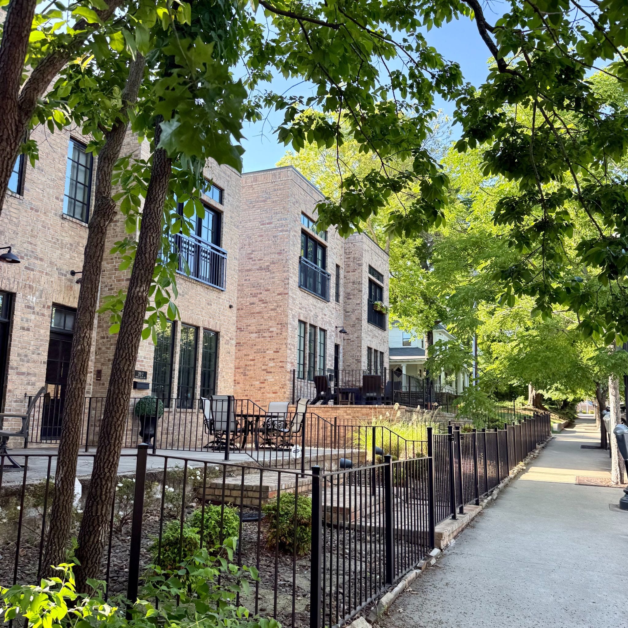
Fayetteville feels more like a traditional university town. It has a downtown core, older neighborhoods, and a ring of newer suburban growth. It also has examples of modest new infill, including duplexes and small residential projects that fit comfortably into the existing neighborhood pattern.
That made Northwest Arkansas a useful place to have this conversation. These are not legacy coastal cities where walkability already exists at scale. They are fast-growing, car-oriented American places trying to become more complete.
The Congress for the New Urbanism was founded by a group of architects, planners, developers, and policy advocates who wanted to improve the quality of cities and reduce the spread of sprawl. In 1996, they created the Charter of the New Urbanism, which lays out many of the movement’s core principles: walkable neighborhoods, mixed-use centers, connected streets, civic spaces, housing variety, and development patterns that support human life instead of just vehicle movement.
For me, the value of CNU was not that every idea was new. Most of the themes are familiar to anyone who reads about urbanism: safer streets, mixed-use development, better codes, fire safety, housing choice, and the long-term costs of sprawl What was useful was hearing those ideas from people who have actually built neighborhoods, written codes, financed projects, and fought through approvals. The members of this organization are active in some of the most interesting urban projects in the country and many of them are the authors of books that I’ve been reading to learn more about what it takes to build better places. The conference was an opportunity to meet some of these people in person, legendary names like Dhiru Thadani, Jeff Speck, Andres Duany. As an aspiring developer, I was not there only to admire good urbanism. I wanted to understand how it gets built.
As an aspiring developer I chose to focus on topics related to development and building, to hear from people who had built new urbanist places and hoped to use the conference as a way of refining thoughts on my own projects. The most interesting idea that emerged for me was the concept of Large Parcel Infill. Infill is a growing urban redevelopment strategy that allows small scale developers to improve, repurpose or add density to existing urban sites. Common infill projects might be taking a single-family home and making townhouses or converting an old factory into a series of mixed use loft apartments (very common in my home town). What happens when a much larger underused site inside or near an existing community can be redeveloped into a more complete neighborhood or district?
Indeed, these kinds of projects aren’t novel. There are neighborhoods in Copenhagen, North Amsterdam, Baltimore Harbor, and Toronto that have found varying levels of success with these large-scale redevelopment plans. But many of these places are already heavily urbanized, benefitting from a high quality street grid, existing density and demand. Could these same principles be applied to create more urban places in car dependent ones? This is a critical goal of my work at Build Better Places: finding ways to improve our existing environments for existing and future residents. Several talks at CNU 34 gave me powerful frameworks for thinking about how to approach this question.
One of the most useful talks I heard was Daniel Wright’s session, “PLACES That Create Value: How Mixed-Use Urbanism Outperforms Its Comparable Parts.”
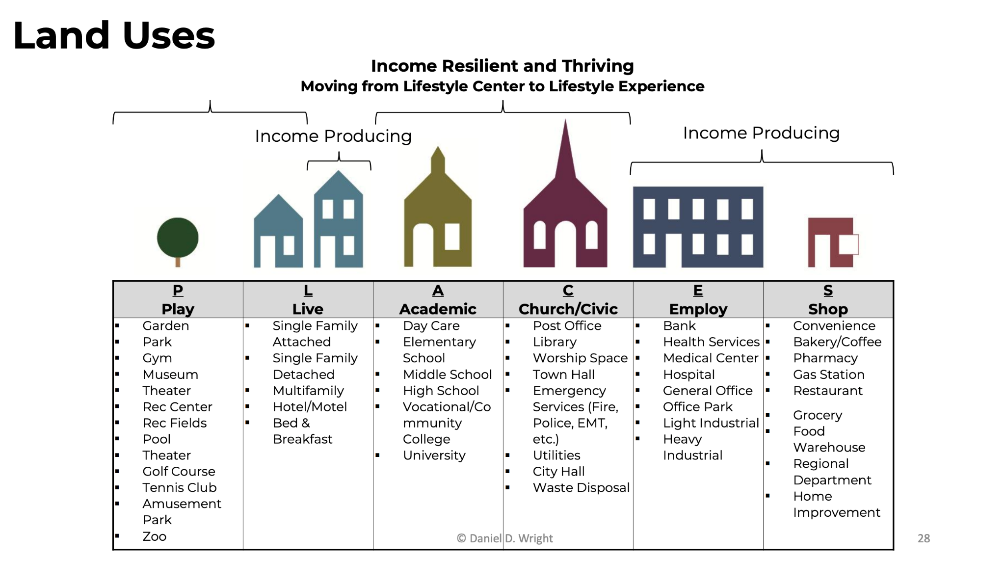
His central argument was that value comes from the relationship between uses, not just the uses themselves. Housing, retail, civic space, streets, parks, and employment do not create the same value when they are isolated from one another. They become more powerful when they are connected in a walkable pattern. He described this as a kind of lattice: many different uses connected in many different ways. A person can walk from home to coffee, from coffee to work, from work to a park, from a park to dinner, from dinner back home. Each use supports the others.
Wright used Norton Commons in Kentucky as a case study. Norton Commons is a new urbanist community built around a traditional main street, a mix of housing types, public spaces, and neighborhood-serving retail. Construction began in 2005, and the project has grown over time into a mature mixed-use neighborhood.
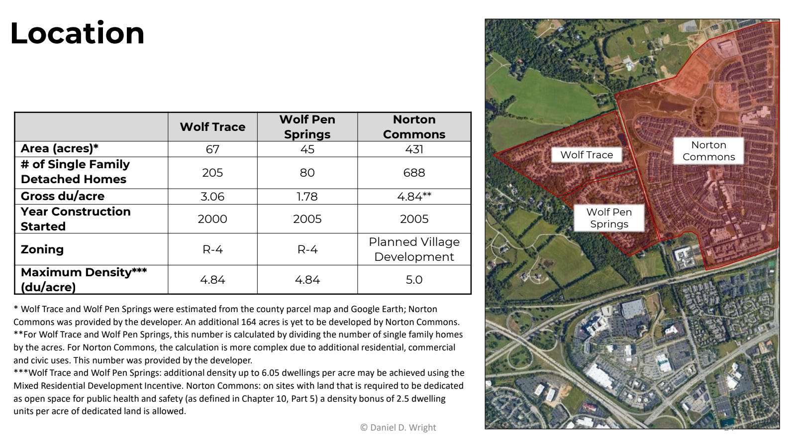
What stood out to me was not just that Norton Commons is more attractive than the subdivisions around it. It was that its design logic appears to create measurable value. Even with smaller average home sizes and smaller lots, the neighborhood outperforms more conventional suburban developments nearby.
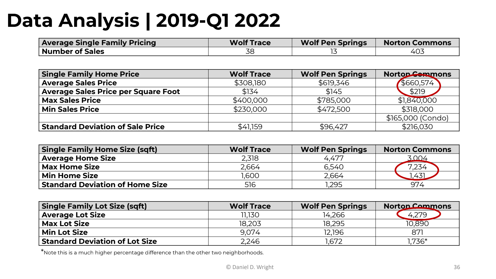
North Commons challenges one of the most common assumptions in development: that value comes mainly from private square footage and lot size. In a complete place, some of the value comes from what is shared. The street is valuable. The storefronts are valuable. The park is valuable. The ability to walk somewhere is valuable. The fact that the front door, porch, window rhythm, and facade all contribute to the public realm is valuable.
Even the houses themselves play a role in the larger place. Front doors face the street instead of hiding behind garage doors. Materials are simpler and more coherent. Shutters, columns, porches, and windows are used with more discipline. The individual building is not treated as a private object sitting on a lot. It is part of the street.
That is the first lesson for large parcel infill: A large site should not begin as a yield plan but rather it should begin as a place.
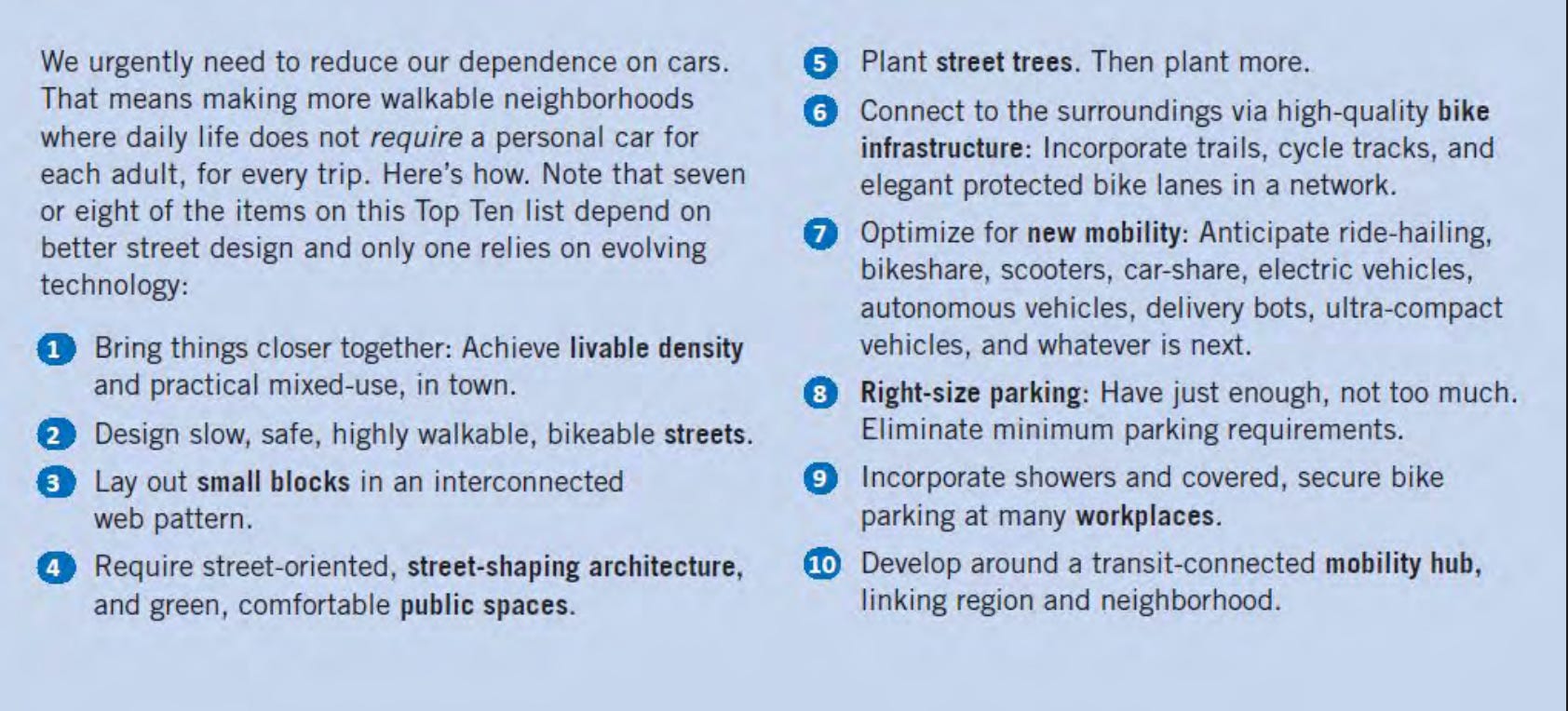
Street design came up again and again at CNU. I heard versions of this from Jeff Speck, Victor Dover and Tristan Cleveland. While each took a different perspective on the goal of “getting people to walk”, there were several consistent patterns around safety, comfort, visual interest and of course utility.
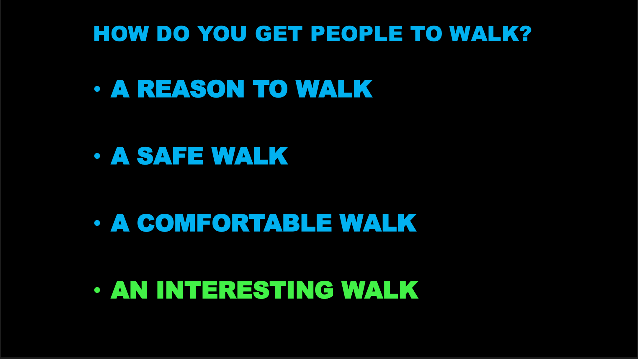
A small infill site has to work within an existing street network but a large parcel may be big enough to create a new one. That is a huge opportunity, but it also means the developer has very little excuse.
The most important point is that different streets should do different jobs. Some streets need to handle more traffic. Some should be slow and narrow. Some should prioritize storefronts. Some should feel residential. Some should terminate in a civic building, park, or public space. Some should connect outward to surrounding neighborhoods. A large parcel is big enough to create its own street grid, but it cannot become an island.
That may be the hardest part of large parcel infill in suburban places. The site may be surrounded by wide roads, disconnected subdivisions, cul-de-sacs, drainage features, parking lots, and hostile intersections. Even if the internal plan is beautiful, the project can fail as urbanism if people nearby cannot reach it comfortably.
Connectivity has to be studied directly: Where are the existing neighborhoods? Where are the desire lines? Where can a pedestrian crossing actually work? Where can a bike connection be added? Which intersections need to be slowed down or redesigned? Where should the project invite people in?
The best street network creates value by making the place legible, connected, and alive, managing speed and access.
The most practical session I attended was Bob Gibbs’ talk on urban retail. His core point was simple: retail should not be treated as decorative ground-floor space. It has to work as a business, as real estate, and as part of the larger place. It is easy to draw shops on the ground floor. It is much harder to make those shops work.
Retail has to start with the development objective. Is the retail supposed to be a profit center? Is it an amenity that raises the value of nearby housing? Is it a legacy investment meant to improve the community over time? Those are different goals, and they lead to different design, leasing, parking, and financing decisions.
Retail should be sized from the market backward. Before designing a redevelopment plan, the developer should understand how many households are within reach, what share of spending the project can realistically capture, what sales volume each tenant needs, and what level of rent those sales can support. New homes within a development may help increase sales, but only modestly. His advice is not to rely on the project’s own residential units as the sole justification for the retail program, but instead to base the retail on the wider market area.
Supportable square footage is to access, not just raw population. In one example, within a five-minute walk, about 1,500 households can support roughly 10,000 square feet of retail. He then expanded this by mode, suggesting about 3,000 square feet can be supported by walkers alone, 15,000 square feet by bike access, and 65,000 square feet by e-bike access. His broader point is that convenience and mobility shape retail demand as much as population totals do.
Occupancy cost should be about 10% of sales. He illustrated this with a simple example: if someone buys a $350 handbag, about $35 of that purchase is effectively supporting rent and related occupancy costs. Therefore a typical corner store which costs about $1 million to build, needs about $100,000 per year in rent, and therefore requires rents around $35 per square foot per year, or roughly $3,000 per month. To support that level of rent, he said the business needs to generate about $1,000 per day in sales. This ratio is a key piece of logic he used to connect tenant revenue to real estate feasibility.
Parking is part of retail performance, not an afterthought. Bob was emphatic in saying that grocery and neighborhood retail still depend on cars. His principle is that shoppers must be able to “park once” and access both the anchor and the smaller shops in a single trip. If parking is too remote, badly organized, or separated from the small shops, the retail mix weakens. For him, good urban retail is not anti-parking; it is parking designed to support walkability and shared trips.
At the conference I immediately bought a copy of his book Principles of Urban Retail Planning and Development which is a really useful reference for thinking about introducing retail into a mixed-use development.
In the CNU Builders and Developers Workshop I heard from a number of developers and architects on how to build more complete places while managing risk. In the session Building Better: Lessons Learned from Developing Thoughtfully experienced developers Steve Maun, Frank Starkey, David Tomes, and Joel Embry converged on the idea that it is a discipline of sequencing that separates successful large parcel projects from ones that stall. “If you have 100 acres, pretend you only have 5 and develop that first 5 acres perfectly.” Phase 1 must include a slice of every planned product type and complete two to four sides of streets and spaces, so that early visitors can actually feel the urbanism rather than squint at a rendering.
A community called Kentlands was cited as proof of concept: a Washington Post photograph of the incomplete development made it look finished, drove a wave of traffic, and created momentum that carried the project forward. Norton Commons, now 85% complete after 26 years, applied a related version of this logic through deliberate scarcity, Joel Embry’s approach of always saying “that’s not for sale yet” concentrated builders in one neighborhood at a time rather than letting them scatter across the site, preserving the sense of a forming community at every stage. The fractal strategy reframes large parcel infill as one of sequencing disciplines focused around creating places.
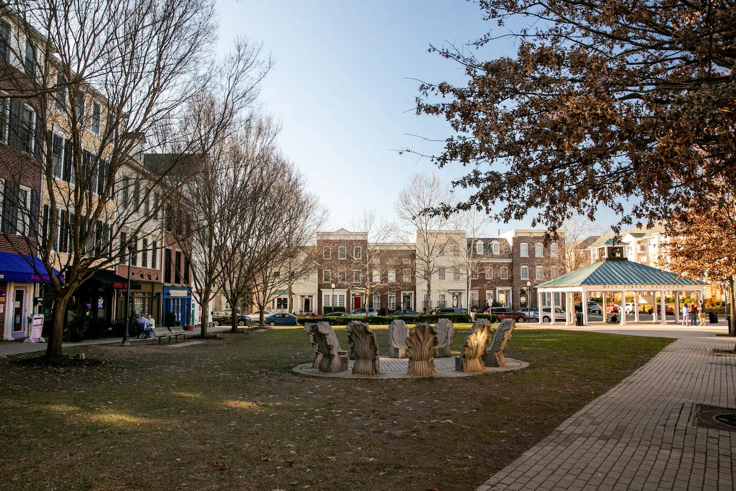
Kentlands was cited as an example. A photograph of the project while it was still incomplete made it look much more finished than it really was because the early phase had been designed with enough completeness to communicate the vision. That image created traffic, attention, and momentum.
Norton Commons followed a related logic through deliberate scarcity. Rather than allowing builders to scatter across the entire site, development was concentrated in one area at a time. The answer to buyers was often, “That’s not for sale yet.” That discipline helped each phase feel like a forming neighborhood rather than a thin layer of houses spread across a huge site.
This is a very different way of thinking about large parcel development. The conventional approach often prioritizes the easiest land, the fastest absorption, or the most efficient infrastructure sequence. Those things matter. But if they produce a first phase that feels unfinished, disconnected, or generic, the project may never recover.
Eric Kronberg’s session on Reregulating Attainability connected large parcel infill to another issue I have been thinking about for a long time: household change.
The American housing market still behaves as if the default household is a married couple with children looking for a large detached house. That household still exists, of course, but it is no longer the dominant model in the way it once was.Kronberg showed that in 1960, traditional nuclear families represented 44% of households. Today, that figure is closer to 18%. Most households are now singles, couples without children, roommates, older adults, single parents, and other non-traditional arrangements.
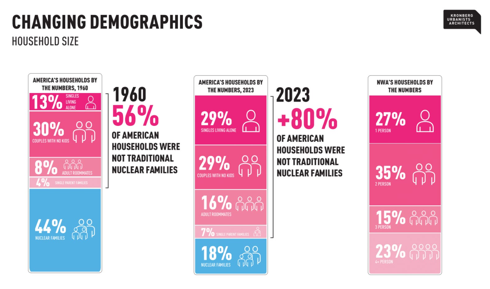
That mismatch creates an opportunity. A large parcel is one of the few development contexts where a builder can deliver a full spectrum of housing in one coherent place: small apartments, studios, duplexes, cottage courts, townhomes, rowhouses, small-lot single-family homes, and larger family units.
It is also a fiscal strategy. Low-density development spreads infrastructure and municipal service costs across too few taxpayers. Roads, pipes, sidewalks, parks, schools, fire service, and police service all have to be paid for. When the tax base per acre is too low, the math gets difficult. Kronberg framed this as a version of the “three impossible demands.” A city cannot indefinitely maintain stable services, low taxes, and low density without subsidies or trade-offs.
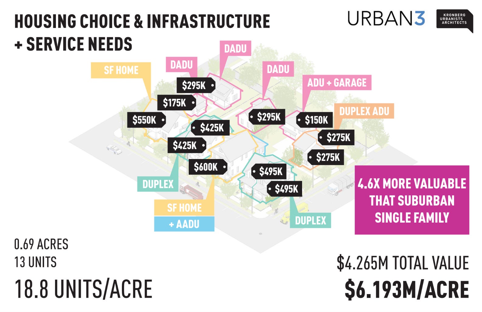
Large parcel infill is one way to respond to that problem. It can add more homes without scattering growth farther outward. It can increase tax value per acre. It can support retail. It can make better use of existing infrastructure. It can create housing variety without forcing every missing-middle project to fight a separate zoning battle on a separate lot.
The fiscal case and the demographic case point in the same direction. We need more complete places because our households are more varied, our infrastructure is expensive, and our existing development pattern is not producing enough value to support itself.
By the end of CNU, I had started to think about how to approach large parcel infill through five questions.
1. Is this more than a collection of buildings? A good project has to create a place. That means a mix of uses, connected streets, civic space, and buildings that contribute to the public realm.
2. Does the street network create value? The streets cannot just move traffic. They have to make walking useful, safe, comfortable, and interesting. They also have to connect outward to the neighborhoods around them.
3. Does the retail plan actually work? Retail has to be sized to real demand. It has to understand customer behavior, tenant economics, parking, visibility, and access. It cannot just be decorative ground-floor space.
4. Can the first phase stand on its own? The first phase should feel like a small but complete version of the whole place. If the first five acres do not work, the next ten may never matter.
5. Does the housing mix reflect the households we actually have? A complete place should offer more than one way to live. Housing variety is central to demand, affordability, and long-term resilience.
This framework does not make large parcel infill easy. These projects require land control, capital, patience, political support, infrastructure planning, retail discipline, design judgment, and careful phasing. A large underused parcel inside a growing suburban community may be one of the few chances to retrofit a more complete center into a place that was not originally built around one.
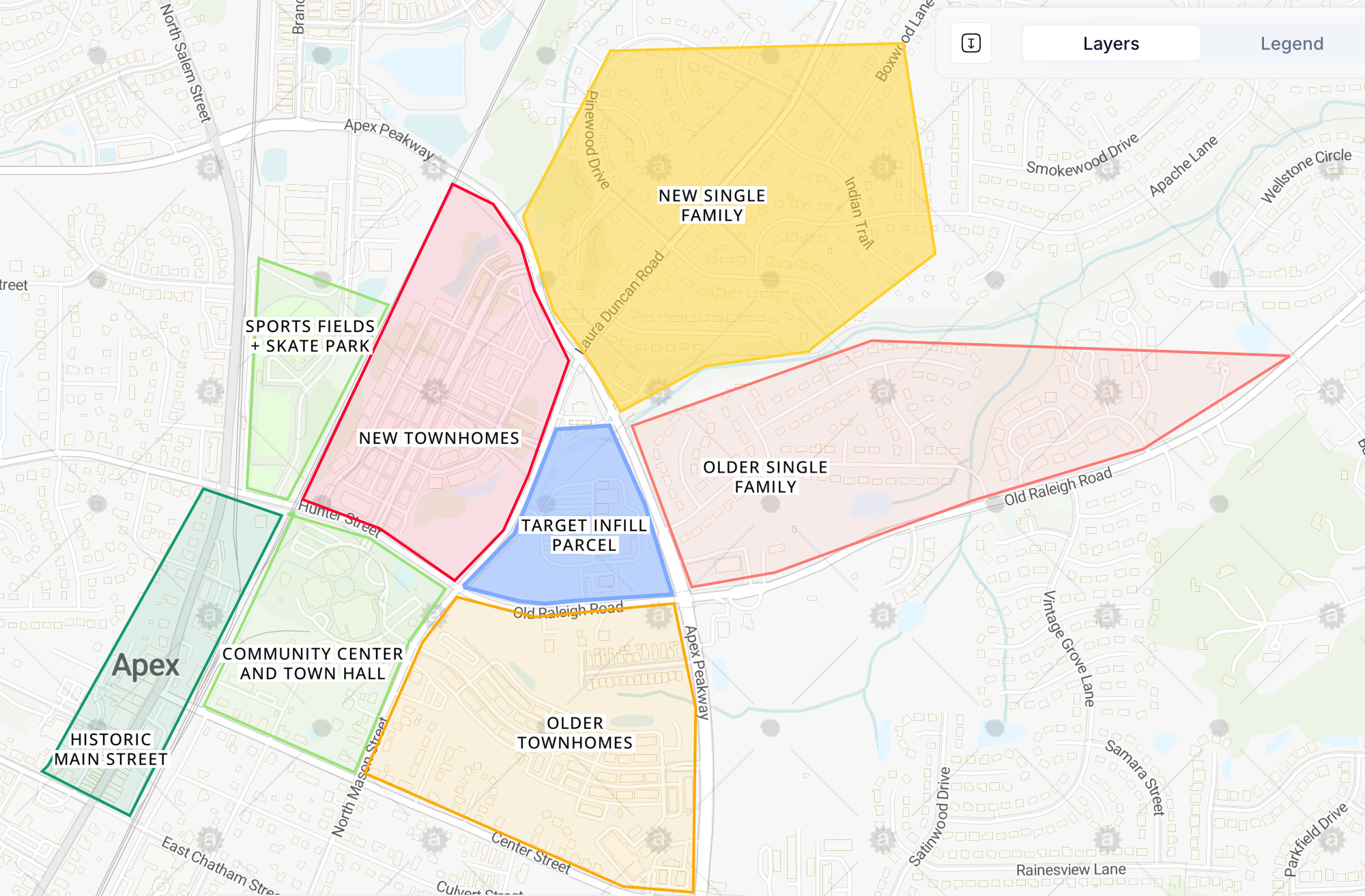
The question is whether these ideas survive contact with a real site, a real zoning code, and a real market. In the next post, I’m going to apply this framework to a large site near my home in Apex, North Carolina. I’ll look at the zoning, the surrounding street network, the retail trade area, the likely housing mix, and the technical constraints that would shape what could actually be built. My goal is to test whether a conventional suburban parcel could become something more useful: a walkable center for the neighborhoods around it. To me this is the promise of a large parcel infill, the opportunity to build a complete place, built a few acres at a time.
No posts
Comments
Nothing yet. Say the first thing.
Sign in to join the conversation.