
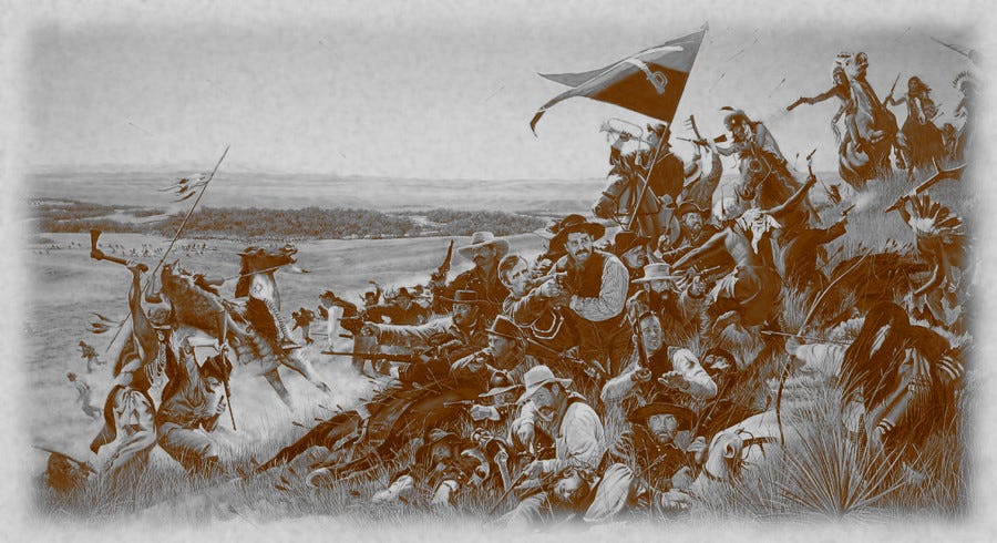
A few weeks ago, my family and I transited southeastern Montana, tracing the highway corridors that lead toward Helena. The open country of the northern plains, framed by wide skies and distant mountain ridges, naturally invites both conversation and quiet reflection. As we crossed the state line from Wyoming into Montana, the roadside markers for the Little Bighorn National Battlefield appeared. We passed the historic high ground without stopping on this trip, yet the proximity of the site left a persistent impression.
The eighteen-hour journey from our home state of Kansas had already proven demanding. My wife was managing significant physical pain, our eighteen-year-old daughter was navigating the long miles with a mix of quiet curiosity and detachment, and the entire transit occurred at a profound inflection point for our family, as our son had just shipped out for Marine Corps boot camp. Standing at the threshold of his military service, I found it impossible to ignore the historical weight of the landscape shifting outside our windows.
Though we lacked the opportunity to turn off the highway and tour the ridge lines and river bottoms on this trip, the view from the road pulled the mind backward to the summer of 1876. The disaster that unfolded along the Little Bighorn River did not occur in isolation. It was the sharp, violent climax of a broader campaign defined by rigid institutional assumptions, vast geographic distances, and severe operational friction.
A Fractured Treaty
The 1876 Great Sioux War developed from structural fractures in the Fort Laramie Treaty of 1868, which had legally guaranteed the Black Hills to the Lakota and Cheyenne. Following an 1874 reconnaissance led by Lieutenant Colonel George Armstrong Custer, confirmed reports of gold deposits prompted an influx of white prospectors across reservation boundaries. The federal government failed to stem this migration and subsequently issued an ultimatum ordering all non-reservation bands to report to Indian agencies by 3 January 1876. When these tribes remained in their winter camps past the deadline, the War Department transferred operational control to Lieutenant General Philip Sheridan. Sheridan engineered a multi-pronged offensive, mobilizing converging columns under Brigadier General Alfred Terry, Brigadier General George Crook, and Colonel John Gibbon to force compliance through military coercion. This strategic framework exposed a profound friction between Washington’s geopolitical ambitions and the operational realities of tracking highly mobile native adversaries across vast expanses.
Sheridan’s plan relied on a three-column pincer to encircle the independent bands within the Powder River basin. General Terry led the Dakota Column westward from Fort Abraham Lincoln, a force that included Custer’s 7th Cavalry Regiment, while Colonel Gibbon marched the Montana Column eastward from Fort Shaw along the Yellowstone River. Concurrently, Brigadier General Crook commanded the Wyoming Column advancing northward from Fort Fetterman. This tactical plan required the disparate forces to establish an interlocking cordon, wherein Custer’s mobile cavalry would locate and fix the native encampments while Terry and Gibbon blocked northward avenues of escape. This operational design underestimated the constraints of late nineteenth-century frontier warfare, where immense geographic distances and primitive communications routinely compromised tight synchronization between separate commands.
This strategic coordination failed on 17 June, at the Battle of the Rosebud. A force of approximately 1,000 to 1,500 Lakota and Northern Cheyenne warriors under the tactical leadership of Oglala commander Crazy Horse intercepted Crook’s Wyoming Column along the upper reaches of Rosebud Creek. Over the course of a six-hour engagement, the native fighters utilized aggressive, decentralized counter-attacks to stall the federal advance. Although Crook retained possession of the ground along Rosebud Creek at nightfall, his command sustained significant casualties and depleted its ammunition reserves, forcing a retreat southward to a supply base on Goose Creek. Crook’s withdrawal effectively severed the southern claw of Sheridan’s pincer, leaving Terry’s command isolated and unaware that their anticipated southern blocking force had been removed from the operational theater.
While the military columns maneuvered, a concentration of Northern Plains tribes coalesced along the Little Bighorn River. This massive encampment comprised roughly 1,200 lodges, sheltering an estimated 7,000 people from the Hunkpapa, Oglala, and Minneconjou Lakota bands, alongside Northern Cheyenne and Arapaho allies. The population swelled during the early summer of 1876 as thousands of agency Indians departed federal reservations to join the non-compliant hunting bands for religious ceremonies and seasonal foraging. This migration produced an effective fighting force of 1,500 to 2,000 warriors, completely upending the War Department’s intelligence estimates, which had anticipated encountering fewer than 1,500 total fighters in the region. Spiritual leaders like Sitting Bull provided a unifying moral authority, while traditional warrior societies handled the tactical distribution and security of the village without relying on a centralized chain of command. This strategic mismatch set the conditions for Custer’s tactical decisions on 25 June.
Custer Divides the Regiment
On the afternoon of 25 June, Custer arrived at the divide between the Rosebud and Little Bighorn valleys at the head of the 7th U.S. Cavalry Regiment. This force, serving as the primary tactical strike element of Terry’s Dakota Column, commanded thirty-one officers alongside 566 enlisted personnel distributed across twelve companies, augmented by civilian packers, an interpreter, reporter Mark Kellogg, and a contingent of Arikara and Crow scouts. Fearing that the native encampment would detect the regiment’s approach and scatter into the surrounding broken country, Custer chose to partition his command into four distinct components. While standard U.S. Army cavalry doctrine favored convergent, multi-directional assaults to fix an elusive enemy, this tactical subdivision immediately compromised the regiment’s structural cohesion by placing the separate detachments beyond the range of mutual visual or physical support.
Custer assigned Major Marcus Reno command of three companies totaling approximately 140 cavalrymen and the Arikara scouts, with direct orders to cross the Little Bighorn River and launch an immediate assault against the southern perimeter of the village. Captain Frederick Benteen received three companies, numbering roughly 125 men, with instructions to scout the ridges to the southwest and engage any hostile forces encountered. Custer retained personal command of five companies, comprising about 210 soldiers, to execute a flanking maneuver northward along the high bluffs overlooking the river, intending to enter the valley via Medicine Tail Coulee and sever northern escape routes. The final element, consisting of one company and detailed men from other units totaling 125 soldiers, escorted the slow-moving pack train carrying the regiment’s reserve ammunition. The allocation of these battalions reflected an operational assumption that the native population would flee rather than stand and fight.
Reno’s battalion crossed the Little Bighorn River approximately two miles south of the encampment and formed into lines of battle to advance downstream against the Hunkpapa and Oglala lodges. Custer intended for Reno’s frontal charge to draw the attention and defensive resources of the warriors southward, creating a diversion that would allow the five companies under his direct command to strike the village unexpectedly from the northeast. By positioning his own force along the high bluffs, Custer sought to trap the population between two converging fires and prevent the non-combatants from fleeing onto the open plains. This cooperative maneuver relied on strict timing that the terrain rendered nearly impossible to maintain.
Finding no hostile bands or lateral villages during his southwest reconnaissance, Captain Benteen wheeled his battalion back toward the main trail, where he encountered Trumpeter John Martin bearing Custer’s written order to bring the ammunition packs quickly. Benteen bypassed the slow train and instead linked with the remnants of Reno’s defeated battalion, which had already retreated across the river in disarray to establish a haphazard position on the high bluffs. Although the combined Reno-Benteen force now fielded over 300 combatants, intensifying warrior pressure pinned the soldiers to the high ground, preventing them from advancing northward to locate Custer. A subsequent reconnaissance led by Captain Thomas Weir reached a high promontory later named Weir Point, but heavy native gunfire forced this detachment to withdraw back to the primary defensive perimeter. The defensive consolidation on the bluffs marked the definitive collapse of Custer’s original offensive design. While the division was made, the execution of Reno’s attack quickly revealed its risks.
Reno’s Collapse and the Shift of Tribal Momentum
Reno’s three companies advanced down the western flood plain of the Little Bighorn River, catching the southern edge of the Hunkpapa camp unprepared. Reno halted his advance approximately one hundred yards short of the lodges, ordered his troopers to dismount, and deployed a standard skirmish line across the valley floor. Lakota and Cheyenne warriors quickly mounted and swarmed out from the village, utilizing the terrain to outflank Reno’s exposed left line. Faced with mounting pressure, Reno ordered his men to abandon the line and withdraw into a bend of timber along the riverbank. Continued native infiltration forced a second, highly disorganized mounted retreat across the river and up the steep clay bluffs on the eastern side, an ascent during which pursuing warriors killed or captured nearly a third of the detachment. The rapid collapse of this initial assault exposed the tactical vulnerability of an un-reinforced cavalry line attempting to fix a numerically superior enemy.
Hundreds of native combatants, including Oglala elements led by Crazy Horse, exploited the open valley floor to break Reno’s left flank and drive the troopers into the woods. The warriors pursued the retreating cavalrymen to the river crossing, inflicting heavy casualties on the bottlenecked soldiers. Once Reno’s battered command established a static position on the eastern bluffs, the native war leaders immediately altered their tactical focus. Leaving a minimal screening force to contain Reno’s remnants on the heights, the bulk of the warriors rode northward through the valley floor and along the western ridges to intercept Custer’s isolated five companies. This rapid reorientation of combat power demonstrated the exceptional mobility and highly responsive, decentralized command structure characteristic of the Plains Warriors.
Captain Benteen’s battalion arrived on the eastern bluffs at approximately 3:30 p.m., terminating his southwest reconnaissance and consolidating with Reno’s disorganized survivors. Although Benteen possessed Custer’s written mandate to bring the ammunition pack train forward at speed, the tactical disarray of Reno’s force necessitated an immediate defensive halt. The arrival of Captain McDougall’s company with the pack train reinforced the position, allowing the combined force of over 300 men to form a shallow defensive perimeter on the high ground. Native marksmen quickly surrounded the hilltop, pinning the soldiers down under constant long-range fire and preventing any substantive advance toward Custer’s northern path. The immediate necessity of preserving the surviving elements of the southern column effectively nullified Custer’s strategic orders for an aggressive concentration of force. With Reno contained, the initiative passed to the warriors now free to mass against Custer.
The Isolation and Destruction of Custer’s Command
Custer led his five companies northward along the high bluffs flanking the eastern side of the Little Bighorn River. The column descended toward the riverbank at Medicine Tail Coulee, attempting to secure a ford to strike the village’s northern flank. Initial native resistance at the coulee forced the battalion to withdraw up the steep slopes toward Calhoun Hill, located at the southern terminus of Battle Ridge. This retrograde movement left the five companies extended across exposed high ground, separated by over four miles from Reno and Benteen’s consolidated position on the southern bluffs. This tactical detachment stripped Custer’s force of the regimental reserves necessary to anchor a sustained defense.
The elimination of the tactical threat at the southern end of the valley allowed hundreds of Hunkpapa and Oglala warriors to shift their focus northward. Native fighters utilized Deep Ravine and the surrounding broken coulees to approach Custer’s position without exposing themselves to direct carbine fire. As the warriors swarmed over the ridges, the fighting dissolved into a series of disconnected engagements along Battle Ridge rather than a consolidated action. The native forces used their superior numbers to isolate and envelope individual companies sequentially. The tactical mobility of the Lakota and Cheyenne forces ultimately neutralized the technological advantage of the regiment’s standard-issue firearms.
The tactical disintegration culminated on the northern knob of Battle Ridge, subsequently designated Last Stand Hill, where Custer and approximately forty remaining troopers attempted to construct a defensive barrier using dead horses before being overrun in close-quarter combat. In total, all 210 soldiers and attached personnel within the five companies perished on the high ground east of the river. Modern archaeological analysis of dropped cartridge cases and skeletal remains disproves the traditional narrative of a single, static defensive perimeter. Instead, the physical evidence indicates a fluid, rapidly deteriorating action characterized by scattered pockets of resistance across the ridges.
Total federal losses during the entire operation reached 268 killed and fifty-five wounded, a figure comprising the total annihilation of Custer’s five companies and fifty-three fatalities sustained within the Reno-Benteen siege perimeter. Native losses remained low by comparison, with tribal counts estimating between sixty and one-hundred warrior deaths across the two days of conflict. Following the collapse of federal resistance, the victors stripped and mutilated the corpses along Battle Ridge according to Plains traditions. Recovered artifacts indicate that mechanical malfunctions, specifically cartridge extraction failures in the Model 1873 Springfield carbine, occurred in limited quantities but did not dictate the rhythm of the engagement. The capture of these carbines by native fighters introduced an array of weapons that simultaneously increased native firepower and complicated their long-term ammunition supply. The stark disparity in casualties underscored the operational advantages of concealment and overwhelming numbers maintained by the tribal coalition.
To address public accusations of misconduct and incompetence, the U.S. Army convened the Reno Court of Inquiry in Chicago during 1879. The military tribunal reviewed extensive testimony from surviving officers, enlisted personnel, and civilian scouts who witnessed the actions in the valley and on the bluffs. The court’s official findings concluded that while specific subordinate officers displayed exceptional initiative during the engagement, Reno’s tactical decisions during the retreat required no adverse criticism. The verdict cleared Reno of direct legal responsibility for the subsequent annihilation of Custer’s immediate command. Although the legal proceedings officially exonerated the major, the conflicting testimonies failed to settle the enduring historical debates regarding the breakdown of regimental coordination.
Firepower, Terrain, and the Adaptive Counteroffensive
The volume of fire delivered by the tribal coalition compromised the defensive capacity of the 7th Cavalry. While the troopers utilized the single-shot, breech-loading Model 1873 Springfield carbine, a substantial contingent of at least 200 Lakota and Cheyenne warriors fielded lever-action Henry and Winchester repeating rifles. These weapons generated a high rate of fire that suppressed the cavalrymen during the engagements along Battle Ridge. Although some native fighters employed captured federal arms, the lack of standardized ammunition limited the long-term utility of those weapons. This localized fire superiority eroded the defensive integrity of Custer’s dispersed companies.
The terrain of the Little Bighorn valley actively favored the defensive and counter-offensive maneuvers of the natives. Deep coulees, such as Medicine Tail Coulee and Deep Ravine, provided assembly areas where warriors could mass out of the direct line of sight before launching assaults. Conversely, Custer’s five companies occupied high, bald ridges that lacked natural cover, leaving the troopers exposed to incoming fire from multiple directions. Farther south, the open bottomland where Reno initially formed his skirmish line offered no defensive anchors once native horsemen turned his left flank. The linear distribution of the village along the western bank of the river allowed tribal leaders to shift interior lines of reinforcement to any threatened sector within minutes.
The decentralized command structure of the Plains tribes enabled a highly adaptive tactical response that outmaneuvered the rigid hierarchy of the 7th Cavalry. War leaders like Crazy Horse exercised localized authority, directing tactical exploitations of Reno’s retreat based on immediate battlefield developments rather than centralized orders. Autonomous warrior societies operated as independent tactical units that could either concentrate force or pursue retreating elements. This flexibility allowed native forces to rapidly reorient hundreds of fighters from the southern valley to the northern bluffs as soon as Reno’s threat receded. The absence of a single, cumbersome chain of command prevented the tactical paralysis that often plagued nineteenth-century armies under sudden pressure.
While Custer’s immediate command faced destruction, the remnants of the regiment maintained a precarious defensive position six miles to the south on the bluffs from 25 June through 26 June. Captain Thomas Weir led Company H in a tentative advance northward toward the sound of gunfire, reaching a high promontory before intense native counterpressure forced a withdrawal back to the primary lines. Under the joint direction of Major Reno and Captain Benteen, the besieged troopers constructed shallow breastworks from pack saddles and dead mules to repel repeated assaults. Despite critical shortages of water and medical supplies, this combined detachment successfully held the perimeter against continuous fire until the approach of General Terry’s column forced the native village to dismantle. This static defense preserved the remaining companies of the 7th Cavalry but exerted no operational influence over the liquidation of Custer’s isolated battalion.
Although the engagement represented a decisive tactical triumph for the Lakota and Cheyenne coalition, it provoked a catastrophic retaliation from the federal government. The annihilation of Custer’s command galvanized public opinion and prompted the U.S. Congress to authorize an immediate escalation of the Great Sioux War. Major General Philip Sheridan flooded the Yellowstone basin with reinforcing infantry and cavalry regiments, pursuing the independent bands through relentless winter campaigns. Concurrently, the destruction of the great bison herds deprived the non-reservation bands of their primary subsistence. By the summer of 1877, the combined weight of military pressure and starvation forced Crazy Horse and the majority of the remaining free bands to surrender at federal agencies.
Carrying the Lessons Home
Driving past the site, even at highway speed, forces those operational frictions into sharp relief. The landscape today appears deceptively tranquil, with its rolling ridges, flowing waters, and scattered white markers glinting in the distance. Yet, the true scale of the ground is immediate. From the road, it is easy to visualize scouts reporting back, columns maneuvering in isolation without a unified operating picture, and commanders forcing decisions under the crushing weight of incomplete intelligence. As a veteran, the terrain speaks a familiar language. It reinforces the timeless maxims of the profession of arms, the absolute necessity of unity of effort, the peril of flawed intelligence, and the danger of discounting an adaptive opponent who commands both the ground and the moral initiative. Overconfidence or rigid adherence to a doctrine can quickly unravel when encountering adversaries who have home ground and everything at stake.
This particular transit carried a distinct weight because of where our family stands in this continuum. Both my wife’s lineage and my own are defined by generations of military service. Her sister and brother-in-law completed full careers in the Navy, and I served in the Marine Corps. Today, our son is at boot camp, taking his first steps along that same path. Stopping in Helena to visit the cemetery where my wife’s grandmother rests added a profound layer to the journey. Walking among those orderly rows of veteran headstones—markers representing individuals who held the line across differing decades and conflicts—served as a stark reminder that military service never occurs in isolation. It is a thread woven through families, sustained by shared memory, quiet endurance on the home front, and the persistent awareness of risk.
Dana has written with great insight about the necessity of transforming hardship into reflection and narrative. On this drive, as our daughter asked questions sparked by the historical mysteries and documentaries we watch together, that sense of generational continuity became palpable. The events of June 1876 are not detached historical curiosities. Their lessons on leadership, adaptability, and human cost remain alive. Passing this ground while our son undergoes recruit training, framed by the silent testimony of the prior generations in the Helena cemetery, underscored the fundamental reality that military families live with history in real time. The miles were long and the drive grueling, but the landscape transformed into a moving classroom.
We lacked the time for a full examination of the battlefield on this particular trip. A proper visit remains a task for the future, when schedules and physical endurance align. I want to walk Last Stand Hill, study the Indian Memorial, and engage my family in a deeper dialogue about what those markers signify for the modern understanding of duty. For now, the view from the highway lingers. It stands as a reminder that campaigns are ultimately decided not by the neat geometry of grand strategy, but by the accumulation of friction, human error, and the choices made by lonely commanders in the dust. Those stories do not end on the ridge lines. They endure in every family that continues to carry the tradition forward.
To fellow veterans, military families, and students of history, have you encountered these geographic touchstones on your own journeys and felt that same historical gravity? Which lessons from past conflicts resonate most deeply within your own family’s legacy? I welcome your reflections in the comments.
Comments
Nothing yet. Say the first thing.
Sign in to join the conversation.