
By Frank Jacobs
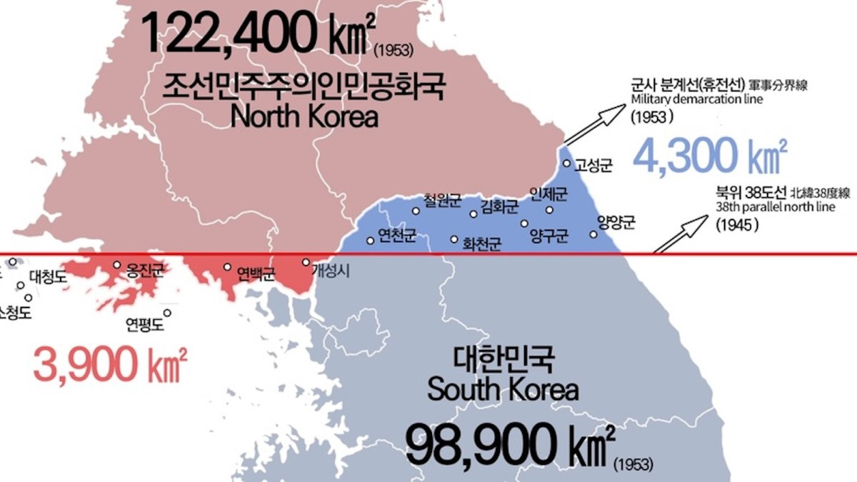
In case you need a reminder that war is not just evil and destructive, but can also be just plain stupid, study this map. It shows how much territory changed hands after the Korean War, which lasted from 1950 to 1953 and claimed between 2.5 and 4 million lives.
Result: The border between North and South Korea changed from the straight red line to the squiggly white one. North Korea gained 3,900 km2 (1,500 sq. mi) in the west, but lost 4,300 km2 (1,660 sq mi) in the east. That’s a net win for South Korea of 400 km2 (160 sq mi), an area about the size of Seattle or one-fourth of Greater London.
Despite great initial advances, first by the North and then by the South, the front line settled near the original border between the two Koreas. Four million lives for 400 km2 works out to one life per 100m2 gained by South Korea. To translate that to American: 53 lives were lost for each area the size of a football field.
The squiggly white line is now known as the DMZ, short for “Demilitarized Zone.” It was originally meant to run along the 38th parallel, although that hasn’t been the case since the war retraced the border.
That initially straight border was first drawn on the night of August 10, 1945, when two young U.S. Army colonels were handed a National Geographic map of Korea and told to find a dividing line that would separate Soviet and American occupation zones. All they had was that map, 30 minutes, and a ruler. The officers — one of them, Dean Rusk, would later serve as Secretary of State under Presidents Kennedy and Johnson — chose the 38th parallel because it roughly split the peninsula in half and kept Seoul in the American zone.

Like their counterparts in post-war Germany, Korea’s communist and capitalist zones of occupation hardened into two separate and ideologically antagonistic states. Unlike the brawling between East and West Germany, the friction between North and South Korea lit the fuse of the Cold War’s first hot conflict.
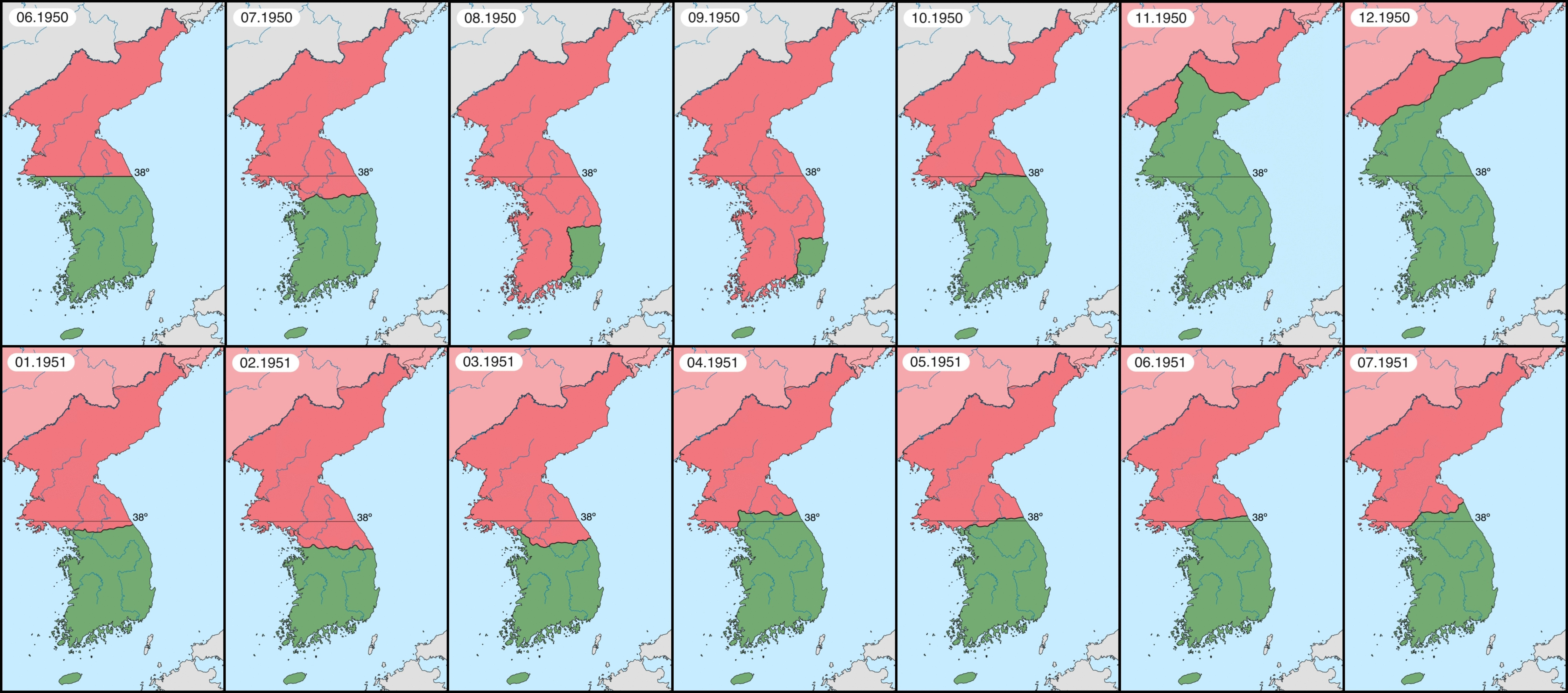
Things came to a head in June 1950, when North Korean troops poured south across the 38th parallel. They advanced fast. By August, they had kettled the lightly armed South Koreans and a hastily assembled U.S.-led auxiliary force of the United Nations into a tiny perimeter around the southern port of Pusan. Under the brilliant leadership of U.S. General Douglas MacArthur, the UN forces managed an equally swift reversal of fortune, crossing the 38th parallel in pursuit of the retreating Northerners by October.
By November, MacArthur had reached the Yalu River on the border with China, which triggered a counterattack by hundreds of thousands of Chinese “volunteers”. UN forces once again retreated south, Seoul once again fell to the North, until the pendulum swung the other way once more. The UN pushed north again. By July 1951, the frontline eventually settled close to the current DMZ. Armistice negotiations took two years, during which time tens of thousands more lives were lost to intermittent fighting.
The bloody cost of taking, losing, and retaking terrain in Korea still distantly echoes in such half-remembered names as Heartbreak Ridge, Bloody Ridge, and Pork Chop Hill. As a bloody, pointless conflict essentially fought to a stalemate, the Korean War has been easily overshadowed by the Second World War, in which the U.S. was victorious. It would later be almost entirely erased from public memory by the ignominy of the Vietnam War, America’s most traumatic defeat.
Korea is the “Forgotten War,” which is darkly ironic because there was no formal peace treaty. Officially, it hasn’t ended yet.
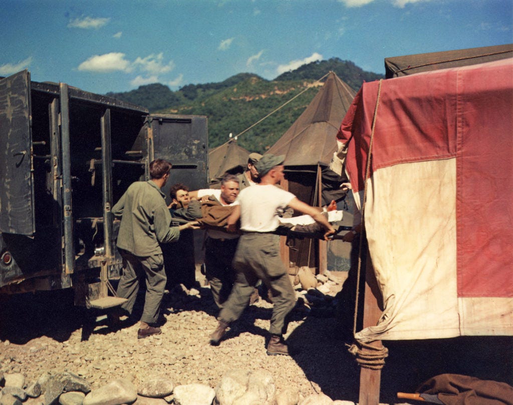
If the Korean War has left an imprint on American culture, it is through M*A*S*H, Robert Altman’s 1970 film. Set in a Mobile Army Surgical Hospital during the Korean War, the film was obviously, transparently, unmistakably a commentary on the Vietnam War. It later spawned a popular TV show that ran from 1972 to 1983, lasting eight years longer than the war it depicted. The series finale was watched by 106 million Americans, the largest audience for a scripted TV event in U.S. history. (The most-watched TV event overall was the Apollo 11 moon landing in 1969, with over 125 million viewers.)
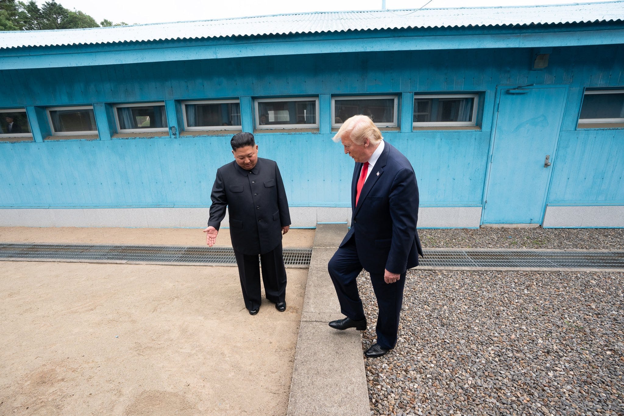
Today, Korea itself remains divided by a zone that may be demilitarized, but only to separate two massive war machines. With the war technically still on, hair-trigger protocols mean incidents remain possible and vigilance necessary.
Serendipitously, the DMZ — a four-km (2.5-mi) wide strip of land untouched by either side for 70-plus years — has become one of the most biodiverse habitats in the world, home to an estimated 6,000 species, including more than 100 protected ones, such as the red-crowned crane, the Asiatic black bear, and the Amur leopard.
For nature, an unexpected sanctuary; for people, an unbridgeable chasm. The twice-accidental border (drawn and re-drawn haphazardly) separates a people that share a history, a language, a cuisine, and a genome into two societies that couldn’t be more different and are drifting ever further apart.
North Korea is a totalitarian hereditary monarchy masquerading as a socialist republic, simultaneously operating a famine economy and a nuclear arsenal. South Korea is a liberal democracy that has risen from war-induced poverty to become the world’s 12th-largest economy and a global pop-cultural powerhouse. Due to differences in nutrition, the average North Korean adult is now about 7 cm (2.8 in) shorter and 9 kg (20 lb) lighter than their southern counterpart.
The DMZ is a reminder that borders are not a fact of nature; they are the result of force. It is also a stark reminder that the Korean War settled nothing. The peninsula is still divided. The war is not over. American soldiers are still stationed in the South, the North has gone nuclear, and the two sides still occasionally exchange fire.
War is stupid, but that’s a lesson that even 4 million dead, over just 400 km2 of territory, struggle to get across.
Got a strange map? Let me know at strangemaps@gmail.com.

Mini Philosophy | Starts With A Bang | Big Think Books | Big Think Business
Comments
Nothing yet. Say the first thing.
Sign in to join the conversation.