
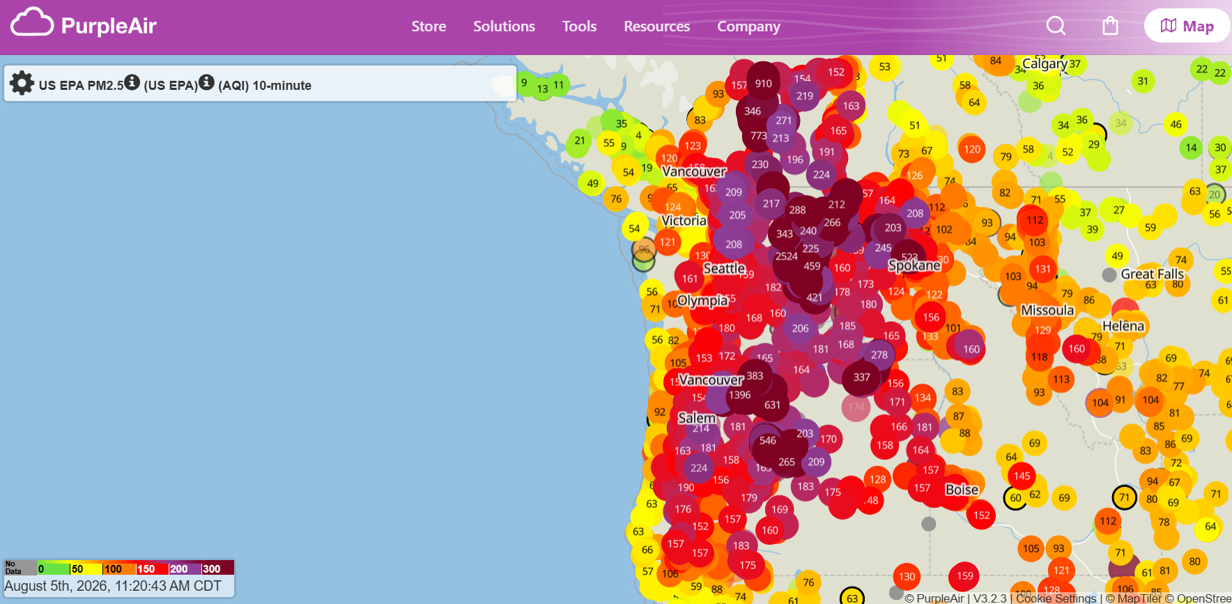
Happy hump day! The Pacific Northwest into British Columbia is continuing to deal with the impacts of the major wildfires that expanded over this past weekend. Smoke from the wildfires is creating poor air quality across much of Washington, Oregon and southern British Columbia, with interior regions from north central Oregon into south central BC having the worst air quality with very unhealthy conditions.
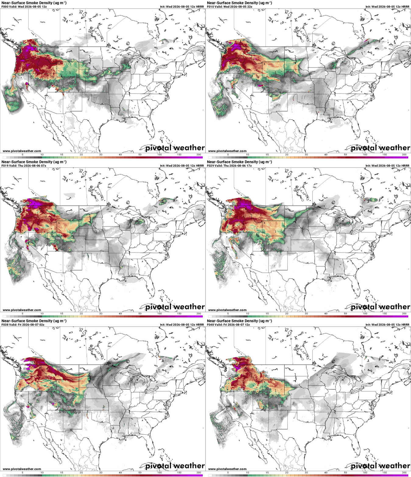
The latest smoke forecast from NOAA’s High Resolution Rapid Refresh (HRRR) model shows that smoke will persist across the Northwest today before gradually spreading east across the Northern Rockies on Thursday. For more info about wildfire smoke, Dr. Jeff Masters has an excellent article summarizing sources of data and forecasts here.
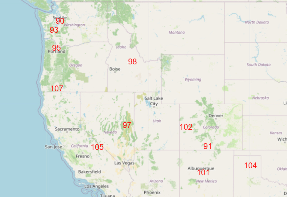
Along with the smoke, the Pacific Northwest is dealing with record heat, with the Seattle and Portland areas both expected to threaten record high temperatures the next couple of days (Thursday’s NWS forecasts of max temperatures near or above records shown above).
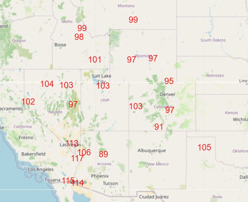
The record heat will build south and east into the weekend (Saturday forecast near/above record maximum temps shown above) as the persistent upper level high pressure area re-strengthens across the Southwest.
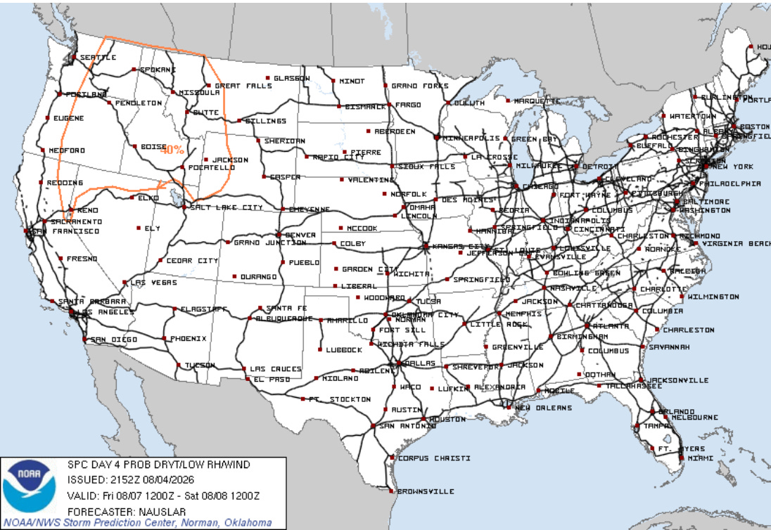
Fire weather conditions will likely deteriorate across the Northwest into the weekend as dry and breezy weather develops once again with a new weather disturbance moving through the region.
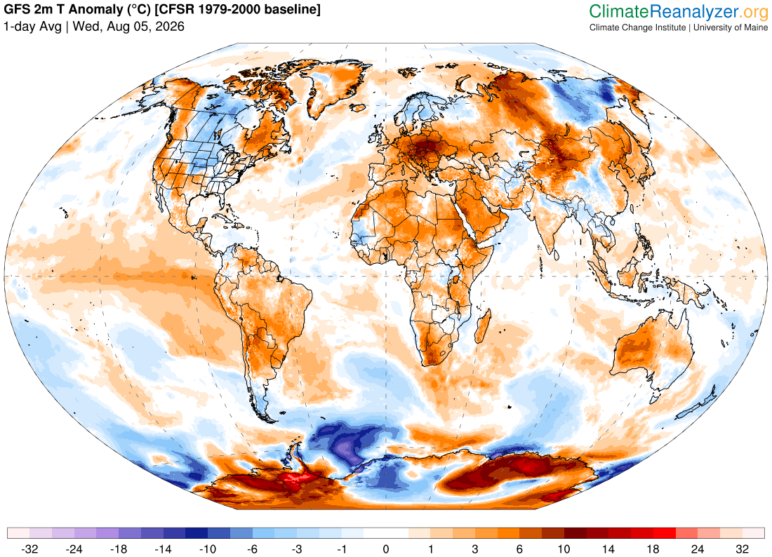
Much of the planet continues to deal with well above normal temperatures, with extreme record heat in locations like central and eastern Europe and eastern Asia. Per climatologist M. Herrera, locations in China, Mongolia, Korea and Japan have been setting monthly and all-time record high temperatures (maximums and minimums). Similar records are also being set in European locations in Austria, Czechia and Slovakia. While some intrusions of cooler air will occur across northern latitudes, overall hot and dry weather is expected to persist across much of Europe for the next couple of weeks, with periods of record heat continuing.
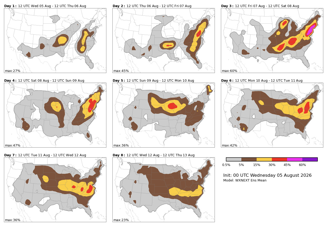
Back in the US, the upper level trough of low pressure that developed over the eastern US this past weekend has been breaking down the last few days, which will allow hotter temperatures to gradually build back toward the Mid-Atlantic and Ohio Valley. Upper level atmospheric disturbances moving southeast around the building upper level high over the Southwest will bring periods of thunderstorms to the Midwest and East over the next several days. Some strong to severe storms will be possible as shown in the Google DeepMind severe weather probabilities above — damaging winds would be the primary risk.
Programming note: I am posting semi-regularly again — but family commitments and travel after the passing of my mom will mean those posts will not be as frequent or consistently timed as they typically have been.
Balanced Weather is made possible by the generous support of paid subscribers, who as thanks get access to live Balanced Weather chats and videos as well as the ability to post comments and ask questions on posts. To become a paid subscriber or a free subscriber (also very much appreciated and you will automatically receive new posts in your email), please click below.
No posts
Comments
Nothing yet. Say the first thing.
Sign in to join the conversation.