
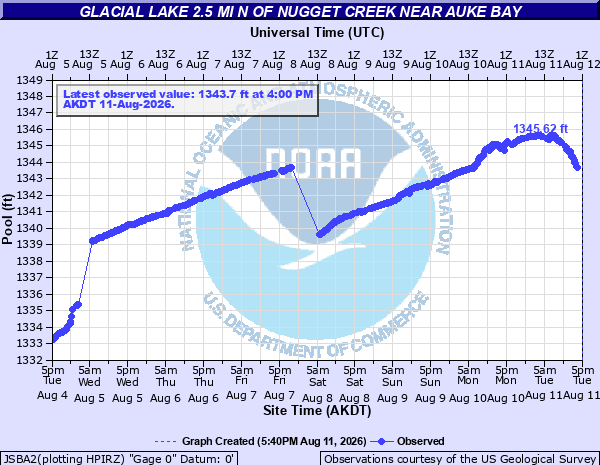
The National Weather Service in Juneau issued a flood warning late this afternoon, announcing that US Geological Survey monitoring data on Suicide Basin — an arm of Mendenhall Glacier — showed that a glacial outburst had begun. In the hydrograph above, one can see that the level of the lake has begun to drop significantly as meltwater has burst from the glacier and is now flowing into the Mendenhall River.
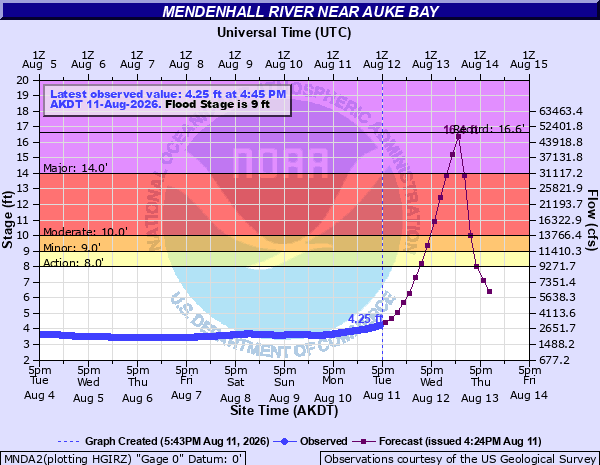
As I discussed in my post Sunday, glacial outburst floods have become an annual and increasingly serious issue on the Mendenhall River near Juneau in recent years. Based on the amount of meltwater estimated to be in the Suicide Basin before today’s outburst occurred, the NWS is forecasting the Mendenhall River near Juneau to crest by early Thursday just below the record level of 16.65’, set in last year’s glacier outburst flood. While state and local officials have installed flood barriers in the last couple of years to help reduce the impacts of these floods, flooding impacts are still expected and local officials are strongly encouraging people within the anticipated flood zone to evacuate.
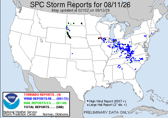
Back in the Lower 48, as anticipated today was a very active day of severe weather with nearly 600 reports of severe weather received by the NWS Storm Prediction Center. The area from eastern Iowa across northern Illinois, Indiana, Ohio and into the central Appalachians was particularly impacted with two dozen reports of significant wind gusts (75+ mph) and widespread damaging winds. At the peak, more than 1.1M customers lost power in this region from the storms (per PowerOutage.us), and as of 9 pm CT tonight more than 900,000 customers remain powerless. Several tornadoes and a number of reports very large hail up to baseball size also occurred. Intense supercells also produced numerous reports of very large hail — up to 4” in diameter — and significant severe wind gusts in parts of the Dakotas and northwest Nebraska.
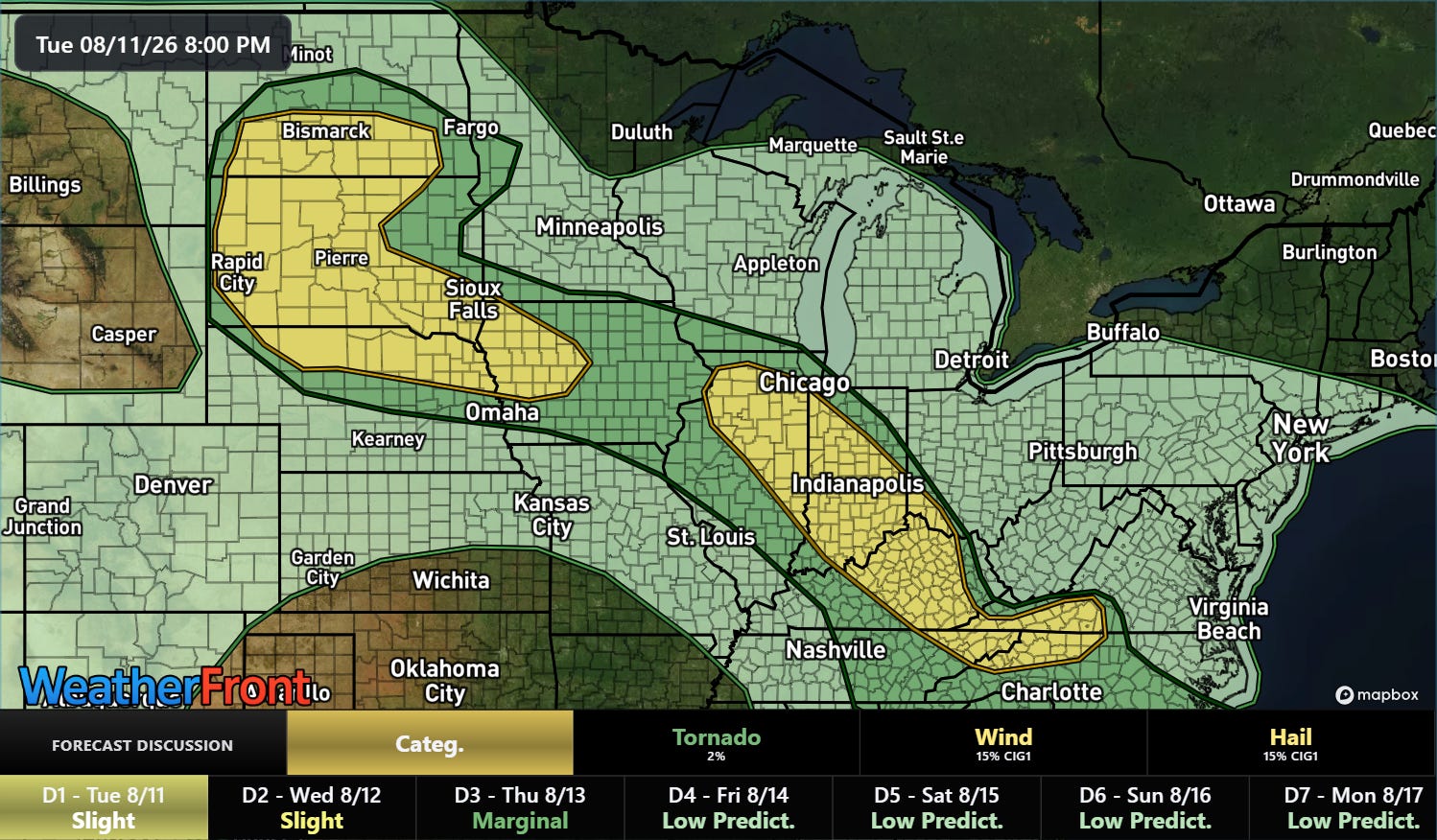
Clusters of severe storms will persist overnight in the same general area, and a slight (level 2 of 5) risk is in effect for much of the region from the Dakotas into the central Appalachians.
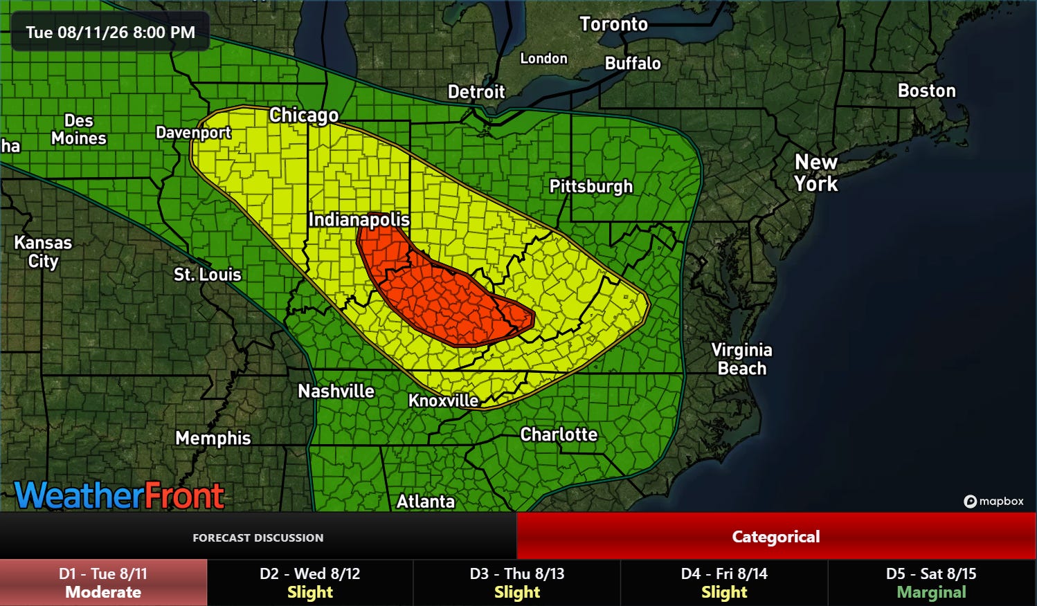
Flash flooding will likely be an even greater concern overnight as the setup appears favorable for training thunderstorms with torrential downpours — particularly from central Indiana into southern West Virginia where a moderate (level 3 of 4) risk of flash flooding is in place.
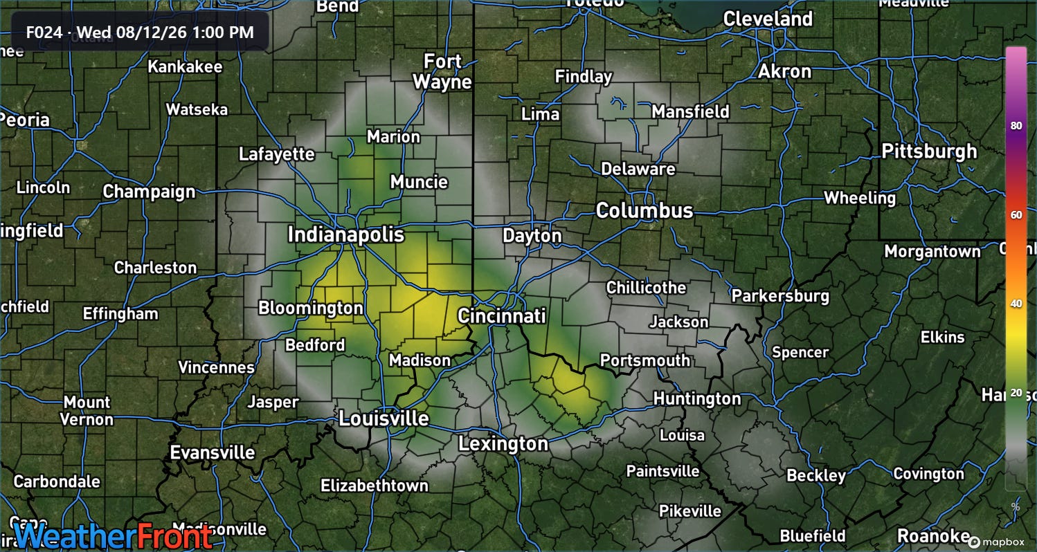
The latest high resolution ensemble forecast shows decent probabilities of additional rainfall in excess of 5” through midday Wednesday across Indiana into northern Kentucky.
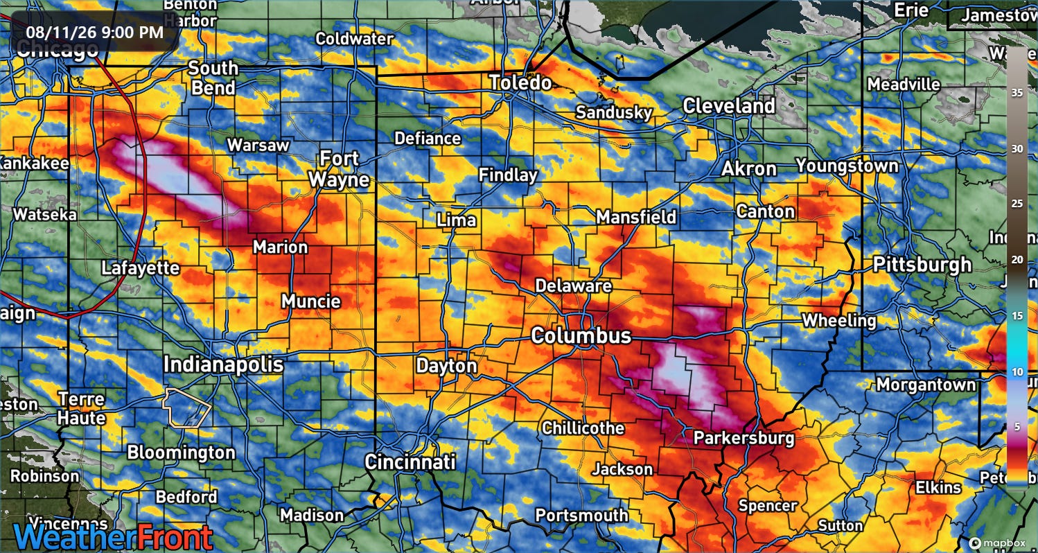
Over the last 24 hours, swaths of very heavy rainfall of 5-9” occurred over parts of northern Indiana and southeast Ohio. Some of the heaviest rainfall occurred in Perry County, OH, where serious flash flooding impacted communities around Crooksville, inundating vehicles and buildings and forcing evacuations and water rescues. One person was reported killed due to the Perry County flooding in the community of Roseville.
Programming note: Given the active weather expected this week, I will likely be doing some occasional live videos and Substack chats. As a reminder, participating in these live events is a benefit that paid subscribers receive for their support of Balanced Weather. My next full newsletter will likely come later on Wednesday or Thursday morning.
Balanced Weather is made possible by the generous support of paid subscribers, who as thanks get access to live Balanced Weather chats and videos as well as the ability to post comments and ask questions on posts. To become a paid subscriber or a free subscriber (also very much appreciated and you will automatically receive new posts in your email), please click below.
No posts
Comments
Nothing yet. Say the first thing.
Sign in to join the conversation.