
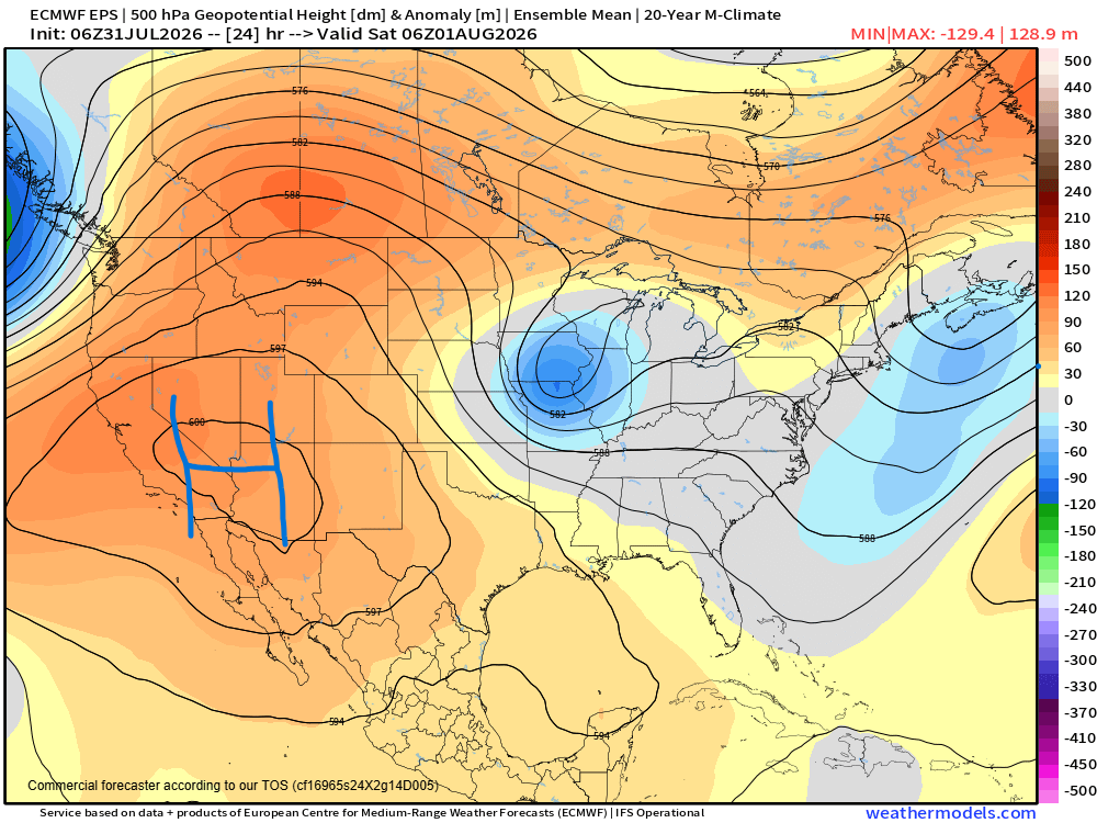
Happy Friday — the big weather story for the US heading into this weekend and the start of August is extreme heat. Another 6000 meter high pressure center at 500 millibars is building as shown in the chart above, this time across the Southwest.
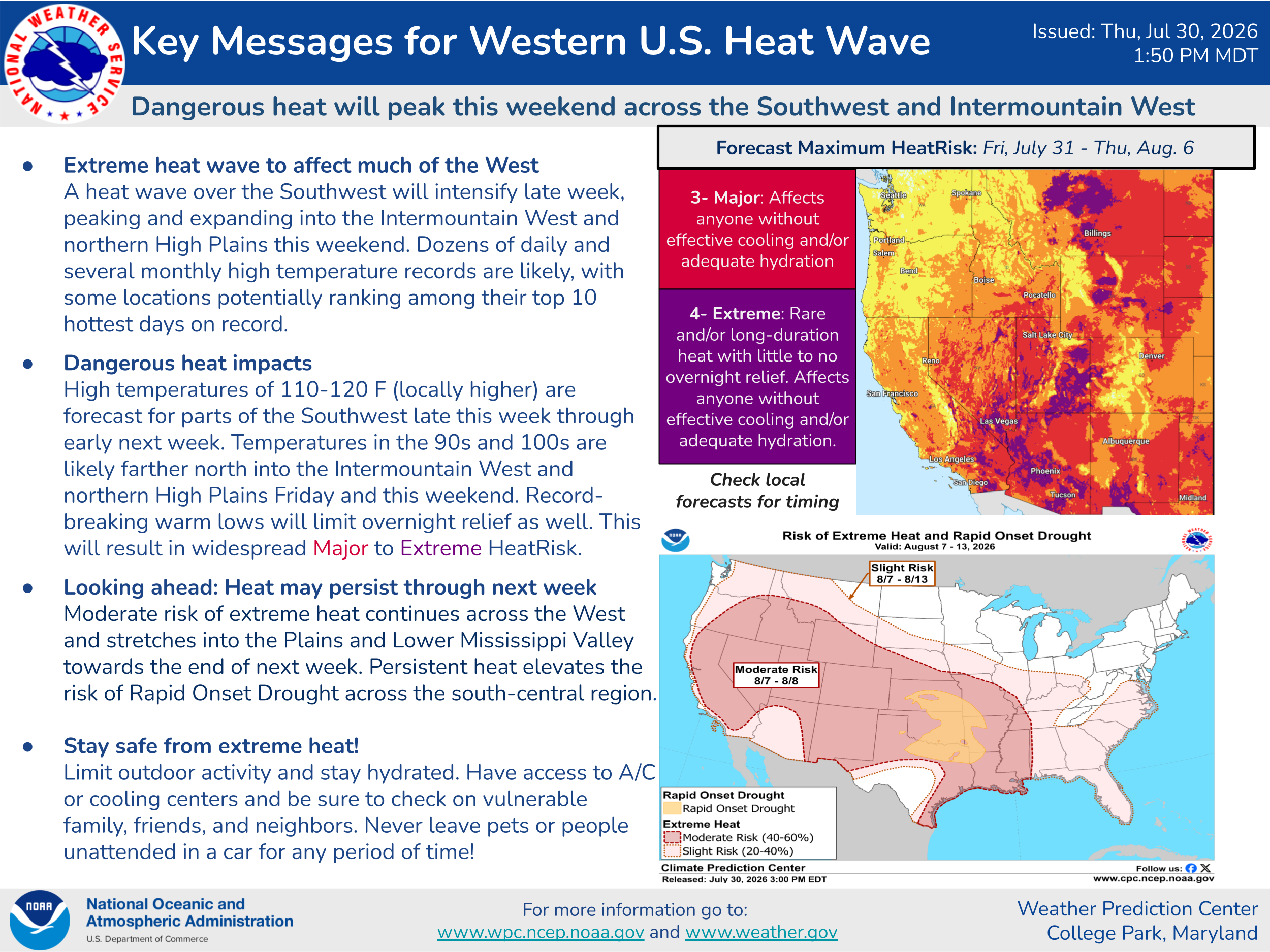
This is going to result in widespread record hot temperatures into the weekend — both maximums and minimums — across the region, with some locations likely to set monthly records, particularly August records on Saturday. A few locations could set all-time records.
On the 500 millibar chart for tonight at the top of this post, along with the large high pressure center over the Southwest you can also see an upper level low pressure center approaching the Pacific Northwest coast (blue image showing abnormally low heights west of Washington). As this system moves east into Saturday, strong southwesterly winds and dry air will overspread much of the interior Northwest ahead of this system, resulting in widespread elevated to critical fire weather conditions.
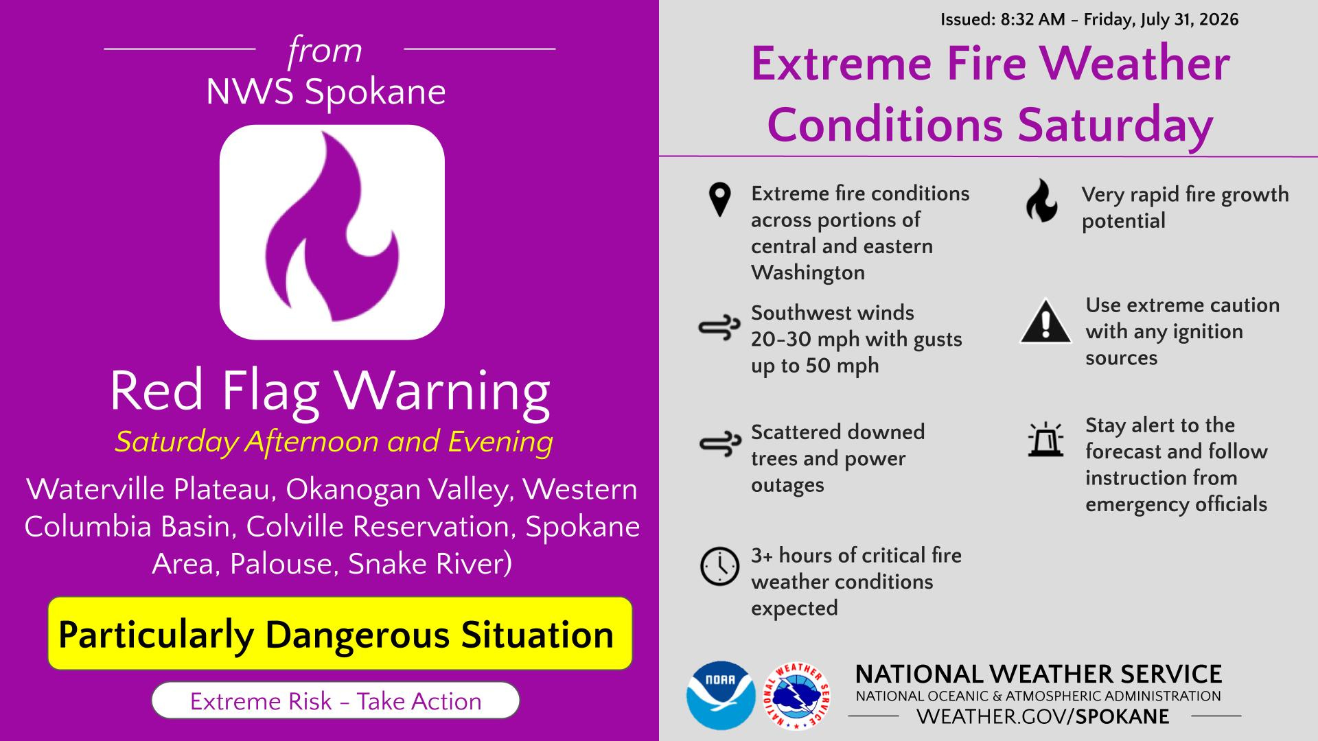
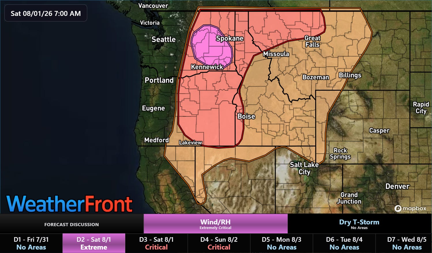
The Storm Prediction Center has placed an extremely critical — their highest level — fire danger area across eastern Washington where wind gusts of up to 50 mph are expected to support very rapid fire growth. Dozens of large wildfires are already in progress across the Northwest region, so obviously these period of dangerous fire weather conditions is of particular concern. The National Interagency Fire Center already has the national wildfire system at its highest level of preparedness. NIFC reports that more than 25,000 firefighters and support personnel are currently working 87 large fires — most of these are in the Northwest.
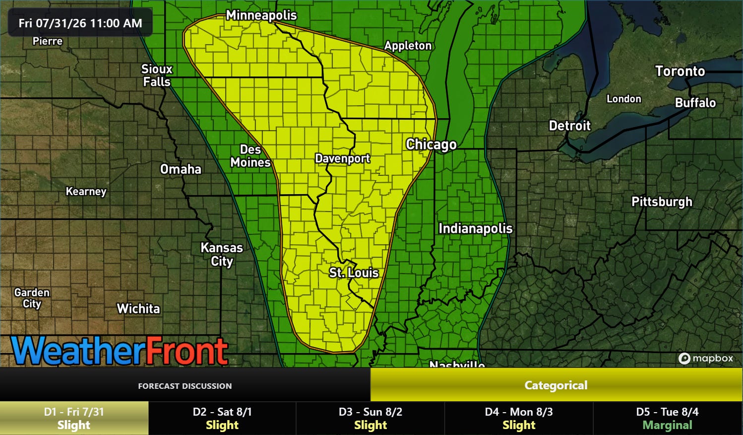
In the 500 millibar chart above, we can also see an upper level low pressure system across the upper Mississippi Valley, dropping down the east side of the large high pressure area. This weather system will drive a few waves of thunderstorms with heavy rainfall across the region, potentially leading to some flash flooding. The Weather Prediction Center has a large slight risk (level 2 of 4, yellow area on m ap above) in place.
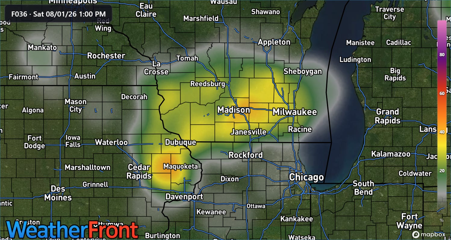
The latest high resolution ensemble model shows that within this slight risk area, the region from eastern Iowa across southern Wisconsin may have a relatively higher level of concern with moderate probabilities of 24-hour rainfall through midday Saturday in excess of 5” (above).
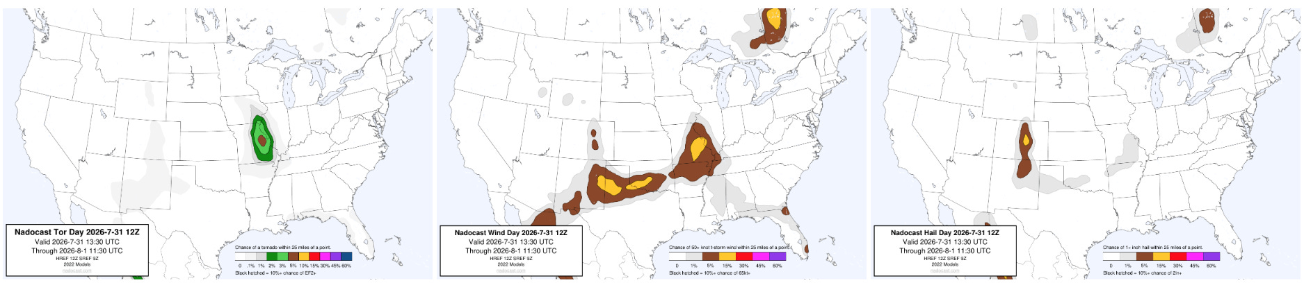
There will also be some risk of severe thunderstorms with this upper level system and the associated cold front dropping south through the Southern Plains. Damaging winds looks to be the primary risk, but the Nadocast AI probabilities do show the risk of a few tornadoes across eastern Missouri.
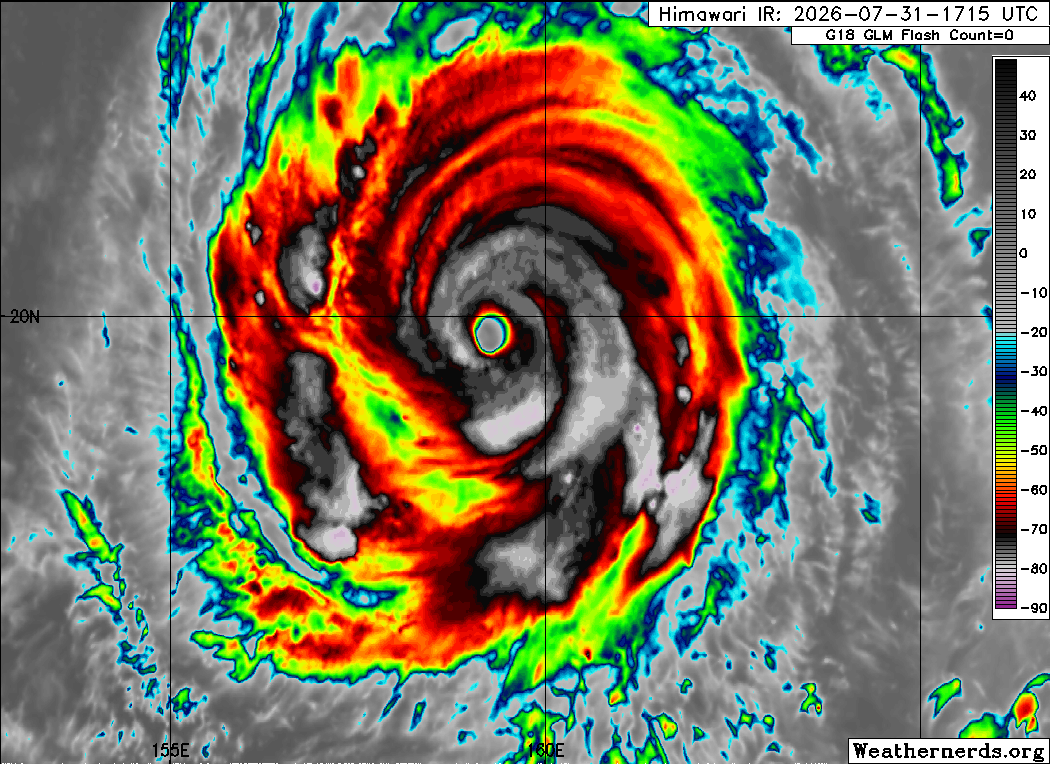
In the tropics, Super Typhoon Dolphin has gone through a series of eyewall replacement cycles resulting in periods of strengthening to category 5 and then subtle weakening. Dolphin has shown this weakening in the last several hours with decreasing intense thunderstorm activity around the eye, and the Joint Typhoon Warning Center now shows it as a category 4 with maximum winds of 150 mph.
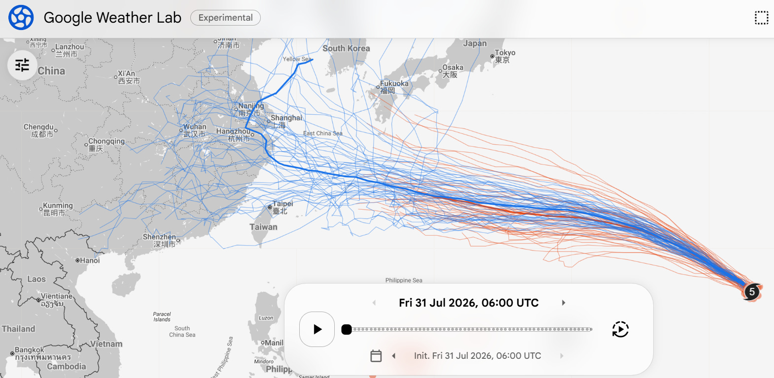
In the longer term, Dolphin should gradually weaken but expand in size. Model forecasts are in pretty good agreement on a track west-northwest toward the far southern Japanese islands around Okinawa through the next several days, but beyond that there is a lot of divergence with solutions ranging from a track west toward mainland China or a turn more northerly toward Korea or Japan.
Programming note: I am posting semi-regularly again — but family commitments and travel after the passing of my mom will mean those posts will not be as frequent or consistently timed as they typically have been.
Balanced Weather is made possible by the generous support of paid subscribers, who as thanks get access to live Balanced Weather chats and videos as well as the ability to post comments and ask questions on posts. To become a paid subscriber or a free subscriber (also very much appreciated and you will automatically receive new posts in your email), please click below.
No posts
Comments
Nothing yet. Say the first thing.
Sign in to join the conversation.