
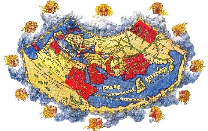
Every now and again, something comes along to remind us all of the continued importance of physical geography in our world — like, oh I don’t know, the Strait of Hormuz. Such basic geographic factors have always been of critical importance, particularly in the realm of international politics, and probably always will be. So too would they be in a constructed world, such as the one(s) you may yourself have invented, and as such understanding what those geographic factors mean is essential for understanding the international politics of your world.
Luckily, this is the precise intersection of things wot I know about, so in this article I’ll be combining my love of worldbuilding with my MA in international relationships to help you do just that, focusing on terrain, resource distribution, and the seas. I’ll also be providing examples from the real world, well known fictional ones, and even my own, the world which provides the backdrop for all my short stories released here on substack.
The first thing I want to briefly harp on about is that geography informs but does not determine the shape of international politics. It’s a factor, not the factor. Geography is the arena within which international politics plays out; it sets the bounds. But this is football, not the WWE — we’re not following a script, we’re merely acting within the constraints of those bounds.
So understanding geopolitics does not strip your polities1 and characters of agency and nor should the ideas I’m about to present be followed dogmatically. There are other factors that will carry weight in any world’s international politics, such as dominant cultural paradigms. Trying to understand the politics of medieval Europe without factoring in Christianity, for example, would be ridiculous.
And, in general, I do not believe any worldbuilding advice should be presented prescriptively, which is why I tend to limit mine to asking questions and raising ideas, rather than developing strict formulas. My only real guide is history and, if history tells us anything, it is that almost anything is possible with the right justification. Furthermore, as I’ve said previously, worldbuilding should be in service of storytelling, not vice versa. If you want a certain element in your international politics, construct your geography to allow it. So, keeping all that in mind, we can begin our geopolitical analyses.
The primary physical element we want to look for in terrain is the existence or absence of physical barriers, in particular rivers, mountains, and forests. In any particular region, you want to know roughly how much is made up of obstructing terrain and how obstructive that terrain actually is (how wide the rivers, how high the mountains, how thick the forests). Roughly knowing the shape of these obstructions — how major rivers and mountain ranges snake across your map — will also be of critical importance. Once we know all that, we can begin the first stage of our analysis.
Obstructing terrain provides a natural barrier that is difficult to cross and easy to defend, making these barriers ‘natural’ borders, as well as merely being useful for demarcation. There is a reason that France, arguably Europe’s oldest state, is demarcated by the Pyrenees to the south-west, the Alps to the south-east, and the Rhine to the east, and that its historically most fluid border is the north-east one, which lacks a major river or mountain range in the area. Just by looking at France on a topographical map, you can already assume that most of its expansionist conflicts historically will have been for control of the low countries and the left bank of the Rhine.2
On the other hand, in areas that lack these barriers, such as open flatland, desert, and steppe regions, borders will naturally be more fluid, ebbing and flowing without anything to latch onto and calcify. That is, if borders are recognised at all. Such regions, devoid of anything to truly use for demarcation, may end up never really developing the concept of solid borders, and instead care more about the control of populations, resources, and specific settlements. Such fluidity in borders seems strange to us today, in a world that has reified borders to an extent without any historical parallel, but was more the norm than the exception historically in such regions.
This furthermore means that polities in more open regions are at greater risk of invasion. Those regions may see empires quickly rise but, without natural barriers to protect their own borders, those same empires could just as easily fall, either from invasion or from internal collapse. It is no coincidence that the Central Asian steppe has historically provided some of humanity’s fastest growing, and fastest collapsing, empires.
More barrier-laden regions will, therefore, trend in the opposite direction. Empires will be slower to conquer, borders will prove more stable, and polities will generally last longer due to a natural protection against invasion. Empires will find it difficult to expand and hold territory for another reason as well: communication and other logistical factors. Even once a barrier is conquered and moved over, it will continue to hamper logistics and communication, making the territory on the other side more difficult to control, and mountains and forests will provide safe havens for dissidents and rebels. Limitations in communication will also foster cultural differentiation.
At the extreme end of this, we have mountainous regions such as Switzerland and Afghanistan. Not only will these regions be difficult to conquer and retain control of, and therefore will trend towards independence from any major empires, but they are also likely to remain internally divided, each valley cut off from its neighbours. Expect loose confederacies or suzerain-tribute relationships with little centralised authority.
And, to go even beyond this extreme, we have archipelagoes3. With the barrier here not merely being rivers or mountains but the sea itself, these island networks are even more likely than mountain regions to maintain political independence while being strongly divided, with the added caveat that strong naval power, meaning control of the seas around the islands, will allow a polity to maintain control of communication and logistics between them. Able to isolate individual islands and completely control everything going on or off them, that naval power may be able to create a stable empire across them, with its control of the seas being its absolute lifeblood. (Thalassocracy is a technical term for this type of polity, though it applies beyond merely archipelagoes.)
Lastly, a note on forests. Forests are barriers of a much more permeable nature than rivers, mountains, and the seas themselves. Not only that, but they’re far more mutable too, in that forests can be removed from the map far more easily than those other features. That forests do not provide a clear line, unlike rivers, the coast, and some mountain ranges, also makes them inferior for border demarcation. And yet, more forested regions are more difficult to conquer and hold and are likely to divide settled populations. Just to give one example of this principle in action, I don’t think it’s a coincidence that over the course of the medieval and early modern era the relatively more forested Germany trended towards disunity while the relatively less forested France trended towards centralisation.
A memorable fantastical use of terrain as a natural barrier is Tolkien’s, using both a mountain range and a river to contain and constrain the evil of Mordor. One way that Tolkien cleverly plays with these dynamics is with his mountains which, by housing the dwarves, become not merely barriers, but centres of commerce and industry, connecting as well as dividing the land on either side of them.
Another I’d like to point out is Leigh Bardugo’s Grishaverse books, in which a magical barrier, difficult to cross, was semi-recently erected in a way that divides a nation in half. The resultant difficulty in travel and communication naturally makes it difficult to hold the state together and completely change its internal dynamics.
I’ve additionally made use of terrain as a barrier in my own stories. In the four stories I currently have on substack using a particular conflict between the states of Lydesis and Prolais as a backdrop (which can be read here, here, here, and also here), the Pyrnine mountain range between them is a major factor in limiting the Lydesi ability to press their advantage despite their overwhelming military superiority. That use of terrain as a force multiplier or minimiser is one I personally find really useful in my own worldbuilding.
The basic geopolitical dynamic when it comes to natural resources is obvious: polities want resources, and therefore want control over the areas with those resources. Ergo, resource rich regions are likely to be fought over more than other regions, or to themselves be the centre of major empires built off the back of those resources.
The first and most basic resource is food, which requires us to look at fertility across different regions. The most fertile regions will be heavily irrigated flatlands with either minimal or predictable flooding. Note that here we find overlap with our terrain analysis, as these most fertile regions have the added dynamics we’ve already analysed of flat land and rivers. Obvious real world regions that fit these criteria include Lower Egypt and Punjab, which have indeed historically been known as breadbaskets. (Which is to say, fertile regions able to export food to support populations in other areas.)
In worlds before modern agriculture, where famines would be all too common, control of these more famine-resistant regions, able to support other areas of an empire, are essential. Even outside of famine conditions, cheap and abundant food is a great way to promote political stability. And, if an empire wants to large city at its heart — heavily dependent on food imports — it will need breadbasket provinces to feed it. Egypt fulfilled this role both for Rome and, later, Constantinople, all the way up until its conquest by the Rashidun Caliphate.
On the other hand, we have regions that cannot support settled agriculture at all due to lack of irrigation and/or poor soil quality. Such areas will be the domain of migratory pastoralists, where control of land means control of grazing for the livestock that groups in the area rely on for their sustenance. Going even further, we have deserts, where any populations will gather at oases. With food in such regions being scarce, small changes in climate might force populations out of their home environments in search of the basic necessities, potentially prompting waves of settlement or invasion into more fertile regions.
And agriculture is not merely the domain of basic sustenance, but of luxuries and cash crops too. Particular prized crops may only grow in certain climates, requiring polities that wish to economically benefit from them to secure and maintain territory such climates, or to open up trade with such regions. They might also be particularly damaging to the soil, requiring constant expansion into new areas to maintain production levels. Sugar in the early modern era, for example, was a highly prized cash crop which was both labour intensive and very damaging to the environment, which were direct financial incentives for the horrors of the transatlantic slave trade and imperial competition for new colonies in sugar growing climates. Other agricultural products might, in contrast, be difficult to introduce to new areas, incentivising competition for control of their traditional areas of production, such as wine and silk.
Besides agricultural products, what other resources are important to polities will depend on their economic needs and capabilities, as well as technology. What resources a given culture has access to will furthermore shape that technological development. Bronze, for example, was initially the preferred metal for early civilisations around the Mediterranean, as it doesn’t rust and, compared to early iron, was less brittle and easier to work with. However, it required a steady supply of tin, much of which came from far-off Britain, which was disrupted during the Bronze Age Collapse. In the aftermath, people turned to iron and, in the process, improved it and developed steel.
We see this kind of technological specialisation due to resource availability all over in our own history. For a fantasy example, we have Riftwar, in which two very different worlds are connected by a portal. One of those worlds looks a lot like medieval Europe, whereas the other has developed very different technology as they have very little metal and completely lack horses.
In the setting of my stories, the world is clearly split into an eastern and western hemisphere that were unaware of each other until a few centuries previously. The east, the setting of all my stories thus far, discovered new goods they were hitherto unaware of, like tobacco, tea, silk, paper, and gunpowder. They also found, however, that the west lacked horses, coffee, glass, cotton, and other staples of theirs. This led to very different technological developments and an explosion of trade and innovation after they established contact.
And now we get into what is, for my money, the most important part: the very shape of the landmasses and seas around them.
The most efficient way to move goods about — and for much of history the quickest too — is via the water. In contrast, able to move under their own steam, people are generally most efficiently moved across land. Hence, routes of expansion, the movement of armies, tends to go overland, while routes of trade tends to go oversea, though of course these are only trends rather than hard-and-fast rules.
The result is that the seas are generally going to be the domain of trade and the highways connecting your polities for these purposes, with land routes only opted for when there’s no other choice (and, even then, trade will follow rivers where possible). And hence, the shape of the seas — the inverse of the shape of the coasts — will determine the shape of those highways.
This also means that areas with easy access to the seas and other trading regions will be able to trade regularly and grow more prosperous from it. Particularly in pre-Industrial worlds, the land is primarily going to be the domain of sustenance, with the seas being the engines of commerce and wealth. Large empires with little sea access might have large populations but still be relatively impoverished compared to smaller polities at the nexus of trade routes.
Looking at the seas between major polities and centres of trade, are there any chokepoints that all ships will have to pass through? This would most likely be straits, where the sea is a narrow strip bisecting land on either side, or peninsulas, which must be navigated around, where the most efficient route will force all ships onto a narrow path skirting the tip of the peninsula. These areas where shipping must concentrate will be the major vulnerabilities, limiting trade and allowing it to be controlled by nearby polities. Those polities might tax trade, or prey on it as pirates, or block it completely, giving them an outsized influence on global trade.
You might also have the inverse of a strait: an isthmus. Here, a narrow strip of land bisects the sea. If going around would take too long, the people here have two options. First, they might just unload their ships on one side of the isthmus, take the goods overland, and reload them on the other side. Otherwise, if they have the capacity to do so, they could build a canal through the isthmus, effectively turning it into a very narrow strait, completely in the power of whoever controls the canal. Suez and Panama are obviously the most notably examples of this principle in the modern world.
Having these features in your world allows for interesting naval geography and thereby international politics, creating areas of critical strategic value based on nothing other than the shape of their coastline. In particular because, while I’ve been focused on trade as the most common use of the seas, in worlds where polities make use of overseas conquest and colonisation, the movement of armies and supplies will also have to go through these oceanic highways. Controlling them will therefore be essential to keep such empires together, as controlling Gibraltar and Suez was to the British Empire in the 19th and 20th centuries.
And, of course, you’ll also have to look at how any fantasy elements change these dynamics. Worlds will teleportation might be able to avoid sea-based transport entirely. In other worlds, travelling the seas might be more dangerous, forcing trade to stay local or go overland. This is true both of Sanderson’s Roshar setting, where regular and incredibly powerful storms make sea travel more difficult, and Jemisin’s setting for the Broken Earth books, in which the tectonic instability of the planet make tsunamis a more common occurrence. The existence of large sea monsters might have a similar impact.
By own fantasy setting lacks these overtly fantastical elements, but has those above mentioned features galore. Most of my stories take place in the Gulf Sea region, centred on a sea semi-enclosed by the Kabtrian peninsula to the east and fully by the Prolaisian isthmus to the west — though perhaps not for long, given an internationally controversial project by the Prolaisians to build a great canal across that isthmus. Within the sea, the large islands of the Gulf Islands archipelago form numerous straits that allow the Islanders to control the trade across their native sea.
I hope this guide can help you to understand the geopolitical implications of fantasy geography (and, perhaps, less fantastical geography too), to identify strategically critical regions and the most likely shape of the polities populating the world.
I did my own analysis on Roshar, the world of Brandon Sanderson’s Stormlight Archive a few weeks ago as an example and I’d love to do more of that. So, if anyone’s game, please send me your fantasy maps and some basic information about the world and I’ll see if I can provide any analysis, posting the result to notes. Just a bit of fun for anyone who’s up for it.
Thank you for reading and apologies for the delay to this article, which was originally promised a few weeks back and had to get shunted around due to time constraints. Honestly, I feel I barely scratched the surface of this topic and will be sure to return to it someday with follow-ups.
In the meantime, in two weeks my next short story will be A Spill of Wine, all about court intrigue and with some light inspirations from some recent reading on the politics of the Jacobean court and rise of the Duke of Buckingham. For two weeks after that, I have nothing currently written but plans for three different articles, so which one you’ll get is as much your guess as mine. A reading wrap-up, discussion of Kantian ethics and Terry Pratchett, or deeply indulgent piece about the French constitutions of 1791-1799 are all equally possible. Please let me know if any of these particularly speak to you — anything to help me make up my mind.
Don’t know where to continue with my writing? This might help:
I’ll be using the term ‘polity’ to generically refer to political units throughout. ‘State’ is a more specific term not applicable to all polities, particular before the modern era, hence I’ll generally avoid it. ‘Empire’ is a term I’ll use for expansionist polities engaged in geopolitical competition.
Yes I also think it’s stupid that it’s called the ‘left bank’ not west bank, but that’s historically what it was called. Control of the ‘left bank’ to achieve France’s so-called ‘natural borders’ was a major motivator of France’s more jingoistic strategists from the Napoleonic Wars up to the early-20th century.
I will not be revealing how many attempts it takes me every single time to correctly spell that word.
Comments
Nothing yet. Say the first thing.
Sign in to join the conversation.