
📚 On the Trace: A Genealogist’s Guide to Buffalo Road Land Entries and Migration Corridor Records is waiting in the Resource Library.
🔍 Free Members: Learn more about the benefits of Free vs. Paid. Click here.
🌲This newsletter runs on courthouse records and coffee. If this research saves you a trip to the archive, Buy Us a Coffee.💚 ☕
Appalachian Genealogy & History is a reader-supported publication. To receive new posts and support my work, consider becoming a free or paid subscriber.

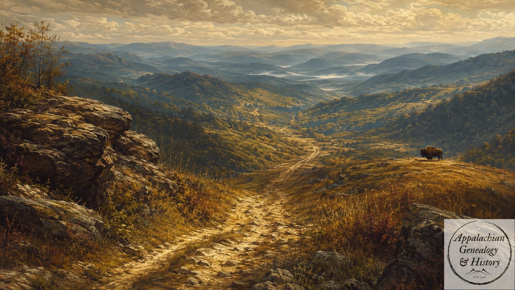
In 1780, Walter Cunningham claimed land a few miles south of the Falls of the Ohio in Jefferson County, Virginia. Three years later, his amended entry placed the tract “on the trace,” next to Alexander Spotswood Dandridge’s claim and William Preston’s Poplar Level Tract (McDowell 1967). The trace was not a settler-built road. It was a bison path old enough, and visible enough, for a clerk to use it as a boundary call.
“On the trace” only worked as a boundary call because people knew which ground the words meant. South of the Falls of the Ohio, the route ran toward Bullitt’s Lick on the Salt River, where commercial saltmaking began in 1779 (McDowell 1967). Bison came there for the mineral-bearing clay in summer and early winter (Verhoeff 1911). From the lick, the worn ground ran back toward the river country. Wet bottoms would have pushed traffic aside when they bogged down; ridges and gaps kept the passage usable. Farther east, a separate line of old travel lay in the Great Valley, running from present-day Pennsylvania through the Shenandoah into southwestern Virginia. Cherokee and Shawnee paths entered that valley road before settlers began using the same corridor under newer names. By the 1740s, the road known as the Great Warrior Path and later the Great Wagon Road was carrying Scots-Irish and German families south and west into Appalachia (FamilySearch Wiki n.d.).
By the 1760s and 1770s, long hunters moving into Kentucky were already using parts of those old routes. In 1775, Richard Henderson hired Daniel Boone to cut a road through the Cumberland Gap into the Kentucky interior for the Transylvania Company. The route was not new; bison had already used it, and Cherokee and Shawnee hunters were well acquainted with it before Boone arrived (Wilderness Road 2025). Boone’s crew still had to make it passable for heavier traffic. They widened tight places, cleared brush and fallen timber, and opened the older path for pack animals and settlement parties.
The widened road sent settlers through the Cumberland Gap. Some were already holding or claiming land when Virginia’s land commissioners began hearing claims in October 1779 (Armao 2016). North Carolina followed and opened grants for the western country that became Tennessee in the 1780s. However, a claim still needed a survey. In the field, the surveyor wrote the tract by its calls: creek mouth, spring, lick, marked tree, neighbor’s line, trace. If a boundary ran with a buffalo trace, the record said so. Later deeds often kept the old calls after the land sold.

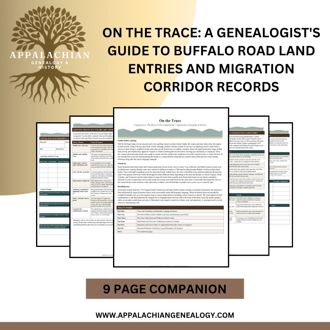
On the Trace: A Genealogist's Guide to Buffalo Road Land Entries and Migration Corridor Records
You find your ancestor in the 1800 census in Jefferson County, Kentucky, and then nothing. No will or deeds can be found in their name. The entry book at the Secretary of State’s Land Office in Frankfort is the next stop. A claim filed in 1780 under Jefferson County may sit inside Bullitt or Nelson county lines now, depending on when the division happened and whether the grant ever issued. However, the survey for that same warrant is a separate document in a separate series, and it usually names the neighbors the entry left out.
9 page PDF research guide includes:
Trace call vocabulary table: 8 boundary terms with record locations and genealogical value for each
Falls of Ohio corridor: 7-step research method for Kentucky land entries, with key sources for Jefferson, Bullitt, and Nelson county records
Great Valley Road and Wilderness Road corridor: 5-segment table from Philadelphia through the Cumberland Gap to the Ohio River settlements, with record series and watch-for notes per segment
Signal table: 4 road order and tax list signals with probable causes and where to check
Road Order Petition Log and Tax List District Tracker
Full 13-state repository guide plus Library of Congress
Land Entry and Survey Log with 4 boundary call analysis prompts
Two ruled notes pages
Appalachian Genealogy & History is a reader-supported publication. To receive new posts and support my work, consider becoming a free or paid subscriber.

Cunningham’s first entry did not give much to work with. In 1780, he claimed land in Jefferson County, Virginia, but the description stayed broad. Three years later, the amended entry tightened the search. It put the tract four or five miles south of the Falls of the Ohio, “on the trace,” with Alexander Spotswood Dandridge on the southeast and William Preston’s Poplar Level Tract on the southwest (McDowell 1967). That one phrase changes the record. Cunningham was not floating somewhere below the Falls. His land touched the buffalo trace running south toward Bullitt’s Lick, a road worn wide enough in places for contemporaries to describe it as twelve to twenty feet across (USDA Forest Service n.d.).
Cunningham’s 1783 amendment appears first in Jefferson County material, then crosses the later Bullitt County line, with another copy surviving in the Filson Historical Society’s Louisville collections. Each version keeps the same call: “on the trace.” Follow that call south from the Falls, and the search narrows toward the old road to Bullitt’s Lick. On a modern map, the line falls close to Preston Street Road as it runs toward the former saltworks site at Shepherdsville (McDowell 1967).
The 1783 amendment also gives names to Cunningham’s closest neighbors. Alexander Spotswood Dandridge’s claim lay on one side. William Preston’s Poplar Level Tract lay on the other. Both names appear again in Jefferson County records from the same period. A researcher who is working backward from a Cunningham in the 1800 or 1810 census in Jefferson County who cannot find a will or deed can use the trace reference and the adjoining claims to reconstruct the original neighborhood, find the neighbors in other records, and work forward again. The trace did not just move settlers through the mountains. It anchored them to the ground, and the ground kept the record.
This post is free for everyone. If we just helped untangle something in your own research, buying us a coffee is the easiest way to say thanks and keep the lights on.
˗ˏˋ☕ˎˊ˗
The Ground Beneath the Deed
A land entry in a Virginia or Kentucky entry book is easy to overlook. The clerk might give only an acreage and a creek name, leaving the next useful word to come from an adjoining owner’s name. When the entry names the trace, the record opens up more possibilities. A census page may place a family inside a county, while deeds and church records may never name the road they lived on. A trace call does. It puts the family on ground people used before the county map caught up.
For families who appear in early tax lists and then fall out of the record after a county division, a trace call can keep the search tied to place. Two claims on the same trace put two families on the same road at the same time. The record may not explain the relationship, but it gives the researcher ground to test against the next deed, tax list, or court entry. Long before a surveyor wrote the call, bison had already worn the road into the land. Settlers used it, surveyors wrote it into boundary calls, and clerks carried the words into the deed books. When the family name runs thin, the old call may still be there: on the trace, adjoining.
Have you found an ancestor named in a land entry or survey that called out a buffalo trace or an old Indian path? Which state and which record type turned it up? Tell me in the comments.
If this post gave you something to think about or a new trail to follow, consider restacking it. Every restack puts Appalachian Genealogy in front of someone who might be looking for exactly this. It takes one click and it means more than you know.
❤️ And if you found value here, a like helps too
Genealogical Connection (Dive Deeper into the Records)
Bison routes may seem far removed from genealogy until the words turn up in a land record. Once you find that a surveyor wrote “buffalo trace,” “buffalo road,” or “the trace,” the path becomes a clue to where a family lived and which records may still hold them.
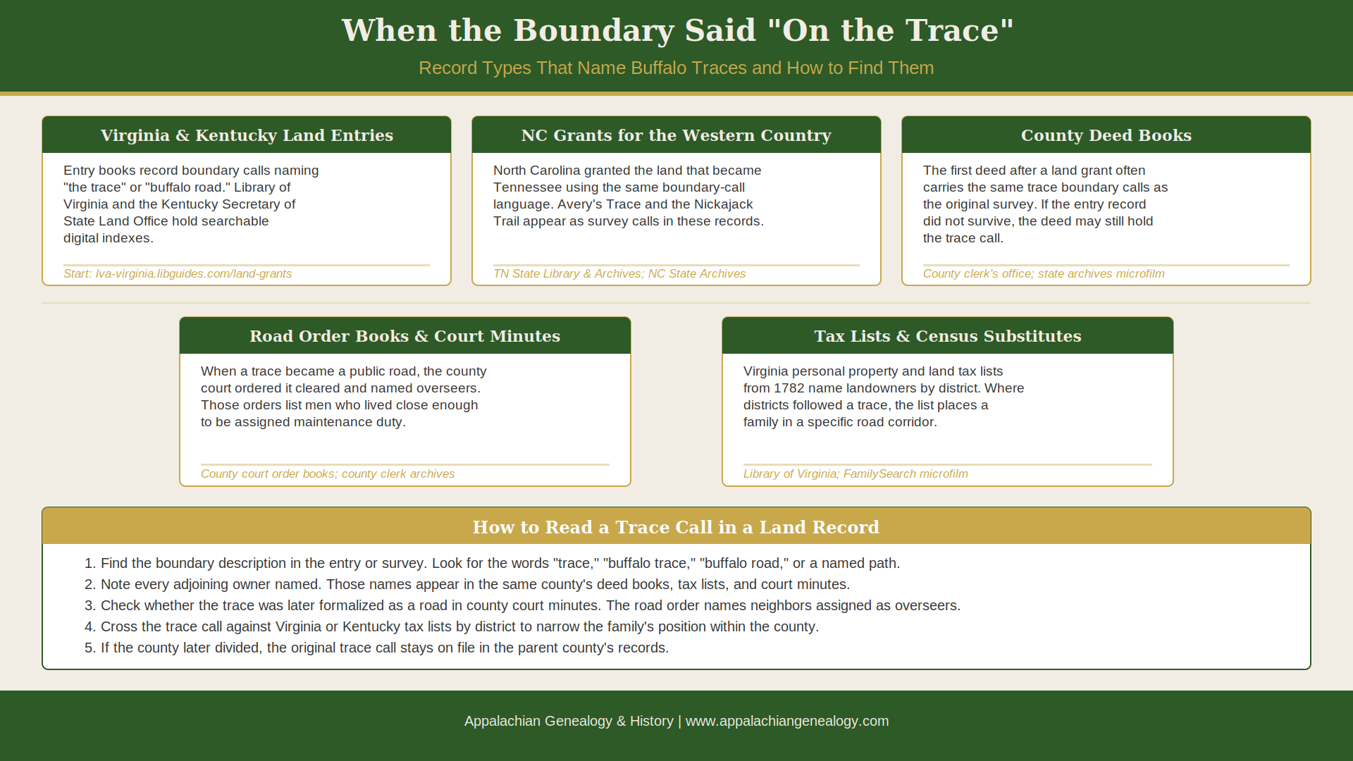
Virginia and Kentucky land entries and surveys. Virginia’s Land Commission began hearing claims in October 1779, and the resulting entries, surveys, and grants recorded boundary features as surveyors found them. When a boundary line ran “to the trace” or “along the buffalo road,” that phrase was the record’s way of placing a family on the landscape before roads had official names. Virginia land records from this period are at the Library of Virginia; Kentucky’s early grants and entries are at the Kentucky Secretary of State’s Land Office in Frankfort. Both repositories hold digital indexes, and the Kentucky Land Office has its own searchable database of early entries and grants.
North Carolina land grants and warrants for the western country. North Carolina granted the land that became Tennessee, and those grants used the same boundary-call language as Virginia’s. A survey calling out Avery’s Trace, the Nickajack Trail, or any of the named Indian paths that bison had originally worn is a placement document. These records are at the Tennessee State Library and Archives (many are indexed and digitized through Ancestry) and at the North Carolina State Archives.
County deed books. After the first land grants passed into private hands, deed books picked up the boundary language. A family selling land in Washington County, Virginia in 1795 or in Knox County, Tennessee in 1805 described the same ground the original survey had described, including trace references. If an entry record has not survived, the first deed may carry the same description.
Road order books and county court minutes. When a trace was formally recognized as a public road, the county court ordered it cleared and assigned overseers. Those orders appear in county court minutes, sometimes by the name the community already used for it. A road order naming “the old buffalo trace” or “the trace road to the lick” is both a historical record of the route and a list of the men who lived close enough to be assigned maintenance duty, which puts your ancestor on the map.
Tax lists and early census substitutes. Virginia’s annual personal property and land tax lists, kept from 1782 onward, recorded landowners by county and sometimes by district. When those districts were drawn along roads or traces, a researcher who knows which trace a family’s land touched can use the tax list to place the family in a specific neighborhood within the county, narrowing later courthouse searches considerably.
🌲🌲🌲🌲
Resource Box:
The Buffalo Trace | Hoosier National Forest, USDA Forest Service
Federal history of the Buffalo Trace as a bison migration corridor and early settler road, from the Falls of the Ohio northwest through southern Indiana to Vincennes, with a downloadable history paper and an interactive ArcGIS storymap.The Wilderness Road in Jefferson County | Bullitt County History Museum
Robert E. McDowell’s 1967 article reconstructed from Bullitt and Jefferson County courthouse plats, Filson Club archives, and deed records, tracing the buffalo trace from the Falls of the Ohio south to Bullitt’s Lick and the land entries that named it as a boundary feature.The Untraveled History of the Wilderness Road | Kentucky Historical Society
Mildred Leedy Armao’s account of William McBride’s 1780 work on the Wilderness Road, drawn from Virginia legislative petitions, pension files, and the Draper Manuscript Collection, with the land commission context for early Kentucky settler claims.Pioneer Families Had Dangerous Paths into Kentucky | Kentucky Genealogical Society
Overview of overland and water routes into Kentucky, covering the Great Road, the Wilderness Road, and the bison corridor origins of the later settler roads, with notes on the record landscape those migrations created.Great Valley Road | FamilySearch Wiki
Genealogical research guide covering the Great Valley Road from Philadelphia to Augusta, including its origins as the Great Warrior Path, its branches into the Wilderness Road and Avery’s Trace, and links to settler lists and record repositories for each state it crosses.Early North Carolina / Tennessee Land Grants | Tennessee Secretary of State
Guide to the indexes and digital images of North Carolina and early Tennessee land records at the Tennessee State Library and Archives, including the Revolutionary War warrants that named traces and paths as boundary features in western country grants.Virginia Land Patents and Grants | Library of Virginia
Searchable database of Virginia land patents from 1623 through 1774 and land grants from 1779 through 2000, including the trans-Appalachian entries and survey plats from the settlement period that named buffalo traces and Indian paths as boundary features.
🌲🌲🌲🌲
Sources
Armao, Mildred Leedy. 2016. “The Untraveled History of the Wilderness Road.” Kentucky Ancestors Online. Frankfort: Kentucky Historical Society.
FamilySearch Wiki. n.d. “Great Valley Road.” FamilySearch. Accessed August 5, 2026.
McDowell, Robert E. 1967. “The Wilderness Road in Jefferson County.” Louisville Magazine, June 20, 1967. Reprinted by permission at Bullitt County History Museum. bullittcountyhistory.org/bchistory/wroadmcdowell.html.
USDA Forest Service. n.d. “Buffalo Trace.” Hoosier National Forest. U.S. Department of Agriculture. fs.usda.gov/r09/hoosier/recreation/discover-history/buffalo-trace.
Verhoeff, Mary. 1911. The Kentucky Mountains: Transportation and Commerce 1750–1911. Vol. 1. Louisville: John P. Morton and Company.
Wilderness Road. 2025. “Wilderness Road.” History.com, updated September 30, 2025. history.com/articles/wilderness-road.
Thank you so much for supporting our publication.
The mountains remember because people like you refuse to let them forget.
🎙️ The Podcast - free for everyone
📺 The Videos - free for everyone
📚 The Resource Library - downloadable research companions included with every paid subscription
Appalachian Genealogy & History is a reader-supported publication. To receive new posts and support my work, consider becoming a free or paid subscriber.


Comments
Nothing yet. Say the first thing.
Sign in to join the conversation.