
Welcome to new readers of the American Geographical Society’s weekly, the AGS Globe! The Globe aims to inform and inspire the public with articles about the realms of geography and geospatial as well as exciting opportunities and news from our network. Our pieces fall under four categories: Exploring the World, Championing Geography, Mapping the News, and EthicalGEO. As the world revolves, geography evolves. The mission of the AGS Globe is to bring our storied legacy of exploration and thought leadership into the frontiers of the future.
Thanks for reading The AGS Globe! Subscribe for free to receive new posts and support our work.

From Railroads to Route 66: Towns of the American Past
By Caitlin Chan

At its peak, the United States railroad network surpassed 254,000 miles (around 400,000 km) of track with over 85,000 railroad stops throughout the country. The invention of the steam locomotive in 1804 forever changed the American landscape and launched the U.S. into its rail era, when the first railroad on the continent was built in 1827. In the following century, the U.S. witnessed the rapid spread of railroad industry and reached unprecedented levels of transportation across the country—in 1916, railroads were responsible for transporting 77 percent of intercity freight goods and 98 percent of all intercity passenger travel. Railroads enabled people and goods to traverse vast areas, connecting distant regions of the U.S. as the country continued to develop and industrialize. Along the tracks, tens of thousands of small towns and depots sprang up to accommodate travelers’ needs, growing with small-scale industry such as logging, mining, and farming.
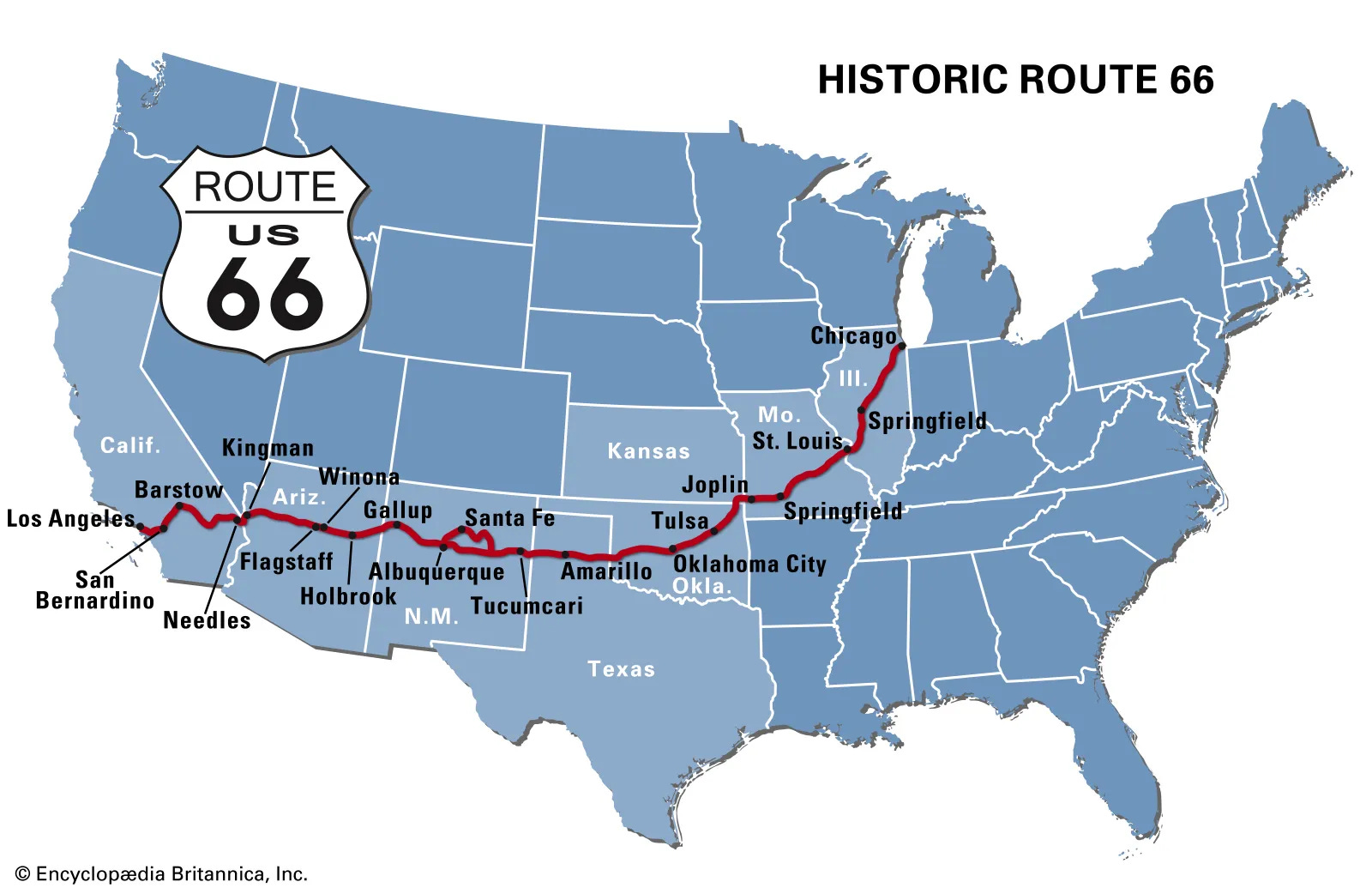
As the use of automobiles became more widespread at the beginning of the twentieth century, railroads faced competition from cars and trucks which could independently transport passengers. Although cars could carry less cargo, they provided individuals the rapid mobility to traverse long distances without relying on a central transportation system. Over time, the federal government looked for ways to establish cross-country highways that could function similarly to interstate railways. In the 1910s, the construction of a series of smaller highways paved the way for the United States Highway 66, colloquially known as Route 66. Formally established in 1926, the two-lane highway stretched southwest from Chicago, Illinois to Santa Monica, California through sparsely populated prairie and desert states, following many existing railroad routes.
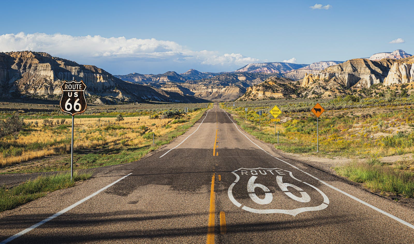
The construction of Route 66 transformed the tiny railroad stops into booming towns which thrived on restaurants, hotels, and gas stations in otherwise remote areas. Thousands of travelers passed through the towns each year, providing residents with opportunities to connect with people from all over the country during this new wave of mass transit. However, as further highway projects developed throughout the twentieth century, Route 66 fell behind—faster and with the capacity for more vehicles, interstate highways took over as the main routes for automobiles. In particular, the four-lane Interstate 40, built in the 1950s to connect California to North Carolina, followed the general route of Route 66 and bypassed many of the towns along the historic highway. Many declined in population and became practical ghost towns, remnants of the shifting American landscape and the people who altered it. Route 66 was decommissioned in 1985.
Three of many towns followed this trajectory: Funks Grove, Illinois, Glenrio, Texas-New Mexico, and Ludlow, California.
Funks Grove, Illinois
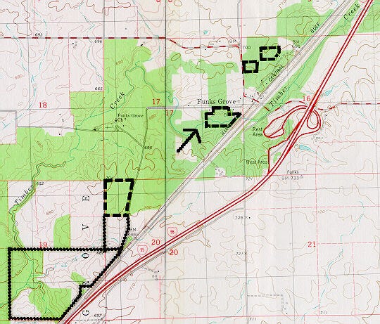
Funks Grove was founded in 1824 by Isaac and Absalom Funk, who moved from Kentucky and quickly amassed over 25,000 acres of land. They became one of the richest families in the area—in fact, Abraham Lincoln was one of their attorneys prior to his entry into American politics. The family brought industry and a maple “sirup” operation to the densely forested region, and they were even known to house escaped enslaved people on their passage north. Funks Grove was home to a train station for the Chicago & Alton Railroad, which was built in 1853. The Funks gave the company a 6-mile (9.7 km) stretch of land on which to build and operate a rail, which remains in place today.
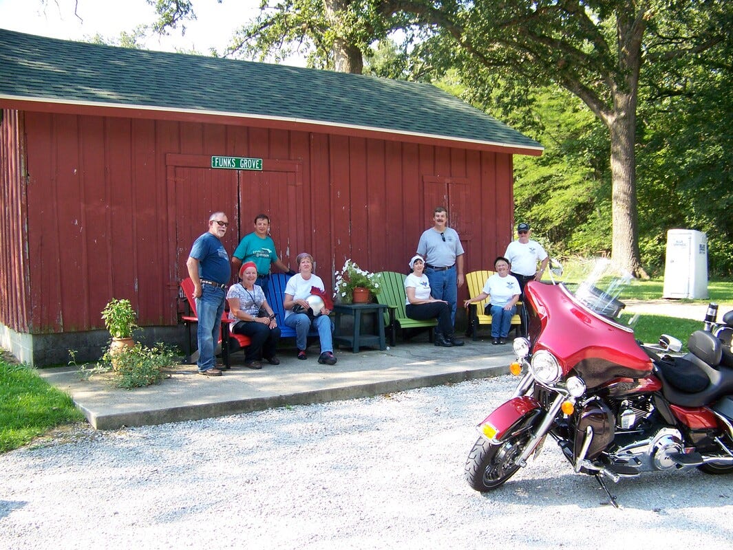
When Route 66 was built in Illinois, the highway passed east of the train depot. Funks Grove became a popular attraction for drivers who wanted to visit one of the largest remaining swaths of prairie grove in the state, which produced its famous syrup at the Funks Grove Pure Maple Sirup Farm. The town’s grocery store, cafe, and gas station also welcomed customers frequently until the construction of larger interstates in the 1960s and 1970s. Its population declined throughout subsequent decades—as of 2026, the town hosts 269 residents. The sirup farm still operates and houses the old train depot, which has been moved from its original location.
Glenrio, Texas-New Mexico
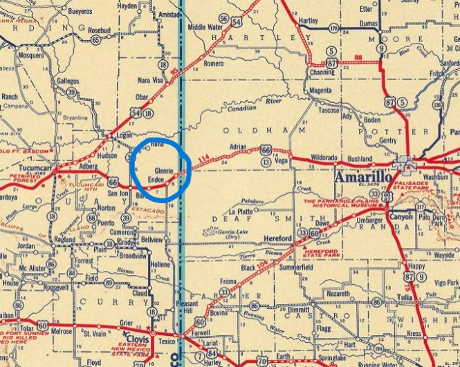
Glenrio uniquely straddles the Texas and New Mexico boundary, having been established following the Rock Island Railroad border stop in 1903. The depot processed freight and cattle shipments and was situated amidst vast cattle feeding operations. Ten years later, the Ozark Trail was built as a rudimentary highway for horse-drawn buggies and wagons, causing the town to be a popular stop for travelers. During this time, the locus of the town’s businesses slowly started to shift closer to the highway and away from the rail depot. The move was finalized when the Ozark Trail was incorporated into Route 66 in 1926 as more businesses sprang up around the highway. From the 1940s to the 1960s, the town’s tiny population of 30 prospered. No longer requiring train services, the depot was closed in 1955 as the residents focused wholly on providing for their Route 66 visitors.
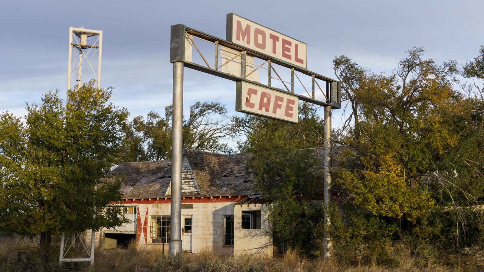
However, the boom ended in 1975 when Interstate 40 completely bypassed Glenrio. The town’s residents slowly moved away, leaving behind a ghost town of 17 abandoned buildings and rundown neon signs. Today, tourists driving down Route 66 are greeted by empty streets and an unused set of train tracks.
Ludlow, California
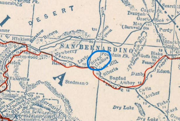
In the middle of the Mojave Desert, Ludlow was founded in 1882 as a water stop on the Atlantic and Pacific Railroad, at the junction of the Tonopah Tidewater Railroad and the east-west Santa Fe track. Although a community had existed in the area as far back as the 1870s, no formal town had been established until the subsequent decade. People moving to the area discovered massive amounts of ore in nearby mountains, leading to an explosion of industry in the desert town. Ludlow served as an anchor for multiple mining camps, which would send their gold ore and borax to the depot to be freighted away. However, activity declined in the 1940s and the town transitioned to serve travelers along Route 66, building restaurants, motels, and gas stations that were only a day’s drive from the Pacific Ocean.
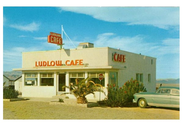
Ludlow was also hit hard by the construction of the new Interstate 40 in the 1970s, which caused all of the buildings in town to shutter their doors. Like Glenrio, it is now a ghost town of abandoned buildings and boarded-up gas stations.
The rapidly shifting landscape of mass transit in the United States forced small towns to adapt quickly to their changing circumstances. Local businesses had to adjust from rail services to automobiles, and then witness their heydays fade as interstate transportation became more streamlined and bypassed them altogether. A timeline rather unique to the United States, these transitions were driven by values of profit, private enterprise, and endless supply—trains, then automobiles, then massive interstate highways, facilitated these ideals. But as the population of the United States continues to grow, it may be prudent to look back to the railways of old and consider their possible role in America’s future of transportation. One that is more accessible, affordable, and can better the livelihoods of all of the country’s inhabitants.
References
Association of American Railroads. Freight Rail History. https://www.aar.org/chronology-of-americas-freight-railroads/
University of Iowa. The Golden Age of Railroading. https://www.lib.uiowa.edu/exhibits/previous/railroad/
National Park Service. Before 1926: The Origins of Route 66.
https://www.nps.gov/articles/before-1926-the-origins-of-route-66.htm
National Trust for Historical Preservation. 7 Ghost Towns on Route 66.
Illinois Department of Natural Resources. Funks Grove Natural Preserve Area.
https://dnr.illinois.gov/inpc/area.area5mcleanfunksgrove.html
Funks Grove, Illinois. http://www.funksgrove.org
The Route 66. Funk’s Grove, Illinois.
National Park Service. Glenrio Historic District.
Legends of America. Glenrio - One More Route 66 Casualty.
Texas Almanac. Glenrio.
The Center for Land Use Interpretation. Ludlow, California.
The Road Wanderer. Ludlow Area & Mojave Desert.
Thanks for reading The AGS Globe! This post is public so feel free to share it.
Did you enjoy reading this? Support the American Geographical Society today with a donation of $50 to help us support Geography education.

Members of the American Geographical Society enjoy reduced-price access to AGS events and free access to the online version of Geographical Review.


Attention APHG Teachers - Join AGS in New York City this November as a Geography 2050 Teacher Fellow! In addition to regular symposium sessions, our fellows participate in 2 days of specialized workshops where they can connect with other educators, get access to new classrooms tools, and learn about college and career pathways for their students. Applications will be open from April 6th to June 14th and can be found in the Geography Educator Initiative page of our website.
We are hosting an APHG Exam prep webinar on April 8th from 6 - 7:30 pm EST! The AGS has brought together various APHG experts, including Chief Reader Lisa Benton-Short to provide best practices for your classroom's review week. Some of the topics covered include task verbs, multiple choice and free response questions, and other review tactics. Join us to help set your students up for a successful exam season: RSVP here!
This year’s Geography 2050 website is up! Save the date for our annual fall symposium, Geography 2050: Africa Shaping Tomorrow, which will be held this November 19-20, 2026, in New York City! By 2100, over one-third of the world’s population will live in Africa, already the world’s youngest and fastest-growing continent, with profound implications for the interconnected human and environmental facets of the transformative demographic and technological boom across Africa. You can view this year’s Geography2050 website here.
Thanks for reading The AGS Globe! Subscribe for free to receive new posts and support our work.
Comments
Nothing yet. Say the first thing.
Sign in to join the conversation.