
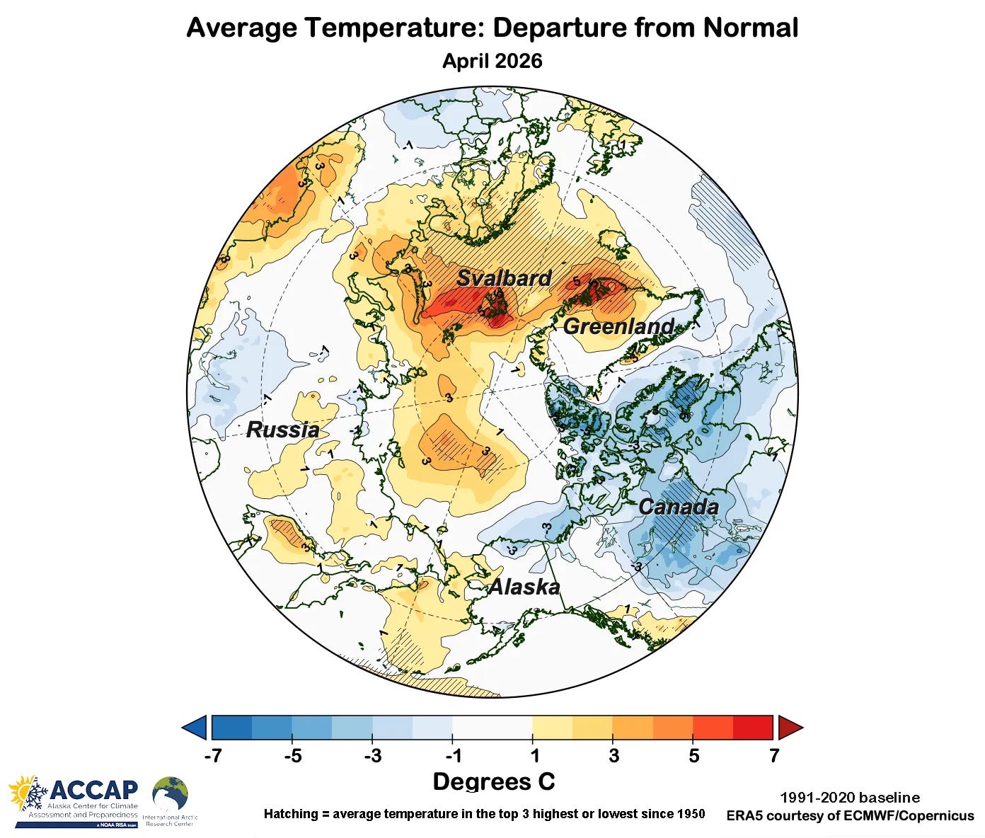
The overall pattern of temperature departures in April was similar to March, though not quite so extreme. Most of the Canadian Arctic was colder than normal, while the European Arctic was milder than normal (Fig. 1). Nunavut, Canada had the second coldest April in the past 40 years (only 2011 colder), and this was the coldest March-April since before 1950. Meanwhile, Svalbard had second mildest April (only 2006 milder) and this was the mildest March-April since 1950. Similarly for Finland this was fifth mildest April but the mildest combined March-April.
In contrast to these regional extremes, temperatures in most of Alaska and the Asian Arctic were not too far from normal in April, itself a significant change in many areas from the extremes in March. Overall, about 67 percent of the Arctic (land and seas poleward of 60°N) averaged warmer than the 1991-2020 baseline normal. About 11 percent of the Arctic had a “top-three” warmest April since 1950, while only about 1.5 percent of the Arctic (all in Canada) had a “top-three” coldest April.
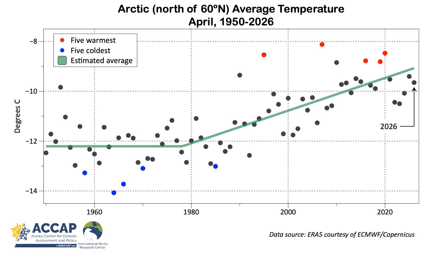
April average temperatures in the Arctic have been trending higher since the early 1980s, with the average temperature nowadays about 3°C higher than before 1980 (Fig. 2). The average temperature this April was typical for the past 15 years but was still the 12th highest in ERA5 reanalysis since 1950.
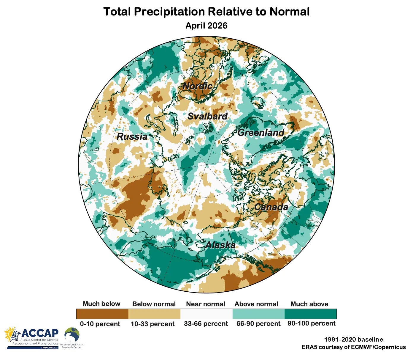
Precipitation is always much “noisier” than temperatures, with dramatic differences in short distances, even relative to normal, which of course takes into account terrain and elevation driven variations. April precipitation was above to much above normal across much of Alaska and into the Yukon Territory as well as parts of Greenland, but below normal in most of the eastern Canadian Arctic as well as the Nordic Arctic and in central Siberia (Fig. 3). Overall, Arctic-wide April precipitation was lower than the past two years and only 2 percent above the 1991-2020 baseline average.
At the end of April, snow still covered about 90 percent of Arctic lands (excluding the Greenland Ice Sheet) in the National Ice Center’s Interactive Multisensor Snow and Ice Mapping System (IMS) analysis, the highest coverage for the end of April since 2023 (Fig. 4). Snow-free areas north of 60°N were mainly confined to the European Arctic, with small snow-free areas at low elevation in Alaska and Iceland. With the below normal temperatures, nearly all of the Canadian Arctic retained snow cover at the end of April, including portions of the Northwest Territories south of Great Slave Lake that sometimes have bare ground by late April.
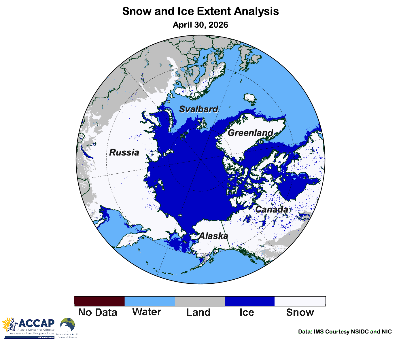
Sea ice extent in April was below normal in all of the peripheral seas in the Arctic except for the Bering Sea (Fig. 5). For the month overall, sea ice extent was the lowest on record in the Sea of Okhotsk, second lowest in the Greenland Sea and third lowest in the Barents Sea.
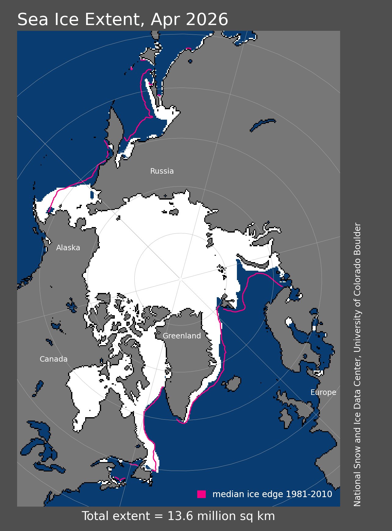
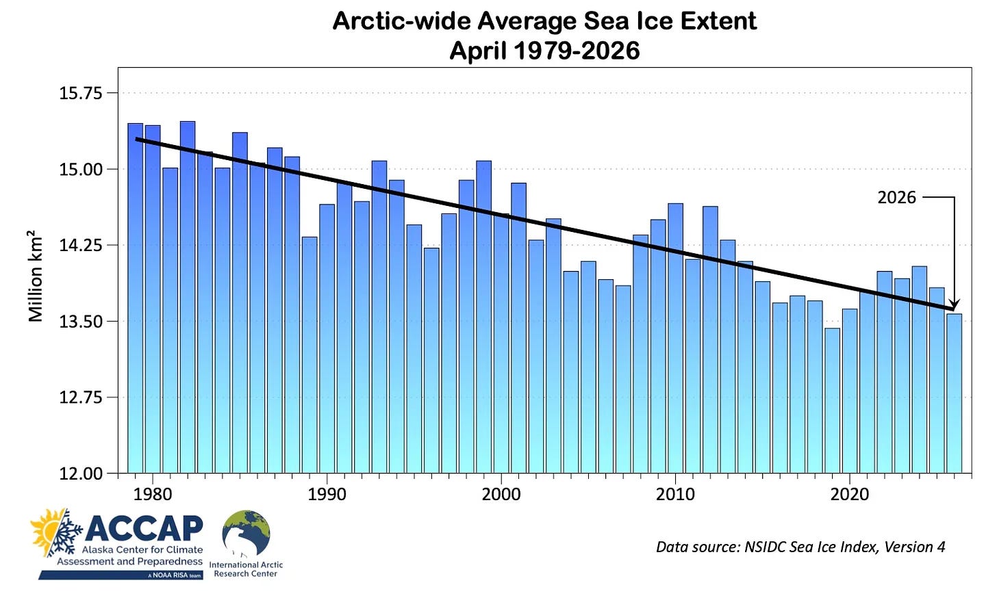
The Arctic-wide average sea ice extent in April in National Snow and Ice Center data was the second lowest in the 48 year satellite-based period of observation, with only 2019 lower (Fig. 6). The typical April ice extent is now 14 percent lower now than it was in 1980.
Technical details and underlying data sources
As usual in this newsletter, Arctic means “poleward of 60°N” unless otherwise specified (principally for sea ice, where “Arctic” refers to all northern hemisphere sea ice).
ERA5 monthly temperature and precipitation data available through the Copernicus Climate Data Store, here.
Code by B. Brettschneider/NWS Alaska Region allowing rapid ERA5 regional analysis is invaluable for my work.
IMS Snow and ice analysis products are available through the landing page here. There is no information in this product about the depth or water content of the snowpack or sea ice thickness or type.
NSIDC Arctic Sea Ice information, graphics and data available here.
No posts
Comments
Nothing yet. Say the first thing.
Sign in to join the conversation.