
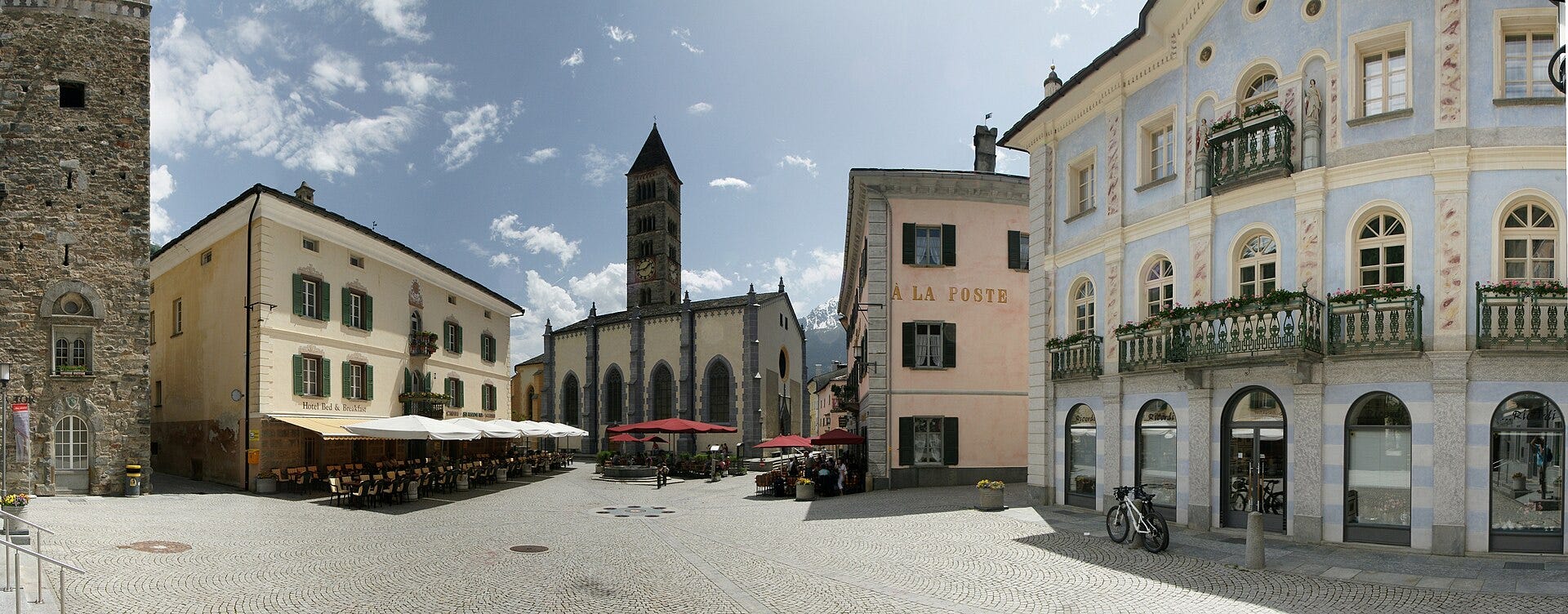
Poschiavo is the Swiss town that thinks it's in Italy – or else the other way round. It has Switalian-style painted buildings, and a proper Alpine clocktower. It speaks Italian, or else the strange Romansch language that’s what you’d get if you tried to speak Italian while actually speaking Swiss German. But below the pink and yellow walls the streets are Swiss-clean and litterless; and the train runs with Swiss strictness.
Thanks for reading About Mountains! For some more about mountains each week, you could
Walking up 1000m through a pine forest is something we’d got used to in our seven-day circuit of the Bregaglia and Bernina ranges. The train was a new way up, and a better one. It started in a spiral so’s to show us the pink buildings and pointy church from all directions. Then it went into a tunnel, rumbled briefly; and we came out with the formerly left-hand landscape surprisingly appearing beyond the right-hand set of windows – as if the train had passed through an exceedingly narrow mountain into the next valley. What had in fact happened was that the train had turned through 180° inside the mountain: we were seeing the same valley the other way round and rather higher up.
Soon this became a game. Train into tunnel: stay same side with camera, or swap windows in anticipation of a rotary track trick? In zig-zags, like a Swiss mountain path, the train climbed the valley wall, so that we saw the pointy church from above, and then from high above, and then from very high above indeed. And it didn’t seem odd at all that the carriage contained mainly elderly English train-fanciers, discussing whether this was the most spectacular ride in Europe or whether there was in fact an even better one in Spain.
The train passed one of those implausibly turquoise Swiss lakes (it’s not true the Tourist Board dyes them with chemicals; it’s sulphate plus ice-particles makes them that way). Suddenly there was a glacier poking its snout over the mountain wall, ready to drop ice lumps and bouldery rubble into the turquoise lake. The train stopped at a mountain restaurant that dangled above a pinewood; and we got out.
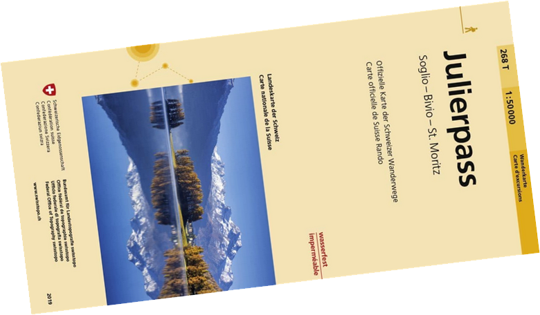
This had all started, as these things do, with a map. My Dad had passed down the Swisstopo 268 T Julierpass (Hiking Edition) 1:50,000. And brooding over it, as one does with a map, I’d idly traced high-level hiking paths all the way around the range. I’d heard of the Tour of Mont Blanc: this would be the tour of Piz Bernina.1
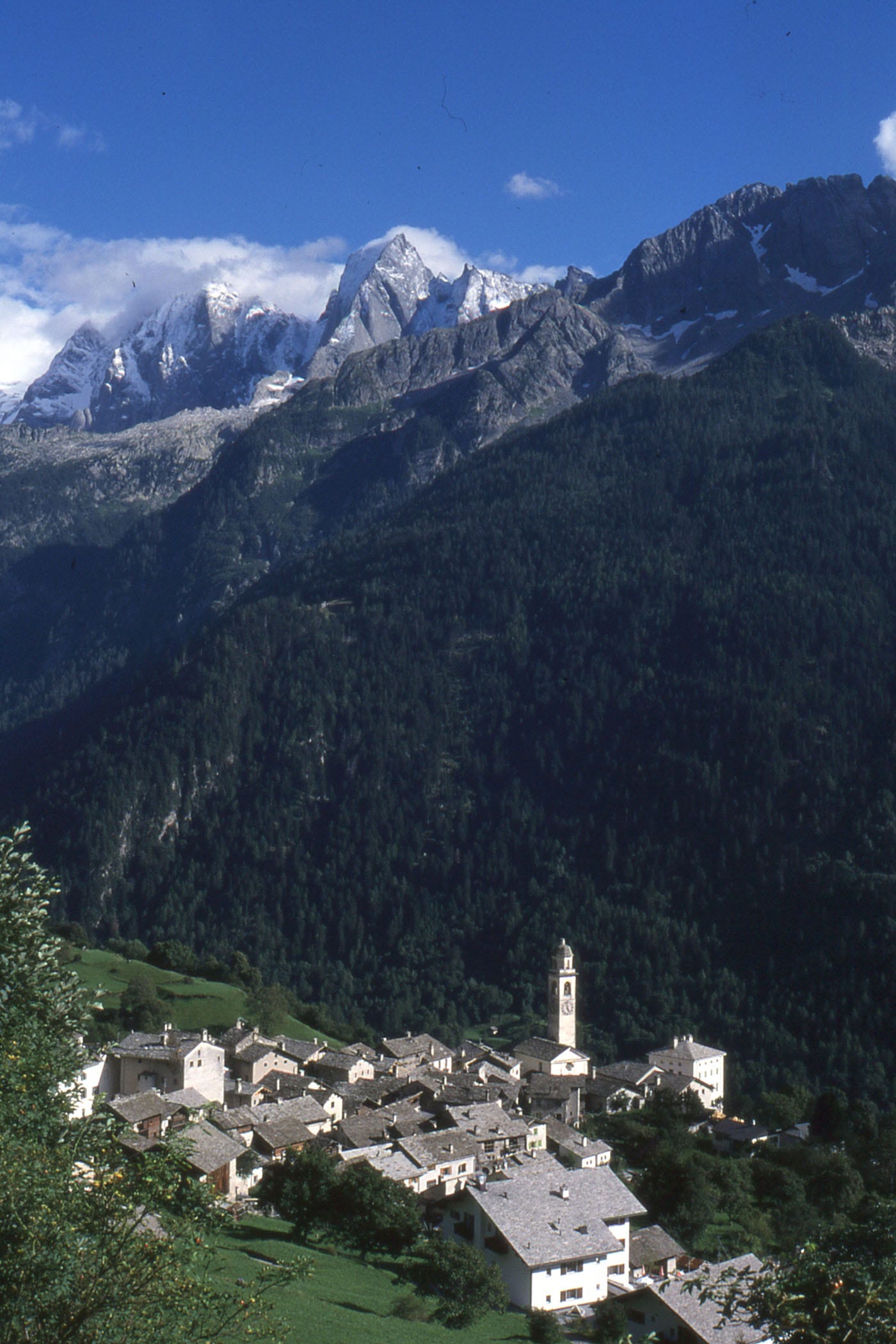
Setting out from Pontresina, the route headed through high ground west of the Bondasca valley. And if I call Soglio a chocolate-box village, that’s so long as you’re thinking proper Swiss high-cocoa chocolate, none of your Cadbury’s Dairy Milk.
Failing to count the contour lines up out of Bondo, I gave us 2000m of ascent. The first half of it, on graded pinewood tracks, went quicker than expected, and the afternoon, still relentlessly uphill, led to a high dangly path around a rockface, and a lonely, unwardened mini-hut surrounded by floppy-eared sheep and a huge view. I wrote about that high overnight in an earlier post.
Now on the Italian side, there is a superb-looking traverse-path, the Sentiero Roma. However we were driven off it by some fresh snow. Leading to the standard sort of replacement: 1000m of descent to valley level, 1000m back up again to the next hut along. From that particular hut we’d sort-of thought about an ascent of the Piz Bernina itself: Alpine Grade PD (slightly difficult), we had crampons and a rope. But the weather was iffy and we failed to find the marked path off of the Upper Scerscen glacier.
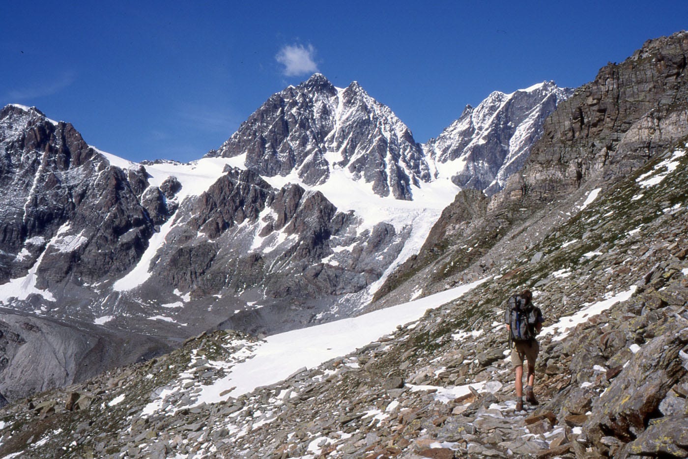
Steep snowfields to another high pass – another high, unwardened bothy,more hutch than hut - and down to Poschiavo. Which is where we took that train up to the pass.
The Bernina Pass is a place of brown boulder, turquoise reservoir and concrete. It’s pleasingly barren after all the grey-green larch lower down. Another 650m up the left-hand side is the Diavolezza. And The view from Diavolezza is - if not world-famous - at least Switzerland famous. And in fact, by cable car, you can do the whole 650m sitting down, provided you’re prepared to pay.
But the cablecar’s a whole lot more expensive than the train was, and we weren’t. So we climbed on into the cloud, gauging height by the cablecar alongside: when the down cablecar passed us before the up cablecar, we knew we were half way. Up in the cloud the ground got rockier, and there was a snowfield turned soggy with recent rain. And at the top was the Famous View.
We stood a moment and enjoyed its sweeping panorama: the huge glacier basin, the Piz Palü, the Bellavista and Piz Bernina. The reason we could enjoy the panorama was that the Swiss have helpfully erected a large signboard with the panorama painted on it. The Famous View on its signboard stood out well, in front of plain grey snowy cloud. After drinking it in, we ducked into the cablecar station with its inexpensive dormitory.
The dormitory is most convenient, the topstation restaurant has nice hot food: but the topstation itself is designed for large numbers of skiers clomping around in snowy boots and buying postcards. Its picture windows give a huge view of snow scudding by and the most famous snowcloud in Switzerland. Or there’s the large-size TV screen. The weather forecast in French had 100kph winds, but the one in German was less discouraging.
Next morning the winds seemed more German than French: scudding by at merely moderate speed and tearing holes in the snowcloud to show us a small patch of the Piz Palü. We decided to make an attempt at a lowish mountain that the map said was nearby in the grey. Well-wrapped as if against a Scottish winter, we set out along the easy, but unseasonably snowcovered, path to Munt Pers. The wind was rising; the holes in the snowcloud were getting bigger.
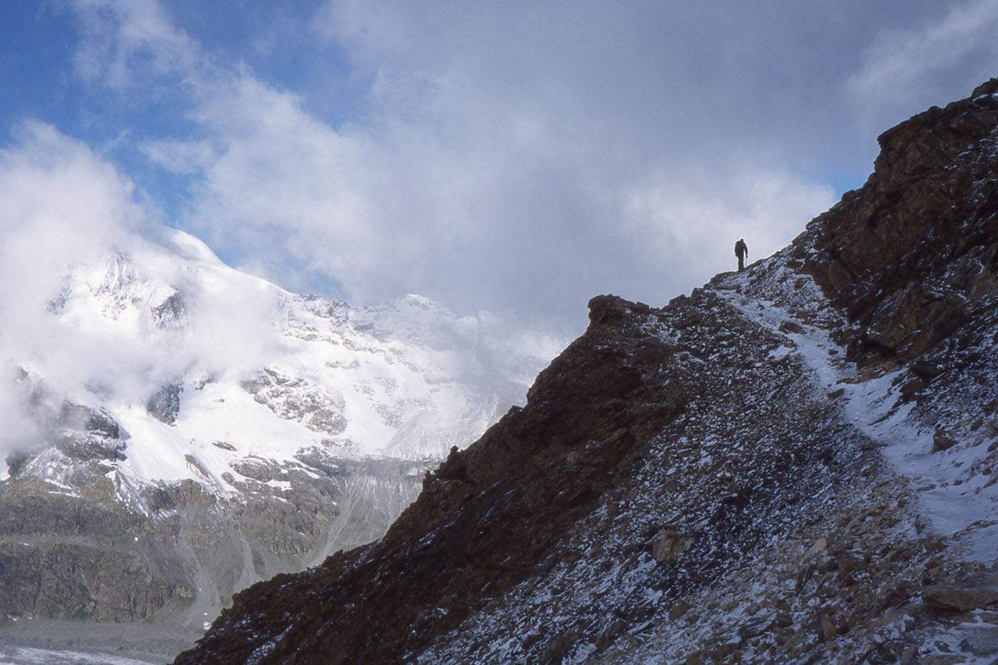
A small cairn marked the top of Munt Pers, 3200 metres approximately. Through a hole in the cloud we looked down on Pontresina. It was an emotional moment. Eight days before, we’d set out southwest from Pontresina, along the Bregaglia valley, into Italy, and all around the back of Piz Bernina. Now we were arriving back again from the south-east; having crossed nine high passes, slept in four mountain huts, and gone up 10,000 and down 12,000 metres of climb (the discrepancy being a bus out of Italy and the Bernina railway).
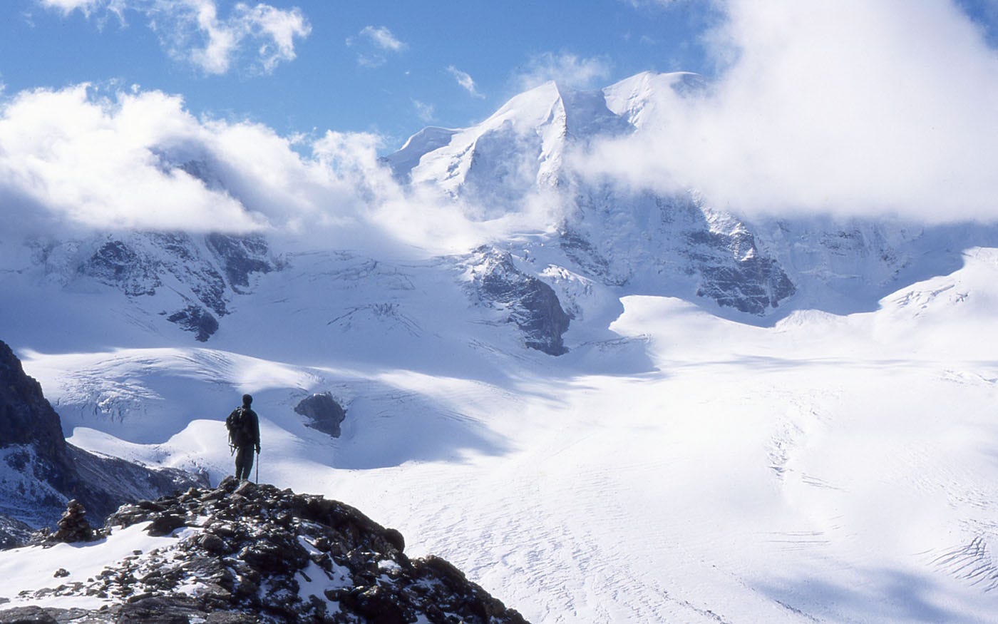
And then we turned round, to an even more emotional moment. Like a spinnaker sail that suddenly rips, shreds and flies away, the cloud had finally yielded to the wind. While a few rags clung to the summits of Bernina and Palü, the Famous View was exposed in wraparound wide-scene splendour. Above, a jagged black-and-white skyline against the true Alpine blue. Further down, an intricate jigsaw of descending glacier, scratched and cracked with crevasse. And on the right, more mountains and another glacier.
Because of the weather, our original plan of a dramatic crossing of both of these glaciers had been sensibly replaced by a simple descent under the cablecar. We now gleefully returned to Plan A.
The glaciers are not difficult ones. Below the cablecar the Pers Glacier is flat and has few crevasses: at its further side you descend rocks and rubble for 300m to where the Morteratsch Glacier in its turn becomes flat and crevasseless. Guides take parties across daily for the small fee of 15 Francs: they require that glacier-crossers should have stout shoes and be at least 7 years old. On the other hand, there was fresh snow lurking over the (admittedly few) crevasses; we had crampons, we had our rope; and we’d been practising crevasse rescue by climbing up the birch trees of Scotland. So we decided to take the glacier slightly seriously.2
You cross serious glaciers roped together; the one at the front watches out for the tell-tale dip in the snow that might indicate a crevasse below, and when they get to one they poke it with the iceaxe. The person at the back is alert to leap backwards and tighten the rope when the person at the front’s leg suddenly breaks through into green nothingness. Most important is that the person at the front shouldn’t suddenly fall into green emptiness at the moment when the person at the back is taking his photo against the backdrop of icefalls, jagged horizon, and Alpine blue sky. Ideally, the person taking the photo shouldn’t fall through either.
At the edge of the Pers Glacier we reached the bouldery rocky slope and descended to the Morteratsch Glacier. We were now below the snowline: the Morteratsch Glacier was bare ice. This meant we could see the crevasses. And because crampons crunch into ice with a reassuringly spiky grip, we could wander along the very brinks peering down into the green emptiness. We could take pictures of ourselves with the green emptiness for foreground (meanwhile the background of icefall, snowpeak, and sky of blue was still there being the background).
Further up-glacier, another couple was crossing. Their tiny forms gave scale to the immensity of the icefall behind, so I took their picture. The picture failed. The two people are so tiny against the immensity that you can’t even see them.
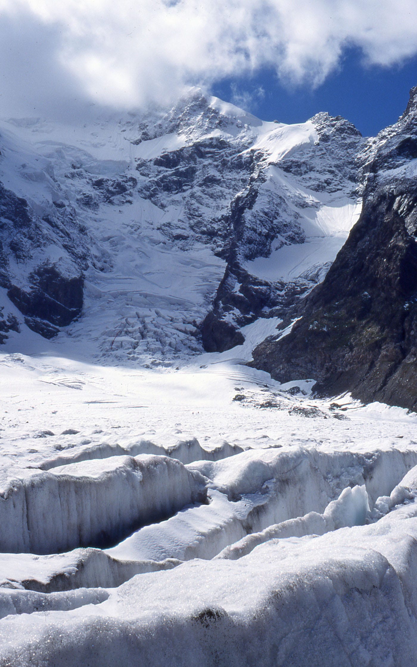
At the edge of the glacier we came onto ground where the occasional alpine flower pushed out between the boulders. There was some grass, and a goat. We stopped at the Boval hut and, instead of chilly green depths, let the sun shine into the cool golden ones of a couple of glasses of Swiss beer. Below the hut a bouldery path led down into pinetrees, with hot scented air below the branches and bits of the wide glacier scene still showing through the gaps behind. Gradually the Famous View shrank behind us, until it was no larger than a picture on a postcard. And after eight days on the path, we arrived back at Pontresina.
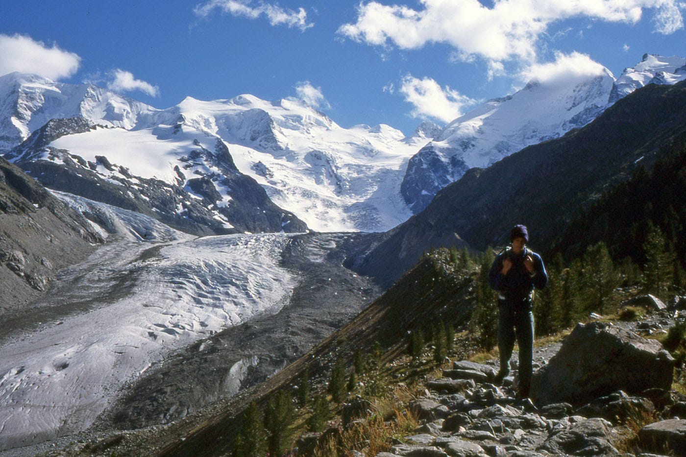
Since walking this, a similar route has been formally created, written into a guidebook from Cicerone by Gillian Price, and gone out of print again.
At the time we walked this, it was possible to join a guide-led roped group to cross the two glaciers to the Boval Hut. I don’t know if this still happens: glaciers in the Alps are becoming generally more challenging and dangerous.
Comments
Nothing yet. Say the first thing.
Sign in to join the conversation.